May Queen
Campground · Colorado · 13 bookable sites ·
Managed by the USDA Forest Service
San Isabel National Forest (NF) · Open Access
- 13
- Bookable sites
- 99 ft
- Max rig length
- up to 8
- People per site
- 1
- Accessible site
- 9,891 ft
- Elevation
Overview
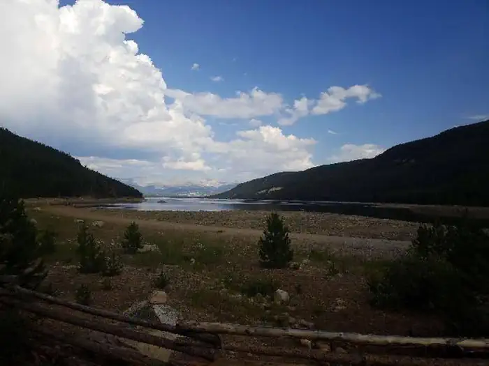
May Queen Campground is located at the far western end of Turquoise Lake in a shaded lodgepole pine forest. Conveniently perched near the Charles Boustead Memorial Tunnel, May Queen offers easy access to boating, fishing and hiking.Incredible views of the Holy Cross and Mount Massive Wildernesses can be seen from the area, and visitors are likely to see native wildlife like chipmunks, beavers and porcupines.
The Charles Boustead Memorial Tunnel is a 5.5-mile tunnel that transports water from the Fryingpan and Roaring Fork River Basins through the Continental Divide to the Arkansas River Basin by emptying water into Turquoise Lake.
Recreation
Explore the 6.4-mile Turquoise Lake Trail, which parallels the shoreline of Turquoise Lake from May Queen Campground to the dam. The trail offers moderate hiking with spectacular views and a variety of flora and fauna, as well as remnants of old mines. The Timberline Lake trailhead is 1/2 mile up the road. A 2-mile hike to this lake is rewarded with stunning views and high alpine lake fishing. The Colorado Trail can also be accessed from this trailhead. On Turquoise Lake, sailing, boating and canoeing are enjoyed. Anglers seek out mostly mackinaw and rainbow trout.Facilities
Campground offers single family sites. Each site is equipped with a campfire ring and picnic table. Vault toilets and trash collection are provided. Easy access to the lake is provided for canoes and other hand-carried boats. Trailered boats can use Matchless Boat Ramp located on the east side of Turquoise Lake.
Natural Features
The campground sits at an elevation of 9,900 ft. on Turquoise Lake. Most campsites are situated on a level, open field along a creek, feeding into the lake. Six first come-first, serve-sites are perched on the wooded hillside above the creek.Nearby is the Mount Massive Wilderness area, a 30,540 acre expanse encompassing Mount Massive, Colorado's second highest peak at 14,421 feet. Much of the wilderness is above timberline with many alpine plant communities and permanent snowfields.
Nearby Attractions
Nearby is the abandoned bed of the Colorado Midland Railroad, built in the 1890s. The trail is hard to trace, but visitors may find artifacts in the gulch it once crossed.The town of Leadville, a historic gold and silver mining town, is a fun place to explore with the family.
Drive on the Top of the Rockies Scenic Byway to Independence Pass, one of the highest paved passes in Colorado. Continue over the pass to the town of Aspen, a well-known ski resort town.
Charges & Cancellations
Cancellations
Individual Campsites: Cancellations up to 2 days before a reservation start date incur a $10.00 cancellation fee.
A visitor who cancels a reservation the day before or on the day of arrival will pay a $10.00 service fee AND forfeit the first night's use fee including tax and applicable add-on for a campsite.
Cancellations for a one-night reservation will forfeit the entire amount paid and will not be subject to an additional service fee.
No-Shows
A no-show visitor is one who does not arrive at a campground and does not cancel the reservation by check-out time on the day after the scheduled arrival date. Staff will hold a campsite until check-out time on the day following the arrival date.
No-shows are assessed $20.00 service fee and forfeit the first night's rate, taxes and applicable add-on for a campsite.
Refunds
Visitors may submit a refund request through their Recreation.gov profile within 7 days of the end date of their reservation. Refunds will not be issued after the 7 days has ended.
Refunds for debit or credit card payments will be issued as a credit to the original bank or credit card used to pay.
For check or cash purchases, Recreation.gov will mail a Treasury check for refunds of cash, check, or money order payments to the address associated with the reservation. Treasury check refunds may take up to 6-8 weeks to arrive.
In the event of an emergency closure, the Recreation.gov team or facility manager will refund all fees and will attempt to notify you using the contact information within the Recreation.gov visitor profile.
The facts
- 13 bookable sites
- 28 sites in total, including non-bookable
- 1 accessible site
- Vehicles up to 99 ft
- Up to 8 people per site
- Loops: MANAGEMENT, MAY
Site types
- 15 Management
- 9 Standard Nonelectric
- 4 Tent Only Nonelectric
Amenities
- Shade
- Pets allowed
Not recorded upstream: electric hookups, water hookups, sewer hookups, campfires allowed, fire pits, picnic tables, grills.
28 campsites at May Queen
| Site | Loop | Type | Entry | Surface | Access | Max rig | People | |
|---|---|---|---|---|---|---|---|---|
| 005 | MANAGEMENT | Management | — | — | — | — | — | |
| 006 | MANAGEMENT | Management | — | — | — | — | — | |
| 007 | MANAGEMENT | Management | — | — | — | — | — | |
| 008 | MANAGEMENT | Management | — | — | — | — | — | |
| 009 | MANAGEMENT | Management | — | — | — | — | — | |
| 011 | MANAGEMENT | Management | — | — | — | — | — | |
| 016 | MANAGEMENT | Management | — | — | — | — | — | |
| 018 | MANAGEMENT | Management | — | — | — | — | — | |
| 021 | MANAGEMENT | Management | — | — | — | — | — | |
| 023 | MANAGEMENT | Management | — | — | — | — | — | |
| 024 | MANAGEMENT | Management | — | — | — | — | — | |
| 025 | MANAGEMENT | Management | — | — | — | — | — | |
| 026 | MANAGEMENT | Management | — | — | — | — | — | |
| 027 | MANAGEMENT | Management | — | — | — | — | — | |
| XXX | MANAGEMENT | Management | Pull Through | Gravel | — | 99 ft | 8 | ♿ |
| 001 | MAY | Tent Only Nonelectric | — | Gravel | Walk In | — | 8 | 🐾 |
| 002 | MAY | Tent Only Nonelectric | — | Gravel | Walk In | — | 8 | 🐾 |
| 003 | MAY | Tent Only Nonelectric | — | Gravel | Walk In | — | 8 | 🐾 |
| 004 | MAY | Tent Only Nonelectric | — | Gravel | Walk In | — | 8 | 🐾 |
| 010 | MAY | Standard Nonelectric | Pull Through | Gravel | — | 30 ft | 8 | 🐾 |
| 012 | MAY | Standard Nonelectric | Pull Through | Gravel | — | 35 ft | 8 | 🐾 |
| 013 | MAY | Standard Nonelectric | Pull Through | Gravel | — | 35 ft | 8 | 🐾 |
| 014 | MAY | Standard Nonelectric | Pull Through | Gravel | — | 40 ft | 8 | 🐾 |
| 015 | MAY | Standard Nonelectric | Pull Through | Gravel | — | 35 ft | 8 | 🐾 |
| 017 | MAY | Standard Nonelectric | Pull Through | Gravel | — | 35 ft | 8 | 🐾 |
| 019 | MAY | Standard Nonelectric | Pull Through | Gravel | — | 35 ft | 8 | 🐾 |
| 020 | MAY | Standard Nonelectric | Pull Through | Gravel | — | 35 ft | 8 | 🐾 |
| 022 | MAY | Standard Nonelectric | Pull Through | Gravel | — | 40 ft | 8 | 🐾 |
Getting there
39.27861, -106.43222 · 39°16'43.0"N 106°25'56.0"W
Typical weather
Typically 73°F in Jul, down to 31°F in Dec.
| Jan | Feb | Mar | Apr | May | Jun | Jul | Aug | Sep | Oct | Nov | Dec | |
|---|---|---|---|---|---|---|---|---|---|---|---|---|
| High °F | 32 | 33 | 39 | 44 | 55 | 68 | 73 | 70 | 62 | 51 | 39 | 31 |
| Low °F | 3 | 3 | 9 | 18 | 27 | 34 | 40 | 38 | 31 | 24 | 14 | 6 |
| Precip in | 1.0 | 1.4 | 1.3 | 1.7 | 1.4 | 0.9 | 1.9 | 2.1 | 1.4 | 1.1 | 1.3 | 1.1 |
1991–2020 averages from the nearest NOAA station, 3.8 mi away — not measured at the facility itself, and elevation can make a real difference over that distance.
Map
Fees and stay limits
Extra Vehicle Fee $10.00
From Recreation.gov, which is not always current. The operator's own page is the authority on what you will be charged.
More photos
Member photos
Common questions about May Queen
- Can you reserve a site at May Queen?
- Yes, May Queen is reservable through Recreation.gov.
- How many campsites does May Queen have?
- 28 sites in total, of which 13 can be booked.
- What is the maximum RV length at May Queen?
- 99 ft. That is the longest vehicle the sites here are recorded as taking; individual sites may be shorter.
- Are pets allowed at May Queen?
- Yes, pets are allowed at May Queen.
Also listed by
May Queen also appears in other federal recreation data. Facts below are matched by name and location, not confirmed by May Queen's operator.
USDA Forest Service — data as of Aug 24, 2026
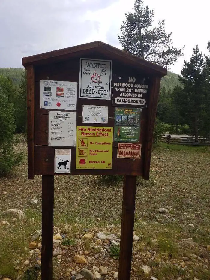
- $29 nightly fee per site for overnight camping which includes two vehicles. A third vehicle is an additional $11 per night. RVs and ATV/boat trailers count as one vehicle.
- Fees are payable by cash, check or money order. Self-servicing fee tube is available.
- First-come, first-served sites must be occupied the first night.
Restrictions:
- Maximum of eight people per site
- Maximum three tents per site or one RV and two tents
- Dogs, including service dogs, must be leashed at all times
- No discharge of firearms or fireworks
- Only licensed vehicles can operate inside campground
- Camping is not allowed behind a locked gate
- Remember to check fishing regulations before fishing at any body of water. For stocking reports and more information on regulations or fishing licenses, check out the Colorado Parks & Wildlife website.
Accessibility:
- Campsites along the south row (nearest the picnic area) are accessible.
Camping near May Queen
- Tabor 4 mi · Campground · we watch it
- Matchless 4.1 mi · Campground · we watch it
- Belle of Colorado 4.4 mi · Campground · we watch it
- Silver Dollar 4.4 mi · Campground · we watch it
- Baby Doe 4.4 mi · Campground · we watch it
- Father Dyer 4.5 mi · Campground · we watch it
- Boustead Tunnel Observation Site 0.4 mi · Facility
- Matchless Boating Site 4.1 mi · Facility
- Matchless Campground 4.1 mi · Campground
- Mount Massive Wilderness 4.3 mi · Facility
- Leadville National Fish Hatchery 4.3 mi · Facility
- Belle of Colorado Campground 4.4 mi · Campground
Contact
Recreation.gov last updated this record on 2026-07-03.
Facility information and photographs from Recreation.gov (RIDB). SpotOpened is not affiliated with Recreation.gov or any federal agency.
Comments