Buckeye Recreation Area (Co)
Campground · Colorado · 31 bookable sites ·
Managed by the USDA Forest Service
Manti-La Sal National Forest (NF) · Open Access
- 31
- Bookable sites
- 74 ft
- Max rig length
- up to 50
- People per site
- 7,619 ft
- Elevation
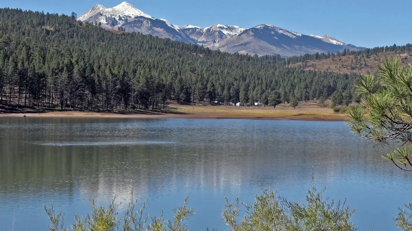
Overview
The Buckeye Recreation Area is located adjacent to Buckeye Reservoir in Montrose County, Colorado. The area is popular for camping, OHV/ATV trails, hunting and fishing.
Note: Some GPS or driving app directions are sending people on 4WD roads or to locked gates that are on private property. If you are unfamiliar with the area, please visit our "Facility Information - Getting Here" section for instructions on the best route to get to Buckeye Reservoir before reserving. DO NOT rely soley on Google Maps or Apple Maps for getting to this campground.
Recreation
Recreation in the area centers around the reservoir which provides excellent opportunities for fishing and canoeing. Forest roads in the area provide for off-highway vehicle touring and the nearby state lands provide motorized trails for Off-highway vehicles and motorcycles. The La Sal Mountains are nearby which provide many hiking and biking trails.Facilities
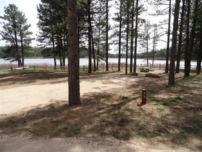
The Buckeye Recreation Area is located adjacent to Buckeye Reservoir. The Recreation Area is spread out around the reservoir and consists of the Pioneer Campground (30 single family reservable campsites), a boat ramp for small fishing boats (5 HP motor limit and wakeless speed), a reservable group site, a day-use picnic area and 18 less developed dispersed campsites scattered around the reservoir. Campsites in the Pioneer Campground include graveled parking spurs, concrete picnic tables, fire rings, a utility table and access to vault toilets. There is a 14 day stay limit at this campground.
Natural Features
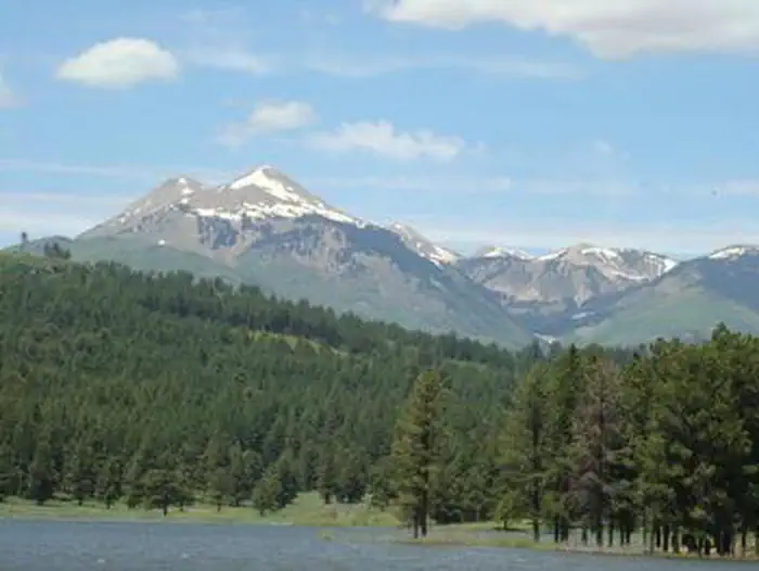
The recreation area is located in a valley at 7,600 feet in elevation and is set amongst mature stands of Ponderosa Pines. The high peaks of the La Sal Mountains are visible from much of the area. The scenic Paradox Valley and the town of Paradox, Colorado are located approximately 10 miles to the southeast.Nearby Attractions
The scenic La Sal Mountains are very close to the area and provide numerous opportunities for recreation. Canyonlands and Arches National Parks are about 1.5 hour drive away from the area as well as numerous recreation opportunities around the towns of Monticello and Moab, Utah.Contact Info
For facility specific information, please call (435) 259-7155.The facts
- 31 bookable sites
- Vehicles up to 74 ft
- Up to 50 people per site
- Loops: Pioneer Campground
Site types
- 30 Standard Nonelectric
- 1 Group Standard Area Nonelectric
Amenities
- Campfires allowed
- Fire pits
- Picnic tables
- Grills
- Shade
- Pets allowed
Not recorded upstream: electric hookups, water hookups, sewer hookups.
31 campsites at Buckeye Recreation Area (Co)
Check-in 1:00 PM · Check-out 11:00 AM
| Site | Loop | Type | Entry | Surface | Water | Max rig | People | |
|---|---|---|---|---|---|---|---|---|
| 01 | Pioneer Campground | Standard Nonelectric | Back In | Gravel | — | 39 ft | 8 | 🐾 |
| 02 | Pioneer Campground | Standard Nonelectric | Pull Through | Gravel | Lakefront | 73 ft | 8 | 🐾 |
| 03 | Pioneer Campground | Standard Nonelectric | Back In | Gravel | Lakefront | 53 ft | 8 | 🐾 |
| 04 | Pioneer Campground | Standard Nonelectric | Back In | Gravel | — | 48 ft | 8 | 🐾 |
| 05 | Pioneer Campground | Standard Nonelectric | Back In | Gravel | Lakefront | 51 ft | 8 | 🐾 |
| 06 | Pioneer Campground | Standard Nonelectric | Back In | Gravel | — | 52 ft | 8 | 🐾 |
| 07 | Pioneer Campground | Standard Nonelectric | Back In | Gravel | Lakefront | 50 ft | 8 | 🐾 |
| 08 | Pioneer Campground | Standard Nonelectric | Pull Through | Gravel | Lakefront | 74 ft | 8 | 🐾 |
| 09 | Pioneer Campground | Standard Nonelectric | Back In | Gravel | — | 43 ft | 8 | 🐾 |
| 10 | Pioneer Campground | Standard Nonelectric | Back In | Gravel | — | 41 ft | 8 | 🐾 |
| 11 | Pioneer Campground | Standard Nonelectric | Back In | Gravel | Lakefront | 35 ft | 8 | 🐾 |
| 12 | Pioneer Campground | Standard Nonelectric | Back In | Gravel | — | 53 ft | 8 | 🐾 |
| 13 | Pioneer Campground | Standard Nonelectric | Back In | Gravel | Lakefront | 45 ft | 8 | 🐾 |
| 14 | Pioneer Campground | Standard Nonelectric | Pull Through | Gravel | Lakefront | 66 ft | 8 | 🐾 |
| 15 | Pioneer Campground | Standard Nonelectric | Back In | Gravel | — | 41 ft | 8 | 🐾 |
| 16 | Pioneer Campground | Standard Nonelectric | Back In | Gravel | — | 52 ft | 8 | 🐾 |
| 17 | Pioneer Campground | Standard Nonelectric | Back In | Gravel | — | 43 ft | 8 | 🐾 |
| 18 | Pioneer Campground | Standard Nonelectric | Back In | Gravel | — | 50 ft | 8 | 🐾 |
| 19 | Pioneer Campground | Standard Nonelectric | Back In | Gravel | — | 44 ft | 8 | 🐾 |
| 20 | Pioneer Campground | Standard Nonelectric | Back In | Gravel | — | 49 ft | 8 | 🐾 |
| 21 | Pioneer Campground | Standard Nonelectric | Back In | Gravel | — | 42 ft | 8 | 🐾 |
| 22 | Pioneer Campground | Standard Nonelectric | Back In | Gravel | — | 46 ft | 8 | 🐾 |
| 23 | Pioneer Campground | Standard Nonelectric | Back In | Gravel | — | 40 ft | 8 | 🐾 |
| 24 | Pioneer Campground | Standard Nonelectric | Back In | Gravel | — | 38 ft | 8 | 🐾 |
| 25 | Pioneer Campground | Standard Nonelectric | Back In | Gravel | — | 48 ft | 8 | 🐾 |
| 26 | Pioneer Campground | Standard Nonelectric | Back In | Gravel | — | 33 ft | 8 | 🐾 |
| 27 | Pioneer Campground | Standard Nonelectric | Back In | Gravel | — | 42 ft | 8 | 🐾 |
| 28 | Pioneer Campground | Standard Nonelectric | Back In | Gravel | — | 42 ft | 8 | 🐾 |
| 29 | Pioneer Campground | Standard Nonelectric | Back In | Gravel | — | 55 ft | 8 | 🐾 |
| 30 | Pioneer Campground | Standard Nonelectric | Back In | Gravel | — | 50 ft | 8 | 🐾 |
| Group Site | Pioneer Campground | Group Standard Area Nonelectric | Back In | Gravel | Lakefront | 40 ft | 50 | 🐾 |
Getting there
Best Route: Head south from Moab on US 191 for approximately 27 miles and turn left onto Highway 46 at La Sal Junction. Continue on Highway 46 for 32 miles into Paradox, Colorado. Turn left at 5.75 Road at the USFS sign. Continue to the T-intersection and left on U5 Road and follow the USFS signs to Buckeye Campground. It is about 13 miles on Forest Service Road 0371 from Paradox to Buckeye Campground and it is winding gravel road. Please drive with caution.
Alternative Route: Very muddy or impassable when wet, please use caution and discretion: Head south from Moab on US 191 for approximately 27 miles and turn left onto Highway 46 at La Sal Junction. Continue about 12 miles and take a slight left at Upper Two Mile Road (Forest Service Road 0208). Continue on Upper Two Mile Road for approximately 18 miles. Follow the signs to Buckeye Campground. This route crosses private property, please respect the wishes and property and do not trespass on this land.
Note: Some GPS or driving app directions are sending people on 4WD roads or to locked gates that are on private property. Please follow the above directions or make sure your alternative directions are accurate before following them.
38.44544, -109.04307 · 38°26'43.6"N 109°2'35.1"W
Typical weather
Typically 94°F in Jul, down to 40°F in Jan.
| Jan | Feb | Mar | Apr | May | Jun | Jul | Aug | Sep | Oct | Nov | Dec | |
|---|---|---|---|---|---|---|---|---|---|---|---|---|
| High °F | 40 | 47 | 59 | 66 | 77 | 88 | 94 | 91 | 83 | 69 | 54 | 42 |
| Low °F | 13 | 20 | 25 | 30 | 40 | 49 | 57 | 55 | 46 | 34 | 22 | 15 |
| Precip in | 0.9 | 1.1 | 0.8 | 1.0 | 0.9 | 0.7 | 1.7 | 1.4 | 1.4 | 1.2 | 0.8 | 1.1 |
1991–2020 averages from the nearest NOAA station, 6.4 mi away — not measured at the facility itself, and elevation can make a real difference over that distance.
Map
More photos
Member photos
Common questions about Buckeye Recreation Area (Co)
- Can you reserve a site at Buckeye Recreation Area (Co)?
- Yes, Buckeye Recreation Area (Co) is reservable through Recreation.gov.
- How many campsites does Buckeye Recreation Area (Co) have?
- 31 sites.
- What is the maximum RV length at Buckeye Recreation Area (Co)?
- 74 ft. That is the longest vehicle the sites here are recorded as taking; individual sites may be shorter.
- Are pets allowed at Buckeye Recreation Area (Co)?
- Yes, pets are allowed at Buckeye Recreation Area (Co).
- Are campfires allowed at Buckeye Recreation Area (Co)?
- Campfires are allowed at Buckeye Recreation Area (Co). Check for a current fire restriction before you go.
Also listed by
Buckeye Recreation Area (Co) also appears in other federal recreation data. Facts below are matched by name and location, not confirmed by Buckeye Recreation Area (Co)'s operator.
USDA Forest Service — data as of Aug 24, 2026
- Individual campsites are $15/night. There is one group site available for $50/night.
Camping near Buckeye Recreation Area (Co)
- Warner Lake 13.6 mi · Campground · we watch it
- Ken's Lake Group Sites 20.6 mi · Campground · we watch it
- Ken's Lake Campground 20.7 mi · Campground · we watch it
- Dewey Bridge Campground 7.9 mi · Campground
- Upper Onion Creek Campground 8.9 mi · Campground
- Bedrock Recreation Site 12.6 mi · Facility
- Oowah Campground 13 mi · Campground
- La Sal Loop - Moab Front Recreation Area 13.9 mi · Facility
- Mason Draw Campground 15.6 mi · Campground
- Ken's Lake Recreation Site 20.9 mi · Facility
- Coyote Canyon Trailhead 21.1 mi · Facility
- Wilson Arch 21.4 mi · Facility
Contact
- Phone 1-435-587-2041
- Email bmurdock@fs.fed.us
- Book Recreation.gov
Recreation.gov last updated this record on 2026-02-25.
Facility information and photographs from Recreation.gov (RIDB). SpotOpened is not affiliated with Recreation.gov or any federal agency.
Comments