Packsaddle
Campground · California · 16 bookable sites ·
Managed by the USDA Forest Service
Tahoe National Forest (NF) · Open Access
- 16
- Bookable sites
- 100 ft
- Max rig length
- up to 6
- People per site
- 6,111 ft
- Elevation
Overview
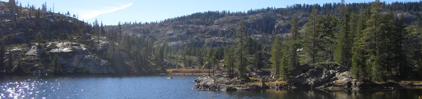
Packsaddle Campground is located in the Packer Lake area near the Sierra Buttes, north of the Yuba River. Visitors enjoy a wide variety of recreational activities in the area, including hiking, horseback riding, hunting, fishing, canoeing and gold panning. This facility is operated and maintained by the Tahoe National Forest.Recreation
A large network of trails is available in the area, including Deer Lake Trail. This 2.9-mile trail is open to hiking, horseback riding and mountain biking. The Pacific Crest Trail can easily be accessed nearby. Many lakes in the area offer fishing. Canoeing and paddeling is available on nearby Packer Lake.Facilities
The campground offers single-family campsites and two equestrian sites for campers with horses. Each site is equipped with a picnic table and campfire ring. The equestrian sites share a corral and have ample space for stock trailers. Vault toilets and drinking water are provided.Natural Features
The campground is split into two loops. The first is more open but is shaded by towering Jeffrey pine and fir trees. The second is located on a forested hillside above the first loop. Some sites have views of the open, wildflower-dotted meadow, while others overlook a ravine and mountain peaks beyond it.Nearby Attractions
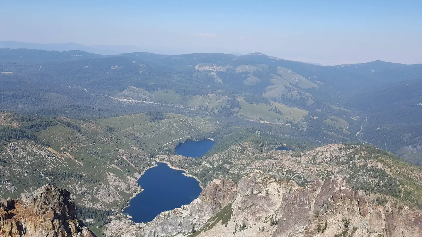
Lakes Basin offers many opportunities for boating, fishing and hiking. Boating, fishing and swimming are available at nearby Packer Lake less than a mile to the west and Sardine Lakes, about three miles south of the campground. Sardine Lakes Resort offers boat rentals. Anglers will find rainbow and brook trout in many of the lakes, streams, and rivers throughout the basin. A more developed boat ramp is located at Gold Lake and accomodates launching of larger boats. Over 30 miles of maintained trails for hiking, mountain biking, and motorcycle singletrack branch out across the area and the Pacific Crest Trail can be accessed at a few spots in the Lakes Basin area. The historic towns of Sierra City and Downieville offer historic and cultural attractions, restaurants, shops, churches, and vistor information.Contact Info
This location is unstaffed. To speak with our main office for general information, please call: (530) 265-4531.Charges & Cancellations
No Show Policy
A no-show customer is one who does not arrive at a campground and does not cancel the reservation by check-out time on the day after the scheduled arrival date (or for day-use facilities, by check-in time the day of arrival).
* No-show customers are only recorded at staffed facilities. At most remote facilities, all customers are noted as automatically checked-in on the date of arrival.
* It is recommended that staffed facilities hold a campsite until check-out time on the day following the arrival date.
* It is recommended that staffed facilities hold group day-use facilities until check-in time on the arrival date.
There is no change fee if a customer extends or shortens a reservation if the change includes dates from the original reservation. If they choose to depart early, they may forfeit some or all of the recreation fees.
There is no change fee if the customer changes campsites that are the same price and on the same reservation dates in the same campground. If the campsite the customer is changing to has a price difference, the customer will be responsible for any additional fees or be provided with a refund, based on the price difference.
Where recorded, no-show customers are assessed a $20.00 no-show fee and forfeit the first night's recreation fee for a campsite or forfeit the entire day-use recreation fee for a day-use facility. We recommend customers contact the facility if they are en route to their reservation but cannot make it by the check-in date. In these cases, no refund will be issued, but the facility can ensure that a "no-show" fee is not assessed.
The facts
- Season: June 13 – October 15 — USDA Forest Service, Aug 24, 2026
- 16 bookable sites
- 18 sites in total, including non-bookable
- Vehicles up to 100 ft
- Up to 6 people per site
- Loops: AREA PACKSADDLE, PACKSADDLE
Site types
- 16 Standard Nonelectric
- 2 Management
Amenities
- Campfires allowed
- Fire pits
- Picnic tables
- Shade
- Pets allowed
Not recorded upstream: electric hookups, water hookups, sewer hookups, grills.
18 campsites at Packsaddle
| Site | Loop | Type | Entry | Surface | Max rig | People | |
|---|---|---|---|---|---|---|---|
| FT1-15 | AREA PACKSADDLE | Management | Back In | Gravel | 15 ft | 6 | |
| FT1-15N | AREA PACKSADDLE | Management | Back In | Gravel | 15 ft | 6 | |
| 001 | PACKSADDLE | Standard Nonelectric | — | Gravel | 27 ft | 6 | 🐾 |
| 002 | PACKSADDLE | Standard Nonelectric | Back In | Gravel | 25 ft | 6 | 🐾 |
| 003 | PACKSADDLE | Standard Nonelectric | Back In | Gravel | 23 ft | 6 | 🐾 |
| 004 | PACKSADDLE | Standard Nonelectric | Back In | Gravel | 26 ft | 6 | 🐾 |
| 005 | PACKSADDLE | Standard Nonelectric | Back In | Gravel | 35 ft | 6 | 🐾 |
| 006 | PACKSADDLE | Standard Nonelectric | Back In | Gravel | 39 ft | 6 | 🐾 |
| 007 | PACKSADDLE | Standard Nonelectric | Back In | Gravel | 48 ft | 6 | 🐾 |
| 008 | PACKSADDLE | Standard Nonelectric | Back In | Gravel | 36 ft | 6 | 🐾 |
| 009 | PACKSADDLE | Standard Nonelectric | Back In | Gravel | 30 ft | 6 | 🐾 |
| 010 | PACKSADDLE | Standard Nonelectric | Pull Through | Gravel | 25 ft | 6 | 🐾 |
| 011 | PACKSADDLE | Standard Nonelectric | Back In | Gravel | 30 ft | 6 | 🐾 |
| 012 | PACKSADDLE | Standard Nonelectric | Back In | Gravel | 31 ft | 6 | 🐾 |
| 013 | PACKSADDLE | Standard Nonelectric | Back In | Gravel | 51 ft | 6 | 🐾 |
| 014 | PACKSADDLE | Standard Nonelectric | Back In | — | 18 ft | 6 | 🐾 |
| 015 | PACKSADDLE | Standard Nonelectric | Back In | Gravel | 45 ft | 6 | 🐾 |
| 016 | PACKSADDLE | Standard Nonelectric | Back In | Gravel | 100 ft | 6 | 🐾 |
Getting there
From Sierra City, travel north (east) on Highway 49 for 5 miles. Turn left at Bassett Station on Gold Lake Highway and continue just over a mile to Packer Lake Road and turn left. Go less than a mile and turn right on Packer Lake Road. Continue for about 2.5 miles and turn left into the campground.
From Sierraville, travel south (west) on Highway 49 for about 17 miles. Turn left at Bassett Station on Gold Lake Highway and continue just over a mile to Packer Lake Road and turn left. Go less than a mile and turn right on Packer Lake Road. Continue for about 2.5 miles and turn left into the campground.
39.62472, -120.64986 · 39°37'29.0"N 120°38'59.5"W
Typical weather
Typically 89°F in Jul, down to 46°F in Dec.
| Jan | Feb | Mar | Apr | May | Jun | Jul | Aug | Sep | Oct | Nov | Dec | |
|---|---|---|---|---|---|---|---|---|---|---|---|---|
| High °F | 48 | 52 | 58 | 63 | 72 | 81 | 89 | 89 | 83 | 72 | 56 | 46 |
| Low °F | 30 | 31 | 33 | 36 | 42 | 46 | 51 | 50 | 46 | 39 | 33 | 29 |
| Precip in | 11.3 | 10.7 | 10.0 | 5.3 | 3.6 | 1.1 | 0.1 | 0.2 | 0.7 | 3.3 | 6.8 | 11.8 |
1991–2020 averages from the nearest NOAA station, 10.2 mi away — not measured at the facility itself, and elevation can make a real difference over that distance.
Map
More photos
Member photos
Common questions about Packsaddle
- Can you reserve a site at Packsaddle?
- Yes, Packsaddle is reservable through Recreation.gov.
- How many campsites does Packsaddle have?
- 18 sites in total, of which 16 can be booked.
- What is the maximum RV length at Packsaddle?
- 100 ft. That is the longest vehicle the sites here are recorded as taking; individual sites may be shorter.
- Are pets allowed at Packsaddle?
- Yes, pets are allowed at Packsaddle.
- Are campfires allowed at Packsaddle?
- Campfires are allowed at Packsaddle. Check for a current fire restriction before you go.
Also listed by
Packsaddle also appears in other federal recreation data. Facts below are matched by name and location, not confirmed by Packsaddle's operator.
USDA Forest Service — data as of Aug 24, 2026
- $24 per site $5 for extra vehicle
Restrictions:
- Camping outside designated campground is prohibited in this area
Camping near Packsaddle
- Berger 0.3 mi · Campground · we watch it
- Diablo 0.9 mi · Campground · we watch it
- Sardine Lake 1.8 mi · Campground · we watch it
- Salmon Creek 2 mi · Campground · we watch it
- Lakes Basin 2.9 mi · Campground · we watch it
- Gold Lake 4 X 4 Campground 3.1 mi · Campground · we watch it
- Gold Lake Campground (CA) 3.6 mi · Campground · we watch it
- Loganville 4.2 mi · Campground · we watch it
- Wild Plum 4.7 mi · Campground · we watch it
- Snag Lake Campground 3.4 mi · Campground
- Haven Lake Campground 3.4 mi · Campground
- Goose Lake Campground 3.6 mi · Campground
Contact
- Phone (530)478-6253
- Book Recreation.gov
Recreation.gov last updated this record on 2026-03-11.
Facility information and photographs from Recreation.gov (RIDB). SpotOpened is not affiliated with Recreation.gov or any federal agency.
Comments