North Algodones Dunes Wilderness
Facility · California ·
Managed by the Bureau of Land Management
El Centro Field Office (Bureau of Land Management CA) · Open Access
- 314 ft
- Elevation
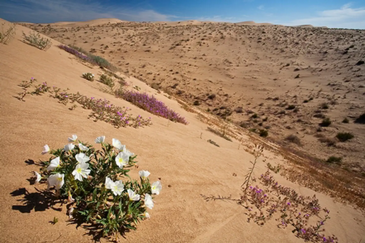
The Wilderness is divided into two distinct zones. On the west side are the primary dunes, the largest and tallest dunes composed of relatively coarse sand. On the east are the secondary dunes, smaller and composed of generally finer sands carried further east by prevailing winds.
A parking area with access to the wilderness site is a perfect place to discover a variety of plant and animal species.
Visitors are welcome to walk or ride horses in this remote area. The wilderness is closed to all vehicles and mechanized use.
Getting there
33.03150, -115.18241 · 33°1'53.4"N 115°10'56.7"W
Typical weather
Typically 108°F in Jul, down to 70°F in Dec.
| Jan | Feb | Mar | Apr | May | Jun | Jul | Aug | Sep | Oct | Nov | Dec | |
|---|---|---|---|---|---|---|---|---|---|---|---|---|
| High °F | 72 | 75 | 81 | 87 | 95 | 104 | 108 | 108 | 104 | 93 | 80 | 70 |
| Low °F | 41 | 45 | 50 | 54 | 61 | 68 | 77 | 78 | 71 | 60 | 49 | 41 |
| Precip in | 0.5 | 0.5 | 0.3 | 0.1 | 0.0 | 0.0 | 0.0 | 0.1 | 0.1 | 0.1 | 0.2 | 0.5 |
1991–2020 averages from the nearest NOAA station, 22.4 mi away — not measured at the facility itself, and elevation can make a real difference over that distance.
Map
Member photos
Common questions about North Algodones Dunes Wilderness
- Can you reserve a site at North Algodones Dunes Wilderness?
- No. North Algodones Dunes Wilderness is not reservable through Recreation.gov, so sites are first-come, first-served or booked elsewhere.
Camping near North Algodones Dunes Wilderness
- Cahuilla Ranger Station 4.1 mi · Facility
- Buttercup Ranger Station 26.6 mi · Facility
- Coon Hollow Campground 33 mi · Campground
- Wiley's Well Campground 36.2 mi · Campground
- Oxbow Recreation and Wildlife Area 36.7 mi · Facility
- Senator Wash North Shore 40.6 mi · Facility
- Senator Wash South Shore 40.8 mi · Facility
- T.K. Jones Campground and Boat Launch 41.8 mi · Campground
- Corn Springs Campground 41.9 mi · Campground
- Kofa Wilderness 47.9 mi · Facility
- Ehrenberg Sandbowl 54.2 mi · Facility
Contact
- Phone 760-337-4400
- Email BLM_CA_Web_EC@blm.gov
- Info Recreation.gov
Recreation.gov last updated this record on 2026-02-25.
Facility information and photographs from Recreation.gov (RIDB). SpotOpened is not affiliated with Recreation.gov or any federal agency.
Comments