Lightning Tree
Campground · California · 39 bookable sites ·
Managed by the USDA Forest Service
Plumas National Forest (NF) · Open Access
- 39
- Bookable sites
- 45 ft
- Max rig length
- up to 16
- People per site
- 4
- Accessible sites
- 5,794 ft
- Elevation
Overview
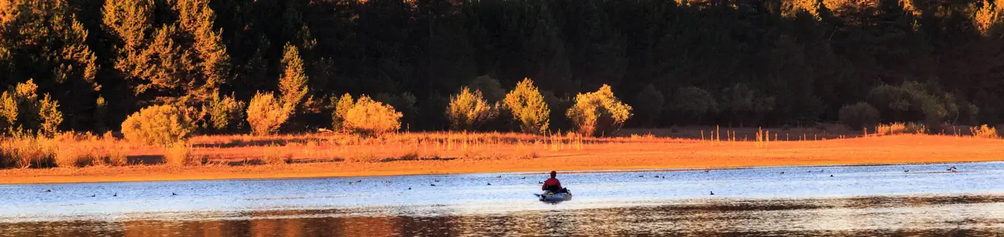
Lightning Tree Campground (5,800 feet) is one of three family-friendly campgrounds located in the Lake Davis Recreation Area. The lake was formed by damming Grizzly Creek in 1967. The purpose of the lake was to provide water for the town of Portola, improve area fishing and provide recreation opportunities. The 32 miles of shoreline has several boat launch facilities and fishing access points. Lightning Tree Campground is a great place to serve as hub for family fun and recreation. At the end of the day return to this home away from home to relax around the campfire.
Recreation
In addition to camping, the area offers a wide variety of popular water-related activities, including fishing, boating and swimming. Numerous fishing access points are located around the perimeter of the lake and anglers will find rainbow and brown trout, bass and catfish. A boat ramp is located nearby.
Mountain biking, hiking, hunting and wildlife viewing are also available in the area. During winter months, visitors enjoy ice fishing, snowmobiling and cross-country skiing.
Facilities
The campground offers more than three dozen single and double capacity campsites, available for tent and RV camping. Some accessible campsites are available. Most sites are available on a first come basis and the rest are open for reservation up to six months in advance. Coin-operated showers are available 4 miles away at Grasshopper Flat Campground.
Natural Features
Lake Davis is situated in the hills north of the town of Portola in the Plumas National Forest. Smith Peak State Game Refuge to the south and west of the lake is a great place for bird watching, nature viewing, photography and exploring. Large sheep herding ranches used this area before the dam was build. Today, cattle trek across the rangeland meadows. Get a panoramic view of Lake Davis, Sierra Valley and peaks of the Sierra Nevada and Cascade Ranges from Smith Peak Fire Lookout.
Contact Info
For facility specific information, please call (530) 836-2575.Nearby Attractions
Restaraunts, stores and services are available in Portola, CA
Visit the largest railroad museum in the Western United States located in Portola.
The old Basque style sheepherder bread oven at Jenkins Point has been restored
Visit Smith Peak Fire Lookout
The facts
- 39 bookable sites
- 40 sites in total, including non-bookable
- 4 accessible sites
- Vehicles up to 45 ft
- Up to 16 people per site
- Loops: AREA LIGHTNING TREE
Site types
- 39 Standard Nonelectric
- 1 Management
Amenities
- Shade
- Pets allowed
Not recorded upstream: electric hookups, water hookups, sewer hookups, campfires allowed, fire pits, picnic tables, grills.
40 campsites at Lightning Tree
Check-in 2:00 PM · Check-out 12:00 PM
| Site | Loop | Type | Entry | Surface | Max rig | People | |
|---|---|---|---|---|---|---|---|
| 001 | AREA LIGHTNING TREE | Standard Nonelectric | Back In | Paved | — | 16 | 🐾 |
| 002 | AREA LIGHTNING TREE | Standard Nonelectric | Back In | Gravel | — | 8 | 🐾 |
| 003 | AREA LIGHTNING TREE | Standard Nonelectric | Back In | Gravel | — | 16 | 🐾 |
| 004 | AREA LIGHTNING TREE | Standard Nonelectric | Back In | Gravel | — | 16 | 🐾 |
| 005 | AREA LIGHTNING TREE | Standard Nonelectric | Back In | Paved | — | 16 | ♿ 🐾 |
| 006 | AREA LIGHTNING TREE | Standard Nonelectric | Back In | Paved | — | 8 | 🐾 |
| 007 | AREA LIGHTNING TREE | Standard Nonelectric | Back In | Gravel | — | 16 | 🐾 |
| 008 | AREA LIGHTNING TREE | Standard Nonelectric | Back In | Gravel | — | 8 | 🐾 |
| 009 | AREA LIGHTNING TREE | Standard Nonelectric | Back In | Paved | 36 ft | 8 | 🐾 |
| 010 | AREA LIGHTNING TREE | Standard Nonelectric | Back In | Gravel | 45 ft | 16 | 🐾 |
| 011 | AREA LIGHTNING TREE | Standard Nonelectric | Back In | Gravel | — | 8 | 🐾 |
| 012 | AREA LIGHTNING TREE | Standard Nonelectric | Back In | Paved | — | 8 | ♿ 🐾 |
| 013 | AREA LIGHTNING TREE | Standard Nonelectric | Back In | Gravel | — | 8 | 🐾 |
| 014 | AREA LIGHTNING TREE | Standard Nonelectric | Back In | Gravel | 45 ft | 8 | 🐾 |
| 015 | AREA LIGHTNING TREE | Standard Nonelectric | Back In | Gravel | 45 ft | 8 | 🐾 |
| 016 | AREA LIGHTNING TREE | Standard Nonelectric | Back In | Gravel | — | 8 | 🐾 |
| 017 | AREA LIGHTNING TREE | Standard Nonelectric | Back In | Paved | 38 ft | 16 | 🐾 |
| 018 | AREA LIGHTNING TREE | Standard Nonelectric | Back In | Gravel | 45 ft | 8 | 🐾 |
| 019 | AREA LIGHTNING TREE | Standard Nonelectric | Back In | Gravel | — | 16 | 🐾 |
| 020 | AREA LIGHTNING TREE | Standard Nonelectric | Back In | Gravel | 45 ft | 8 | 🐾 |
| 021 | AREA LIGHTNING TREE | Standard Nonelectric | Back In | Gravel | — | 8 | 🐾 |
| 023 | AREA LIGHTNING TREE | Standard Nonelectric | Back In | Gravel | 45 ft | 16 | 🐾 |
| 024 | AREA LIGHTNING TREE | Standard Nonelectric | Back In | Paved | 38 ft | 8 | 🐾 |
| 025 | AREA LIGHTNING TREE | Standard Nonelectric | Back In | Gravel | 45 ft | 16 | 🐾 |
| 026 | AREA LIGHTNING TREE | Standard Nonelectric | Back In | Gravel | 45 ft | 16 | 🐾 |
| 027 | AREA LIGHTNING TREE | Standard Nonelectric | Back In | Paved | — | 16 | ♿ 🐾 |
| 028 | AREA LIGHTNING TREE | Standard Nonelectric | Back In | Gravel | 45 ft | 8 | 🐾 |
| 029 | AREA LIGHTNING TREE | Standard Nonelectric | Back In | Gravel | 45 ft | 8 | 🐾 |
| 030 | AREA LIGHTNING TREE | Standard Nonelectric | Pull Through | Paved | — | 16 | 🐾 |
| 031 | AREA LIGHTNING TREE | Standard Nonelectric | Back In | Paved | — | 8 | ♿ 🐾 |
| 032 | AREA LIGHTNING TREE | Standard Nonelectric | Back In | Gravel | — | 8 | 🐾 |
| 033 | AREA LIGHTNING TREE | Standard Nonelectric | Back In | Gravel | — | 8 | 🐾 |
| 034 | AREA LIGHTNING TREE | Standard Nonelectric | Back In | Gravel | — | 16 | 🐾 |
| 035 | AREA LIGHTNING TREE | Standard Nonelectric | Back In | Gravel | — | 8 | 🐾 |
| 036 | AREA LIGHTNING TREE | Standard Nonelectric | Back In | Gravel | — | 16 | 🐾 |
| 037 | AREA LIGHTNING TREE | Standard Nonelectric | Back In | Paved | 43 ft | 8 | 🐾 |
| 038 | AREA LIGHTNING TREE | Standard Nonelectric | Back In | Gravel | 45 ft | 16 | 🐾 |
| 039 | AREA LIGHTNING TREE | Standard Nonelectric | Back In | Gravel | 45 ft | 16 | 🐾 |
| 040 | AREA LIGHTNING TREE | Standard Nonelectric | Back In | Gravel | — | 8 | 🐾 |
| XXX5 | AREA LIGHTNING TREE | Management | Back In | Gravel | 45 ft | 8 | 🐾 |
Getting there
39.92546, -120.51049 · 39°55'31.6"N 120°30'37.8"W
Typical weather
Typically 86°F in Jul, down to 42°F in Dec.
| Jan | Feb | Mar | Apr | May | Jun | Jul | Aug | Sep | Oct | Nov | Dec | |
|---|---|---|---|---|---|---|---|---|---|---|---|---|
| High °F | 43 | 46 | 52 | 58 | 67 | 77 | 86 | 85 | 79 | 66 | 53 | 42 |
| Low °F | 19 | 21 | 25 | 29 | 35 | 40 | 45 | 43 | 37 | 30 | 24 | 19 |
| Precip in | 4.2 | 3.9 | 3.6 | 1.6 | 1.1 | 0.5 | 0.3 | 0.3 | 0.4 | 1.1 | 2.0 | 4.3 |
1991–2020 averages from the nearest NOAA station, 8.6 mi away — not measured at the facility itself, and elevation can make a real difference over that distance.
Map
More photos
Member photos
Common questions about Lightning Tree
- Can you reserve a site at Lightning Tree?
- Yes, Lightning Tree is reservable through Recreation.gov.
- How many campsites does Lightning Tree have?
- 40 sites in total, of which 39 can be booked.
- What is the maximum RV length at Lightning Tree?
- 45 ft. That is the longest vehicle the sites here are recorded as taking; individual sites may be shorter.
- Are pets allowed at Lightning Tree?
- Yes, pets are allowed at Lightning Tree.
Camping near Lightning Tree
- Grasshopper Flat 3 mi · Campground · we watch it
- Grizzly 3.3 mi · Campground · we watch it
- Crocker Guard Station 5.1 mi · Campground · we watch it
- Crocker Campground 5.3 mi · Campground · we watch it
- Cottonwood (Ca) 14.8 mi · Campground · we watch it
- Lightning Tree Campground 0.6 mi · Campground
- Honker Cove Overflow 2.9 mi · Campground
- Lake Davis Dump Station 3.3 mi · Campground
- Conklin Park Campground 11.4 mi · Campground
- Frenchman Dump Station 15.9 mi · Campground
- Cottonwood Springs Campground 15.9 mi · Campground
- Brady's Camp Campground 16.2 mi · Campground
Contact
- Email james.bradeen@usda.gov
- Book Recreation.gov
Recreation.gov last updated this record on 2026-05-08.
Facility information and photographs from Recreation.gov (RIDB). SpotOpened is not affiliated with Recreation.gov or any federal agency.
Comments