Desolation Wilderness Permit
Permit · California ·
Managed by the USDA Forest Service
Desolation Wilderness · Restricted Access
- 8,396 ft
- Elevation
Overview:
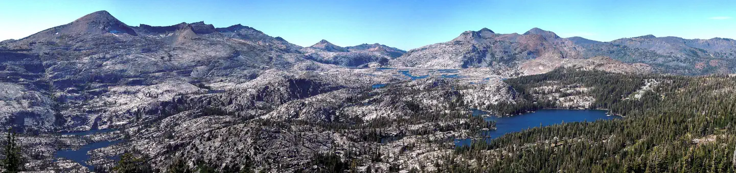
With numerous alpine lakes, scenic waterfalls and towering granite peaks, Desolation Wilderness is a perfect location for a summer trip. Whether you want an arduous climb or a relaxing walk, you'll find what you're looking for here. While summertime draws the most visitors, during the winter, the area becomes a popular playground for experienced backcountry skiers and snowshoers.
Thanks to its breathtaking granite landscape and surrounding scenery, as well as relative accessibility, Desolation Wilderness is one of the most popular wilderness areas in the National Wilderness Preservation System.
Long recognized for its mountain splendor, Desolation Valley Primitive Area was established in 1931 and granted wilderness status in 1969. It is located west of Lake Tahoe and north of Highway 50 in El Dorado County, California. It straddles the crest of the Sierra Nevada range, encompassing 63,690 acres, and has elevations ranging from 6,500 feet to nearly 10,000 feet.
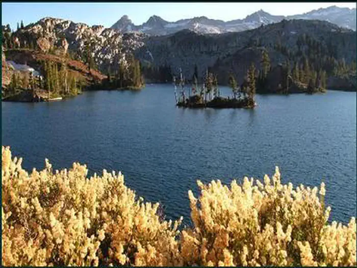
Lake Aloha is a feature of the wilderness area, with shallow, clear waters sitting in a wide, granite basin carved by glaciers in the most recent ice age. The Crystal Range is also within the area, with Pyramid Peak as the highest point both in the range and the wilderness, topping out at 9,987 feet. Horsetail Falls, which tumbles in stages for nearly 500 feet, is just one of the area's many waterfalls.
The Pacific Crest National Scenic Trail traverses 17 miles through Desolation Wilderness, from Echo Lakes to the south to Richardson Lake just past the northern boundary. An abundance of additional trails are found in the area. During the winter months, most of the trailheads are covered by snow and are not accessible. Contact a local U.S. Forest Service office for current conditions.
Visitors must obtain a permit for overnight camping and should be aware that throughout the summer months, a quota system is in place for the 45 destination zones within the wilderness. The system helps to disperse visitors throughout the area, providing an opportunity for solitude and reflection. Seventy percent of the available permits are available for advanced reservation. The remaining quota is available on a first-come, first-served basis.
Camping within the wilderness area is permitted, but campsites must be on hard surfaces at least 100 feet from water and trails. Maximum group size is limited to 12 people who will be together at any given time during the trip. A signed permit must be carried at all times by a group leader. Campfires are not allowed within the area and haven't been since 1990. Camp stoves for cooking are permissible. Overnight parking may require a pass in some areas, or may be subject to an additional fee.
Getting there
Trailheads are located west of South Lake Tahoe, along California State Highway 89 and U.S. Highway 50.
38.91972, -120.17000 · 38°55'11.0"N 120°10'12.0"W
Typical weather
| Jan | Feb | Mar | Apr | May | Jun | Jul | Aug | Sep | Oct | Nov | Dec | |
|---|---|---|---|---|---|---|---|---|---|---|---|---|
| High °F | — | — | — | — | — | — | — | — | — | — | — | — |
| Low °F | — | — | — | — | — | — | — | — | — | — | — | — |
| Precip in | 7.1 | 6.5 | 6.3 | 3.4 | 2.2 | 0.8 | 0.3 | 0.4 | 0.7 | 2.4 | 3.9 | 7.1 |
1991–2020 averages from the nearest NOAA station, 5.9 mi away — not measured at the facility itself, and elevation can make a real difference over that distance.
Map
Ways in
Showing 40 of 63.
- Aloha — Entry Point · Desolation Wilderness
- American — Entry Point · Desolation Wilderness
- Avalanche — Entry Point · Desolation Wilderness
- Bayview — Trailhead · Desolation Wilderness
- Brown Mountain — Entry Point · Desolation Wilderness
- Buck Island — Trailhead · Desolation Wilderness
- Camper Flat — Entry Point · Desolation Wilderness
- Cathedral — Trailhead · Desolation Wilderness
- Cathedral — Entry Point · Desolation Wilderness
- China Flat — Entry Point · Desolation Wilderness
- Dicks — Entry Point · Desolation Wilderness
- Dicks Peak — Entry Point · Desolation Wilderness
- Eagle — Entry Point · Desolation Wilderness
- Eagle Falls — Trailhead · Desolation Wilderness
- Echo — Trailhead · Desolation Wilderness
- General Creek — Entry Point · Desolation Wilderness
- General Creek — Trailhead · Desolation Wilderness
- Genevieve — Entry Point · Desolation Wilderness
- Gilmore — Entry Point · Desolation Wilderness
- Glen Alpine — Trailhead · Desolation Wilderness
- Grass — Entry Point · Desolation Wilderness
- Grouse Lakes — Entry Point · Desolation Wilderness
- Half Moon — Entry Point · Desolation Wilderness
- Hemlock — Entry Point · Desolation Wilderness
- Highland — Entry Point · Desolation Wilderness
- Kalmia — Entry Point · Desolation Wilderness
- Lake of the Woods — Entry Point · Desolation Wilderness
- Lakes #3 and #5 — Entry Point · Desolation Wilderness
- Lawrence — Entry Point · Desolation Wilderness
- Lelands — Entry Point · Desolation Wilderness
- Lois — Entry Point · Desolation Wilderness
- Loon Lake — Trailhead · Desolation Wilderness
- Lower Velmas — Entry Point · Desolation Wilderness
- Lyons — Entry Point · Desolation Wilderness
- Lyons Creek — Trailhead · Desolation Wilderness
- Maud — Entry Point · Desolation Wilderness
- Meeks Bay — Trailhead · Desolation Wilderness
- Middle Velma — Entry Point · Desolation Wilderness
- Mt. Price — Entry Point · Desolation Wilderness
- Pacific Crest Trail — Entry Point · Desolation Wilderness
More photos
Member photos
Common questions about Desolation Wilderness Permit
- Can you reserve a site at Desolation Wilderness Permit?
- Yes, Desolation Wilderness Permit is reservable through Recreation.gov.
Camping near Desolation Wilderness Permit
- Wrights Lake 5.9 mi · Campground · we watch it
- Wrights Lake Equestrian Campground 6.4 mi · Campground · we watch it
- Fallen Leaf Campground 6.6 mi · Campground · we watch it
- Badgers Den at Camp Richardson Resort 7 mi · Campground · we watch it
- Eagles Nest at Camp Richardson Resort 7 mi · Campground · we watch it
- RV Village Campground at Camp Richardson Resort 7 mi · Campground · we watch it
- Bayview Trailhead and Day-Use Area 4.1 mi · Campground
- Cascade Falls 4.1 mi · Facility
- Baldwin Beach 5.8 mi · Facility
- Kiva Picnic Area 6.7 mi · Facility
- Valhalla 6.9 mi · Facility
- Sawmill Pond 12N30 8.1 mi · Facility
Contact
- Book Recreation.gov
Recreation.gov last updated this record on 2026-02-25.
Facility information and photographs from Recreation.gov (RIDB). SpotOpened is not affiliated with Recreation.gov or any federal agency.
Comments