Chekaka Recreation Area Lake Mendocino
Campground · California · 1 bookable site ·
Managed by the US Army Corps of Engineers
- 1
- Bookable site
- 43 ft
- Max rig length
- up to 50
- People per site
- 2
- Accessible sites
- 788 ft
- Elevation
Overview
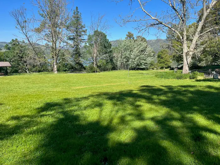
Chekaka Recreation Area is situated on Lake Mendocino in California's Mendocino Range, where redwood forests meet wine country. There is one reservable picnic pad in the Overlook Day-Use Area. Chekaka Campground has been permanently closed.
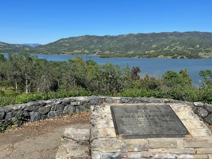
The lake is formed by the Coyote Dam on the Russian River. A wide variety of recreational opportunities is available, including boating, swimming, water skiing, fishing, hiking and horseback riding.
Recreation
The 1,822-acre lake provides abundant boating, swimming and water skiing opportunities. Anglers will find sunfish, smallmouth bass, striped bass, crappie, white and channel catfish, bluegill and perch.
Several miles of trails wind around Lake Mendocino, including the 3-mile Shakota Trail that begins at the Overlook Day-Use Area and offers beautiful views of the lake.
Lake Mendocino also offers two disc golf courses that can be found near the Overlook Day-Use Area on the south end and the Pomo A Day-Use Area parking lot on the north end. The rolling terrain is heavily wooded in some areas, making for challenging tunnel shots with obstacles around most pins.
Facilities
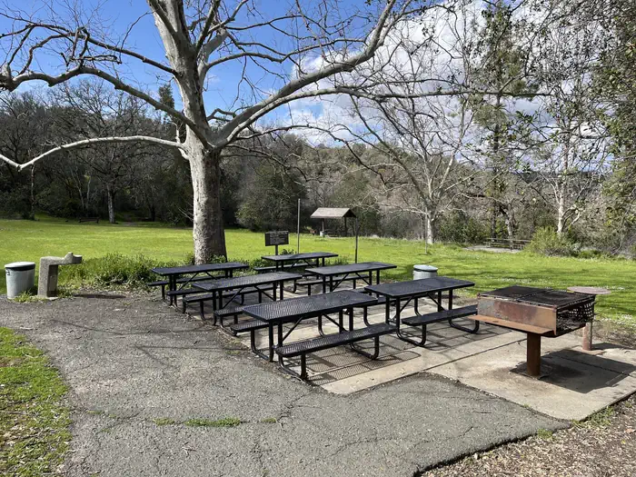
The old Chekaka Campground is permanently closed to camping. The Overlook Day-Use Area group picnic site in the Chekaka Recreation Area is available for reservations.
Natural Features
Lake Mendocino lies in the scenic rolling hills of Coyote Valley. Groves of oak mixed with manzanita and pines forest the area, offering limited shade and an excellent bird and wildlife habitat.Contact Info
This location has limited staffing. Please call (707) 467-4200 for general information.Nearby Attractions
The charming city of Ukiah, less than 15 minutes away, offers a variety of shopping and dining opportunities, museums and golf courses. The Ukiah Farmer's Market runs Saturday mornings throughout the summer, offering fresh produce, local wines, arts and crafts and live music.
The facts
- 1 bookable site
- 24 sites in total, including non-bookable
- 2 sites for day use only
- 2 accessible sites
- Vehicles up to 43 ft
- Up to 50 people per site
- Loops: CHE-KAKA CAMPGROUND, JOE RILEY, OVERLOOK DAY-USE AREA
Site types
- 23 Management
- 1 Group Picnic Area
Amenities
- Electric hookups
- Sewer hookups
- Fire pits
- Picnic tables
- Shade
- Pets allowed
Not recorded upstream: water hookups, campfires allowed, grills.
24 campsites at Chekaka Recreation Area Lake Mendocino
| Site | Loop | Type | Entry | Surface | Max rig | People | |
|---|---|---|---|---|---|---|---|
| C001 | CHE-KAKA CAMPGROUND | Management | Back In | Paved | 33 ft | 8 | 🐾 |
| C002 | CHE-KAKA CAMPGROUND | Management | Back In | Paved | 42 ft | 8 | 🐾 |
| C003 | CHE-KAKA CAMPGROUND | Management | Back In | Paved | 42 ft | 8 | 🐾 |
| C004 | CHE-KAKA CAMPGROUND | Management | Back In | Paved | 33 ft | 8 | 🐾 |
| C005 | CHE-KAKA CAMPGROUND | Management | Back In | Paved | 34 ft | 8 | 🐾 |
| C006 | CHE-KAKA CAMPGROUND | Management | Back In | Paved | 37 ft | 8 | ♿ 🐾 |
| C007 | CHE-KAKA CAMPGROUND | Management | Back In | Paved | 35 ft | 8 | 🐾 |
| C008 | CHE-KAKA CAMPGROUND | Management | Back In | Paved | 33 ft | 8 | 🐾 |
| C009 | CHE-KAKA CAMPGROUND | Management | Back In | Paved | 35 ft | 8 | 🐾 |
| C010 | CHE-KAKA CAMPGROUND | Management | Back In | Paved | 25 ft | 8 | 🐾 |
| C011 | CHE-KAKA CAMPGROUND | Management | Back In | Paved | 32 ft | 8 | 🐾 |
| C012 | CHE-KAKA CAMPGROUND | Management | Back In | Paved | 35 ft | 8 | ♿ 🐾 |
| C013 | CHE-KAKA CAMPGROUND | Management | Back In | Paved | 28 ft | 8 | 🐾 |
| C014 | CHE-KAKA CAMPGROUND | Management | Back In | Paved | 34 ft | 8 | 🐾 |
| C015 | CHE-KAKA CAMPGROUND | Management | Back In | Paved | 30 ft | 8 | 🐾 |
| C016 | CHE-KAKA CAMPGROUND | Management | Back In | Paved | 32 ft | 8 | 🐾 |
| C017 | CHE-KAKA CAMPGROUND | Management | Back In | Paved | 34 ft | 8 | 🐾 |
| C018 | CHE-KAKA CAMPGROUND | Management | Back In | Paved | 40 ft | 8 | 🐾 |
| C019 | CHE-KAKA CAMPGROUND | Management | Back In | Paved | 40 ft | 8 | 🐾 |
| C021 | CHE-KAKA CAMPGROUND | Management | Back In | Paved | 35 ft | 8 | 🐾 |
| C022 | CHE-KAKA CAMPGROUND | Management | Back In | Paved | 43 ft | 8 | 🐾 |
| C023 | CHE-KAKA CAMPGROUND | Management | Back In | Paved | 36 ft | 8 | 🐾 |
| JOE RILEY | JOE RILEY | Management | — | Paved | 20 ft | 50 | 🐾 |
| OVERLOOK GROUP PICNIC SITE | OVERLOOK DAY-USE AREA | Group Picnic Area | — | — | — | 50 | 🐾 |
Getting there
From the South (San Francisco, Santa Rosa, Ukiah): Follow Highway 101 North towards Ukiah. Approximately 2 miles north of Ukiah, take the Lake Mendocino Dr. exit and turn right. Turn left at North State St., then right again onto Lake Mendocino Dr. Chekaka Recreation Area is at the top of the hill. Take a slight left before reaching the Coyote Valley Dam to visit the Overlook Day-Use Area.
From the North (Eureka, Willits, Fort Bragg): Follow Highway 101 South. Approximately 17 miles south of Willits, take the Lake Mendocino Dr. exit and turn left. Turn left at North State St., then right onto Lake Mendocino Dr. Chekaka Recreation Area is at the top of the hill. Take a slight left before reaching the Coyote Valley Dam to visit the Overlook Day-Use Area.
From the East (Sacramento): From the city of Williams, take Highway 20 West. Continue on Highway 20 for approximately 2 hours or 80 miles traveling past Clearlake and Blue Lakes. Approximately 5 miles after the Potter Valley turn-off, continue onto Highway 101 South. Take the Lake Mendocino Dr. exit and turn left. Turn left at North State St., then right onto Lake Mendocino Dr. Chekaka Recreation Area is at the top of the hill. Take a slight left before reaching the Coyote Valley Dam to visit the Overlook Day-Use Area.
39.20306, -123.18639 · 39°12'11.0"N 123°11'11.0"W
Typical weather
Typically 91°F in Jul, down to 56°F in Dec.
| Jan | Feb | Mar | Apr | May | Jun | Jul | Aug | Sep | Oct | Nov | Dec | |
|---|---|---|---|---|---|---|---|---|---|---|---|---|
| High °F | 57 | 60 | 65 | 70 | 76 | 83 | 91 | 91 | 87 | 77 | 63 | 56 |
| Low °F | 37 | 38 | 40 | 42 | 47 | 52 | 56 | 54 | 51 | 46 | 40 | 36 |
| Precip in | 7.4 | 7.0 | 5.3 | 2.8 | 1.7 | 0.4 | 0.0 | 0.1 | 0.2 | 1.9 | 4.1 | 8.0 |
1991–2020 averages from the nearest NOAA station, 4.1 mi away — not measured at the facility itself, and elevation can make a real difference over that distance.
Map
More photos
Member photos
Common questions about Chekaka Recreation Area Lake Mendocino
- Can you reserve a site at Chekaka Recreation Area Lake Mendocino?
- Yes, Chekaka Recreation Area Lake Mendocino is reservable through Recreation.gov.
- How many campsites does Chekaka Recreation Area Lake Mendocino have?
- 24 sites in total, of which 1 can be booked.
- What is the maximum RV length at Chekaka Recreation Area Lake Mendocino?
- 43 ft. That is the longest vehicle the sites here are recorded as taking; individual sites may be shorter.
- Are pets allowed at Chekaka Recreation Area Lake Mendocino?
- Yes, pets are allowed at Chekaka Recreation Area Lake Mendocino.
- Does Chekaka Recreation Area Lake Mendocino have hookups?
- Electric, Sewer.
Camping near Chekaka Recreation Area Lake Mendocino
- Pomo Day Use Area 2.3 mi · Campground · we watch it
- Kyen Campground and Oak Grove Day Use Area 2.4 mi · Campground · we watch it
- Bushay Recreation Area 2.5 mi · Campground · we watch it
- Pine Mountain Lookout 14.4 mi · Campground · we watch it
- Letts Lake Campground 26.5 mi · Campground · we watch it
- Lake Pillsbury 19.7 mi · Facility
- Fuller Grove Group Campground 19.8 mi · Campground
- Pogie Point Campground 20.2 mi · Campground
- Sunset Campground 20.9 mi · Campground
- Sanhedrin Wilderness 22.6 mi · Facility
- Lower Nye Campground 25.4 mi · Campground
- Cedar Camp Campground 26.4 mi · Campground
Contact
- Phone 707-467-4200
- Book Recreation.gov
Recreation.gov last updated this record on 2026-07-10.
Facility information and photographs from Recreation.gov (RIDB). SpotOpened is not affiliated with Recreation.gov or any federal agency.
Comments