Ahart Campground
Campground · California · 11 bookable sites ·
Managed by the USDA Forest Service
Tahoe National Forest (NF) · Open Access
- 11
- Bookable sites
- up to 6
- People per site
- 5,333 ft
- Elevation
Overview
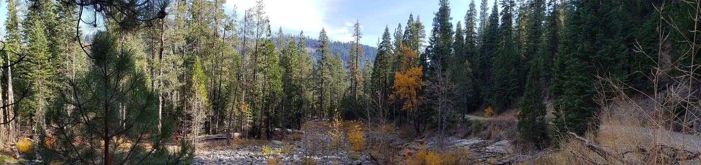
Ahart Campground is located on the tree covered banks of the North Fork of the American River near French Meadows Reservoir, about 40 miles from the town of Foresthill, high in the Sierra mountains. Visitors enjoy the area for the rugged mountain beauty, fishing, boating and trail opportunities. This facility is operated and maintained by the Tahoe National Forest.
Natural Features
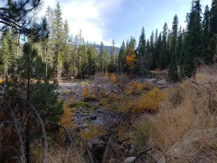
The campground is near the north shore of French Meadows Reservoir along the banks of the Middle Fork of the American River while nestled in a Coniferous Forest. Summer days can be warm and pleasant with cool evenings.
The facts
- Season: June – November — USDA Forest Service, Aug 24, 2026
- 11 bookable sites
- 12 sites in total, including non-bookable
- Up to 6 people per site
- Loops: A, B
Site types
- 11 Standard Nonelectric
- 1 Management
Amenities
- Pets allowed
- Water hookups — not available
Not recorded upstream: electric hookups, sewer hookups, campfires allowed, fire pits, picnic tables, grills, shade.
12 campsites at Ahart Campground
| Site | Loop | Type | Entry | Surface | Max rig | People | |
|---|---|---|---|---|---|---|---|
| 1 | A | Standard Nonelectric | — | — | — | — | |
| 2 | A | Standard Nonelectric | — | — | — | 6 | 🐾 |
| 3 | A | Standard Nonelectric | — | — | — | 6 | 🐾 |
| 4 | A | Standard Nonelectric | — | — | — | 6 | 🐾 |
| 8 | A | Standard Nonelectric | — | — | — | 6 | 🐾 |
| 10 | B | Management | — | — | — | 6 | 🐾 |
| 11 | B | Standard Nonelectric | — | — | — | 6 | 🐾 |
| 12 | B | Standard Nonelectric | — | — | — | 6 | 🐾 |
| 5 | B | Standard Nonelectric | — | — | — | 6 | 🐾 |
| 6 | B | Standard Nonelectric | — | — | — | 6 | 🐾 |
| 7 | B | Standard Nonelectric | — | — | — | 6 | 🐾 |
| 9 | B | Standard Nonelectric | — | — | — | — | 🐾 |
Getting there
High clearance vehicles may take Foresthill Rd to the 43 Rd (Robinson Flat Rd) to Mosquito Ridge Rd, snow permitting. Access from Soda Springs and the 43 Rd is not recommended for trucks with trailers, motorhomes/RV's or passenger vehicles that are not high clearance vehicles with four wheel drive.
39.14600, -120.40820 · 39°8'45.6"N 120°24'29.5"W
Typical weather
| Jan | Feb | Mar | Apr | May | Jun | Jul | Aug | Sep | Oct | Nov | Dec | |
|---|---|---|---|---|---|---|---|---|---|---|---|---|
| High °F | — | — | — | — | — | — | — | — | — | — | — | — |
| Low °F | — | — | — | — | — | — | — | — | — | — | — | — |
| Precip in | 10.6 | 9.3 | 8.8 | 5.0 | 3.5 | 1.3 | 0.3 | 0.4 | 0.8 | 4.1 | 6.8 | 11.5 |
1991–2020 averages from the nearest NOAA station, 8.5 mi away — not measured at the facility itself, and elevation can make a real difference over that distance.
Map
More photos
Member photos
Common questions about Ahart Campground
- Can you reserve a site at Ahart Campground?
- Yes, Ahart Campground is reservable through Recreation.gov.
- How many campsites does Ahart Campground have?
- 12 sites in total, of which 11 can be booked.
- Are pets allowed at Ahart Campground?
- Yes, pets are allowed at Ahart Campground.
- Does Ahart Campground have hookups?
- No hookups are recorded here.
Also listed by
Ahart Campground also appears in other federal recreation data. Facts below are matched by name and location, not confirmed by Ahart Campground's operator.
USDA Forest Service — data as of Aug 24, 2026
- $20 per site
Restrictions:
- Firearms or any other implements of destruction(including but not limited to bow & arrow and slingshots) are prohibited in this area; camping outside designated campground is prohibited in this area
Camping near Ahart Campground
- Gates Group 0.3 mi · Campground · we watch it
- Coyote Group 0.7 mi · Campground · we watch it
- Lewis 1.1 mi · Campground · we watch it
- French Meadows 2.4 mi · Campground · we watch it
- Mumford Bar Campground 1.6 mi · Campground
- French Meadows Reservoir 2.3 mi · Facility
- Poppy Campground 2.4 mi · Campground
- Talbot Campground 3.4 mi · Campground
- Big Meadows Campground 5 mi · Campground
- Robinson Flat Campground 5.1 mi · Campground
- Upper Hole Campground 5.2 mi · Campground
- Hell Hole Campground 5.2 mi · Campground
Contact
- Phone (530) 367-2224
- Book Recreation.gov
Recreation.gov last updated this record on 2026-06-19.
Facility information and photographs from Recreation.gov (RIDB). SpotOpened is not affiliated with Recreation.gov or any federal agency.
Comments