Pendleton Bend
Campground · Arkansas · 32 bookable sites ·
Managed by the US Army Corps of Engineers
Wilbur D. Mills Pool Recreation Area (Recreation Area) · Open Access
- 32
- Bookable sites
- 115 ft
- Max rig length
- up to 25
- People per site
- 169 ft
- Elevation
Overview
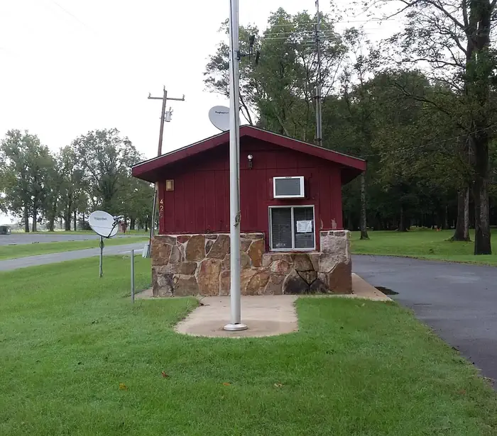
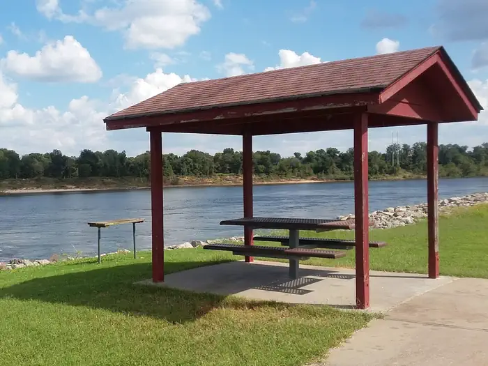
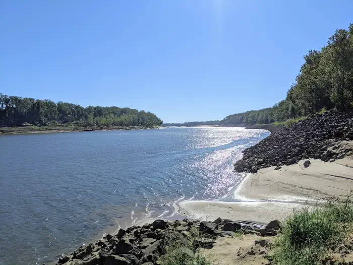
Pendleton Bend Campground and Day Use Park is located on the bank of the Arkansas River. The campground offers 31 campsites, a two lane boatramp, a comfort station with hot showers and restrooms, playground, picnic sites, and a group shelter that can accomodate 75 users.Recreation
Hiking, fishing, boating, birding, and hunting are all popular activities for visitors. World-class bass and crappie fishing is found in Pool 2, and the tailwaters of the dam provide excellent opportunities to catch a variety of gamefish, especially catfish. A boat ramp is available for access to the Arkansas River. Hiking and birding is available in the nearby Trusten Holder Wildlife Management Area. Many species of waterfowl frequent the lower Arkansas River and its adjacent wetlands making this area a destination for waterfowl hunters.Facilities
Pendleton Bend offers 31 campsites with electric and water hookups, 25 of which may be reserved. Additional amenities include a boat ramp, comfort station with hot showers and flush toilets, group picnic shelter, and a playground with picnic sites.Natural Features
Pendleton Bend Campground and Park is located in the lush Eastern Arkansas alluvial bottomland forest in Desha County. Pendleton Bend Campground and Park is approximately 3.5 miles upstream of the Wilbur D. Mills Dam and Arkansas Electric Coop Hydropower Dam. The Campground and Park sits along the track for migratory birds as they come and go from the Gulf of Mexico, making it a destination for birders. Many species of waterfowl frequent the Arkansas River and adjacent wetlands making it a destination for waterfowl hunters.Nearby Attractions
Nearby, visitors can visit the Arkansas Post National Memorial. Here, Henri de Tonti established the first European village west of the Mississippi River in 1686. In 1819, Arkansas Post became the capital of the Arkansas Territory and remained so until the Civil War. The Dale Bumpers White River Refuge is nearby that offers 160,000 acres of excellent hunting, fishing, and wildlife viewing opportunities as well.The facts
- 32 bookable sites
- 1 site for day use only
- Vehicles up to 115 ft
- Up to 25 people per site
- Loops: A, B, PBEN
Site types
- 31 Standard Electric
- 1 Group Picnic Area
Amenities
- Electric hookups
- Water hookups
- Campfires allowed
- Picnic tables
- Shade
- Pets allowed
Not recorded upstream: sewer hookups, fire pits, grills.
32 campsites at Pendleton Bend
| Site | Loop | Type | Entry | Surface | Max rig | People | |
|---|---|---|---|---|---|---|---|
| A-01 | A | Standard Electric | Pull Through | Gravel | 43 ft | 8 | 🐾 |
| A-02 | A | Standard Electric | Back In | Gravel | 103 ft | 8 | 🐾 |
| A-03 | A | Standard Electric | Back In | Gravel | 70 ft | 8 | 🐾 |
| A-04 | A | Standard Electric | Back In | Gravel | 115 ft | 8 | 🐾 |
| A-05 | A | Standard Electric | Back In | Gravel | 80 ft | 8 | 🐾 |
| A-06 | A | Standard Electric | Back In | Gravel | 76 ft | 8 | 🐾 |
| A-07 | A | Standard Electric | Back In | Gravel | 73 ft | 8 | 🐾 |
| A-08 | A | Standard Electric | Back In | Gravel | 82 ft | 8 | 🐾 |
| A-09 | A | Standard Electric | Back In | Gravel | 78 ft | 8 | 🐾 |
| A-10 | A | Standard Electric | Back In | Gravel | 85 ft | 8 | 🐾 |
| A-11 | A | Standard Electric | Back In | Gravel | 80 ft | 8 | 🐾 |
| A-12 | A | Standard Electric | Back In | Gravel | 106 ft | 8 | 🐾 |
| A-13 | A | Standard Electric | Back In | Gravel | 102 ft | 8 | 🐾 |
| A-14 | A | Standard Electric | Back In | Gravel | 87 ft | 8 | 🐾 |
| A-15 | A | Standard Electric | Back In | Gravel | 87 ft | 8 | 🐾 |
| A-16 | A | Standard Electric | Pull Through | Gravel | 40 ft | 8 | 🐾 |
| A-17 | A | Standard Electric | Back In | Gravel | 93 ft | 8 | 🐾 |
| A-18 | A | Standard Electric | Back In | Gravel | 97 ft | 8 | 🐾 |
| B-01 | B | Standard Electric | Back In | Paved | 52 ft | 8 | 🐾 |
| B-02 | B | Standard Electric | Back In | Paved | 56 ft | 8 | 🐾 |
| B-03 | B | Standard Electric | Back In | Paved | 102 ft | 8 | 🐾 |
| B-04 | B | Standard Electric | Back In | Paved | 82 ft | 8 | 🐾 |
| B-05 | B | Standard Electric | Back In | Paved | 88 ft | 8 | 🐾 |
| B-06 | B | Standard Electric | Back In | Paved | 78 ft | 8 | 🐾 |
| B-07 | B | Standard Electric | Back In | Paved | 86 ft | 8 | 🐾 |
| B-08 | B | Standard Electric | Back In | Paved | 52 ft | 8 | 🐾 |
| B-09 | B | Standard Electric | Back In | Paved | 93 ft | 8 | 🐾 |
| B-10 | B | Standard Electric | Back In | Paved | 77 ft | 8 | 🐾 |
| C-01 | B | Standard Electric | Back In | Paved | 80 ft | 8 | 🐾 |
| C-02 | B | Standard Electric | Back In | Paved | 83 ft | 8 | 🐾 |
| C-03 | B | Standard Electric | Back In | Paved | 78 ft | 8 | 🐾 |
| GL1 | PBEN | Group Picnic Area | — | Paved | — | 25 | 🐾 |
Getting there
From Dumas, Arkansas, take US-165 north for 9 miles to State Route 212. Head east for 2 miles and
follow signs to the park.
33.98694, -91.36083 · 33°59'13.0"N 91°21'39.0"W
Typical weather
Typically 90°F in Jul, down to 52°F in Jan.
| Jan | Feb | Mar | Apr | May | Jun | Jul | Aug | Sep | Oct | Nov | Dec | |
|---|---|---|---|---|---|---|---|---|---|---|---|---|
| High °F | 52 | 57 | 65 | 73 | 81 | 87 | 90 | 90 | 85 | 75 | 62 | 54 |
| Low °F | 35 | 39 | 46 | 54 | 63 | 70 | 73 | 72 | 66 | 55 | 45 | 38 |
| Precip in | 4.8 | 5.2 | 5.5 | 5.8 | 5.0 | 3.3 | 3.0 | 3.4 | 2.6 | 4.5 | 4.4 | 6.0 |
1991–2020 averages from the nearest NOAA station, 2.8 mi away — not measured at the facility itself, and elevation can make a real difference over that distance.
Map
More photos
Member photos
Common questions about Pendleton Bend
- Can you reserve a site at Pendleton Bend?
- Yes, Pendleton Bend is reservable through Recreation.gov.
- How many campsites does Pendleton Bend have?
- 32 sites.
- What is the maximum RV length at Pendleton Bend?
- 115 ft. That is the longest vehicle the sites here are recorded as taking; individual sites may be shorter.
- Are pets allowed at Pendleton Bend?
- Yes, pets are allowed at Pendleton Bend.
- Does Pendleton Bend have hookups?
- Electric, Water.
- Are campfires allowed at Pendleton Bend?
- Campfires are allowed at Pendleton Bend. Check for a current fire restriction before you go.
Camping near Pendleton Bend
- Notrebes Bend Park 3 mi · Campground · we watch it
- Wilbur D. Mills 3 mi · Campground · we watch it
- Merrisach Lake 6.2 mi · Campground · we watch it
- Rising Star 24.9 mi · Campground · we watch it
- Ste Marie Park 38.4 mi · Campground · we watch it
- Tar Camp 53.5 mi · Campground · we watch it
- Pendleton Bend Day Use and Dump Station less than 0.1 mi · Activity pass
- Merrisach Lake Day Use and Dump Station 6.2 mi · Activity pass
- Rising Star Day Use and Dump Station 24.9 mi · Activity pass
- Ste Marie Day Use and Dump Station 38.4 mi · Activity pass
- Tar Camp Day Use and Dump Station 53.5 mi · Activity pass
- Emmett Till Interpretive Center 56.8 mi · Visitor Center
Contact
- Phone 870-548-2291
- Book Recreation.gov
Recreation.gov last updated this record on 2026-02-25.
Facility information and photographs from Recreation.gov (RIDB). SpotOpened is not affiliated with Recreation.gov or any federal agency.
Comments