Namekagon River Visitor Center
Facility · Wisconsin ·
Managed by the National Park Service
Saint Croix National Scenic Riverway (National Wild & Scenic River) · Open Access
- 1,057 ft
- Elevation
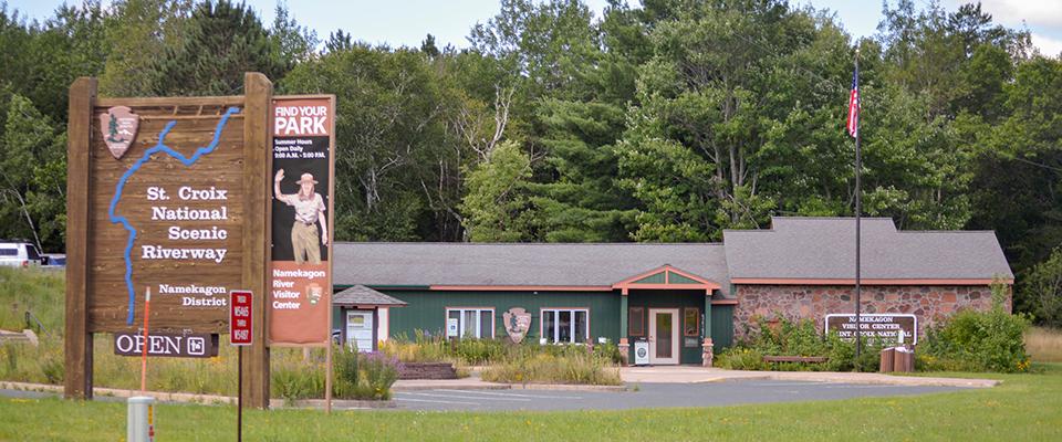
When open, visitors can view exhibits, pick up park publications, Junior Ranger booklets, and maps, and watch the park movie. Park rangers staff an information counter and offer trip planning assistance for the Namekagon and upper St. Croix rivers. The visitor center is located near the Namekagon River off Highway 63 in Trego, WI.
Getting there
From U.S. Highway 53, take the U.S. Highway 63 Trego exit. Drive approximately one-half mile to the visitor center which is on the right. Follow the signs for the Namekagon River Visitor Center.
From U.S. Highway 63 coming west, drive approximately 4 miles past Earl, Wisconsin. The Namekagon River Visitor Center is on the left. Follow the signs for the Namekagon River Visitor Center.
45.90482, -91.81651 · 45°54'17.4"N 91°48'59.4"W
Typical weather
Typically 80°F in Jul, down to 21°F in Jan.
| Jan | Feb | Mar | Apr | May | Jun | Jul | Aug | Sep | Oct | Nov | Dec | |
|---|---|---|---|---|---|---|---|---|---|---|---|---|
| High °F | 21 | 26 | 40 | 54 | 67 | 76 | 80 | 78 | 70 | 56 | 39 | 26 |
| Low °F | 1 | 4 | 18 | 31 | 44 | 54 | 58 | 56 | 48 | 36 | 23 | 9 |
| Precip in | 0.8 | 0.8 | 1.4 | 2.8 | 4.1 | 4.2 | 4.0 | 3.9 | 3.6 | 3.2 | 1.7 | 1.2 |
1991–2020 averages from the nearest NOAA station, 6.3 mi away — not measured at the facility itself, and elevation can make a real difference over that distance.
Map
More photos

Member photos
Common questions about Namekagon River Visitor Center
- Can you reserve a site at Namekagon River Visitor Center?
- No. Namekagon River Visitor Center is not reservable through Recreation.gov, so sites are first-come, first-served or booked elsewhere.
Camping near Namekagon River Visitor Center
- Moose Lake 39 mi · Campground · we watch it
- Two Lakes 40.1 mi · Campground · we watch it
- Black Lake 42.7 mi · Campground · we watch it
- Day Lake 47.4 mi · Campground · we watch it
- East Twin 50 mi · Campground · we watch it
- Namekagon District less than 0.1 mi · Campground
- Lake Owen Recreation Area 39.9 mi · Facility
- Porcupine Lake Wilderness 41.9 mi · Facility
- Namekagon Lake Recreation Area 42.2 mi · Campground
- Rainbow Lake Wilderness 43.2 mi · Facility
- Perch Lake Recreation Area 43.3 mi · Campground
- Middle St. Croix 47.3 mi · Campground
Contact
- Phone (715) 635-8346
- Email SACN_Info@nps.gov
- Info Recreation.gov
Recreation.gov last updated this record on 2026-05-21.
Facility information and photographs from Recreation.gov (RIDB). SpotOpened is not affiliated with Recreation.gov or any federal agency.
Comments