Tumwater Group Site
Campground · Washington · 1 bookable site ·
Managed by the USDA Forest Service
Wenatchee National Forest (NF) · Open Access
- 1
- Bookable site
- 25 ft
- Max rig length
- up to 70
- People per site
- 1
- Accessible site
- 1,682 ft
- Elevation
Overview
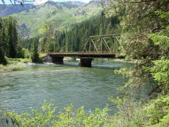
Tumwater Campground, located at the confluence of Chiwaukum Creek and the Nenatchee River in the Okanogan-Wenatchee National Forest, offers a serene setting for groups and large gatherings.Recreation
Tumwater Group Campground offers outdoor enthusiasts the opportunity to hike, fish, ski and enjoy a long list of outdoor recreational activities throughout the year.The confluence of Chiwaukum Creek and the Nenatchee River offers anglers a scenic backdrop as they cast their lines into the pools along the shore. Populations of trout and salmon find habitat along its banks.
Skiing, snowmobiling, tubing and skijouring are popular winter activities for visitors to the Wenatchee Ranger District. Both motorized and non-motorized Sno-Parks in the area offer access to both groomed trails and natural settings for those wanting to explore the winter wonderland.
Facilities
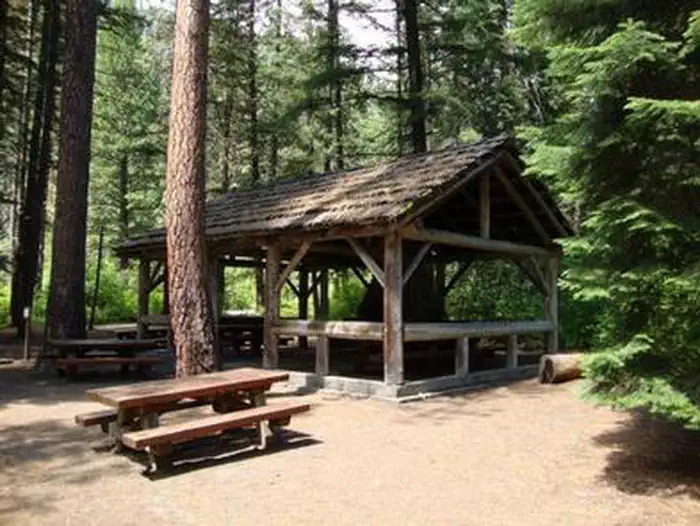
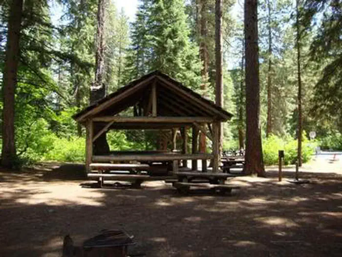
Tumwater Group Campground has one large site that can accommodate up to 70 people and 40 vehicles. The site is equipped with picnic tables, campfire rings, drinking water, accessible flush toilets and electric hookups.The campground also has a covered shelter and picnic area, complete with a wood stove and fireplace.
Natural Features
Okanogan-Wenatchee National Forest offers stunning scenic views, with high, glaciated alpine peaks, valleys of old growth forest and rugged shrub-steppe country making up the diverse landscape. Elevations range from below 1,000 feet to more than 9,000 feet.Precipitation varies greatly throughout the area, ranging from approximately 140 inches along the Cascade Crest to only 10 inches along the eastern edge. Visitors can expect many days of warm, sunny weather in the summer, and winters with clear skies and plenty of snow.
More than 700 lakes and mountain ponds dot the glacier-carved terrain of nearby Alpine Lake Wilderness. Tree-covered valleys give way to rocky ridges and rugged peaks along the crest of the Cascades. Many peaks and slopes are permanently cloaked in snowfields. From wet forests of Douglas fir, cedar, and an understory of salal and berries, to firs and mountain hemlock, the landscape opens up to expansive meadows matted with low growth and ends with dry forestland of ponderosa pine and grasses.
The surrounding undeveloped wilderness, clean streams and diverse forests support an abundance of wildlife, including deer, porcupine, native fish and migratory birds.
Nearby Attractions
Visitors enjoy the Mt. Rainer National Park, where interpretive programs and exhibits offer education about the diverse landscape and history of the area.The spectacular Pacific Crest Trail (PCT), one of the world's premier National Scenic Trails, showcases some of North America's most fantastic scenery, winding its way its way from Mexico to Canada through California, Oregon and Washington, and is accessible near the campground.
The facts
- 1 bookable site
- 1 accessible site
- Vehicles up to 25 ft
- Up to 70 people per site
- Loops: AREA TUMWATER GROUP SITE
Site types
- 1 Group Standard Electric
Amenities
- Electric hookups
- Shade
Not recorded upstream: water hookups, sewer hookups, campfires allowed, fire pits, picnic tables, grills, pets allowed.
1 campsite at Tumwater Group Site
Check-in 3:00 PM · Check-out 2:00 PM
| Site | Loop | Type | Entry | Surface | Max rig | People | |
|---|---|---|---|---|---|---|---|
| 001 | AREA TUMWATER GROUP SITE | Group Standard Electric | Back In | Paved | 25 ft | 70 | ♿ |
Getting there
From the east, take Highway 2 west through Leavenworth. The campground is 10 miles west of Leavenworth on the right hand side of the highway.
47.67806, -120.73083 · 47°40'41.0"N 120°43'51.0"W
Typical weather
Typically 82°F in Jul, down to 32°F in Dec.
| Jan | Feb | Mar | Apr | May | Jun | Jul | Aug | Sep | Oct | Nov | Dec | |
|---|---|---|---|---|---|---|---|---|---|---|---|---|
| High °F | 34 | 40 | 48 | 57 | 67 | 73 | 82 | 82 | 74 | 58 | 42 | 32 |
| Low °F | 21 | 23 | 27 | 32 | 39 | 45 | 50 | 49 | 42 | 33 | 27 | 21 |
| Precip in | 4.6 | 3.0 | 2.4 | 1.3 | 1.3 | 0.9 | 0.5 | 0.4 | 0.8 | 2.6 | 4.6 | 5.0 |
1991–2020 averages from the nearest NOAA station, 8.4 mi away — not measured at the facility itself, and elevation can make a real difference over that distance.
Map
More photos
Member photos
Common questions about Tumwater Group Site
- Can you reserve a site at Tumwater Group Site?
- No. Tumwater Group Site is not reservable through Recreation.gov, so sites are first-come, first-served or booked elsewhere.
- How many campsites does Tumwater Group Site have?
- 1 site.
- What is the maximum RV length at Tumwater Group Site?
- 25 ft. That is the longest vehicle the sites here are recorded as taking; individual sites may be shorter.
- Does Tumwater Group Site have hookups?
- Electric.
Also listed by
Tumwater Group Site also appears in other federal recreation data. Facts below are matched by name and location, not confirmed by Tumwater Group Site's operator.
USDA Forest Service — data as of Aug 24, 2026
- Currently closed. Single unit: $23 / night Double unit: $46 / night Extra vehicle: $14 / night Group site: $100 / night Picnic site: $7 / vehicle between 10:00 a.m. & 4:00 p.m.
Restrictions:
- Trailers 50 ft. max. Maximum of 70 people and 40 vehicles at group site.
Camping near Tumwater Group Site
- Icicle Group Campground 7.3 mi · Campground · we watch it
- Bridge Creek Group Site 8.2 mi · Campground · we watch it
- Nason Creek Campground 8.4 mi · Campground · we watch it
- Chatter Creek Group Site 8.6 mi · Campground · we watch it
- Eightmile Campground 8.9 mi · Campground · we watch it
- Eightmile Group Site 8.9 mi · Campground · we watch it
- Johnny Creek Campground 6.8 mi · Campground
- Ida Creek Campground 7.4 mi · Campground
- Leavenworth National Fish Hatchery 8.7 mi · Facility
- Rock Island Campground 9.9 mi · Campground
- Glacier View Campground 10.7 mi · Campground
- Goose Creek Campground 11.8 mi · Campground
Contact
- Phone 509-548-6816
- Email rob-miller@hotmail.com
- Info Recreation.gov
Recreation.gov last updated this record on 2026-02-25.
Facility information and photographs from Recreation.gov (RIDB). SpotOpened is not affiliated with Recreation.gov or any federal agency.
Comments