Douglas Fir Campground
Campground · Washington · 30 bookable sites ·
Managed by the USDA Forest Service
Mt. Baker National Forest (NF) · Open Access
- 30
- Bookable sites
- 100 ft
- Max rig length
- up to 25
- People per site
- 3
- Accessible sites
- 1,007 ft
- Elevation
Overview
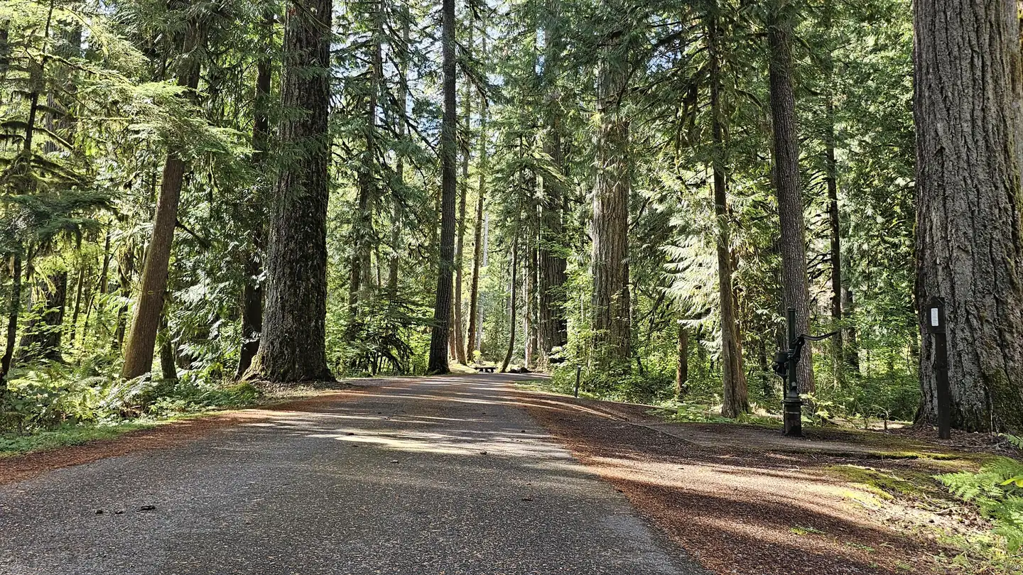
Situated on the banks of North Fork Nooksack River in Mt. Baker-Snoqualmie National Forest, Douglas Fir Campground offers stunning scenery and access to numerous recreational activities popular in the north Cascades Mountains in Washington.Recreation
The campground provides a prime location for hiking and picnicking in summer and early fall. Horseshoe Bend Trail is an easy forest hike along the Mt. Baker Scenic Byway, highlighting old-growth forests, gushing whitewater and forest wildflowers. Whitewater rafting enthusiasts put in at the trailhead, and experienced kaykers can be seen on rapids as the trail follows the North Fork of the Nooksack River upstream past a stunning view of Church Mountain. Hikers and backpackers are especially fortunate to have access to a variety of trails near the campground and in the surrounding Mt. Baker Wilderness area. One of the most popular hikes in the Mt. Baker Ranger District is the Skyline Divide Trail. This trail climbs steadily for two miles through forest into lush, open meadows with sweeping views of glacier-draped Mt. Baker. The trail then wanders along Skyline Divide for another 2 miles, offering views of rivers, forests and countless peaks.Facilities
Douglas Fir Campground offers standard sites, accomodating tents and RVs. Several campsites are located at the river's edge, while others are shaded by a mature, mixed conifer forest. A historic sheltered picnic area, constructed by the Civilian Conservation Crew, is also available for reservation. Vault toilets and drinking water are available Individual sites are equipped with picnic tables, campfire rings and tent pads.Natural Features
Hemmed in by several designated wilderness areas, the Mt. Baker-Snoqualmie National Forest showcases rugged peaks, sparkling alpine lakes and old-growth forests, providing visitors with a variety of scenic landscapes. On a clear day visitors can spot Mt. Baker, the most prominent feature of the Mt. Baker Wilderness Area. Rising to an elevation of 10,781 feet, this active volcano is perpetually snow-capped and mantled with an extensive network of creeping glaciers. Mt. Baker's summit, Grant Peak, is actually a 1,300-foot-deep mound of ice, which hides a massive volcanic crater. Wildlife in the area include a variety of salmon species, elk, bald eagle and black tail deer. Migratory birds and black bears find ample habitat in the surrounding ecosystems.Contact Info
For facility specific information, please call (530) 932-0242.Nearby Attractions
Visitors enjoy hiking, picnicking and photography in the Heather Meadows area located along the upper reaches of the Mt. Baker Scenic Byway, SR 542. Many popular hikes and climbing routes are located in the surrounding Mt. Baker Wilderness and backpackers enjoy visiting the northern reaches of North Cascades National Park.Charges & Cancellations
Once your reservation start date has begun, neither the Recreation.gov Contact Center nor the campground manager will be able to modify your reservation.
The facts
- 30 bookable sites
- 1 site for day use only
- 3 accessible sites
- Vehicles up to 100 ft
- Up to 25 people per site
- Loops: DOUG
Site types
- 26 Standard Nonelectric
- 3 Tent Only Nonelectric
- 1 Group Picnic Area
Amenities
- Campfires allowed
- Fire pits
- Picnic tables
- Shade
- Pets allowed
Not recorded upstream: electric hookups, water hookups, sewer hookups, grills.
30 campsites at Douglas Fir Campground
| Site | Loop | Type | Entry | Surface | Grade | Max rig | People | |
|---|---|---|---|---|---|---|---|---|
| 001 | DOUG | Tent Only Nonelectric | Pull Through | Gravel | — | 100 ft | 6 | ♿ 🐾 |
| 002 | DOUG | Standard Nonelectric | Back In | Gravel | Slight | 50 ft | 6 | ♿ 🐾 |
| 003 | DOUG | Standard Nonelectric | Back In | Gravel | — | 35 ft | 6 | 🐾 |
| 004 | DOUG | Standard Nonelectric | Back In | Gravel | — | 40 ft | 6 | ♿ 🐾 |
| 005 | DOUG | Standard Nonelectric | Back In | Gravel | Slight | 40 ft | 6 | 🐾 |
| 006 | DOUG | Standard Nonelectric | Back In | Gravel | — | 25 ft | 6 | 🐾 |
| 007 | DOUG | Standard Nonelectric | Back In | Gravel | — | 35 ft | 6 | 🐾 |
| 008 | DOUG | Standard Nonelectric | Back In | Gravel | — | 50 ft | 6 | 🐾 |
| 009 | DOUG | Tent Only Nonelectric | Back In | Gravel | Slight | — | 6 | 🐾 |
| 010 | DOUG | Standard Nonelectric | Back In | Gravel | — | 30 ft | 6 | 🐾 |
| 011 | DOUG | Standard Nonelectric | Back In | Gravel | — | 30 ft | 6 | 🐾 |
| 012 | DOUG | Standard Nonelectric | Back In | Gravel | — | 50 ft | 6 | 🐾 |
| 013 | DOUG | Standard Nonelectric | Back In | Gravel | — | 35 ft | 6 | 🐾 |
| 014 | DOUG | Standard Nonelectric | Back In | Gravel | — | 35 ft | 6 | 🐾 |
| 015 | DOUG | Standard Nonelectric | Back In | Gravel | — | 39 ft | 6 | 🐾 |
| 016 | DOUG | Standard Nonelectric | Back In | Gravel | — | 35 ft | 6 | 🐾 |
| 017 | DOUG | Standard Nonelectric | Back In | Gravel | — | 55 ft | 6 | 🐾 |
| 019 | DOUG | Tent Only Nonelectric | Back In | Gravel | Slight | 30 ft | 6 | 🐾 |
| 020 | DOUG | Standard Nonelectric | Back In | Gravel | Slight | 20 ft | 6 | 🐾 |
| 021 | DOUG | Standard Nonelectric | Back In | Gravel | — | 25 ft | 6 | 🐾 |
| 022 | DOUG | Standard Nonelectric | Back In | Gravel | — | 25 ft | 6 | 🐾 |
| 023 | DOUG | Standard Nonelectric | Back In | Gravel | — | 25 ft | 6 | 🐾 |
| 024 | DOUG | Standard Nonelectric | Back In | Gravel | — | 25 ft | 6 | 🐾 |
| 025 | DOUG | Standard Nonelectric | Back In | Gravel | — | 40 ft | 6 | 🐾 |
| 026 | DOUG | Standard Nonelectric | Back In | Gravel | — | 35 ft | 6 | 🐾 |
| 027 | DOUG | Standard Nonelectric | Back In | Gravel | — | 30 ft | 6 | 🐾 |
| 028 | DOUG | Standard Nonelectric | Back In | Gravel | — | 30 ft | 6 | 🐾 |
| 029 | DOUG | Standard Nonelectric | Back In | Gravel | — | 30 ft | 6 | 🐾 |
| 030 | DOUG | Standard Nonelectric | Back In | Gravel | — | 30 ft | 6 | 🐾 |
| Day Use | DOUG | Group Picnic Area | — | Gravel | — | 25 ft | 25 | 🐾 |
Getting there
48.90266, -121.91195 · 48°54'9.6"N 121°54'43.0"W
Typical weather
| Jan | Feb | Mar | Apr | May | Jun | Jul | Aug | Sep | Oct | Nov | Dec | |
|---|---|---|---|---|---|---|---|---|---|---|---|---|
| High °F | — | — | — | — | — | — | — | — | — | — | — | — |
| Low °F | — | — | — | — | — | — | — | — | — | — | — | — |
| Precip in | 9.5 | 7.2 | 6.7 | 4.7 | 4.5 | 3.6 | 1.9 | 1.8 | 3.4 | 7.7 | 10.1 | 9.5 |
1991–2020 averages from the nearest NOAA station, 1.9 mi away — not measured at the facility itself, and elevation can make a real difference over that distance.
Map
More photos
Member photos
Common questions about Douglas Fir Campground
- Can you reserve a site at Douglas Fir Campground?
- Yes, Douglas Fir Campground is reservable through Recreation.gov.
- How many campsites does Douglas Fir Campground have?
- 30 sites.
- What is the maximum RV length at Douglas Fir Campground?
- 100 ft. That is the longest vehicle the sites here are recorded as taking; individual sites may be shorter.
- Are pets allowed at Douglas Fir Campground?
- Yes, pets are allowed at Douglas Fir Campground.
- Are campfires allowed at Douglas Fir Campground?
- Campfires are allowed at Douglas Fir Campground. Check for a current fire restriction before you go.
Also listed by
Douglas Fir Campground also appears in other federal recreation data. Facts below are matched by name and location, not confirmed by Douglas Fir Campground's operator.
USDA Forest Service — data as of Aug 24, 2026
- View Recreation.gov for Fee Information and for open season dates.
Accessibility:
- See video
Camping near Douglas Fir Campground
- Excelsior Group Camp 4.1 mi · Campground · we watch it
- Silver Fir Campground 9.8 mi · Campground · we watch it
- Park Creek Campground 16 mi · Campground · we watch it
- Boulder Creek Campground 16.3 mi · Campground · we watch it
- Panorama Point Campground 16.4 mi · Campground · we watch it
- Swift Creek Campground 16.6 mi · Campground · we watch it
- Shannon Creek Campground 18.1 mi · Campground · we watch it
- Mt. Baker Highway (SR 542) 2.3 mi · Facility
- Coleman Glacier Climbing Route 7 mi · Facility
- Mt. Baker Summit - Climbing 9.7 mi · Facility
- Park Glacier Climbing Route 10.7 mi · Facility
- Winchester Mountain Lookout 12.8 mi · Facility
Contact
- Phone 360-804-1103
- Book Recreation.gov
Recreation.gov last updated this record on 2026-03-11.
Facility information and photographs from Recreation.gov (RIDB). SpotOpened is not affiliated with Recreation.gov or any federal agency.
Comments