John W. Flannagan Day Use
Campground · Virginia · 2 bookable sites ·
Managed by the US Army Corps of Engineers
John W Flannagan Recreation Area (Recreation Area) · Open Access
- 2
- Bookable sites
- up to 100
- People per site
- 2
- Accessible sites
- 1,238 ft
- Elevation
Overview
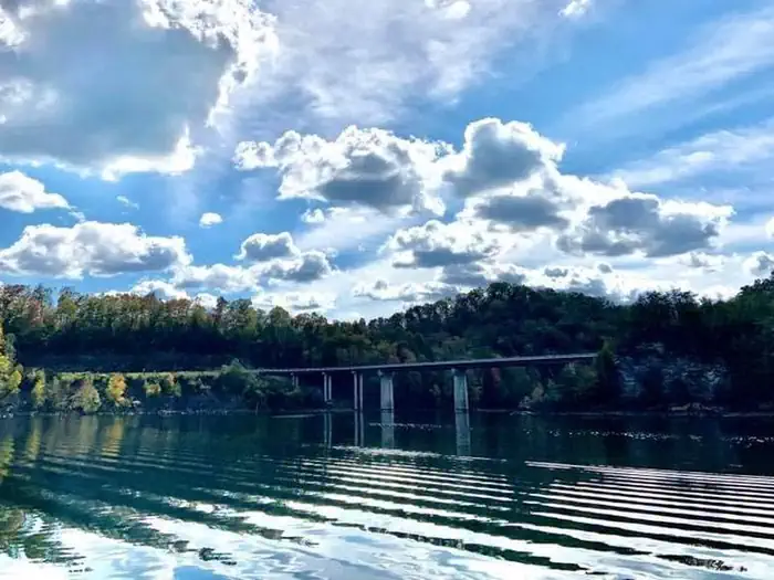
The John W. Flannagan Day Use Area boasts an expansive lake nestled in the rolling green Cumberland Mountains of southwest Virginia, offering visitors an oasis of recreation in the summer months. The nearby dam, built primarily for flood control for the Cranesnest and Pound Rivers, creates a breathtaking lake that is maintained at nearly 1,400 feet above sea level.This day-use facility is an ideal spot for picnicking, water activities, and hiking.
Recreation
Flannagan's reputation as a fisherman's paradise is well-known. Visitors can enjoy secluded coves of deep, clean water that are well-stocked with bass, bream, walleye and trout. Boating, canoeing, whitewater rafting, and biking top the long list of activities available nearby.Facilities
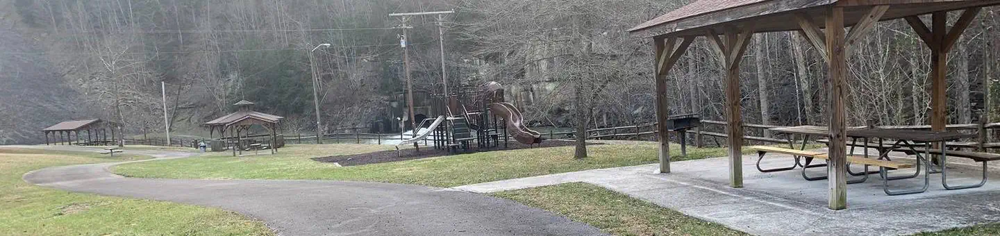
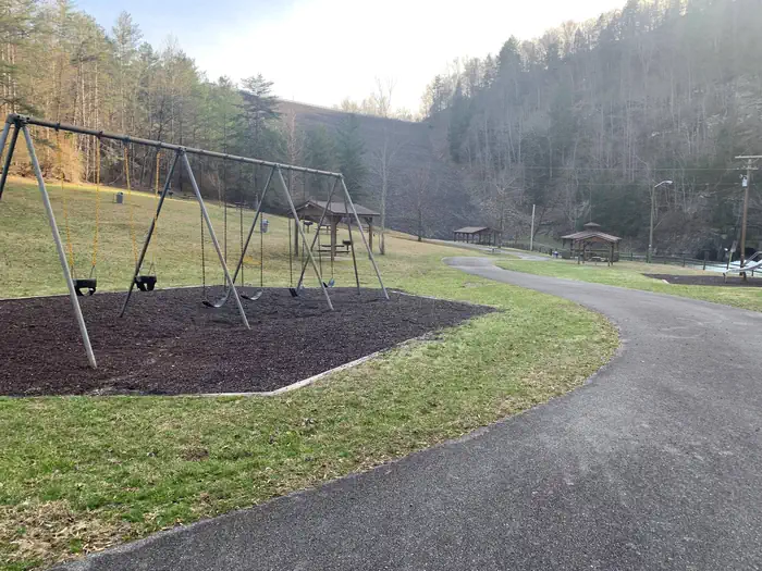
Picnic shelters with grills, electrical hookups, a playground, and horseshoe pits provide an ideal location for parties and other get-togethers.Natural Features
The John W. Flannagan Dam, completed in 1964, carves out a 1,145-acre lake with nearly 40 miles of beautiful shoreline in the lush Virginia terrain.Nearby Attractions
The Lower Twin, Cranes Nest and Pound River Campgrounds, located near the day-use area, offer overnight camping.Breaks Interstate Park is nearby, offering lodging, dining, a museum, gift shop, rafting, canoeing, and other outdoor activities.
The facts
- 2 bookable sites
- 3 sites in total, including non-bookable
- 3 sites for day use only
- 2 accessible sites
- Up to 100 people per site
- Loops: Below Dam, CRAN
Site types
- 2 Group Shelter Electric
- 1 Management
Amenities
- Electric hookups
- Water hookups
- Picnic tables
- Grills
- Shade
- Pets allowed
Not recorded upstream: sewer hookups, campfires allowed, fire pits.
3 campsites at John W. Flannagan Day Use
Check-in 8:00 AM · Check-out 8:00 PM
| Site | Loop | Type | Entry | Surface | Water | Max rig | People | |
|---|---|---|---|---|---|---|---|---|
| Below Dam Shelter 1 | Below Dam | Group Shelter Electric | — | Paved | — | — | 100 | ♿ |
| Below Dam Shelter 2 | Below Dam | Group Shelter Electric | — | Paved | Riverfront | — | — | 🐾 |
| 001 | CRAN | Management | — | Paved | — | — | 100 | ♿ |
Getting there
From VA-63, turn right onto State Route 614. Continue straight for approximately two miles.
37.23653, -82.34447 · 37°14'11.5"N 82°20'40.1"W
Typical weather
| Jan | Feb | Mar | Apr | May | Jun | Jul | Aug | Sep | Oct | Nov | Dec | |
|---|---|---|---|---|---|---|---|---|---|---|---|---|
| High °F | — | — | — | — | — | — | — | — | — | — | — | — |
| Low °F | — | — | — | — | — | — | — | — | — | — | — | — |
| Precip in | 3.8 | 3.5 | 4.4 | 4.3 | 4.8 | 5.0 | 5.2 | 4.1 | 3.2 | 3.3 | 2.9 | 4.2 |
1991–2020 averages from the nearest NOAA station, 0.3 mi away — not measured at the facility itself, and elevation can make a real difference over that distance.
Map
More photos
Member photos
Common questions about John W. Flannagan Day Use
- Can you reserve a site at John W. Flannagan Day Use?
- Yes, John W. Flannagan Day Use is reservable through Recreation.gov.
- How many campsites does John W. Flannagan Day Use have?
- 3 sites in total, of which 2 can be booked.
- Are pets allowed at John W. Flannagan Day Use?
- Yes, pets are allowed at John W. Flannagan Day Use.
- Does John W. Flannagan Day Use have hookups?
- Electric, Water.
Camping near John W. Flannagan Day Use
- Lower Twin Campground (Va) 1.9 mi · Campground · we watch it
- Pound River Campground (Va) 6.1 mi · Campground · we watch it
- Cranesnest Campground (Va) 7 mi · Campground · we watch it
- Fishtrap Lake Shelters 13.8 mi · Campground · we watch it
- Phillip's Creek Group Picnic Area 20 mi · Campground · we watch it
- Cane Patch 20.6 mi · Campground · we watch it
- Flatwoods Group Picnic Area 23.2 mi · Campground · we watch it
- Bark Camp 27.4 mi · Campground · we watch it
- High Knob Campground 28.4 mi · Campground · we watch it
- Littcarr Campground 33.3 mi · Campground · we watch it
- Carr Creek Lake Shelters 38 mi · Campground · we watch it
- Birch Knob Observation Site 6.2 mi · Facility
Contact
- Phone 276-835-9544
- Book Recreation.gov
Recreation.gov last updated this record on 2026-02-25.
Facility information and photographs from Recreation.gov (RIDB). SpotOpened is not affiliated with Recreation.gov or any federal agency.
Comments