Fenwick Mines Pavilion
Campground · Virginia · 1 bookable site ·
Managed by the USDA Forest Service
Jefferson National Forest (NF) · Open Access
- 1
- Bookable site
- up to 100
- People per site
- 1
- Accessible site
- 1,397 ft
- Elevation
Overview
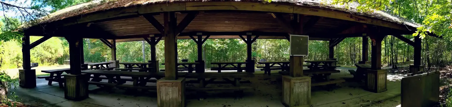
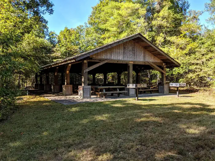
With ample parking, plenty of picnic tables and three barbcue grills, the Fenwick Mines Pavilion is a great option to host your next outdoor get togther. The pavilion is part of the larger Fenwick Mines Day-Use Area which includes one-mile of trail, picnic areas, and small fishing pond.
Recreation
- Access to the overlook on Bald Mountain and access to the gated Mill Creek Road, a popular 'trail' by mountain bikers and horses (closed to motor vehicles).
- Horseshoe pits
- Fishing pond
- 3/4 mile long Wetlands Trail and 1/4 mile long Nature Trail
Facilities
- Vault Toilets
- Picnic Tables
- Three large barbecue grills
- Horseshoe Pits
Natural Features
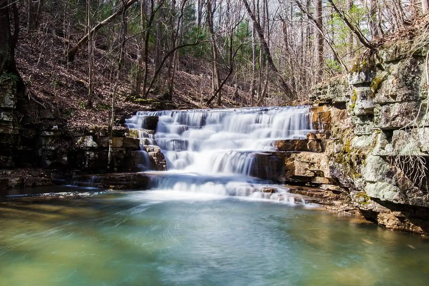
Located at the base of Bald Mountain and adjacent to Mill Creek in Craig County, Fenwick is surrounded by natural beauty that invites further exploration. A one-mile stroll through the forest and large wetlands area will take you to the falls at Fenwick, a picturesque, small multi-tiered waterfall.
The facts
- 1 bookable site
- 1 site for day use only
- 1 accessible site
- Up to 100 people per site
- Loops: N/A
Site types
- 1 Group Shelter Nonelectric
Amenities
- Picnic tables
- Shade
Not recorded upstream: electric hookups, water hookups, sewer hookups, campfires allowed, fire pits, grills, pets allowed.
1 campsite at Fenwick Mines Pavilion
Check-in 09:00 AM · Check-out 09:00 PM
| Site | Loop | Type | Entry | Surface | Max rig | People | |
|---|---|---|---|---|---|---|---|
| Group Pavilion | N/A | Group Shelter Nonelectric | — | — | — | 100 | ♿ |
Getting there
From New Castle, VA. Follow VA 615 for five miles to VA 611 (Peaceful Valley Road). Turn Left.
Go 1/3 mile and turn right on VA 685.
Follow signs to Fenwick Mines Recreation Area.
37.56917, -80.05444 · 37°34'9.0"N 80°3'16.0"W
Typical weather
| Jan | Feb | Mar | Apr | May | Jun | Jul | Aug | Sep | Oct | Nov | Dec | |
|---|---|---|---|---|---|---|---|---|---|---|---|---|
| High °F | — | — | — | — | — | — | — | — | — | — | — | — |
| Low °F | — | — | — | — | — | — | — | — | — | — | — | — |
| Precip in | 3.2 | 2.8 | 3.6 | 3.9 | 4.7 | 4.4 | 4.3 | 3.5 | 3.7 | 3.5 | 2.8 | 3.5 |
1991–2020 averages from the nearest NOAA station, 4.8 mi away — not measured at the facility itself, and elevation can make a real difference over that distance.
Map
More photos
Member photos
Common questions about Fenwick Mines Pavilion
- Can you reserve a site at Fenwick Mines Pavilion?
- Yes, Fenwick Mines Pavilion is reservable through Recreation.gov.
- How many campsites does Fenwick Mines Pavilion have?
- 1 site.
Camping near Fenwick Mines Pavilion
- Craig Creek Recreation Area 5.5 mi · Campground · we watch it
- Steel Bridge Campground 9.7 mi · Campground · we watch it
- Caldwell Fields Group Campground 21.9 mi · Campground · we watch it
- Morris Hill Campground 25.4 mi · Campground · we watch it
- North Creek 25.8 mi · Campground · we watch it
- Fenwick Mines Day Use Area less than 0.1 mi · Facility
- The Pines Campground 2.8 mi · Campground
- Potts Slope Shooting Range 9.1 mi · Facility
- Roaring Run Day Use Area 13 mi · Facility
- White Sulphur Springs National Fish Hatchery 20.6 mi · Facility
- Hanging Rock Raptor Observatory 22.2 mi · Facility
- Peaks of Otter Visitor Center (Milepost 85.6) 25.8 mi · Facility
Contact
- Phone USE DISTRICT OFFICE PHONE NUMBER: 540-552-4641
- Email Mailroom_R8_George_Washington_Jefferson@usda.gov
- Book Recreation.gov
Recreation.gov last updated this record on 2026-02-25.
Facility information and photographs from Recreation.gov (RIDB). SpotOpened is not affiliated with Recreation.gov or any federal agency.
Comments