Yakutat
Visitor Center ·
Managed by the National Park Service
Yakutat Alaska Native Village Statistical Area (E1)
- 66 ft
- Elevation
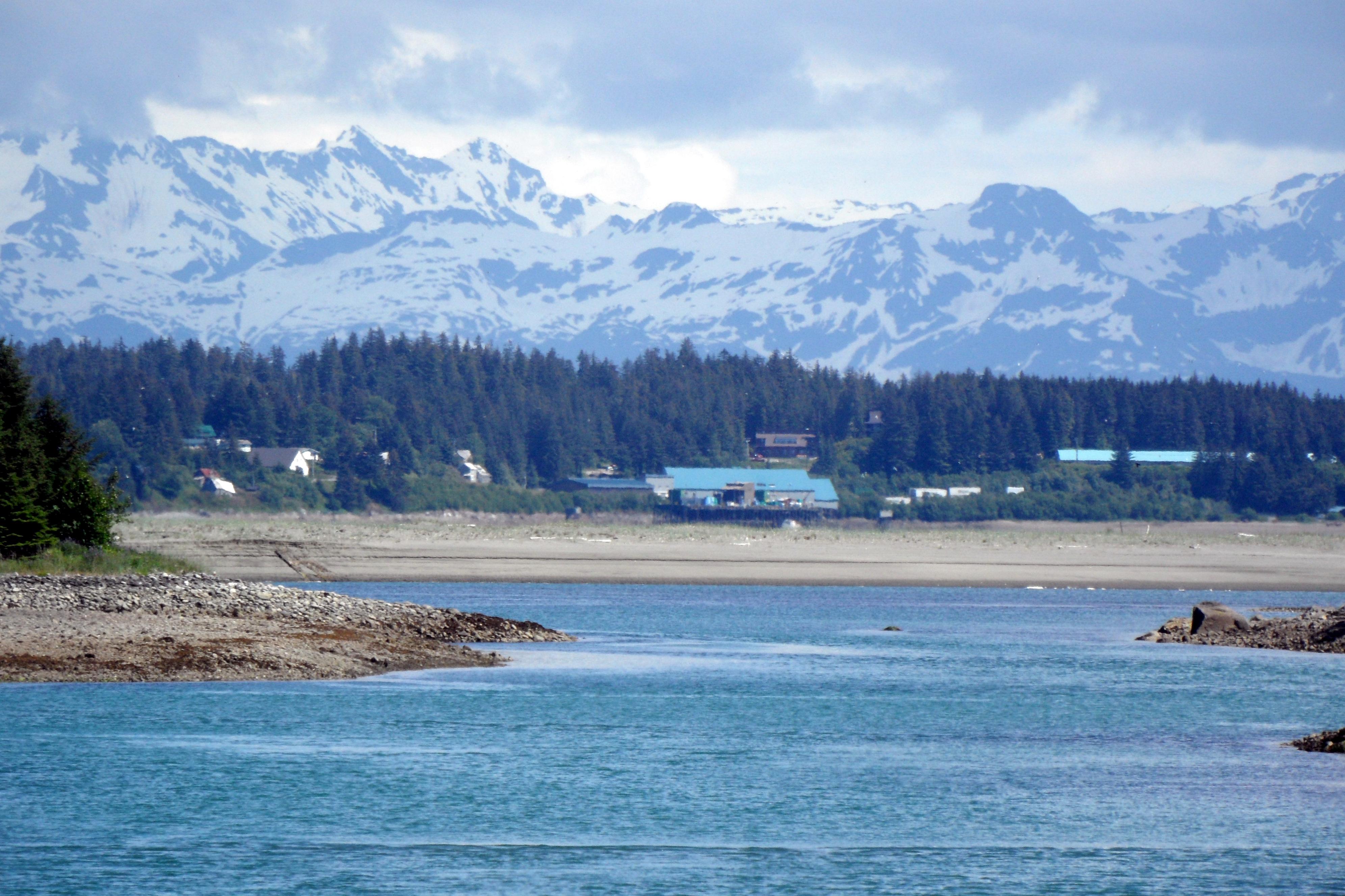
Yakutat is located in the southern portion of the park along the coastline in Yakutat Bay at the base of the St. Elias Mountains. Accessible only by plane or boat, this area encompasses the park's coastal region, with 155 miles of little-known coastline, where giant mountains, enormous glaciers, and temperate rainforest meet the ocean. For information, please call Park Headquarters in Copper Center at (907) 822-5234.
Getting there
Yakutat is a remote community and, like many cities in Southeast Alaska, can only be accessed by air or water. Alaska Airlines offers daily jet passenger and freight service to and from both Juneau and Anchorage. Flight times vary depending on the season. The local airport is 4 miles southeast of the city of Yakutat. The Alaska State Ferry System offers a stop in Yakutat, but does not service the community year-round.
59.54887, -139.72877 · 59°32'55.9"N 139°43'43.6"W
Typical weather
Typically 62°F in Aug, down to 31°F in Jan.
| Jan | Feb | Mar | Apr | May | Jun | Jul | Aug | Sep | Oct | Nov | Dec | |
|---|---|---|---|---|---|---|---|---|---|---|---|---|
| High °F | 31 | 36 | 38 | 46 | 53 | 58 | 61 | 62 | 56 | 48 | 38 | 34 |
| Low °F | 20 | 23 | 25 | 30 | 36 | 43 | 48 | 47 | 41 | 35 | 27 | 25 |
| Precip in | 14.0 | 10.6 | 9.2 | 8.4 | 9.5 | 4.8 | 8.0 | 15.1 | 19.4 | 18.9 | 10.2 | 14.1 |
1991–2020 averages from the nearest NOAA station, 3.2 mi away — not measured at the facility itself, and elevation can make a real difference over that distance.
Map
More photos
Member photos
Common questions about Yakutat
- Can you reserve a site at Yakutat?
- No. Yakutat is not reservable through Recreation.gov, so sites are first-come, first-served or booked elsewhere.
Camping near Yakutat
- Raven Cabin 7.6 mi · Campground · we watch it
- Eagle Cabin 7.6 mi · Campground · we watch it
- Situk Lake Cabin 13.6 mi · Campground · we watch it
- Middle Dangerous River Cabin 23.6 mi · Campground · we watch it
- Italio River Cabin 25.7 mi · Campground · we watch it
- Tanis Mesa Cabin 47.9 mi · Campground · we watch it
- Alsek River Cabin 51 mi · Campground · we watch it
- Yakutat Beach Campsite 2 3.4 mi · Campground
- Situk Lake Cabin 12.9 mi · Campground
- Middle Dangerous River Cabin 24.2 mi · Campground
- Harlequin Lake Shelter 26.7 mi · Campground
Contact
- Phone (907) 822-5234
- Email wrst_info@nps.gov
- Info Recreation.gov
Recreation.gov last updated this record on 2026-02-25.
Facility information and photographs from Recreation.gov (RIDB). SpotOpened is not affiliated with Recreation.gov or any federal agency.
Comments