West Damsite Picnic Area Shetlers
Campground · 3 bookable sites ·
Managed by the US Army Corps of Engineers
- 3
- Bookable sites
- 469 ft
- Elevation
Overview
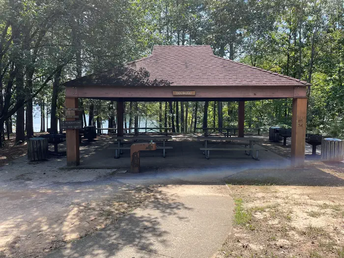
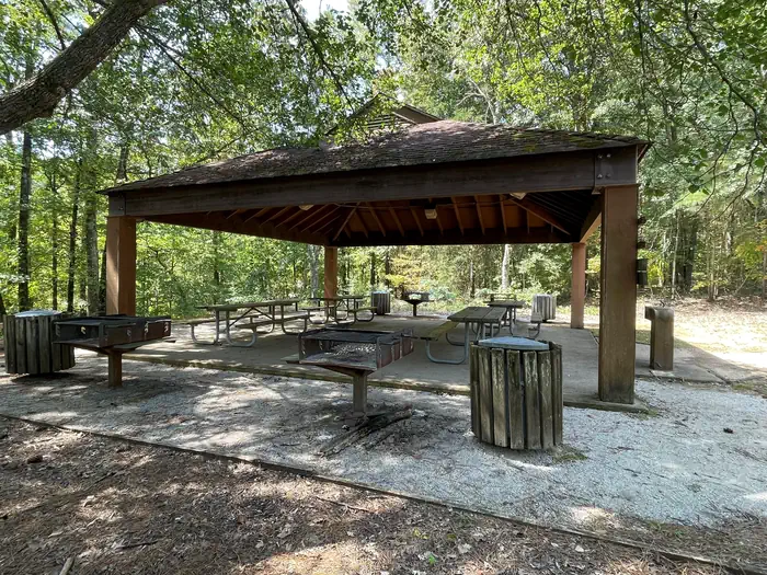
West Dam Site Day Use area is located on Bay Springs Lake in New Site,MS. This day use area offers 3 picinc shelters,1 playground, and one bathroom facility.
Recreation
Fishing, picnicking, Playground
Facilities
3 picnic shelters, 1 bathroom, and 1 playground
Natural Features
The Tennessee-Tombigbee Waterway extends 234 miles from the Tennessee River to the junction of the Tombigbee River in Alabama. The man-made waterway connects the nation's midsection of commercial water transportation with the Gulf of Mexico. The Tenn-Tom Waterway is the largest earth moving project in the history of the world! The Tenn-Tom Waterway has 180,000 acres of public land waiting for you to explore.
Nearby Attractions
Bay Springs Marina, West Dam Site Boat Ramp, Old Bridge Beach, Piney Grove Campground
The facts
- 3 bookable sites
- 3 sites for day use only
Site types
- 3 Group Shelter Electric
Amenities
- Shade
- Pets allowed
Not recorded upstream: electric hookups, water hookups, sewer hookups, campfires allowed, fire pits, picnic tables, grills.
3 campsites at West Damsite Picnic Area Shetlers
| Site | Loop | Type | Entry | Surface | Max rig | People | |
|---|---|---|---|---|---|---|---|
| Dogwood Picnic Shelter | — | Group Shelter Electric | — | — | — | — | 🐾 |
| Mulberry Picnic Shelter | — | Group Shelter Electric | — | — | — | — | 🐾 |
| Red Bud Picnic Shelter | — | Group Shelter Electric | — | — | — | — | 🐾 |
Getting there
34.53341, -88.34532 · 34°32'0.3"N 88°20'43.2"W
Typical weather
| Jan | Feb | Mar | Apr | May | Jun | Jul | Aug | Sep | Oct | Nov | Dec | |
|---|---|---|---|---|---|---|---|---|---|---|---|---|
| High °F | — | — | — | — | — | — | — | — | — | — | — | — |
| Low °F | — | — | — | — | — | — | — | — | — | — | — | — |
| Precip in | 4.9 | 5.3 | 6.0 | 5.7 | 5.2 | 4.0 | 4.5 | 4.2 | 4.1 | 3.7 | 4.3 | 6.1 |
1991–2020 averages from the nearest NOAA station, 9.2 mi away — not measured at the facility itself, and elevation can make a real difference over that distance.
Map
More photos
Member photos
Common questions about West Damsite Picnic Area Shetlers
- Can you reserve a site at West Damsite Picnic Area Shetlers?
- Yes, West Damsite Picnic Area Shetlers is reservable through Recreation.gov.
- How many campsites does West Damsite Picnic Area Shetlers have?
- 3 sites.
- Are pets allowed at West Damsite Picnic Area Shetlers?
- Yes, pets are allowed at West Damsite Picnic Area Shetlers.
Camping near West Damsite Picnic Area Shetlers
- Piney Grove 2.7 mi · Campground · we watch it
- Piney Grove Beach Picnic Shelter 2.7 mi · Campground · we watch it
- Piney Grove Picnic Area Shelters 3.7 mi · Campground · we watch it
- Paden Picnic Shelter 9.6 mi · Campground · we watch it
- Rance Johnson Picnic Shelter 10.6 mi · Campground · we watch it
- Holcut Picnic Shelter 13.6 mi · Campground · we watch it
- Whitten Park 17.3 mi · Campground · we watch it
- Whitten Park Picnic Shelters 17.3 mi · Campground · we watch it
- Cherokee Picnic Shelter 17.4 mi · Campground · we watch it
- Natchez Trace Parkway Visitor Center 25.1 mi · Visitor Center
- Natchez Trace Parkway Visitor Center 25.1 mi · Facility
- Parkway Visitor Center Milepost 266 25.1 mi · Facility
Contact
- Phone 662-423-1287
- Book Recreation.gov
Recreation.gov last updated this record on 2026-02-25.
Facility information and photographs from Recreation.gov (RIDB). SpotOpened is not affiliated with Recreation.gov or any federal agency.
Comments