Soda Creek Campground
Campground · 10 bookable sites ·
Managed by the USDA Forest Service
Deschutes National Forest (NF) · Open Access
- 10
- Bookable sites
- 40 ft
- Max rig length
- up to 6
- People per site
- 5,447 ft
- Elevation
Overview
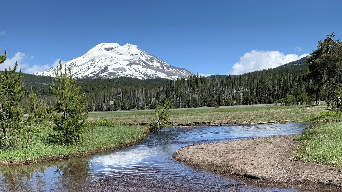
Soda Creek Campground sits adjacent to Soda Creek as it flows across an open meadow into Sparks Lake.
Recreation
Sparks Lake's clear water and mountainous backdrop make it a popular destination for paddling and photography.
Facilities
Soda Creek Campground can accommodate RV, trailer or tent campers, however, electric hookups are not available. There are limited sites that are RV friendly, with most of the sites suitable for smaller vehicles or tent camping. All sites are equipped with a picnic table and campfire ring with grill and the campground has vault toilets available. Campers will need to bring their own water supply.
Natural Features
Sparks Lake, fed by streams originating on the slopes of Broken Top, rests atop a porous, volcanic lakebed. Throughout the summer the lake level decreases as snowmelt declines and water seeps underground into nearby lakes and streams.
Nearby Attractions
The accessible Ray Atkeson Trailhead begins near Sparks Lake Day Use area. The trail winds through lava channels and lodgepole pines. Less than a mile in, visitors will reach the Ray Atkeson Memorial Overlook where they will find one of the most iconic views in Central Oregon.
Visitors can travel the Cascade Lakes Scenic Byway, a 66-mile drive through the Cascade Range that weaves past snow-capped peaks and alpine lakes.
Charges & Cancellations
Once your reservation start date has begun, neither the Recreation.gov Contact Center nor the campground manager will be able to modify your reservation.
The facts
- Season: Tentative Opening: May 30, 2025 – September 28, 2025 — USDA Forest Service, Aug 24, 2026
- 10 bookable sites
- Vehicles up to 40 ft
- Up to 6 people per site
- Loops: Loop 1
Site types
- 10 Standard Nonelectric
Amenities
- Campfires allowed
- Fire pits
- Picnic tables
- Shade
- Pets allowed
Not recorded upstream: electric hookups, water hookups, sewer hookups, grills.
10 campsites at Soda Creek Campground
Check-in 2:00 PM · Check-out 12:00 PM
| Site | Loop | Type | Entry | Surface | Grade | Max rig | People | |
|---|---|---|---|---|---|---|---|---|
| 001 | Loop 1 | Standard Nonelectric | Back In | Gravel | Slight | 30 ft | 6 | 🐾 |
| 002 | Loop 1 | Standard Nonelectric | Pull Through | Gravel | Slight | 36 ft | 6 | 🐾 |
| 003 | Loop 1 | Standard Nonelectric | Back In | Gravel | Slight | 20 ft | 6 | 🐾 |
| 004 | Loop 1 | Standard Nonelectric | Back In | Gravel | Slight | 28 ft | 6 | 🐾 |
| 005 | Loop 1 | Standard Nonelectric | Back In | Gravel | Slight | 30 ft | 6 | 🐾 |
| 006 | Loop 1 | Standard Nonelectric | Back In | Gravel | Slight | 18 ft | 6 | 🐾 |
| 007 | Loop 1 | Standard Nonelectric | Back In | Gravel | Slight | 40 ft | 6 | 🐾 |
| 008 | Loop 1 | Standard Nonelectric | Back In | Gravel | Slight | 20 ft | 6 | 🐾 |
| 009 | Loop 1 | Standard Nonelectric | Back In | Gravel | Slight | 20 ft | 6 | 🐾 |
| 010 | Loop 1 | Standard Nonelectric | Back In | Gravel | Slight | 20 ft | 6 | 🐾 |
Getting there
44.02554, -121.72676 · 44°1'31.9"N 121°43'36.3"W
Typical weather
| Jan | Feb | Mar | Apr | May | Jun | Jul | Aug | Sep | Oct | Nov | Dec | |
|---|---|---|---|---|---|---|---|---|---|---|---|---|
| High °F | — | — | — | — | — | — | — | — | — | — | — | — |
| Low °F | — | — | — | — | — | — | — | — | — | — | — | — |
| Precip in | 6.8 | 4.8 | 4.6 | 3.0 | 2.3 | 1.1 | 0.6 | 0.7 | 1.1 | 3.2 | 6.1 | 7.9 |
1991–2020 averages from the nearest NOAA station, 9 mi away — not measured at the facility itself, and elevation can make a real difference over that distance.
Map
Member photos
Common questions about Soda Creek Campground
- Can you reserve a site at Soda Creek Campground?
- Yes, Soda Creek Campground is reservable through Recreation.gov.
- How many campsites does Soda Creek Campground have?
- 10 sites.
- What is the maximum RV length at Soda Creek Campground?
- 40 ft. That is the longest vehicle the sites here are recorded as taking; individual sites may be shorter.
- Are pets allowed at Soda Creek Campground?
- Yes, pets are allowed at Soda Creek Campground.
- Are campfires allowed at Soda Creek Campground?
- Campfires are allowed at Soda Creek Campground. Check for a current fire restriction before you go.
Also listed by
Soda Creek Campground also appears in other federal recreation data. Facts below are matched by name and location, not confirmed by Soda Creek Campground's operator.
USDA Forest Service — data as of Aug 24, 2026
- Single Campsite Rate: $24/night
- One vehicle included with reservation – Each Additional Vehicle: $10.00
Restrictions:
- Maximum site spur length is 40 feet. No motorboats on Sparks Lake.
Camping near Soda Creek Campground
- Quinn Meadow Horse Camp 3.5 mi · Campground · we watch it
- Elk Lake Campground 5.1 mi · Campground · we watch it
- Mallard Marsh Campground 5.2 mi · Campground · we watch it
- South Campground - Hosmer Lake (OR) 5.3 mi · Campground · we watch it
- Little Fawn Campground 5.5 mi · Campground · we watch it
- Point Campground - Deschutes 5.8 mi · Campground · we watch it
- Sparks Lake Boating Site 1 mi · Facility
- Devils Lake 1.9 mi · Facility
- Todd Lake Day Use Area/Trailhead 2.2 mi · Facility
- Crater Creek Ditch 2.2 mi · Facility
- Elk Lake 5 mi · Facility
- South Campground 5.3 mi · Campground
Contact
- Phone 541-323-1746
- Email Jen@Hoodoo.com
- Book Recreation.gov
Recreation.gov last updated this record on 2026-06-12.
Facility information and photographs from Recreation.gov (RIDB). SpotOpened is not affiliated with Recreation.gov or any federal agency.
Comments