Skookum Creek Campground
Campground · 1 bookable site ·
Managed by the USDA Forest Service
Willamette National Forest (NF) · Open Access
- 1
- Bookable site
- 4,530 ft
- Elevation
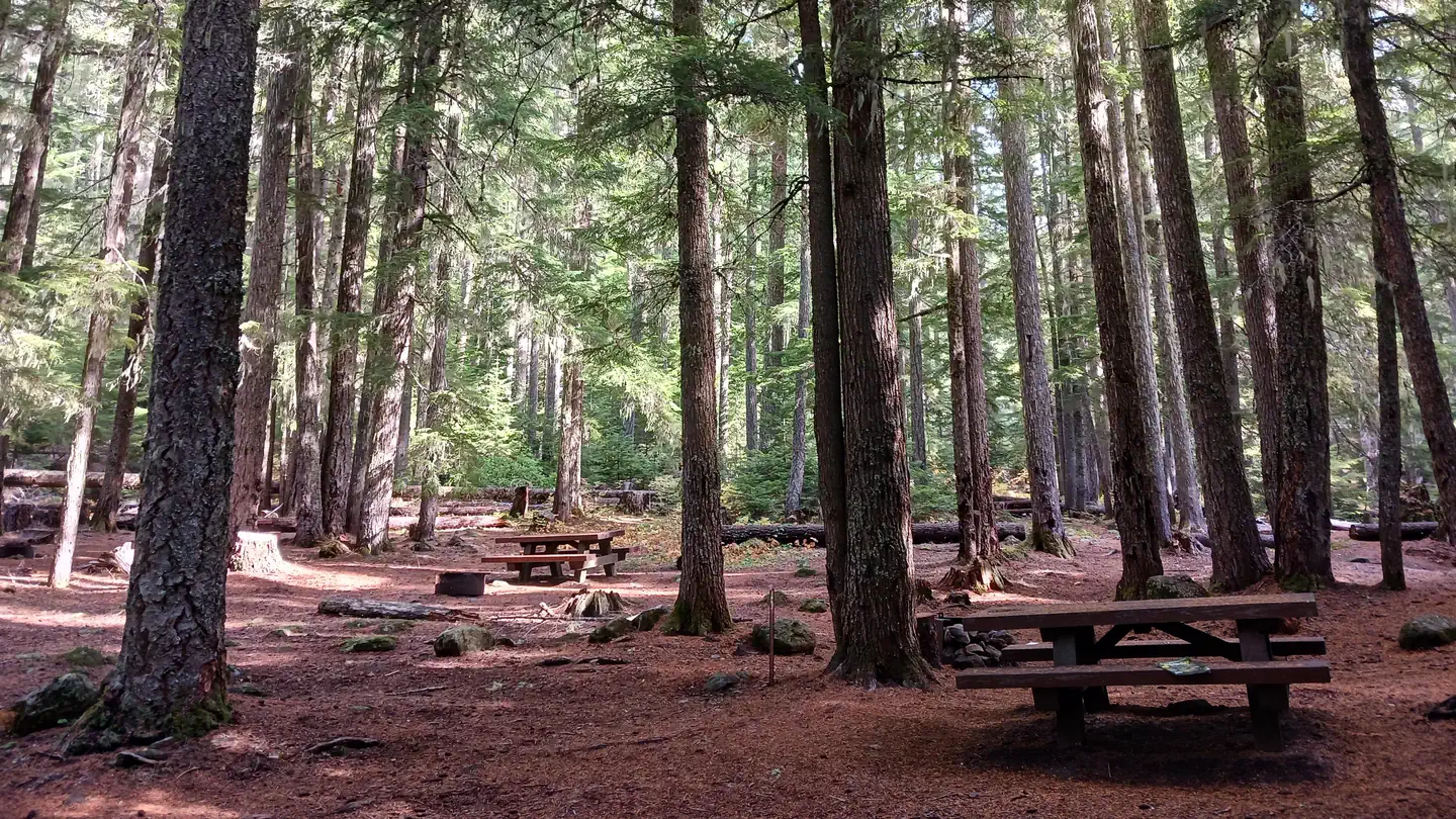
Overview
This location is available on a first-come, first-served basis only. Visitors are required to physically arrive at the campground to purchase and claim a site. Once on-site, you may be able to pay for your campsite(s) by scanning a QR code using the Recreation.gov mobile app, and the Scan and Pay feature.
If this option is available, you will need to first download the free Recreation.gov mobile app https://www.recreation.gov/mobile-app prior to your arrival as some remote areas have limited or no cellular service.
The facts
- Season: Early June, weather dependent – Late October, weather dependent — USDA Forest Service, Aug 24, 2026
- 1 bookable site
- 4 sites in total, including non-bookable
- Loops: Scan and Pay
Site types
- 3 Management
- 1 Standard Nonelectric
4 campsites at Skookum Creek Campground
| Site | Loop | Type | Entry | Surface | Max rig | People | |
|---|---|---|---|---|---|---|---|
| ScanPay 2 | Scan and Pay | Management | — | — | — | — | |
| ScanPay 3 | Scan and Pay | Management | — | — | — | — | |
| ScanPay 4 | Scan and Pay | Management | — | — | — | — | |
| Standard | Scan and Pay | Standard Nonelectric | — | — | — | — |
Getting there
Exit I-5 heading east on Highway 58 heading towards Oakridge, OR. Just past mile post 31 take a left on the road across from the Middle Fork Ranger District. After crossing the metal bridge take a left at the stop sign onto Forest Service Road 19. In approximately 1 mile go straight through the intersection to remain on the 19 Road. Just before mile post 32 take a right onto the 1957 road. This road will continue for approximately 4 miles before ending in the campground parking area.
Note: The 1957 road is rough and brushy. A high clearance vehicle is needed to reach the campground safely.
43.86154, -122.04579 · 43°51'41.6"N 122°2'44.8"W
Typical weather
| Jan | Feb | Mar | Apr | May | Jun | Jul | Aug | Sep | Oct | Nov | Dec | |
|---|---|---|---|---|---|---|---|---|---|---|---|---|
| High °F | — | — | — | — | — | — | — | — | — | — | — | — |
| Low °F | — | — | — | — | — | — | — | — | — | — | — | — |
| Precip in | 10.2 | 7.2 | 7.9 | 6.6 | 4.6 | 2.7 | 0.7 | 0.8 | 2.1 | 5.6 | 9.9 | 11.7 |
1991–2020 averages from the nearest NOAA station, 2.8 mi away — not measured at the facility itself, and elevation can make a real difference over that distance.
Map
More photos
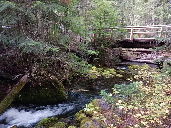

Member photos
Common questions about Skookum Creek Campground
- Can you reserve a site at Skookum Creek Campground?
- Yes, Skookum Creek Campground is reservable through Recreation.gov.
- How many campsites does Skookum Creek Campground have?
- 4 sites in total, of which 1 can be booked.
Also listed by
Skookum Creek Campground also appears in other federal recreation data. Facts below are matched by name and location, not confirmed by Skookum Creek Campground's operator.
USDA Forest Service — data as of Aug 24, 2026
- Single Campsites -$5 per vehicle, per day
- Day Use - $5 per vehicle, per day
Restrictions:
- No trailer facilities
- Quiet hours: 10 pm to 6 am
- Camping is not allowed more than 14 days in a 60 day period.
- Check-in time: 2:00 pm or later. Check-out time: 1:00 pm
- Use of chainsaws in the campground is prohibited
- Dogs MUST be on leash at all times within the campground
Camping near Skookum Creek Campground
- Box Canyon Guard Station Cabin 3.5 mi · Campground · we watch it
- Roaring River (Group) 6.5 mi · Campground · we watch it
- Frissell Crossing Campground 7.1 mi · Campground · we watch it
- North Waldo 7.4 mi · Campground · we watch it
- Cultus Lake Boat In - West Campground 7.9 mi · Campground · we watch it
- Islet Campground 8.1 mi · Campground · we watch it
- Cultus Lake Boat In - Big Cove Campground 9 mi · Campground · we watch it
- Cultus Lake Boat In - Little Cove Campground 9.9 mi · Campground · we watch it
- Irish-Taylor Trailhead 5.5 mi · Facility
- Islet Campground (Waldo Lake) 8.1 mi · Campground
- Waldo Lake Wilderness 9.6 mi · Facility
- Little Cultus Lake 9.8 mi · Facility
Contact
- Phone N/A
- Book Recreation.gov
Recreation.gov last updated this record on 2026-02-25.
Facility information and photographs from Recreation.gov (RIDB). SpotOpened is not affiliated with Recreation.gov or any federal agency.
Comments