Sheep Bridge
Campground · 23 bookable sites ·
Managed by the USDA Forest Service
Deschutes National Forest (NF) · Open Access
- 23
- Bookable sites
- 40 ft
- Max rig length
- up to 6
- People per site
- 4,402 ft
- Elevation
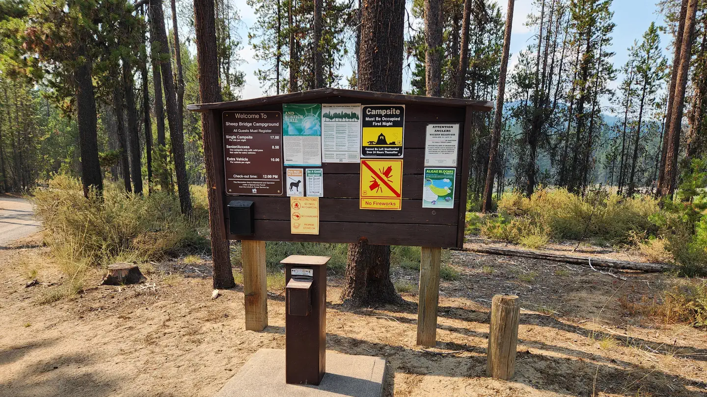
Overview
Sheep Bridge Campground is located at the point where the Deschutes River flows into Wickiup Reservoir.
Recreation
Sheep Bridge Campground offers great access for fishing. A short drive away, visitors can find numerous trailheads leading into the Three Sisters Wilderness.
Facilities
Sheep Bridge Campground can accommodate both tent and RV camping, however, hookups are not available. The campground offers picnic tables, campfire rings, drinking water and vault toilets.
A boat ramp for river access is also available at the campground.
Natural Features
The Deschutes River provides habitat for a variety of fish species, including rainbow trout, whitefish, bull trout and kokanee salmon.
Nearby Attractions
Visitors can explore wilderness areas, rivers, lakes and reservoirs, and approximately hundred of miles of trail. Newberry National Volcanic Monument, approxiately 45 minutes by vehicle, is a great starting point for visitors to learn about the diverse landscape and history of the area through interpretive programs and exhibits. Visitors can explore Lava River Cave, the longest continuous lava tube in Oregon. Visitors enjoy traveling the Cascade Lakes Scenic Bywaywhich climbs 66 miles through the Cascade Range, weaving past snow-capped peaks and alpine lakes.
Charges & Cancellations
Once your reservation start date has begun, neither the Recreation.gov Contact Center nor the campground manager will be able to modify your reservation.
The facts
- 23 bookable sites
- Vehicles up to 40 ft
- Up to 6 people per site
- Loops: SHEEP BRIDGE
Site types
- 23 Standard Nonelectric
Amenities
- Campfires allowed
- Fire pits
- Picnic tables
- Shade
- Pets allowed
Not recorded upstream: electric hookups, water hookups, sewer hookups, grills.
23 campsites at Sheep Bridge
Check-in 2:00 PM · Check-out 12:00 PM
| Site | Loop | Type | Entry | Surface | Max rig | People | |
|---|---|---|---|---|---|---|---|
| 001 | SHEEP BRIDGE | Standard Nonelectric | Pull Through | Gravel | 40 ft | 6 | 🐾 |
| 002 | SHEEP BRIDGE | Standard Nonelectric | Pull Through | Gravel | 40 ft | 6 | 🐾 |
| 003 | SHEEP BRIDGE | Standard Nonelectric | Pull Through | Gravel | 40 ft | 6 | 🐾 |
| 004 | SHEEP BRIDGE | Standard Nonelectric | Pull Through | Gravel | 40 ft | 6 | 🐾 |
| 005 | SHEEP BRIDGE | Standard Nonelectric | Back In | Gravel | 40 ft | 6 | 🐾 |
| 006 | SHEEP BRIDGE | Standard Nonelectric | Back In | Gravel | 40 ft | 6 | 🐾 |
| 007 | SHEEP BRIDGE | Standard Nonelectric | Pull Through | Gravel | 40 ft | 6 | 🐾 |
| 008 | SHEEP BRIDGE | Standard Nonelectric | Back In | Gravel | 40 ft | 6 | 🐾 |
| 009 | SHEEP BRIDGE | Standard Nonelectric | Pull Through | Gravel | 40 ft | 6 | 🐾 |
| 010 | SHEEP BRIDGE | Standard Nonelectric | Back In | Gravel | 40 ft | 6 | 🐾 |
| 011 | SHEEP BRIDGE | Standard Nonelectric | Pull Through | Gravel | 40 ft | 6 | 🐾 |
| 012 | SHEEP BRIDGE | Standard Nonelectric | Pull Through | Gravel | 40 ft | 6 | 🐾 |
| 013 | SHEEP BRIDGE | Standard Nonelectric | Back In | Gravel | 30 ft | 6 | 🐾 |
| 014 | SHEEP BRIDGE | Standard Nonelectric | Pull Through | Gravel | 40 ft | 6 | 🐾 |
| 015 | SHEEP BRIDGE | Standard Nonelectric | Back In | Gravel | 40 ft | 6 | 🐾 |
| 016 | SHEEP BRIDGE | Standard Nonelectric | Pull Through | Gravel | 40 ft | 6 | 🐾 |
| 017 | SHEEP BRIDGE | Standard Nonelectric | Back In | Gravel | 40 ft | 6 | 🐾 |
| 018 | SHEEP BRIDGE | Standard Nonelectric | Back In | Gravel | 40 ft | 6 | 🐾 |
| 019 | SHEEP BRIDGE | Standard Nonelectric | Pull Through | Gravel | 40 ft | 6 | 🐾 |
| 020 | SHEEP BRIDGE | Standard Nonelectric | Back In | Gravel | 40 ft | 6 | 🐾 |
| 021 | SHEEP BRIDGE | Standard Nonelectric | Pull Through | Gravel | 40 ft | 6 | 🐾 |
| 022 | SHEEP BRIDGE | Standard Nonelectric | Back In | Gravel | 40 ft | 6 | 🐾 |
| 023 | SHEEP BRIDGE | Standard Nonelectric | Back In | Gravel | 40 ft | 6 | 🐾 |
Getting there
From Bend, Oregon: Travel 26.8 miles south on Hwy 97 to Wickiup Junction, then 11.0 miles west on County Road 43, then continue 4.6 miles west on Forest Road 42 , and finally 0.8 miles south on Forest Road 4260.
43.73444, -121.78889 · 43°44'4.0"N 121°47'20.0"W
Typical weather
Typically 83°F in Jul, down to 38°F in Dec.
| Jan | Feb | Mar | Apr | May | Jun | Jul | Aug | Sep | Oct | Nov | Dec | |
|---|---|---|---|---|---|---|---|---|---|---|---|---|
| High °F | 40 | 43 | 48 | 54 | 63 | 71 | 83 | 82 | 75 | 62 | 46 | 38 |
| Low °F | 21 | 22 | 26 | 30 | 36 | 42 | 47 | 46 | 38 | 31 | 26 | 21 |
| Precip in | 3.0 | 2.0 | 1.7 | 1.3 | 1.3 | 0.9 | 0.5 | 0.6 | 0.6 | 1.4 | 2.6 | 3.6 |
1991–2020 averages from the nearest NOAA station, 6.2 mi away — not measured at the facility itself, and elevation can make a real difference over that distance.
Map
More photos
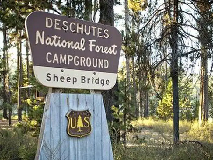
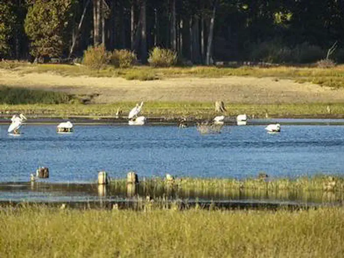
Member photos
Common questions about Sheep Bridge
- Can you reserve a site at Sheep Bridge?
- Yes, Sheep Bridge is reservable through Recreation.gov.
- How many campsites does Sheep Bridge have?
- 23 sites.
- What is the maximum RV length at Sheep Bridge?
- 40 ft. That is the longest vehicle the sites here are recorded as taking; individual sites may be shorter.
- Are pets allowed at Sheep Bridge?
- Yes, pets are allowed at Sheep Bridge.
- Are campfires allowed at Sheep Bridge?
- Campfires are allowed at Sheep Bridge. Check for a current fire restriction before you go.
Camping near Sheep Bridge
- North Twin Lake Campground 1.3 mi · Campground · we watch it
- West South Twin Campground 1.6 mi · Campground · we watch it
- Gull Point Campground 2.5 mi · Campground · we watch it
- Rock Creek Campground (Deschutes National Forest, OR) 3.2 mi · Campground · we watch it
- Quinn River Campground 4.3 mi · Campground · we watch it
- Crane Prairie Campground 4.5 mi · Campground · we watch it
- North Davis Creek Campground 4.5 mi · Campground · we watch it
- Reservoir Campground 4.6 mi · Campground · we watch it
- Cow Meadow Campground 5.5 mi · Campground · we watch it
- Sheep Bridge Campground 0.7 mi · Campground
- Wickiup Reservoir 5.1 mi · Facility
- Elk Lake Campground 5.8 mi · Campground
Contact
- Phone 541-323-1746
- Book Recreation.gov
Recreation.gov last updated this record on 2026-06-12.
Facility information and photographs from Recreation.gov (RIDB). SpotOpened is not affiliated with Recreation.gov or any federal agency.
Comments