Price Canyon Recreation Area
Campground · 14 bookable sites ·
Managed by the Bureau of Land Management
Price Field Office (Bureau of Land Management UT) · Open Access
- 14
- Bookable sites
- 6,736 ft
- Elevation
Overview
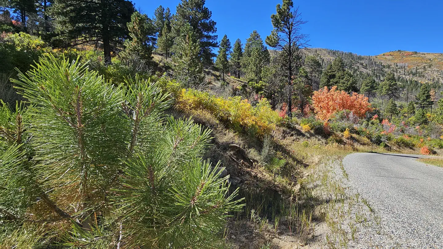
Price Canyon Recreation Area offers visitors a chance to enjoy cooler temperatures and the shade of large ponderosa pine trees during the summer. The recreation area is located on a ridge high above Price Canyon.
Recreation
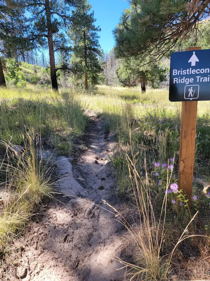
The Bristlecone Ridge trail (3.1 miles starting in the north campground loop) allows visitors to hike through the burned bristlecone forest. Post-fire, these open grasslands fill with wildflowers in the summer months. There are two bouldering areas on the way up to the campground, and day use areas at each campground.
Facilities
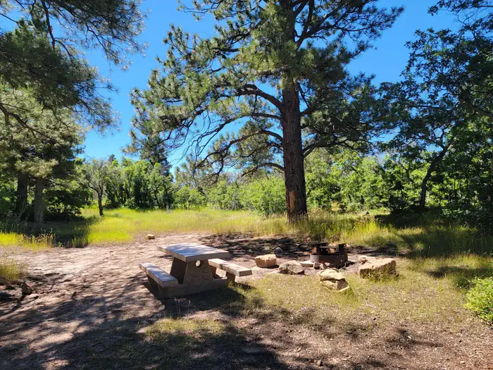
The north campground loop access two group sites and the south loop has twelve individual sites. Both loops have vault toilets, and all campsites have picnic tables, fire rings, and flat areas for tents. Many are shaded by ponderosa pines.
Natural Features
Situated at an elevation of 7,500 feet, the recreation area is forested with ponderosa pines and shrubs. The 2021 Bear Fire burned most of the bristlecone pines in the forest, but the ridge still offers scenic views and some portions of the forest are intact.
The facts
- 14 bookable sites
- Loops: Price Canyon Recreation Area
Site types
- 12 Standard Nonelectric
- 2 Group Standard Nonelectric
Amenities
- Fire pits
- Picnic tables
- Water hookups — not available
Not recorded upstream: electric hookups, sewer hookups, campfires allowed, grills, shade, pets allowed.
14 campsites at Price Canyon Recreation Area
| Site | Loop | Type | Entry | Surface | Max rig | People | |
|---|---|---|---|---|---|---|---|
| Group site 1 | Price Canyon Recreation Area | Group Standard Nonelectric | Parallel | Gravel | — | — | |
| Group site 2 | Price Canyon Recreation Area | Group Standard Nonelectric | Parallel | Gravel | — | — | |
| Site 1 | Price Canyon Recreation Area | Standard Nonelectric | Parallel | Gravel | — | — | |
| Site 10 | Price Canyon Recreation Area | Standard Nonelectric | Parallel | Gravel | — | — | |
| Site 11 | Price Canyon Recreation Area | Standard Nonelectric | Parallel | Gravel | — | — | |
| Site 12 | Price Canyon Recreation Area | Standard Nonelectric | Back In | Gravel | — | — | |
| Site 2 | Price Canyon Recreation Area | Standard Nonelectric | Pull Through | Gravel | — | — | |
| Site 3 | Price Canyon Recreation Area | Standard Nonelectric | Back In | Gravel | — | — | |
| Site 4 | Price Canyon Recreation Area | Standard Nonelectric | Back In | Gravel | — | — | |
| Site 5 | Price Canyon Recreation Area | Standard Nonelectric | Pull Through | Gravel | — | — | |
| Site 6 | Price Canyon Recreation Area | Standard Nonelectric | Parallel | Gravel | — | — | |
| Site 7 | Price Canyon Recreation Area | Standard Nonelectric | Back In | Gravel | — | — | |
| Site 8 | Price Canyon Recreation Area | Standard Nonelectric | Parallel | Gravel | — | — | |
| Site 9 | Price Canyon Recreation Area | Standard Nonelectric | Back In | Gravel | — | — |
Getting there
Price Canyon Recreation Area is located 15 miles north of Price and 43 miles south of Spanish Fork via US-6. The turnoff is on the west side of the road at mile 224.4.
39.78765, -110.92908 · 39°47'15.5"N 110°55'44.7"W
Typical weather
Typically 78°F in Jul, down to 30°F in Jan.
| Jan | Feb | Mar | Apr | May | Jun | Jul | Aug | Sep | Oct | Nov | Dec | |
|---|---|---|---|---|---|---|---|---|---|---|---|---|
| High °F | 30 | 34 | 42 | 49 | 61 | 72 | 78 | 78 | 68 | 55 | 42 | 31 |
| Low °F | 4 | 6 | 15 | 25 | 32 | 39 | 45 | 45 | 37 | 29 | 18 | 6 |
| Precip in | — | — | — | — | — | — | — | — | — | — | — | — |
1991–2020 averages from the nearest NOAA station, 10.1 mi away — not measured at the facility itself, and elevation can make a real difference over that distance.
Map
More photos
Member photos
Common questions about Price Canyon Recreation Area
- Can you reserve a site at Price Canyon Recreation Area?
- Yes, Price Canyon Recreation Area is reservable through Recreation.gov.
- How many campsites does Price Canyon Recreation Area have?
- 14 sites.
- Does Price Canyon Recreation Area have hookups?
- No hookups are recorded here.
Camping near Price Canyon Recreation Area
- Avintaquin Campground 10.5 mi · Campground · we watch it
- Fish Creek Campground 14.5 mi · Campground · we watch it
- Flat Canyon 20.1 mi · Campground · we watch it
- Gooseberry Reservoir 20.1 mi · Campground · we watch it
- Bridges Campground 20.3 mi · Campground · we watch it
- Gooseberry Creek Campground 20.7 mi · Campground · we watch it
- Chute Group 20.9 mi · Campground · we watch it
- Little Rock Campground 21 mi · Campground · we watch it
- Gordon Creek Trailhead 11.6 mi · Facility
- Chute Group Campground 20.2 mi · Campground
- Candland Mountain Trailhead 20.4 mi · Facility
- Bridges Campground 20.9 mi · Campground
Contact
- Book Recreation.gov
Recreation.gov last updated this record on 2026-02-25.
Facility information and photographs from Recreation.gov (RIDB). SpotOpened is not affiliated with Recreation.gov or any federal agency.
Comments