Juniper Campground (Quemado Lake)
Campground · 36 bookable sites ·
Managed by the USDA Forest Service
Apache National Forest (NF) · Open Access
- 36
- Bookable sites
- 7,704 ft
- Elevation
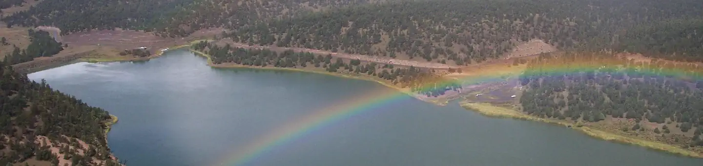
Overview
Juniper Campground is Quemado Ranger District's most popular campground. It offers electric RV hookups (no sewer), leveled tent sites, and easy lake access. This campground is a mix of first come, first served sites and reservable sites. For more information, you can visit our website:Gila National Forest : Recreation Group - Quemado Lake Recreation Area
Recreation
Recreational opportunities include fishing and boating on Quemado Lake, hiking forest and lakeside trails, and RV and tent camping.
Facilities
Boat Ramp / Tent Camping/ Trailer/RV Camping / Picnic Tables / Vault Toilets / Grills / Campfire Rings
Natural Features
Lake Access/ Forested / Unrestricted Night Sky Views
Contact Info
For facility specific information, please call (575) 773-4678.Nearby Attractions
- El Caso I-3 Campgrounds
- El Caso 4 & 5 Campgrounds
- Piñon Campground
- Quemado Lake and Day Use Area
- Boat Ramp at Quemado Lake
Charges & Cancellations
Cancellation Policy:
- A customer who cancels a reservation the day before or the day of arrival will pay a $10.00 service fee AND forfeit the first night's use fee (not to exceed the total paid for the original reservation). Cancellations for a one-night reservation will forfeit the entire amount paid and will not be subject to an additional service fee.
The facts
- 36 bookable sites
- Loops: RV, Upper Loop
Site types
- 18 RV Electric
- 18 Standard Nonelectric
Amenities
- Electric hookups
- Water hookups
- Campfires allowed
- Fire pits
- Picnic tables
- Grills
- Shade
- Pets allowed
Not recorded upstream: sewer hookups.
36 campsites at Juniper Campground (Quemado Lake)
Check-in 3:00 PM · Check-out 11:00 AM
| Site | Loop | Type | Entry | Surface | Grade | Water | Max rig | People | |
|---|---|---|---|---|---|---|---|---|---|
| 01 | RV | Rv Electric | Back In | Gravel | Slight | Lakefront | — | — | 🐾 |
| 02 | RV | Rv Electric | Back In | Gravel | Slight | Lakefront | — | — | 🐾 |
| 03 | RV | Rv Electric | Back In | — | Slight | — | — | — | 🐾 |
| 04 | RV | Rv Electric | Back In | Gravel | Slight | Lakefront | — | — | 🐾 |
| 05 | RV | Rv Electric | Back In | — | Slight | — | — | — | 🐾 |
| 06 | RV | Rv Electric | Back In | Gravel | Slight | Lakefront | — | — | 🐾 |
| 07 | RV | Rv Electric | Back In | — | Slight | — | — | — | 🐾 |
| 08 | RV | Rv Electric | Back In | Gravel | Slight | Lakefront | — | — | 🐾 |
| 09 | RV | Rv Electric | Back In | — | Slight | — | — | — | 🐾 |
| 10 | RV | Rv Electric | Back In | Gravel | Slight | Lakefront | — | — | 🐾 |
| 11 | RV | Rv Electric | Back In | — | Slight | — | — | — | 🐾 |
| 12 | RV | Rv Electric | Back In | Gravel | Slight | Lakefront | — | — | 🐾 |
| 13 | RV | Rv Electric | Back In | — | Slight | — | — | — | 🐾 |
| 14 | RV | Rv Electric | Back In | Gravel | Slight | Lakefront | — | — | 🐾 |
| 15 | RV | Rv Electric | Back In | — | Slight | — | — | — | 🐾 |
| 16 | RV | Rv Electric | Back In | Gravel | Slight | Lakefront | — | — | 🐾 |
| 17 | RV | Rv Electric | Back In | — | Slight | — | — | — | 🐾 |
| 18 | RV | Rv Electric | Back In | Gravel | Slight | Lakefront | — | — | 🐾 |
| 19 | Upper Loop | Standard Nonelectric | Back In | Gravel | Slight | — | — | — | 🐾 |
| 20 | Upper Loop | Standard Nonelectric | Back In | Gravel | Slight | — | — | 0 | 🐾 |
| 21 | Upper Loop | Standard Nonelectric | Back In | Gravel | Slight | — | — | — | 🐾 |
| 22 | Upper Loop | Standard Nonelectric | Back In | Gravel | Slight | — | — | — | 🐾 |
| 23 | Upper Loop | Standard Nonelectric | Back In | Gravel | Slight | — | — | — | 🐾 |
| 24 | Upper Loop | Standard Nonelectric | Back In | Gravel | Slight | — | — | — | 🐾 |
| 25 | Upper Loop | Standard Nonelectric | Back In | Gravel | Slight | — | — | — | 🐾 |
| 26 | Upper Loop | Standard Nonelectric | Back In | Gravel | Slight | — | — | — | 🐾 |
| 27 | Upper Loop | Standard Nonelectric | Back In | Gravel | Slight | — | — | — | 🐾 |
| 28 | Upper Loop | Standard Nonelectric | Back In | Gravel | Slight | — | — | — | 🐾 |
| 29 | Upper Loop | Standard Nonelectric | Back In | Gravel | Slight | — | — | — | 🐾 |
| 30 | Upper Loop | Standard Nonelectric | Back In | Gravel | Slight | — | — | — | 🐾 |
| 31 | Upper Loop | Standard Nonelectric | Back In | Gravel | Slight | — | — | — | 🐾 |
| 32 | Upper Loop | Standard Nonelectric | Back In | Gravel | Slight | — | — | — | 🐾 |
| 33 | Upper Loop | Standard Nonelectric | Back In | Gravel | Slight | — | — | — | 🐾 |
| 34 | Upper Loop | Standard Nonelectric | Back In | Gravel | Slight | — | — | — | 🐾 |
| 35 | Upper Loop | Standard Nonelectric | Back In | Gravel | Slight | — | — | — | 🐾 |
| 36 | Upper Loop | Standard Nonelectric | Back In | Gravel | Slight | — | — | — | 🐾 |
Getting there
The campground is located 14.2 miles south of Quemado. Take NM 32 south to Quemado Lake/NM 103 sign. Turn left onto NM 103 and drive 4 miles to Quemado Lake/Forest Road 13. NM103 ends when the paved road turns to gravel. The gravel road is an indication that you are now driving on Forest Road 13. Continue driving on Forest Road 13 for 1 mile to reach the Juniper Campground. Turn right into the campground.
Latitude : 34.137543 Longitude : -108.48919 Elevation : 7,712 Feet
34.13754, -108.48919 · 34°8'15.2"N 108°29'21.1"W
Typical weather
Typically 85°F in Jul, down to 46°F in Dec.
| Jan | Feb | Mar | Apr | May | Jun | Jul | Aug | Sep | Oct | Nov | Dec | |
|---|---|---|---|---|---|---|---|---|---|---|---|---|
| High °F | 46 | 50 | 58 | 66 | 75 | 84 | 85 | 82 | 77 | 68 | 56 | 46 |
| Low °F | 15 | 19 | 23 | 27 | 34 | 43 | 52 | 51 | 43 | 31 | 22 | 16 |
| Precip in | 0.5 | 0.6 | 0.6 | 0.4 | 0.1 | 0.6 | 1.9 | 2.9 | 1.9 | 0.9 | 0.5 | 0.5 |
1991–2020 averages from the nearest NOAA station, 14.3 mi away — not measured at the facility itself, and elevation can make a real difference over that distance.
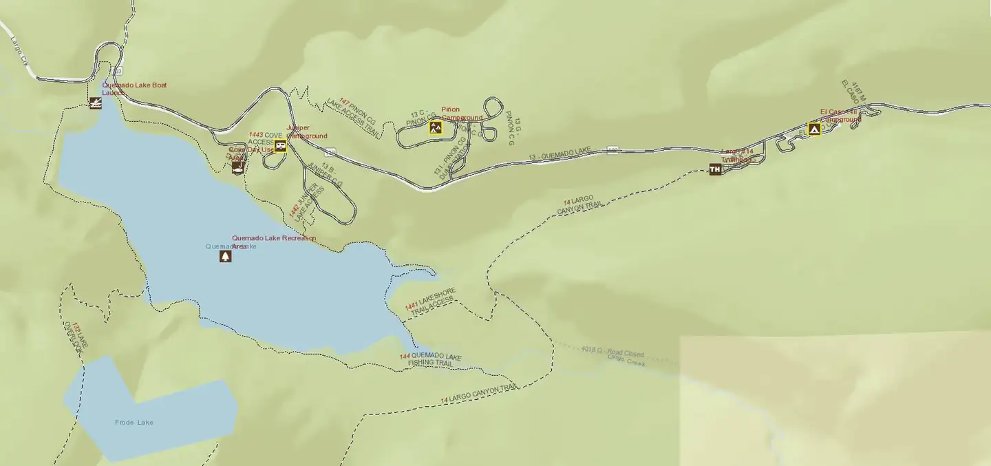
Map
Fees and stay limits
Payments made for first come, first served sites must be made using cash or check. Exact change is required. There is a self-pay fee station at the entrance of the campground.
From Recreation.gov, which is not always current. The operator's own page is the authority on what you will be charged.
More photos
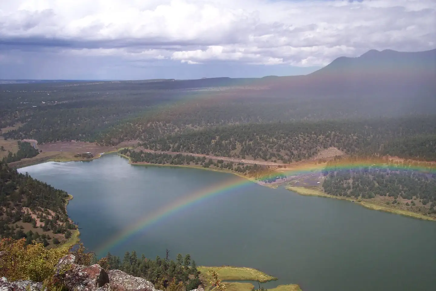
Member photos
Common questions about Juniper Campground (Quemado Lake)
- Can you reserve a site at Juniper Campground (Quemado Lake)?
- Yes, Juniper Campground (Quemado Lake) is reservable through Recreation.gov.
- How many campsites does Juniper Campground (Quemado Lake) have?
- 36 sites.
- Are pets allowed at Juniper Campground (Quemado Lake)?
- Yes, pets are allowed at Juniper Campground (Quemado Lake).
- Does Juniper Campground (Quemado Lake) have hookups?
- Electric, Water.
- Are campfires allowed at Juniper Campground (Quemado Lake)?
- Campfires are allowed at Juniper Campground (Quemado Lake). Check for a current fire restriction before you go.
Camping near Juniper Campground (Quemado Lake)
- Pinon Campground (Quemado Lake) 0.3 mi · Campground · we watch it
- Luna Lake 39.9 mi · Campground · we watch it
- Juniper Campground less than 0.1 mi · Campground
- Quemado Lake Recreation Area 0.3 mi · Facility
- Piñon Campground 0.3 mi · Campground
- El Caso I-IV Campground 1.1 mi · Campground
- Armijo Springs Campground 5.4 mi · Campground
- Valle Tio Vinces Campground 10.7 mi · Campground
- Apache Creek Campground 22.8 mi · Facility
- Datil Well Recreation Area Campground 36.1 mi · Campground
- Head of the Ditch Campground 36.1 mi · Campground
- Gwynn Tank Campground 41.5 mi · Campground
Contact
- Book Recreation.gov
Recreation.gov last updated this record on 2026-07-09.
Facility information and photographs from Recreation.gov (RIDB). SpotOpened is not affiliated with Recreation.gov or any federal agency.
Comments