Hell's Revenge Trailhead
Facility ·
Managed by the Bureau of Land Management
Moab Field Office (Bureau of Land Management UT) · Open Access
- 4,631 ft
- Elevation
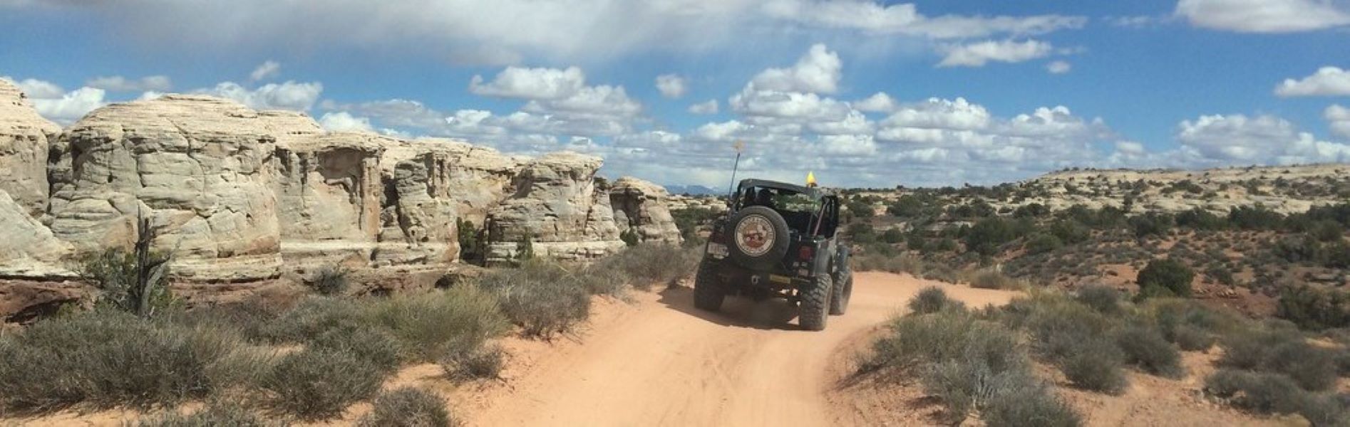
Hell’s Revenge Trailhead serves as the gateway for a challenging and iconic 4×4 route through the slickrock mesas near Moab, Utah. The trail is known for steep slickrock climbs, narrow ledges, and dramatic rock formations. Only very experienced drivers with advanced off-highway vehicles should attempt the route, though hikers may also explore – but they should watch for vehicle traffic and navigate the slick sandstone with care.
About half a mile from the trailhead, the Hell’s Revenge Dinosaur Tracksite preserves over 50 footprints in a limestone layer within Jurassic Navajo Sandstone. These trace fossils come from at least three types of dinosaurs that lived here about 190 million-years-ago, including the large, predatory Dilophosaurus; the small, meat-eating Segisaurus; and Seitaad, an ancestor of large, long-necked dinosaurs. This site offers some of the only evidence in the region for these particular genera.
Hours and Seasons
Open year-round. Weather can be extreme; hot summers and cold winters make spring and fall the best seasons for visiting.
Hell’s Revenge 4x4 Trail
The Hell’s Revenge 4×4 Trail is a popular — but extremely difficult — route through slickrock terrain. It’s about 6.5 miles long and takes 2–3 hours to navigate. Only very experienced drivers with advanced vehicles should attempt it; it is not suitable for ATVs.
The trail starts just past the Sand Flats Recreation Area entrance station and crosses the Slickrock Bike Trail (marked with painted white “dashes”), which is open only to motorcycles and mountain bikes.
- Stay on trail: All vehicles must remain on designated roads and trails.
- No open play areas: All play occurs on the marked trail; roadside parking only.
- Trailer parking: Available at the trailhead
- Speed limit: 15 mph
The trail includes several optional obstacles — such as the Escalator and Tip‑Over Challenge. When watching, please park on the road and out of vehicle travel paths.
Additional information is available through the Sand Flats Recreation Area Website.
Features and Services
- Facilities: None at trailhead
- Access and Parking: Sandflats Road is paved to the Hell’s Revenge Trailhead parking lot, which is on sandstone. The parking lot can accommodate trailers.
- Cell Service: Limited or none — Moab area coverage only
- Toilets: None
- Drinking Water: None
- Pets: Must be on a leash and cleaned up after
- Camping: Camping adjacent to Hell’s Revenge Trail is allowed in designated sites only. Visit the Sand Flats Recreation Area website for additional information.
- Nearby Amenities: Moab offers food, fuel, lodging, and medical services.
Respect and Protect
By practicing responsible outdoor ethics, you help ensure future visitors can enjoy this remarkable site.
- All vehicles must remain on designated roads and trails. Off-trail driving is a Class A misdemeanor punishable by fines, imprisonment, and vehicle forfeiture. Report violations at 435‑259‑8115.
- Do not disturb or remove any dinosaur footprints — trace fossils are protected by law.
Accessibility Description (ABA/ADA)
The terrain is technical slickrock and steep 4×4 ledges. This location would not generally be considered wheelchair accessible.
Getting there
From Moab, Utah, turn east on 300 South, then turn right on 400 East to Mill Creek Drive. Go east on Mill Creek Drive to Sand Flats Road. Go east on Sand Flats Road approximately 1 mile to the Hell's Revenge Trailhead.
38.57532, -109.52258 · 38°34'31.1"N 109°31'21.3"W
Typical weather
Typically 99°F in Jul, down to 44°F in Jan.
| Jan | Feb | Mar | Apr | May | Jun | Jul | Aug | Sep | Oct | Nov | Dec | |
|---|---|---|---|---|---|---|---|---|---|---|---|---|
| High °F | 44 | 52 | 65 | 72 | 83 | 94 | 99 | 96 | 88 | 74 | 57 | 44 |
| Low °F | 21 | 27 | 36 | 43 | 51 | 59 | 66 | 64 | 55 | 42 | 30 | 22 |
| Precip in | 0.7 | 0.7 | 0.7 | 0.8 | 0.8 | 0.3 | 0.9 | 0.9 | 0.9 | 1.0 | 0.7 | 0.8 |
1991–2020 averages from the nearest NOAA station, 1.3 mi away — not measured at the facility itself, and elevation can make a real difference over that distance.
Map
Fees and stay limits
Visitors must pay for entry into Sand Flats Recreation Area. There are no additional fees associated with recreating at Hell's Revenge Trailhead.
Stay limit: Day-use Only
From Recreation.gov, which is not always current. The operator's own page is the authority on what you will be charged.
Member photos
Common questions about Hell's Revenge Trailhead
- Can you reserve a site at Hell's Revenge Trailhead?
- No. Hell's Revenge Trailhead is not reservable through Recreation.gov, so sites are first-come, first-served or booked elsewhere.
- How long can you stay at Hell's Revenge Trailhead?
- Day-use Only
Camping near Hell's Revenge Trailhead
- Sand Flats Recreation Area Group Campsites 0.6 mi · Campground · we watch it
- Goose Island Group Sites 3 mi · Campground · we watch it
- Fins and Things Trailhead 1.3 mi · Facility
- Grandstaff Canyon Trailhead 2.4 mi · Facility
- Grandstaff Campground 2.5 mi · Campground
- Kane Creek Recreation Area 3 mi · Facility
- Hidden Valley Trail 3 mi · Facility
- Pipe Dream Trailhead 3 mi · Facility
- Goose Island Campground 3 mi · Campground
- Stairmaster Trailhead 3.4 mi · Facility
- King's Bottom Campground 3.6 mi · Campground
- Jaycee Park Campground 4.8 mi · Campground
Contact
- Phone 435-259-2100
- Email blm_ut_mb_mail@blm.gov
- Info Recreation.gov
Recreation.gov last updated this record on 2026-05-13.
Facility information and photographs from Recreation.gov (RIDB). SpotOpened is not affiliated with Recreation.gov or any federal agency.
Comments