Demotte
Campground · 38 bookable sites ·
Managed by the USDA Forest Service
Kaibab National Forest (NF) · Open Access
- 38
- Bookable sites
- 40 ft
- Max rig length
- up to 8
- People per site
- 8,800 ft
- Elevation
Overview
The DeMotte Campground is located within the North Kaibab Ranger District just seven miles north of the entrance to the Grand Canyon National Park's North Rim. This is about 25 miles south of the Kaibab Plateau Visitor Center on Arizona’s Highway 67.Recreation
Visitors to the DeMotte Campground enjoy camping and picnicking, sight-seeing and wildlife viewing. Enjoy a visit to the North Rim from mid-May through mid-October; the road is closed during winter. Hiking trails, spruce-fir and Ponderosa pine forests and unparalleled views of one of the Seven Natural Wonders of the World.Facilities
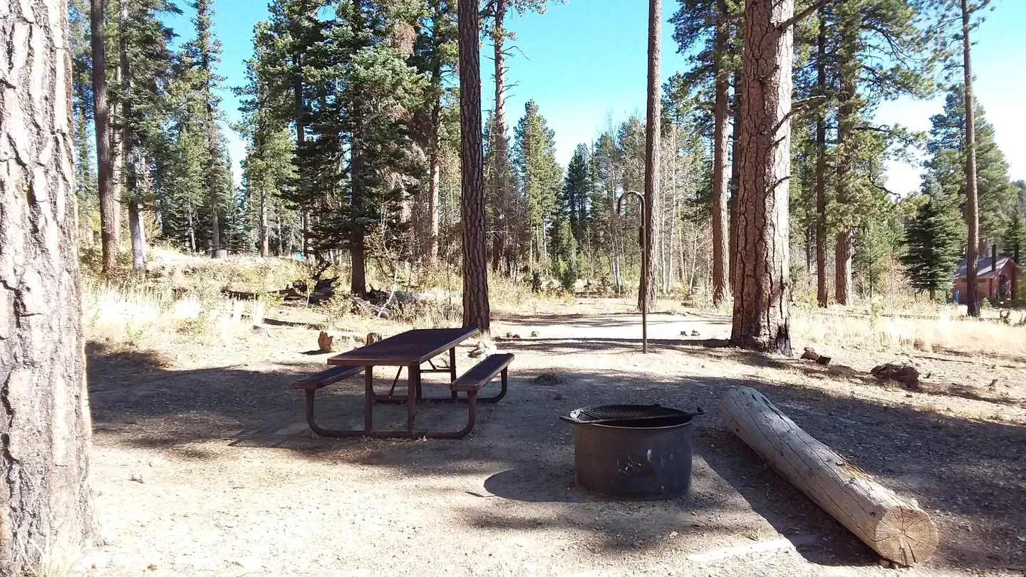
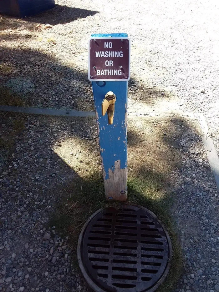
The campground offers 38 single-family campsites with tables and cooking grills. DeMotte's campsites can accommodate tents, trailers and small motor homes. No utility hookups are available at this campground. Drinking water is available.Natural Features
Many species of wildlife call the Kaibab home, including the tassel-eared Kaibab squirrel, found nowhere else in the world, and numerous species of birds.Contact Info
For facility specific information, please call (928) 537-8888.Nearby Attractions
The North Rim of the Grand Canyon National Park.The facts
- 38 bookable sites
- Vehicles up to 40 ft
- Up to 8 people per site
- Loops: Loop A, Loop B
Site types
- 31 Standard Nonelectric
- 7 Tent Only Nonelectric
Amenities
- Campfires allowed
- Fire pits
- Picnic tables
- Grills
- Shade
- Pets allowed
Not recorded upstream: electric hookups, water hookups, sewer hookups.
38 campsites at Demotte
| Site | Loop | Type | Entry | Surface | Grade | Max rig | People | |
|---|---|---|---|---|---|---|---|---|
| 001 | Loop A | Standard Nonelectric | — | — | — | — | 8 | 🐾 |
| 002 | Loop A | Standard Nonelectric | — | — | — | — | 8 | 🐾 |
| 003 | Loop A | Standard Nonelectric | — | — | — | — | 8 | 🐾 |
| 004 | Loop A | Standard Nonelectric | — | — | — | — | 8 | 🐾 |
| 005 | Loop A | Standard Nonelectric | — | — | — | — | 8 | 🐾 |
| 006 | Loop A | Standard Nonelectric | — | — | — | — | 8 | 🐾 |
| 007 | Loop A | Standard Nonelectric | — | — | — | — | 8 | 🐾 |
| 008 | Loop A | Standard Nonelectric | — | — | — | — | 8 | 🐾 |
| 009 | Loop A | Standard Nonelectric | — | — | — | — | 8 | 🐾 |
| 010 | Loop A | Standard Nonelectric | — | — | — | — | 8 | 🐾 |
| 011 | Loop A | Standard Nonelectric | Pull Through | Gravel | Slight | 35 ft | 8 | 🐾 |
| 012 | Loop A | Tent Only Nonelectric | Back In | Gravel | — | — | 8 | 🐾 |
| 013 | Loop A | Standard Nonelectric | Pull Through | Gravel | Slight | 40 ft | 8 | 🐾 |
| 014 | Loop A | Tent Only Nonelectric | Back In | Gravel | — | — | 8 | 🐾 |
| 015 | Loop A | Standard Nonelectric | Back In | Gravel | — | 30 ft | 8 | 🐾 |
| 016 | Loop A | Standard Nonelectric | Back In | Gravel | — | 20 ft | 8 | 🐾 |
| 017 | Loop A | Standard Nonelectric | Back In | Gravel | — | 30 ft | 8 | 🐾 |
| 018 | Loop A | Standard Nonelectric | Pull Through | Gravel | Slight | 20 ft | 8 | 🐾 |
| 019 | Loop A | Standard Nonelectric | Back In | Gravel | Slight | 20 ft | 8 | 🐾 |
| 020 | Loop A | Standard Nonelectric | Pull Through | Gravel | — | 30 ft | 8 | 🐾 |
| 021 | Loop A | Tent Only Nonelectric | Back In | Gravel | — | — | 8 | 🐾 |
| 022 | Loop B | Standard Nonelectric | Pull Through | Gravel | Moderate | — | 8 | 🐾 |
| 023 | Loop B | Standard Nonelectric | Back In | Gravel | — | 30 ft | 8 | 🐾 |
| 024 | Loop B | Standard Nonelectric | Back In | Gravel | — | 20 ft | 8 | 🐾 |
| 025 | Loop B | Tent Only Nonelectric | Back In | Gravel | — | — | 8 | 🐾 |
| 026 | Loop B | Standard Nonelectric | Pull Through | Gravel | — | 40 ft | 8 | 🐾 |
| 027 | Loop B | Standard Nonelectric | Pull Through | Gravel | — | 40 ft | 8 | 🐾 |
| 028 | Loop B | Standard Nonelectric | Pull Through | Gravel | — | — | 8 | 🐾 |
| 029 | Loop B | Standard Nonelectric | — | — | — | — | 8 | 🐾 |
| 030 | Loop B | Standard Nonelectric | — | — | — | — | 8 | 🐾 |
| 031 | Loop B | Standard Nonelectric | — | — | — | — | 8 | 🐾 |
| 032 | Loop B | Tent Only Nonelectric | — | — | — | — | 8 | 🐾 |
| 033 | Loop B | Standard Nonelectric | — | — | — | — | 8 | 🐾 |
| 034 | Loop B | Tent Only Nonelectric | — | — | — | — | 8 | 🐾 |
| 035 | Loop B | Standard Nonelectric | — | — | — | — | 8 | 🐾 |
| 036 | Loop B | Standard Nonelectric | — | — | — | — | 8 | 🐾 |
| 037 | Loop B | Standard Nonelectric | — | — | — | — | 8 | 🐾 |
| 038 | Loop B | Tent Only Nonelectric | — | — | — | — | 8 | 🐾 |
Getting there
From Bitter Springs intersection of U.S. 89 and 89A. Take 89A north 55 miles to Jacob Lake. Then south 25 miles on AZ State Route 67 to DeMotte campground.
36.41111, -112.13472 · 36°24'40.0"N 112°8'5.0"W
Typical weather
Typically 77°F in Jul, down to 36°F in Jan.
| Jan | Feb | Mar | Apr | May | Jun | Jul | Aug | Sep | Oct | Nov | Dec | |
|---|---|---|---|---|---|---|---|---|---|---|---|---|
| High °F | 36 | 37 | 44 | 52 | 62 | 73 | 77 | 74 | 67 | 56 | 45 | 36 |
| Low °F | 18 | 19 | 23 | 28 | 36 | 43 | 49 | 48 | 42 | 33 | 24 | 17 |
| Precip in | 3.6 | 3.5 | 3.0 | 1.6 | 0.8 | 0.4 | 1.8 | 2.8 | 1.9 | 1.8 | 1.4 | 1.9 |
1991–2020 averages from the nearest NOAA station, 14.2 mi away — not measured at the facility itself, and elevation can make a real difference over that distance.
Map
More photos
Member photos
Common questions about Demotte
- Can you reserve a site at Demotte?
- Yes, Demotte is reservable through Recreation.gov.
- How many campsites does Demotte have?
- 38 sites.
- What is the maximum RV length at Demotte?
- 40 ft. That is the longest vehicle the sites here are recorded as taking; individual sites may be shorter.
- Are pets allowed at Demotte?
- Yes, pets are allowed at Demotte.
- Are campfires allowed at Demotte?
- Campfires are allowed at Demotte. Check for a current fire restriction before you go.
Also listed by
Demotte also appears in other federal recreation data. Facts below are matched by name and location, not confirmed by Demotte's operator.
USDA Forest Service — data as of Aug 24, 2026
- For fees and reservations go to www.recreation.gov website or via telephone at 1-877-444-6777.
Restrictions:
- Check out time is 2 p.m.
- Pets are welcome but must be kept on a leash.
- It is strictly forbidden to drain wastewater onto the ground.
- All campgrounds limit campers to a 14-day stay.
Camping near Demotte
- North Rim Campground (AZ) 14.5 mi · Campground · we watch it
- Big Springs Cabin Site 17.8 mi · Campground · we watch it
- Jacob Lake Recreation Area 20.4 mi · Campground · we watch it
- Saddle Mountain Wilderness 7 mi · Facility
- North Timp Snowmobile Route #152 12.4 mi · Facility
- Monument Viewpoint 12.4 mi · Facility
- Marble Viewpoint 16.4 mi · Facility
- Big Springs Cabins 17.8 mi · Facility
- Indian Hollow Campground 19.8 mi · Campground
- Jacob Lake Group Campground & Picnic Site 21.3 mi · Campground
- Dominguez-Escalante Site 23.4 mi · Facility
- Grand Canyon Visitor Center (South Rim) 24.4 mi · Facility
Contact
- Phone (928) 638-1960
- Email camping@rrmofa.com
- Book Recreation.gov
Recreation.gov last updated this record on 2026-03-11.
Facility information and photographs from Recreation.gov (RIDB). SpotOpened is not affiliated with Recreation.gov or any federal agency.
Comments