Decision Point Overlook
Facility ·
Managed by the Bureau of Land Management
Upper Missouri River Breaks National Monument (BLM_NM) · Open Access
- 2,626 ft
- Elevation
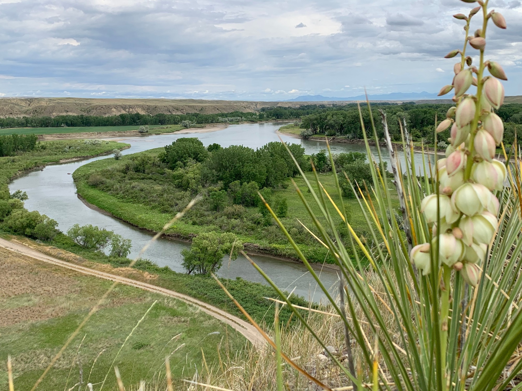
Located near Loma in the Upper Missouri River Breaks National Monument, Decision Point Overlook offers a short walk to a ridge with sweeping views of the confluence of the Marias and Missouri rivers — one of the most consequential stops of the Lewis and Clark Expedition. Today, the ridge is known for abundant prickly pear cactus, which produce showy blooms in spring, as well as the sword‑like Great Plains yucca.
Decision Point sits less than a mile southeast of U.S. Highway 87. From the parking area, a ¼‑mile trail climbs moderately to the ridge above the confluence. Interpretive panels at the parking lot and the overlook share stories of the town of Ophir, Fort Piegan, and the Corps of Discovery’s encampment at the site. Boaters can access the overlook by landing river left immediately after floating under the Loma Bridge, then hiking about a ½‑mile up the county road to the parking area.
History highlight: On June 2, 1805, the Lewis and Clark Corps of Discovery arrived at this overlook and spent several days determining which river to follow west. While most of the crew believed the right fork — the Marias — was the true Missouri, further exploration led the captains to conclude that the south fork — the Missouri — was the correct route. Lewis subsequently named the north fork Maria’s River after his cousin, Maria Wood; over time, the apostrophe was dropped and the river became known as the Marias.
Their choice proved correct. After a 10‑day encampment at Decision Point, the Expedition continued up the Missouri toward the Great Falls, and beyond to the Pacific and an enduring place in the story of American history.
Hours and Seasons
Open year‑round.
Features and Services
- Access and Parking: The parking lot is gravel/dirt. It is large enough to accommodate oversized vehicles.
- Cell Service: Coverage across the Monument can be limited, with little to no reliable cell service in many areas—plan accordingly.
- Toilets: None available at the parking area or overlook.
- Drinking Water: No water is available on‑site; please bring your own.
- Pets: Leashed pets are welcome – please pack out waste.
- Camping: Day‑use only at the overlook. For nearby camping and a boat launch on the Missouri, consider Wood Bottom Recreation Area – about 1–2 miles from Loma – with a gravel boat ramp and vault toilet.
- Nearby Attractions and Amenities: Fort Benton offers food, gas, lodging, medical facilities, and the Missouri Breaks Interpretive Center – your best stop for trip planning, maps, river conditions, and exhibits.
Respect and Protect
By practicing responsible outdoor ethics, you help ensure future visitors can enjoy this remarkable site.
Getting there
From Loma, go south on US-87 for 0.5 miles. Turn left (southeast) on Loma Ferry Road. In 0.6 miles, the parking lot will be on your left.
47.92494, -110.49851 · 47°55'29.8"N 110°29'54.6"W
Typical weather
Typically 88°F in Jul, down to 34°F in Jan.
| Jan | Feb | Mar | Apr | May | Jun | Jul | Aug | Sep | Oct | Nov | Dec | |
|---|---|---|---|---|---|---|---|---|---|---|---|---|
| High °F | 34 | 38 | 49 | 59 | 69 | 77 | 88 | 87 | 76 | 61 | 46 | 36 |
| Low °F | 7 | 10 | 20 | 30 | 39 | 48 | 53 | 51 | 41 | 30 | 19 | 10 |
| Precip in | 0.5 | 0.4 | 0.5 | 1.4 | 2.0 | 2.5 | 1.2 | 1.2 | 1.1 | 1.0 | 0.6 | 0.4 |
1991–2020 averages from the nearest NOAA station, 0.8 mi away — not measured at the facility itself, and elevation can make a real difference over that distance.
Map
Fees and stay limits
No fees
Stay limit: Day-use only
From Recreation.gov, which is not always current. The operator's own page is the authority on what you will be charged.
Member photos
Common questions about Decision Point Overlook
- Can you reserve a site at Decision Point Overlook?
- No. Decision Point Overlook is not reservable through Recreation.gov, so sites are first-come, first-served or booked elsewhere.
- How long can you stay at Decision Point Overlook?
- Day-use only
Camping near Decision Point Overlook
- Coal Banks Landing 14.2 mi · Facility
- Thain Creek Campground 31.3 mi · Facility
- Pugsley Bridge 35.8 mi · Facility
- Snowy Mountain Range 41.6 mi · Facility
- Judith Landing 42.4 mi · Facility
- Lewis and Clark Interpretive Center 43.8 mi · Facility
- Fresno OHV Area 59.1 mi · Facility
Contact
- Phone 406-622-4000
- Email BLM_MT_UMRBNM@blm.gov
- Info Recreation.gov
Recreation.gov last updated this record on 2026-04-03.
Facility information and photographs from Recreation.gov (RIDB). SpotOpened is not affiliated with Recreation.gov or any federal agency.
Comments