Captain John Smith Chesapeake National Historic Trail
Facility ·
Managed by the Bureau of Land Management
Lower Potomac River230 (Environmental System) · Closed to Public Access
- 1 ft
- Elevation
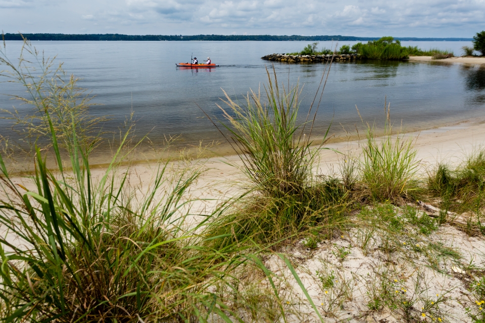
The Captain John Smith Chesapeake National Historic Trail is a series of water routes extending approximately 3,000 miles along the Chesapeake Bay, the nation's largest estuary. These historic routes trace the 1607 to 1609 voyages of Captain John Smith as he charted the land and waterways of the Chesapeake. People first arrived in the Chesapeake Bay during the last ice age. As glaciers melted, diverse societies learned to thrive in a world of water. When Englishman Captain John Smith explored the Chesapeake Bay in 1608, he documented hundreds of American Indian communities and created a map of the Chesapeake Bay region. Today, dozens of sites on his map are archeological treasures and sacred sites for tribal citizens. Come join us on the shores of the Chesapeake Bay!
Douglas Point is a water stop for this water trail at Blue Bay. The shoreline provides access to the +2 miles of trails including the Potomac Heritage National Scenic Trail and the historic Chiles Homesite with interpretive signage. There are picnic facilities at Blue Bay overlook, with a stunning view of the Potomac River. During your stop at the Blue Banks shoreline, test your luck at finding shark teeth and other fossils.
Flickr Album
Getting there
Douglas Point has two parking lots, North Trailhead and South Trailhead. The two parking lots are about 1 mile apart and are connected by Cal Posey Trail.
From Interstate Highway 95/495 in Maryland: Take Exit 3 for Hwy 210 South to Hwy 225, connecting with Hwy 224. Take 224 for about 14 miles. You should see signs for Nanjemoy and the Purse State Park. The parking lot is on the right side.
From US-301 N: Turn left onto MD-6 (Port Tabacco Rd). Take MD-6 for about 15 miles. Turn right onto Greenleek Hill Rd and in 0.2 miles keep right to continue on Greenleek Hill/Jacksontown Rd for 2.3 miles. At the end of the road take a right onto Liverpool Point Rd, and at the stop sign (400 feet ahead) take a left on MD-224 S. The parking lot will be on the right in 1 mile.
Trailhead Address:
- North Trailhead – 9275 Riverside Rd, Nanjemoy, MD
- Chiles Homesite Trailhead – 9699 Riverside Rd, Nanjemoy, MD
38.45125, -77.26235 · 38°27'4.5"N 77°15'44.5"W
Typical weather
Typically 88°F in Jul, down to 45°F in Jan.
| Jan | Feb | Mar | Apr | May | Jun | Jul | Aug | Sep | Oct | Nov | Dec | |
|---|---|---|---|---|---|---|---|---|---|---|---|---|
| High °F | 45 | 48 | 56 | 68 | 76 | 84 | 88 | 86 | 80 | 69 | 58 | 49 |
| Low °F | 28 | 30 | 37 | 47 | 57 | 66 | 71 | 69 | 62 | 50 | 39 | 32 |
| Precip in | 2.7 | 2.4 | 3.6 | 3.2 | 3.6 | 3.5 | 4.6 | 4.2 | 3.4 | 3.3 | 3.1 | 3.3 |
1991–2020 averages from the nearest NOAA station, 3.9 mi away — not measured at the facility itself, and elevation can make a real difference over that distance.
Map
Fees and stay limits
No Fees.
From Recreation.gov, which is not always current. The operator's own page is the authority on what you will be charged.
Member photos
Common questions about Captain John Smith Chesapeake National Historic Trail
- Can you reserve a site at Captain John Smith Chesapeake National Historic Trail?
- No. Captain John Smith Chesapeake National Historic Trail is not reservable through Recreation.gov, so sites are first-come, first-served or booked elsewhere.
Camping near Captain John Smith Chesapeake National Historic Trail
- Telegraph Picnic Pavilion 8.6 mi · Campground · we watch it
- Cabin Camp 3 9.4 mi · Campground · we watch it
- Chopawamsic Backcountry Camping Permits 10.8 mi · Campground · we watch it
- Turkey Run Ridge Group 10.8 mi · Campground · we watch it
- Star-Spangled Banner National Historic Trail less than 0.1 mi · Facility
- Potomac Heritage National Scenic Trail 0.8 mi · Facility
- Prince William Forest Park Visitor Center 8.8 mi · Facility
- Cabin Camp 3 (Group Site By Reservation Only) 9.5 mi · Campground
- Cabin Camp 4 (By Reservation Only) 10.9 mi · Campground
- Cabin Camp 1 (By Reservation Only) 11.3 mi · Facility
- Prince William Forest RV Campground 11.6 mi · Campground
- Cabin Camp 5 (By Reservation Only) 11.8 mi · Campground
Contact
- Phone 703-339-8009
- Email BLM_ES_DouglasPoint@blm.gov
- Info Recreation.gov
Recreation.gov last updated this record on 2026-04-14.
Facility information and photographs from Recreation.gov (RIDB). SpotOpened is not affiliated with Recreation.gov or any federal agency.
Comments