Big Flat
Campground · 12 bookable sites ·
Managed by the USDA Forest Service
Payette National Forest (NF) · Open Access
- 12
- Bookable sites
- up to 10
- People per site
- 4,083 ft
- Elevation
Overview
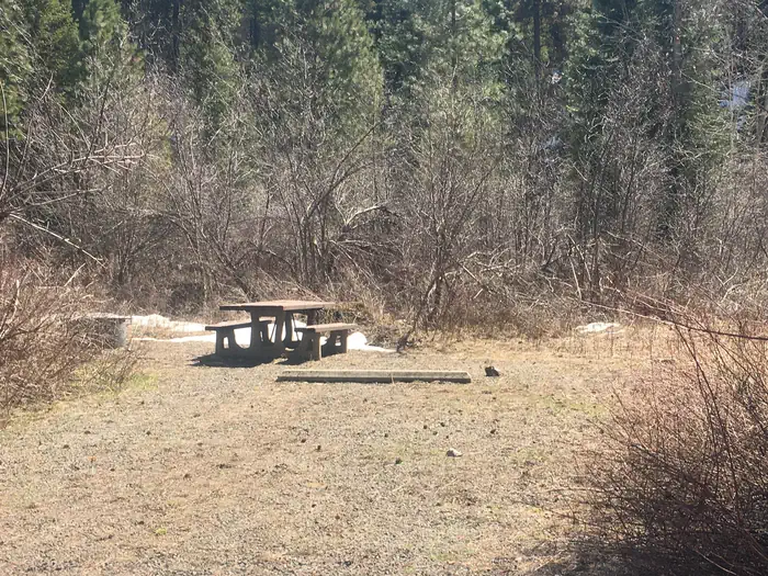
Big Flat Campground is closed indefinitely due to the 2024 Lava Fire. The site was burned.
This location is available on a first-come, first-served basis only. Visitors are required to physically arrive at the campground to purchase and claim a site. Once on-site, you may be able to pay for your campsite(s) by scanning a QR code using the Recreation.gov mobile app, and the Scan and Pay feature.
If this option is available, you will need to first download the free Recreation.gov mobile app https://www.recreation.gov/mobile-app prior to your arrival as some remote areas have limited or no cellular service.
Recreation
You may pass the day fishing for warmwater fish, like bass, in the river.
Facilities
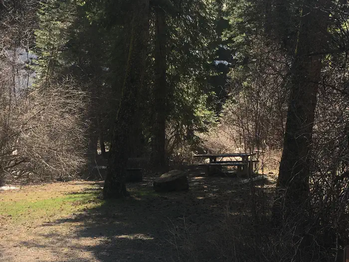
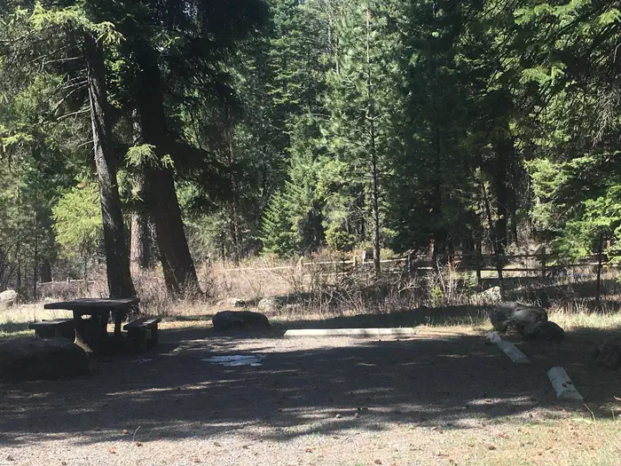
No hook-ups are available. Please Pack-It-In/Pack-It-Out. Potable water is available for cooking and drinking. The campground has handicapped accessible toilets.
The facts
- 12 bookable sites
- 14 sites in total, including non-bookable
- Up to 10 people per site
- Loops: Big Flat, Scan and Pay
Site types
- 12 Standard Nonelectric
- 2 Management
Amenities
- Campfires allowed
- Pets allowed
Not recorded upstream: electric hookups, water hookups, sewer hookups, fire pits, picnic tables, grills, shade.
14 campsites at Big Flat
Check-in 2:00 PM · Check-out 11:00 AM
| Site | Loop | Type | Entry | Surface | Max rig | People | |
|---|---|---|---|---|---|---|---|
| 01 | Big Flat | Standard Nonelectric | — | — | — | 10 | 🐾 |
| 02 | Big Flat | Standard Nonelectric | — | — | — | 5 | 🐾 |
| 03 | Big Flat | Standard Nonelectric | — | — | — | 5 | 🐾 |
| 04 | Big Flat | Standard Nonelectric | — | — | — | 5 | 🐾 |
| 05 | Big Flat | Standard Nonelectric | — | — | — | 10 | 🐾 |
| 06 | Big Flat | Standard Nonelectric | — | — | — | 5 | 🐾 |
| 07 | Big Flat | Standard Nonelectric | — | — | — | 5 | 🐾 |
| 08 | Big Flat | Standard Nonelectric | — | — | — | 5 | 🐾 |
| 09 | Big Flat | Standard Nonelectric | — | — | — | 5 | 🐾 |
| 10 | Big Flat | Standard Nonelectric | — | — | — | 5 | 🐾 |
| 11 | Big Flat | Standard Nonelectric | — | — | — | 5 | 🐾 |
| 12 | Big Flat | Standard Nonelectric | — | — | — | 10 | 🐾 |
| Double S&P | Scan and Pay | Management | — | — | — | — | |
| Standard | Scan and Pay | Management | — | — | — | — |
Getting there
Twenty six miles south of the town of Council. From Hwy 95 turn east on Road #206 and travel approximately 16 miles to the campground entrance. Long and windy gravel road. Narrow in spots.
44.50117, -116.25961 · 44°30'4.2"N 116°15'34.6"W
Typical weather
| Jan | Feb | Mar | Apr | May | Jun | Jul | Aug | Sep | Oct | Nov | Dec | |
|---|---|---|---|---|---|---|---|---|---|---|---|---|
| High °F | — | — | — | — | — | — | — | — | — | — | — | — |
| Low °F | — | — | — | — | — | — | — | — | — | — | — | — |
| Precip in | 3.9 | 2.3 | 3.0 | 2.2 | 2.8 | 2.0 | 0.4 | 0.4 | 0.9 | 1.6 | 2.9 | 4.5 |
1991–2020 averages from the nearest NOAA station, 9.3 mi away — not measured at the facility itself, and elevation can make a real difference over that distance.
Map
More photos
Member photos
Common questions about Big Flat
- Can you reserve a site at Big Flat?
- Yes, Big Flat is reservable through Recreation.gov.
- How many campsites does Big Flat have?
- 14 sites in total, of which 12 can be booked.
- Are pets allowed at Big Flat?
- Yes, pets are allowed at Big Flat.
- Are campfires allowed at Big Flat?
- Campfires are allowed at Big Flat. Check for a current fire restriction before you go.
Also listed by
Big Flat also appears in other federal recreation data. Facts below are matched by name and location, not confirmed by Big Flat's operator.
USDA Forest Service — data as of Aug 24, 2026
- $10 individual/$15 for designated double occupancy campsites
Camping near Big Flat
- French Creek 7.7 mi · Campground · we watch it
- Third Fork Cabin 9.1 mi · Campground · we watch it
- Cabin Creek 10.6 mi · Campground · we watch it
- Antelope (Boise National Forest, ID) 12 mi · Campground · we watch it
- Sagehen Creek 12.2 mi · Campground · we watch it
- Eastside 12.4 mi · Campground · we watch it
- French Creek Boat Docks 7.8 mi · Facility
- Cascade Ranger District and Office 10.7 mi · Facility
- Shady Pines Campground 11.9 mi · Campground
- Cartwright Ridge Campground 12 mi · Campground
- Sage Hen Nature Trail Trailhead 12.2 mi · Facility
- Hollywood Campground 12.7 mi · Campground
Contact
- Phone N/A
- Book Recreation.gov
Recreation.gov last updated this record on 2026-02-25.
Facility information and photographs from Recreation.gov (RIDB). SpotOpened is not affiliated with Recreation.gov or any federal agency.
Comments