Dale Hollow Lake - Primitive Camping
Campground · Tennessee · 76 bookable sites ·
Managed by the US Army Corps of Engineers
- 76
- Bookable sites
- up to 60
- People per site
- 854 ft
- Elevation
Overview
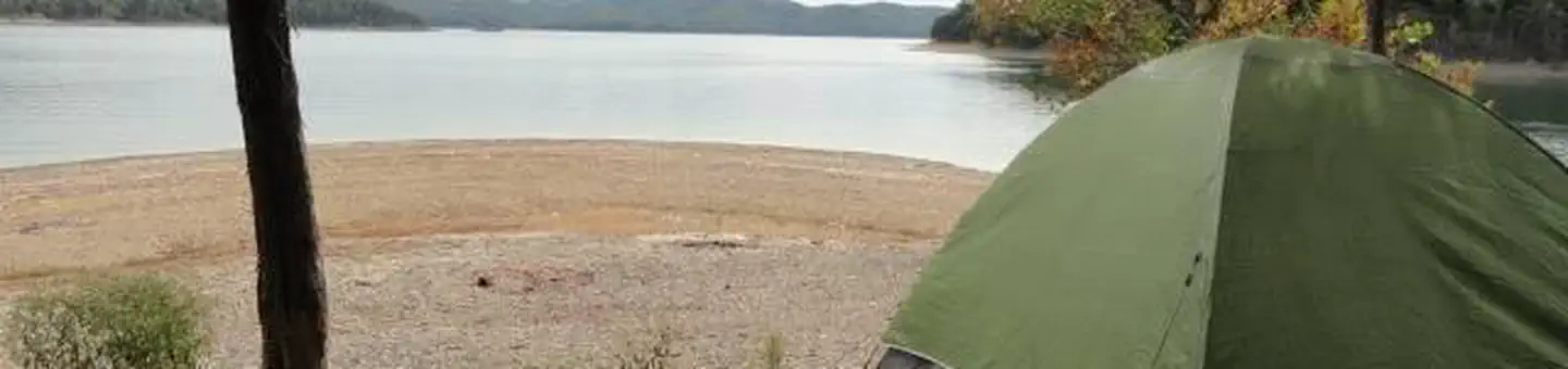
Dale Hollow Lake Primitive Camping is a unique series of 32 locations with a total of over 70 individually designated family campsites dispersed over 620 miles of shoreline. Campsites are located in both the states of Tennessee and Kentucky. Primitive camping offers a unique rustic lake front camping experience. Remote locations along the shoreline offer campers a peaceful nature experience. Most designated tent sites are accessible only by boat; while a few can be reached by country road.
Campers are advised that these areas are remote, primitive sites. Toilets are vault/pit type outhouses. Campers desiring on-site attendant, security and law enforcement services are encouraged to use developed campgrounds where such services are provided. These services are not provided for primitive camping.
Recreation
Dale Hollow Lake, with its crystal clear water and forested hillsides, is an outdoor enthusiast's paradise. Dale Hollow is renowned for its fishing opportunities and holds the world record for smallmouth bass and is known as a trophy smallmouth lake. Boating and water skiing are popular activities, and with 27,700 surface acres of water and 620 miles of shoreline, there is plenty of space for campers to explore the lake.Facilities
Primitive camping sites are remote and accessible by boat; a few have vehicle access. Each location is designated and marked. Each area has a vault or pit type toilet and a ground grill or fire circle. Tent camping is permissible within the designated areas. Cove Creek, Eagle Creek Ferry, Gunnel's Camp, Jones Chapel, Red Oak Ridge A, and Taylors Ford are the only locations which provide for vehicle access, all other sites are boat in only. All areas are considered pack-it-in, pack-it-out locations with minimal services. Campers are expected to bring plenty of water and garbage bags. Cove Creek is the only location with drinking water.
Camping is limited to a 14-day stay within a 30-consecutive day period.
Natural Features
Dale Hollow Dam and Lake was completed in 1943. Although the dam was built for flood control and power generation, it has now become a recreational oasis for more than 3 million visitors each year. The dam is located on the Obey River, about three miles east of Celina, Tennessee. Surrounded by a thick expanse of forest, the clear blue lake creates a stunning scenic backdrop for a variety of water and land recreational activities. In the late fall through early spring, the American bald eagle can be spotted flying overhead or perched on low-lying limbs. Dale Hollow hosts the second-largest wintering eagle population in the states of Tennessee and Kentucky.Charges & Cancellations
Full rules and reservation policies for fees associated with changes and cancellations can be found at https://www.recreation.gov/rules-reservation-policies
There is no fee to make a reservation.
- A $10 service fee will be withheld from any refund for a cancellation.
- A $10 service fee may be charged to changes made to an existing reservation (see full policies for when this is applicable).
- A customer who cancels a reservation the day before or on the day of arrival will pay a $10.00 service fee AND forfeit the first night's use fee (not to exceed the total paid for the original reservation).
- No-shows are assessed $20.00 service fee and forfeit the first night’s recreation fee for a campsite.
- Applicable fees, including service/cancellation fees and change fees, are non-refundable and subject to change.
- No refunds for recreation use fees may be made locally at the lake.
The facts
- 76 bookable sites
- 83 sites in total, including non-bookable
- Up to 60 people per site
- Loops: ANDERSON POINT, BIG GOAT ISLAND, CACTUS ISLAND, CASEY CREEK POINT, CLARK ISLAND, COUNTY LINE ISLAND, COVE CREEK (Walk-In), COVE CREEK., EAGLE CREEK FERRY LEFT BANK, FIRST ISLAND, FIRST ISLAND (Walk-In), GEIGER ISLAND (Hill Top), GEIGER ISLAND (Island Point), GRAVEYARD ISLAND, GUNNEL'S CAMP, HENDRICK'S CREEK, HUFFAKRE BRANCH, JACKSON CREEK ISLAND, JARVIS POINT, JONES CHAPEL, JOUETT CREEK POINT, KEMPER FLATS A, KEMPER FLATS B, MITCHELL CREEK, MOORE HOLLOW POINT, NOEL ISLAND, PHILLIP'S ISLAND, PLANKYARD, RAYBURN POINT, RED OAK RIDGE A (Trail Head), RED OAK RIDGE B (Barn & Corral), RED OAK RIDGE C (Storm Shelter), ROBERT'S HOLLOW POINT, SEWELL BEND A (1st Finger Upstream from Dam), SEWELL BEND B (2nd Finger Upstream from Dam), SEWELL BEND C (3rd Finger Upstream from Dam), SHERMAN HOLLOW, SITE 10 ROBERT'S HOLLOW POINT, SITE 24 GUNNEL'S CAMP, SITE 2A RED OAK RIDGE A (Trail Head), SITE 31 COVE CREEK (Walk-In), SITE 31 COVE CREEK., SITE 32 EAGLE CREEK FERRY LEFT BANK, SITE 33 TAYLOR'S FORD, SITE 33 TAYLOR'S FORD (Walk-In), SITE 4 FIRST ISLAND, SITE 4 FIRST ISLAND (Walk-In), STATE LINE ISLAND A (Tennessee Side), STATE LINE ISLAND B (Tennessee Side), STATE LINE ISLAND C (Kentucky Side), STATE LINE POINT, TAYLOR'S FORD, WEST FORK ASHBURN CREEK
Site types
- 38 Boat In
- 25 Tent Only Nonelectric
- 8 Equestrian Nonelectric
- 7 Management
- 5 Standard Nonelectric
Amenities
- Campfires allowed
- Picnic tables
- Grills
- Shade
- Pets allowed
- Water hookups — not available
Not recorded upstream: electric hookups, sewer hookups, fire pits.
83 campsites at Dale Hollow Lake - Primitive Camping
| Site | Loop | Type | Entry | Surface | Access | Water | Max rig | People | |
|---|---|---|---|---|---|---|---|---|---|
| 34 Plankyard (Multiple Campsite Area-Drive In) | — | Management | — | — | Drive In | Lakefront | — | 15 | 🐾 |
| 12 Anderson Point | ANDERSON POINT | Boat In | — | — | Boat In | Lakefront | — | 15 | 🐾 |
| 8 Big Goat Island | BIG GOAT ISLAND | Management | — | — | Boat In | Lakefront | — | 15 | 🐾 |
| 19 Cactus Island | CACTUS ISLAND | Boat In | — | — | Boat In | Lakefront | — | 15 | 🐾 |
| 16 Casey Creek Point | CASEY CREEK POINT | Boat In | — | — | Boat In | Lakefront | — | 15 | 🐾 |
| 6 Clark Island | CLARK ISLAND | Management | — | — | Boat In | Lakefront | — | 15 | 🐾 |
| 27 County Line Island | COUNTY LINE ISLAND | Boat In | — | — | Boat In | Lakefront | — | 15 | 🐾 |
| 31 | COVE CREEK (Walk-In) | Tent Only Nonelectric | — | Paved | Drive In | Lakefront | — | 6 | 🐾 |
| 31A | COVE CREEK. | Tent Only Nonelectric | — | Paved | Drive In | Lakefront | — | 6 | 🐾 |
| 31B | COVE CREEK. | Tent Only Nonelectric | — | Paved | Drive In | Lakefront | — | 6 | 🐾 |
| 31C | COVE CREEK. | Tent Only Nonelectric | — | Paved | — | Lakefront | — | 6 | 🐾 |
| 31D | COVE CREEK. | Tent Only Nonelectric | — | Paved | Drive In | Lakefront | — | 6 | 🐾 |
| 31E | COVE CREEK. | Tent Only Nonelectric | — | Paved | Drive In | Lakefront | — | 6 | 🐾 |
| 31F | COVE CREEK. | Tent Only Nonelectric | — | Paved | Drive In | Lakefront | — | 6 | 🐾 |
| 31G | COVE CREEK. | Tent Only Nonelectric | — | Paved | — | Lakefront | — | 6 | 🐾 |
| 31H | COVE CREEK. | Tent Only Nonelectric | — | Paved | Drive In | Lakefront | — | 6 | 🐾 |
| 31I | COVE CREEK. | Tent Only Nonelectric | — | Paved | Drive In | Lakefront | — | 6 | 🐾 |
| 32A | EAGLE CREEK FERRY LEFT BANK | Tent Only Nonelectric | — | Gravel | Drive In | Lakefront | — | 15 | 🐾 |
| 32B | EAGLE CREEK FERRY LEFT BANK | Tent Only Nonelectric | — | Gravel | Drive In | Lakefront | — | 15 | 🐾 |
| 32C | EAGLE CREEK FERRY LEFT BANK | Tent Only Nonelectric | — | Gravel | Drive In | Lakefront | — | 15 | 🐾 |
| 4A | FIRST ISLAND | Boat In | — | — | Boat In | Lakefront | — | 15 | 🐾 |
| 4B | FIRST ISLAND | Boat In | — | — | Boat In | Lakefront | — | 15 | 🐾 |
| 4C | FIRST ISLAND | Boat In | — | — | Boat In | Lakefront | — | 15 | 🐾 |
| 4D | FIRST ISLAND | Boat In | — | — | Boat In | — | — | 15 | 🐾 |
| 4 | FIRST ISLAND (Walk-In) | Boat In | — | — | Boat In | Lakefront | — | 15 | 🐾 |
| 13A Geiger Island (Hill Top) | GEIGER ISLAND (Hill Top) | Boat In | — | — | Boat In | Lakefront | — | 60 | 🐾 |
| 13B Geiger Island (Island Point) | GEIGER ISLAND (Island Point) | Boat In | — | — | Boat In | Lakefront | — | 15 | 🐾 |
| 9 Graveyard Island | GRAVEYARD ISLAND | Boat In | — | — | Boat In | Lakefront | — | 15 | 🐾 |
| 24A | GUNNEL'S CAMP | Standard Nonelectric | — | Gravel | Drive In | Lakefront | — | 6 | 🐾 |
| 24B | GUNNEL'S CAMP | Standard Nonelectric | — | — | — | — | — | — | |
| 24C | GUNNEL'S CAMP | Standard Nonelectric | — | — | — | — | — | — | |
| 24D | GUNNEL'S CAMP | Standard Nonelectric | — | — | — | — | — | — | |
| 11 Hendrick's Creek | HENDRICK'S CREEK | Boat In | — | — | Boat In | Lakefront | — | 15 | 🐾 |
| 18 Huffakre Branch | HUFFAKRE BRANCH | Boat In | — | — | Boat In | Lakefront | — | 15 | 🐾 |
| 30 Jackson Creek Island | JACKSON CREEK ISLAND | Boat In | — | — | Boat In | Lakefront | — | 15 | 🐾 |
| 17 Jarvis Point | JARVIS POINT | Boat In | — | — | Boat In | Lakefront | — | 15 | 🐾 |
| 23 Jones Chapel | JONES CHAPEL | Tent Only Nonelectric | — | — | Drive In | Lakefront | — | 15 | 🐾 |
| 29 Jouett Creek Point | JOUETT CREEK POINT | Boat In | — | — | Boat In | Lakefront | — | 15 | 🐾 |
| 5A Kemper Flats A | KEMPER FLATS A | Boat In | — | — | Boat In | Lakefront | — | 15 | 🐾 |
| 5B Kemper Flats B | KEMPER FLATS B | Boat In | — | — | Boat In | Lakefront | — | 15 | 🐾 |
| 1 Mitchell Creek-Boat In Only | MITCHELL CREEK | Boat In | — | — | Boat In | Lakefront | — | 15 | 🐾 |
| 14 Moore Hollow Point | MOORE HOLLOW POINT | Boat In | — | — | Boat In | Lakefront | — | 15 | 🐾 |
| 26 Noel Island | NOEL ISLAND | Boat In | — | — | Boat In | Lakefront | — | 15 | 🐾 |
| 25 Phillip's Island | PHILLIP'S ISLAND | Boat In | — | — | Boat In | Lakefront | — | 15 | 🐾 |
| 34A | PLANKYARD | Tent Only Nonelectric | — | Gravel | Drive In | Lakefront | — | 15 | 🐾 |
| 34B | PLANKYARD | Tent Only Nonelectric | — | Gravel | Drive In | Lakefront | — | 15 | 🐾 |
| 34C | PLANKYARD | Tent Only Nonelectric | — | Gravel | Drive In | Lakefront | — | 15 | 🐾 |
| 22 Rayburn Point | RAYBURN POINT | Boat In | — | — | Boat In | Lakefront | — | 15 | 🐾 |
| 2A1 | RED OAK RIDGE A (Trail Head) | Equestrian Nonelectric | — | Gravel | Drive In | — | — | 15 | 🐾 |
| 2A2 | RED OAK RIDGE A (Trail Head) | Equestrian Nonelectric | — | Gravel | Drive In | — | — | 15 | 🐾 |
| 2A3 | RED OAK RIDGE A (Trail Head) | Equestrian Nonelectric | — | — | Drive In | — | — | 15 | 🐾 |
| 2A4 | RED OAK RIDGE A (Trail Head) | Equestrian Nonelectric | — | Gravel | — | — | — | 15 | 🐾 |
| 2A5 | RED OAK RIDGE A (Trail Head) | Equestrian Nonelectric | — | Gravel | — | — | — | 15 | 🐾 |
| 2B Red Oak Ridge B (Barn & Corral) | RED OAK RIDGE B (Barn & Corral) | Equestrian Nonelectric | — | — | Hike In | — | — | 15 | 🐾 |
| 2C Red Oak Ridge C (Storm Shelter) | RED OAK RIDGE C (Storm Shelter) | Equestrian Nonelectric | — | — | Hike In | — | — | 15 | 🐾 |
| 10A | ROBERT'S HOLLOW POINT | Boat In | — | — | — | — | — | — | |
| 10B | ROBERT'S HOLLOW POINT | Boat In | — | — | Boat In | — | — | — | 🐾 |
| 10C | ROBERT'S HOLLOW POINT | Boat In | — | — | Boat In | — | — | — | 🐾 |
| 10D | ROBERT'S HOLLOW POINT | Boat In | — | — | Boat In | — | — | — | 🐾 |
| 3A Sewell Bend A (1st Finger Upstream from Dam) | SEWELL BEND A (1st Finger Upstream from Dam) | Boat In | — | — | Boat In | Lakefront | — | 15 | 🐾 |
| 3B Sewell Bend B (2nd Finger Upstream from Dam) | SEWELL BEND B (2nd Finger Upstream from Dam) | Boat In | — | — | Boat In | Lakefront | — | 15 | 🐾 |
| 3C Sewell Bend C (3rd Finger Upstream from Dam) | SEWELL BEND C (3rd Finger Upstream from Dam) | Boat In | — | — | Boat In | Lakefront | — | 15 | 🐾 |
| 15 Sherman Hollow | SHERMAN HOLLOW | Boat In | — | — | Boat In | Lakefront | — | 15 | 🐾 |
| 10 Robert's Hollow Point | SITE 10 ROBERT'S HOLLOW POINT | Management | — | — | Boat In | Lakefront | — | 15 | 🐾 |
| 24 Gunnel's Camp (Multiple Campsite Area-Drive In) | SITE 24 GUNNEL'S CAMP | Standard Nonelectric | — | — | Drive In | Lakefront | — | 6 | 🐾 |
| 2A Red Oak Ridge A (Trail Head) | SITE 2A RED OAK RIDGE A (Trail Head) | Equestrian Nonelectric | — | — | Drive In | — | — | 15 | 🐾 |
| Cove Creek (Walk-In) | SITE 31 COVE CREEK (Walk-In) | Management | — | — | Drive In | Lakefront | — | 6 | 🐾 |
| 31 Cove Creek (Multiple Campsite Area-Drive In) | SITE 31 COVE CREEK. | Tent Only Nonelectric | — | — | Drive In | Lakefront | — | 6 | 🐾 |
| 32 Eagle Creek Ferry Left Bank | SITE 32 EAGLE CREEK FERRY LEFT BANK | Tent Only Nonelectric | — | — | Drive In | Lakefront | — | 15 | 🐾 |
| 33 Taylor's Ford (Multiple Campsite Area-Drive In) | SITE 33 TAYLOR'S FORD | Tent Only Nonelectric | — | — | Drive In | Lakefront | — | 15 | 🐾 |
| Taylor's Ford (Walk-In) | SITE 33 TAYLOR'S FORD (Walk-In) | Management | — | — | Drive In | Lakefront | — | 15 | 🐾 |
| 4 First Island (Multiple Campsite Area-Boat In) | SITE 4 FIRST ISLAND | Boat In | — | — | Boat In | Lakefront | — | 15 | 🐾 |
| First Island (Walk-In) | SITE 4 FIRST ISLAND (Walk-In) | Management | — | — | Boat In | Lakefront | — | 15 | 🐾 |
| 20A State Line Island A (Tennessee Side) | STATE LINE ISLAND A (Tennessee Side) | Boat In | — | — | Boat In | Lakefront | — | 15 | 🐾 |
| 20B State Line Island B (Tennessee Side) | STATE LINE ISLAND B (Tennessee Side) | Boat In | — | — | Boat In | Lakefront | — | 15 | 🐾 |
| 20C State Line Island C (Kentucky Side) | STATE LINE ISLAND C (Kentucky Side) | Boat In | — | — | Boat In | Lakefront | — | 15 | 🐾 |
| 21 State Line Point | STATE LINE POINT | Boat In | — | — | Boat In | Lakefront | — | 15 | 🐾 |
| 33A | TAYLOR'S FORD | Tent Only Nonelectric | — | Gravel | Drive In | Lakefront | — | 15 | 🐾 |
| 33B | TAYLOR'S FORD | Tent Only Nonelectric | — | Gravel | Drive In | Lakefront | — | 15 | 🐾 |
| 33C | TAYLOR'S FORD | Tent Only Nonelectric | — | Gravel | Drive In | Lakefront | — | 15 | 🐾 |
| 33D | TAYLOR'S FORD | Tent Only Nonelectric | — | Gravel | Drive In | Lakefront | — | 15 | 🐾 |
| 33E | TAYLOR'S FORD | Tent Only Nonelectric | — | Gravel | Drive In | Lakefront | — | 15 | 🐾 |
| 28 West Fork Ashburn Creek | WEST FORK ASHBURN CREEK | Boat In | — | — | Boat In | Lakefront | — | 15 | 🐾 |
Getting there
Camping locations are dispersed throughout Dale Hollow Lake. Reference primitive camping map or site details for information on how to get to the specific site. Mailing and contact information is for the Resource Manager's Office.
GPS Coordinates listed above is the location of the Resource Manager's Office in Celina, TN. It is NOT the location of the camping site.
36.56694, -85.47861 · 36°34'1.0"N 85°28'43.0"W
Typical weather
| Jan | Feb | Mar | Apr | May | Jun | Jul | Aug | Sep | Oct | Nov | Dec | |
|---|---|---|---|---|---|---|---|---|---|---|---|---|
| High °F | — | — | — | — | — | — | — | — | — | — | — | — |
| Low °F | — | — | — | — | — | — | — | — | — | — | — | — |
| Precip in | 4.4 | 4.6 | 5.1 | 5.2 | 4.7 | 5.1 | 5.7 | 3.9 | 3.8 | 3.3 | 4.0 | 5.5 |
1991–2020 averages from the nearest NOAA station, 1.6 mi away — not measured at the facility itself, and elevation can make a real difference over that distance.
Map
More photos


Member photos
Common questions about Dale Hollow Lake - Primitive Camping
- Can you reserve a site at Dale Hollow Lake - Primitive Camping?
- Yes, Dale Hollow Lake - Primitive Camping is reservable through Recreation.gov.
- How many campsites does Dale Hollow Lake - Primitive Camping have?
- 83 sites in total, of which 76 can be booked.
- Are pets allowed at Dale Hollow Lake - Primitive Camping?
- Yes, pets are allowed at Dale Hollow Lake - Primitive Camping.
- Does Dale Hollow Lake - Primitive Camping have hookups?
- No hookups are recorded here.
- Are campfires allowed at Dale Hollow Lake - Primitive Camping?
- Campfires are allowed at Dale Hollow Lake - Primitive Camping. Check for a current fire restriction before you go.
Camping near Dale Hollow Lake - Primitive Camping
- Dale Hollow Damsite 2.3 mi · Campground · we watch it
- Pleasant Grove Recreation Area 2.9 mi · Campground · we watch it
- Willow Grove Campground 7.7 mi · Campground · we watch it
- Dale Hollow Lake Eagle Watch 10.1 mi · Tickets · we watch it
- Lillydale Campground and Day Use 10.1 mi · Campground · we watch it
- Roaring River Park 15.5 mi · Campground · we watch it
- Obey River Park 17.4 mi · Campground · we watch it
- Wartrace CK Rec Area 21.8 mi · Campground · we watch it
- Salt Lick Creek 24.9 mi · Campground · we watch it
- Kendall Campground 28 mi · Campground · we watch it
- Dale Hollow National Fish Hatchery 2.6 mi · Facility
- Wolf Creek National Fish Hatchery 28.1 mi · Facility
Contact
- Phone DALE HOLLOW LAKE RESOURCE MANAGERS OFFICE-931-243-3136. SHERIFF'S DEPARTMENT EMERGENCY CONTACTS: CLAY COUNTY 931-243-3266 OVERTON COUNTY 931-823-5404 PICKETT COUNTY 931-864-3210 CLINTON COUNTY 606-387-5111 CUMBERLAND COUNTY 270-864-4141
- Email sondra.f.carmen@usace.army.mil
- Book Recreation.gov
Recreation.gov last updated this record on 2026-07-06.
Facility information and photographs from Recreation.gov (RIDB). SpotOpened is not affiliated with Recreation.gov or any federal agency.
Comments