Whittaker Creek Recreation Site
Campground · Oregon · 13 bookable sites ·
Managed by the Bureau of Land Management
Nw Oregon Siuslaw Field Office (Bureau of Land Management OR) · Open Access
- 13
- Bookable sites
- up to 8
- People per site
- 1
- Accessible site
- 317 ft
- Elevation
Overview
Overnight camping is closed until further notice. Day-use recreation areas remain open for public use.
Reserve a site at Whittaker Creek on recreation.gov or pay when you arrive for non-reserved campsites using the Recreation.gov Mobile App. You must download before you reach the site since there is no cell reception in the drainage.
Whittaker Creek Recreation Site is a Bureau of Land Management (BLM) campground and day use area. The campground has 30 sites. Campground amenities include vault toilets, potable water, picnic areas, a children's play area, an Old Growth Ridge National Recreation Trail (2.5 miles), and a swimming area.
In the fall, winter, and spring, busloads of middle school students visit the Whittaker Creek Watchable Wildlife Site to learn about spawning salmon and trout and to assist with the Oregon Department of Fish and Wildlife's breeding program.
Recreation
Camping, hiking, swimming, fishing in Siuslaw River, photography, hunting, Salmon Watch, and nature study.
Facilities
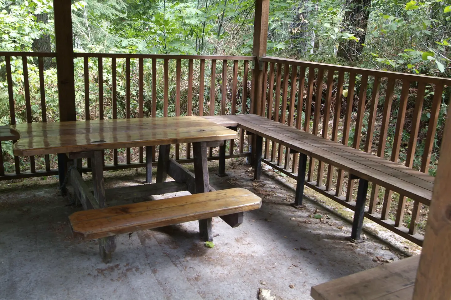
Facilities include: 30 tent only campsites (not recommended for trailers), an accessible campsite, 2 picnic sites, accessible vault toilets, potable water available from hand pumps, picnic tables, fire rings, swimming beach area (June-September), horseshoe pit, Old Growth Ridge National Recreation Trail (2.5 mile loop trail), and a camp host (June-September). Electricity and firewood are unavailable.
Natural Features
Besides the trail to the wildlife viewing area, you can hike the Old Growth Ridge National Recreation Trail, which climbs 1,000 feet above the river into the Coast Range. The 2.5-mile trail was designated in 1994 as a National Recreation Trail due to the exceptional wildlife, geologic features, and old growth trees that are typical of coast range ecosystems. This moderately difficult trail winds through a stand of old growth Douglas fir and offers a look at geologic and botanical features unique to the area.
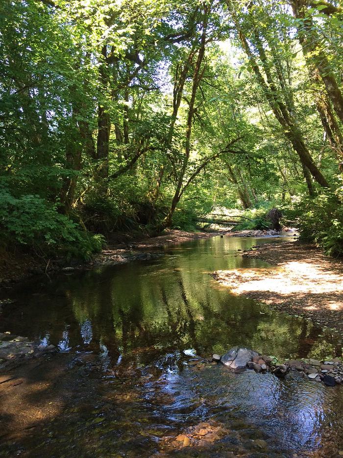
Chinook and coho salmon, as well as steelhead trout can be observed in the fall and winter months in the creek next to the campground.
The site also features a paved boat ramp that provides drift boat and canoe access to the Siuslaw River. No permit required to paddle the 6.5-mile river, with Class II - III rapids.
Contact Info
For local information, please call (541) 683-6600 or call (503) 375-5646 for general information.Nearby Attractions
- Clay Creek Campground, is approximately 16 miles past Whittaker Creek.
- The Oregon Coast is less than 30 miles from this recreation site.
- (Florence) Alder Dune Campground
- (Florence) Archie Knowles Campground
- (Florence) B & E Wayside Mobile and RV Park
- (Cottage Grove) Baker Bay Campground
- (Dorena) Baker Bay County Park
- (Westfir) Bedrock Camp
- You can observe Chinook, and Coho salmon, as well as steelhead trout in the fall and winter months in the creek next to the campground during Salmon Watch.
Charges & Cancellations
Standard fees apply and are non-refundable.
Visit https://www.recreation.gov/rules-reservation-policies for more information.
The facts
- 13 bookable sites
- 31 sites in total, including non-bookable
- 1 accessible site
- Up to 8 people per site
- Loops: Back Loop, Front Loop
Site types
- 18 Management
- 11 Tent Only Nonelectric
- 1 Group Tent Only Area Nonelectric
- 1 Tent Only Electric
Amenities
- Campfires allowed
- Fire pits
- Picnic tables
- Shade
- Pets allowed
- Water hookups — not available
Not recorded upstream: electric hookups, sewer hookups, grills.
31 campsites at Whittaker Creek Recreation Site
Check-in 1:00 PM · Check-out 11:00 AM
| Site | Loop | Type | Entry | Surface | Water | Max rig | People | |
|---|---|---|---|---|---|---|---|---|
| Site 15 | Back Loop | Tent Only Nonelectric | — | — | Riverfront | — | 8 | 🐾 |
| Site 16 | Back Loop | Management | — | — | — | — | 8 | 🐾 |
| Site 17 | Back Loop | Management | — | — | — | — | 8 | 🐾 |
| Site 18 | Back Loop | Management | — | — | — | — | 8 | 🐾 |
| Site 19 | Back Loop | Management | — | — | — | — | 8 | 🐾 |
| Site 20 | Back Loop | Management | — | — | — | — | 8 | 🐾 |
| Site 21 | Back Loop | Management | — | — | — | — | 8 | 🐾 |
| Site 22 | Back Loop | Management | — | — | Riverfront | — | 8 | 🐾 |
| Site 23 | Back Loop | Management | — | — | Riverfront | — | 8 | 🐾 |
| Site 24 | Back Loop | Management | — | — | Riverfront | — | 8 | 🐾 |
| Site 25 | Back Loop | Management | — | — | Riverfront | — | 8 | 🐾 |
| Site 26 | Back Loop | Management | — | — | Riverfront | — | 8 | 🐾 |
| Site 27 | Back Loop | Management | — | — | — | — | 8 | 🐾 |
| Site 28 | Back Loop | Management | — | — | — | — | 8 | 🐾 |
| Site 29 | Back Loop | Management | — | — | — | — | 8 | 🐾 |
| Site 30 | Back Loop | Management | — | — | Riverfront | — | 8 | 🐾 |
| Site 31 | Back Loop | Management | — | — | Riverfront | — | 8 | 🐾 |
| Site 1 | Front Loop | Tent Only Nonelectric | — | — | Riverfront | — | 8 | 🐾 |
| Site 10 | Front Loop | Tent Only Nonelectric | — | — | — | — | 8 | 🐾 |
| Site 11 | Front Loop | Group Tent Only Area Nonelectric | — | Paved | Riverfront | — | 8 | 🐾 |
| Site 12 | Front Loop | Tent Only Nonelectric | — | — | Riverfront | — | 8 | 🐾 |
| Site 13 | Front Loop | Tent Only Electric | — | — | Riverfront | — | 8 | 🐾 |
| Site 14 | Front Loop | Management | — | — | Riverfront | — | 8 | 🐾 |
| Site 2 | Front Loop | Tent Only Nonelectric | — | — | — | — | 8 | 🐾 |
| Site 3 | Front Loop | Tent Only Nonelectric | — | — | — | — | 8 | ♿ 🐾 |
| Site 4 | Front Loop | Tent Only Nonelectric | — | — | — | — | 8 | 🐾 |
| Site 5 | Front Loop | Tent Only Nonelectric | — | — | — | — | 8 | 🐾 |
| Site 6 | Front Loop | Management | — | — | — | — | 8 | 🐾 |
| Site 7 | Front Loop | Tent Only Nonelectric | — | — | — | — | 8 | 🐾 |
| Site 8 | Front Loop | Tent Only Nonelectric | — | — | — | — | 8 | 🐾 |
| Site 9 | Front Loop | Tent Only Nonelectric | — | — | — | — | 8 | 🐾 |
Getting there
From Eugene (valley)
From Interstate 5 go west on Beltline Road to West 11th Avenue. Turn right onto West 11th Avenue (Highway OR-126). Follow Highway 126 about 29 miles to Siuslaw River Road just west of Walton. Turn left on Siuslaw River Road and follow about 1.6 miles to the intersection of Whittaker Creek Road. Turn right on Whittaker Creek Road crossing the bridge over the Siuslaw River. The main entrance to the recreation site is located on the right.
From Florence (coast)
Take Highway OR-126 east about 14 miles to Mapleton. Turn right and follow Highway 126 for about 12 miles to Siuslaw River Road. Turn right on Siuslaw River Road and follow about 1.6 miles to the intersection of Whittaker Creek Road. Turn right on Whittaker Creek Road crossing the bridge over the Siuslaw River. The main entrance to the recreation site is located on the right.
43.98551, -123.66220 · 43°59'7.8"N 123°39'43.9"W
Typical weather
Typically 80°F in Aug, down to 50°F in Dec.
| Jan | Feb | Mar | Apr | May | Jun | Jul | Aug | Sep | Oct | Nov | Dec | |
|---|---|---|---|---|---|---|---|---|---|---|---|---|
| High °F | 52 | 55 | 58 | 62 | 68 | 73 | 80 | 80 | 77 | 66 | 56 | 50 |
| Low °F | 41 | 41 | 42 | 44 | 48 | 51 | 54 | 55 | 51 | 47 | 44 | 40 |
| Precip in | 13.4 | 9.8 | 10.2 | 7.2 | 3.9 | 2.4 | 0.5 | 0.7 | 2.1 | 6.3 | 12.3 | 15.3 |
1991–2020 averages from the nearest NOAA station, 10.6 mi away — not measured at the facility itself, and elevation can make a real difference over that distance.
Map
Fees and stay limits
Campsite fee includes one vehicle per site. Extra camping vehicle fee of $5 each is collected at the site. Cash or check, made out to Bureau of Land Management, is accepted. Fee envelope receipt stub must be displayed on the dash.
From Recreation.gov, which is not always current. The operator's own page is the authority on what you will be charged.
More photos
Member photos
Common questions about Whittaker Creek Recreation Site
- Can you reserve a site at Whittaker Creek Recreation Site?
- Yes, Whittaker Creek Recreation Site is reservable through Recreation.gov.
- How many campsites does Whittaker Creek Recreation Site have?
- 31 sites in total, of which 13 can be booked.
- Are pets allowed at Whittaker Creek Recreation Site?
- Yes, pets are allowed at Whittaker Creek Recreation Site.
- Does Whittaker Creek Recreation Site have hookups?
- No hookups are recorded here.
- Are campfires allowed at Whittaker Creek Recreation Site?
- Campfires are allowed at Whittaker Creek Recreation Site. Check for a current fire restriction before you go.
Camping near Whittaker Creek Recreation Site
- Clay Creek Recreation Site 7.3 mi · Campground · we watch it
- Alder Dune 22.6 mi · Campground · we watch it
- Sutton Campground 22.6 mi · Campground · we watch it
- Horse Creek Campground 22.9 mi · Campground · we watch it
- South Jetty Sand Camping 23.4 mi · Campground · we watch it
- Tyee Campground - Oregon Dunes 23.8 mi · Campground · we watch it
- Archie Knowles Campground 7.4 mi · Campground
- North Fork Siuslaw Campground 15.9 mi · Campground
- Rock Creek Wilderness 23.7 mi · Facility
- Baker Beach Campground 23.7 mi · Campground
- Tyee Campground 23.9 mi · Campground
- Newport to Florence 24.4 mi · Facility
Contact
- Email BLM_OR_NO_Mail@blm.gov
- Book Recreation.gov
Recreation.gov last updated this record on 2026-05-05.
Facility information and photographs from Recreation.gov (RIDB). SpotOpened is not affiliated with Recreation.gov or any federal agency.
Comments