Shady Grove Picnic Area
Facility · Oregon ·
Managed by the Bureau of Land Management
Prineville Central Oregon Field Office (Bureau of Land Management OR) · Open Access
- 1,787 ft
- Elevation
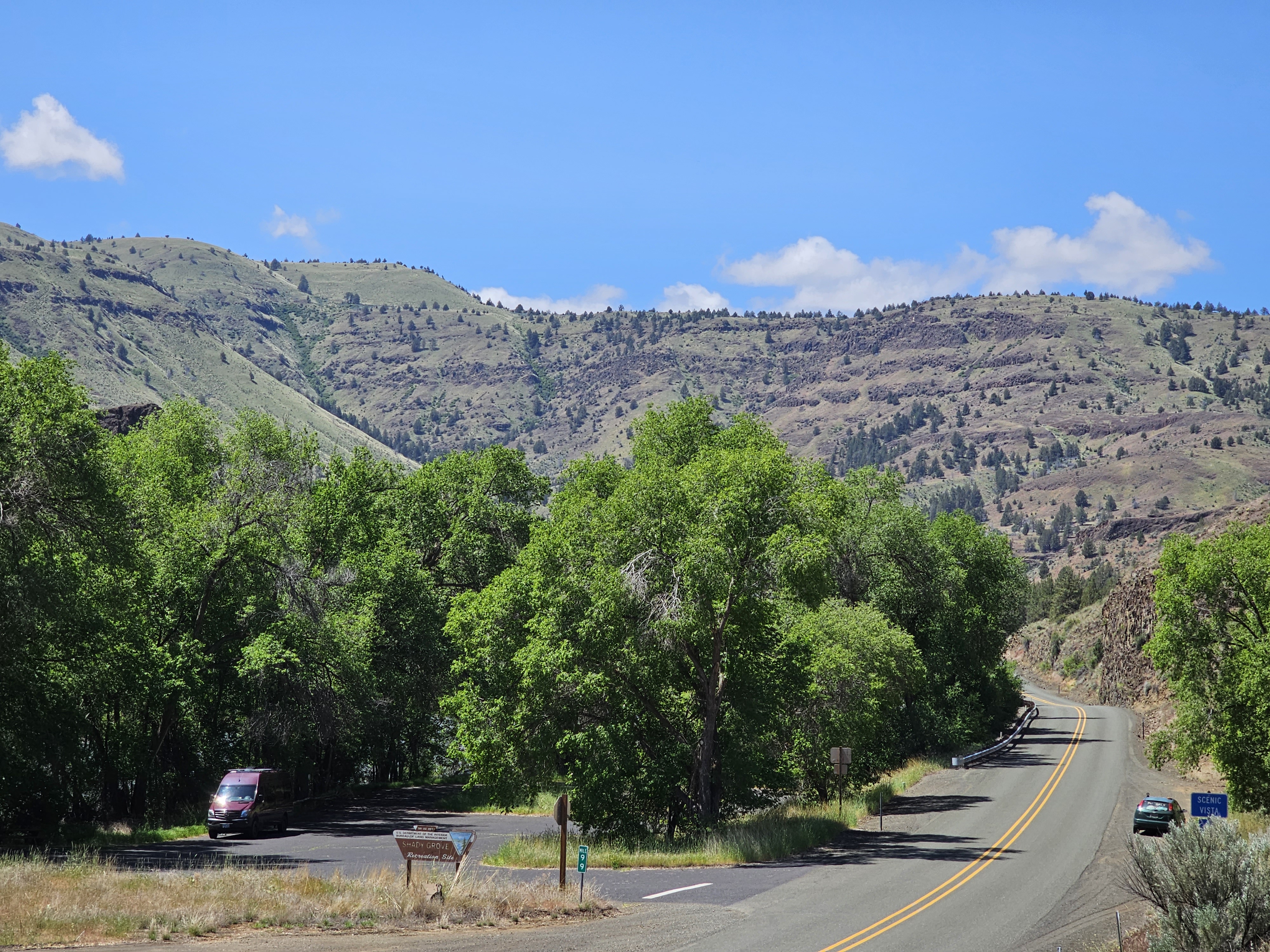
This cozy day use area is situated between State highway 19 and the John Day River. A shady grove of cottonwoods provides a cool sojourn in the hot summer months.
Know Before You Go
-
Open year round.
-
Site features and accessible vault toilet and three picnic tables.
-
Day use only; no camping is allowed.
- Watch for bicycles - the John Day Highway is also designated as the the Painted Hills State Scenic Byway.
Getting there
From Kimberly, Oregon: Drive 6.1 miles west on State Highway 19; the picnic area is located right at milepost 99.
44.81225, -119.71879 · 44°48'44.1"N 119°43'7.6"W
Typical weather
| Jan | Feb | Mar | Apr | May | Jun | Jul | Aug | Sep | Oct | Nov | Dec | |
|---|---|---|---|---|---|---|---|---|---|---|---|---|
| High °F | — | — | — | — | — | — | — | — | — | — | — | — |
| Low °F | — | — | — | — | — | — | — | — | — | — | — | — |
| Precip in | 1.3 | 1.1 | 0.8 | 1.5 | 1.5 | 1.1 | 0.3 | 0.4 | 0.5 | 1.0 | 1.4 | 1.1 |
1991–2020 averages from the nearest NOAA station, 2.8 mi away — not measured at the facility itself, and elevation can make a real difference over that distance.
Map
Fees and stay limits
No fees.
Stay limit: Day use only
From Recreation.gov, which is not always current. The operator's own page is the authority on what you will be charged.
Member photos
Common questions about Shady Grove Picnic Area
- Can you reserve a site at Shady Grove Picnic Area?
- No. Shady Grove Picnic Area is not reservable through Recreation.gov, so sites are first-come, first-served or booked elsewhere.
- How long can you stay at Shady Grove Picnic Area?
- Day use only
Camping near Shady Grove Picnic Area
- Tamarack Cabin 5.1 mi · Campground · we watch it
- Bull Prairie Campground (OR) 11.5 mi · Campground · we watch it
- John Day River Basin Developed Campgrounds 13.9 mi · Campground · we watch it
- Lone Pine Campground 5.3 mi · Facility
- Big Bend Campground (John Day River) 5.7 mi · Facility
- Fairview Campground 9.9 mi · Campground
- Muleshoe Campground 12.2 mi · Facility
- Donnelly Service Creek River Access Park 13.9 mi · Facility
- Historic Cant Ranch Museum 18.1 mi · Visitor Center
- Thomas Condon Visitor Center 18.3 mi · Facility
- Barnhouse Campground 26.2 mi · Campground
- Priest Hole Recreation Site 27.6 mi · Facility
Contact
- Phone 541-416-6700
- Email BLM_OR_PR_Mail@blm.gov
- Info Recreation.gov
Recreation.gov last updated this record on 2026-02-25.
Facility information and photographs from Recreation.gov (RIDB). SpotOpened is not affiliated with Recreation.gov or any federal agency.
Comments