Ochoco Forest Camp
Campground · Oregon · 1 bookable site ·
Managed by the USDA Forest Service
Ochoco National Forest (NF) · Open Access
- 1
- Bookable site
- up to 125
- People per site
- 3,989 ft
- Elevation
Overview
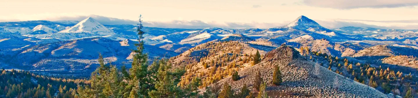
Ochoco Forest Camp is nestled in the Ochoco Mountain range near the 6,926-foot Lookout Mountain, which is known for its unusual rock formations. The pavilion offers a large group picnic area and several campsites. A small meadow and group fire ring with BBQ is popular for weddings and family reunions. Wild horses are sometimes seen near the camp and surrounding area.
Recreation
The shelter is close to the Lookout Mountain Trail, which climbs to the top of the mountain and offers terrific views of the Cascades and meadow wildflowers in the spring. This trail is open to hikers, mountain bikers and horse riders. However, horses are not allowed at the pavilion and campground. Anglers can also go fishing for trout in nearby Walton Lake.
Facilities
The large picnic shelter sits in a quiet and secluded location at the far end of the campground. Groups of up to 125 people can enjoy picnicking and other recreational activities. Picnic tables and grills are provided at the shelter, and drinking water and vault toilets are available in the campground as well. Electricity is provided only for pavilion use and not compatible as a RV hookup.
Several first-come, first-served campsites are available for visitors wishing to spend the night.
Natural Features
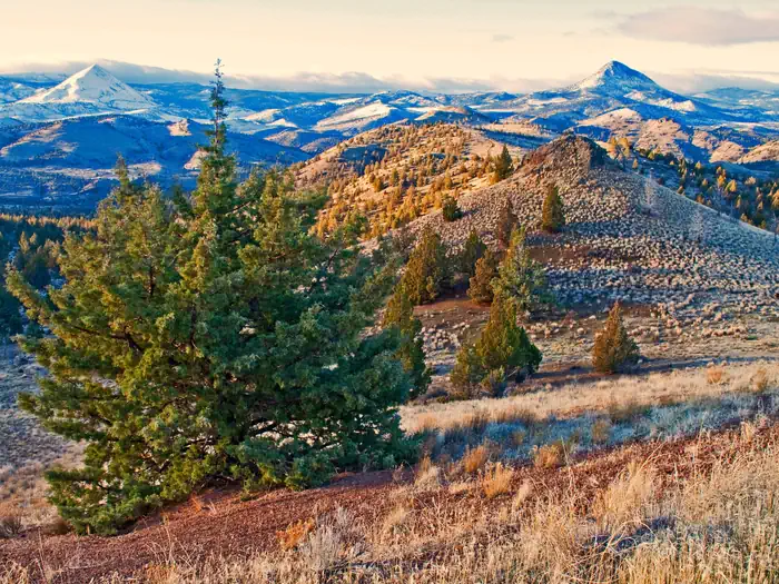
Much of the area is dominated by old-growth Ponderosa pine. Wildlife include Rocky Mountain elk and mule deer, as well as several bird species that include white-headed woodpecker, belted kingfisher, spotted sandpiper, cinnamon teal, American coot, Steller's jay, yellow-headed blackbird and Brewer's blackbird. Wild horses are commonly seen in the area. Excellent hiking, mt biking, and horse riding is available on the trails nearby.
Nearby Attractions
Walton Lake offers a variety of activities for day-use visitors. There is a swimming beach, fishing pier and boat ramp, and the lake is stocked with rainbow trout. There is exellent trail hiking and mt. biking at Lookout Mt and Round Mt. trails.
The facts
- Season: May 15 – October 15 — USDA Forest Service, Aug 24, 2026
- 1 bookable site
- Up to 125 people per site
- Loops: AREA OCHOCO FOREST CAMP
Site types
- 1 Group Shelter Nonelectric
Amenities
- Campfires allowed
- Picnic tables
- Shade
- Pets allowed
Not recorded upstream: electric hookups, water hookups, sewer hookups, fire pits, grills.
1 campsite at Ochoco Forest Camp
Check-in 2:00 PM · Check-out 12:00 PM
| Site | Loop | Type | Entry | Surface | Max rig | People | |
|---|---|---|---|---|---|---|---|
| 001 | AREA OCHOCO FOREST CAMP | Group Shelter Nonelectric | — | Gravel | — | 125 | 🐾 |
Getting there
From Prineville, Oregon, take Highway 26 north for 16 miles. Turn right on Ochoco Ranger Station Road and go 9 miles to the Ranger Station, then turn left onto Forest Service Road 2610, proceed across the small bridge and take a right into the Forest Camp fee station. Continue on to the pavilion group site, follow signs.
44.39722, -120.42528 · 44°23'50.0"N 120°25'31.0"W
Typical weather
| Jan | Feb | Mar | Apr | May | Jun | Jul | Aug | Sep | Oct | Nov | Dec | |
|---|---|---|---|---|---|---|---|---|---|---|---|---|
| High °F | — | — | — | — | — | — | — | — | — | — | — | — |
| Low °F | — | — | — | — | — | — | — | — | — | — | — | — |
| Precip in | 4.2 | 2.9 | 2.9 | 2.7 | 2.4 | 1.5 | 0.7 | 0.7 | 0.8 | 1.8 | 3.3 | 4.5 |
1991–2020 averages from the nearest NOAA station, 5.2 mi away — not measured at the facility itself, and elevation can make a real difference over that distance.
Map
More photos
Member photos
Common questions about Ochoco Forest Camp
- Can you reserve a site at Ochoco Forest Camp?
- Yes, Ochoco Forest Camp is reservable through Recreation.gov.
- How many campsites does Ochoco Forest Camp have?
- 1 site.
- Are pets allowed at Ochoco Forest Camp?
- Yes, pets are allowed at Ochoco Forest Camp.
- Are campfires allowed at Ochoco Forest Camp?
- Campfires are allowed at Ochoco Forest Camp. Check for a current fire restriction before you go.
Also listed by
Ochoco Forest Camp also appears in other federal recreation data. Facts below are matched by name and location, not confirmed by Ochoco Forest Camp's operator.
USDA Forest Service — data as of Aug 24, 2026
- Camping per night, per site: $20 single campsite/ $10 extra vehicle fee
- Day use: $7/vehicle or group
Restrictions:
- Pets must be on a leash no more than 6 feet in length. Quiet time is from 10 p.m. to 6 a.m. Campfires must be fully contained in fire rings or grills provided at the campground. There is a 14 day stay limit on all National Grassland and US Forest Service land including but not limited to campgrounds
Accessibility:
- This is not and ADA accessible facility.
Camping near Ochoco Forest Camp
- Ochoco Ranger Rental 0.1 mi · Campground · we watch it
- Walton Lake 5 mi · Campground · we watch it
- Ochoco Divide Group Site 7.4 mi · Campground · we watch it
- Ochoco NF-Ochoco West - Prineville Area 0.5 mi · Facility
- Walton Lake 5.2 mi · Facility
- White Rock Campground 6.2 mi · Campground
- Ochoco National Forest 6.3 mi · Facility
- Wildwood Campground 7.4 mi · Campground
- Whistler Campground 7.4 mi · Campground
- Scotty Creek Trailhead 7.7 mi · Facility
- Wildcat Campground and Day Use Area 8.2 mi · Campground
- Bingham Springs Campground 9.6 mi · Campground
Contact
- Phone 541-351-1182
- Email audi1@scinternet.net
- Book Recreation.gov
Recreation.gov last updated this record on 2026-02-25.
Facility information and photographs from Recreation.gov (RIDB). SpotOpened is not affiliated with Recreation.gov or any federal agency.
Comments