Maston Trail System
Facility · Oregon ·
Managed by the Bureau of Land Management
Prineville Deschutes Field Office (Bureau of Land Management OR) · Open Access
- 3,165 ft
- Elevation
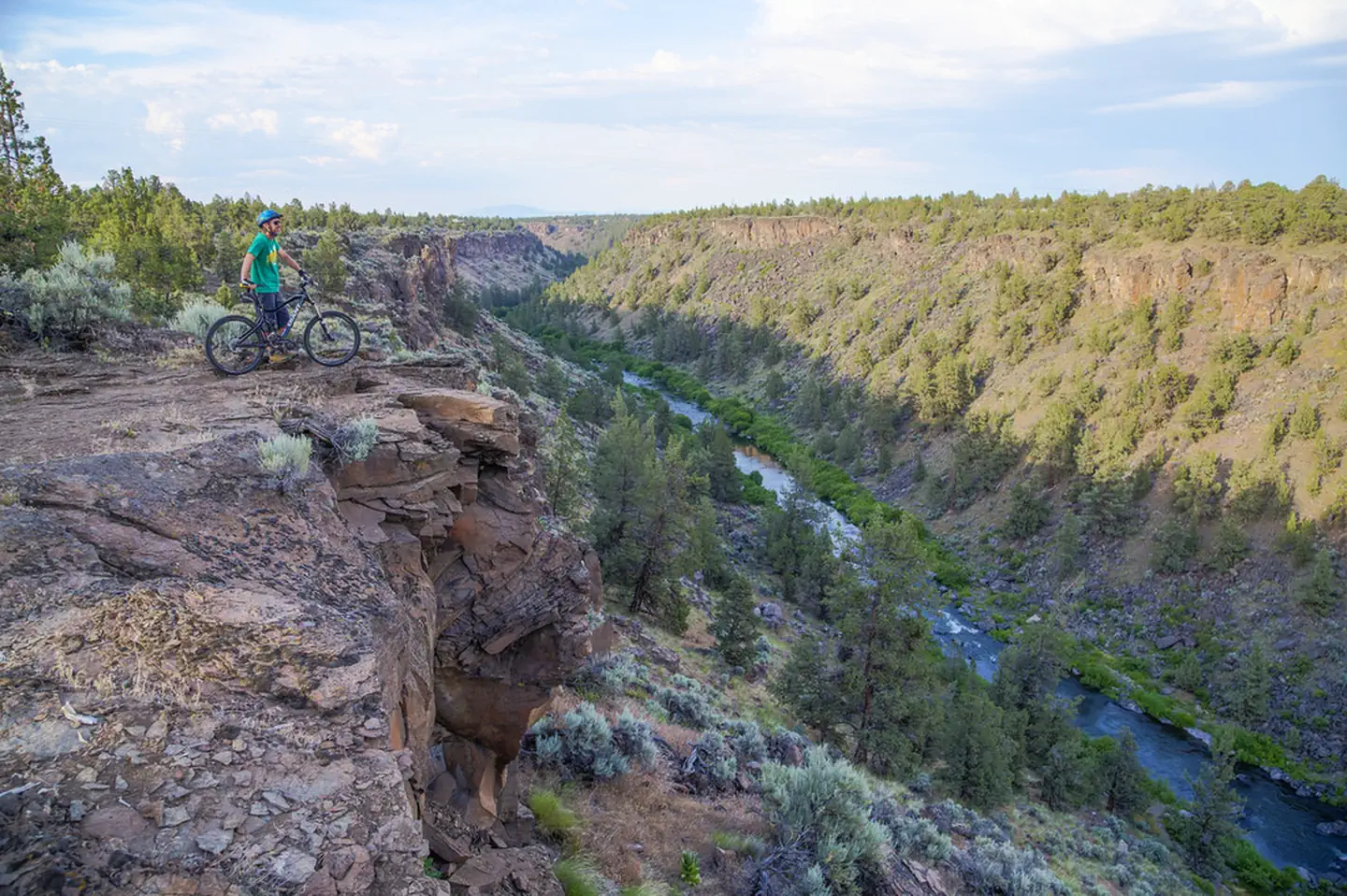
There's a hidden jewel on the east side of the Cascade Mountains. Here, there are over 4,000 acres where mountain bikers and horseback riders share the space but not the trails. Hikers can meander along lava rock-lined routes to breathtaking views of the Deschutes River, and trail runners can beat the snow in the winter. Start your adventure into the Maston Area through the Maston or Juniper Trailheads, and spend a day exploring the geology and landscape of Central Oregon on almost 50 miles of trail. Lunch under the twisted limbs of an old-growth juniper and watch eagles soar overhead.
Know Before You Go:
- Open year round and often available in winter when higher elevation trails are snowed out.
- No water.
- No overnight camping.
- Juniper is a small trailhead for single vehicles only.
- This area is open to trapping, so dogs need to stay within sight of you; control dogs around horses, bicyclists, and hikers.
Point of Interest:
Discover this 4,000-acre land of opportunity! The rides follow gentle draws around basalt outcrops, while the hikes go further into the rugged Deschutes River Canyon and the views shift from great to incredible!
Getting there
There are two trailheads that access the Maston Trail Use Area. To get to the main Maston Trailhead from Bend, head north to Tumalo and then turn on to Cline Falls Highway. Travel about 4.5 miles toward Eagle Crest Resort. Turn right (east) on Newcomb Road and the trailhead is 3/4 mile down the road on your left.
The smaller Juniper Trailhead is located along Cline Falls Highway at the north end of the Maston area.
44.21139, -121.30269 · 44°12'41.0"N 121°18'9.7"W
Typical weather
| Jan | Feb | Mar | Apr | May | Jun | Jul | Aug | Sep | Oct | Nov | Dec | |
|---|---|---|---|---|---|---|---|---|---|---|---|---|
| High °F | — | — | — | — | — | — | — | — | — | — | — | — |
| Low °F | — | — | — | — | — | — | — | — | — | — | — | — |
| Precip in | 1.3 | 1.3 | 0.9 | 0.9 | 2.3 | 0.9 | 0.7 | 0.6 | 0.5 | 0.8 | 2.6 | 1.6 |
1991–2020 averages from the nearest NOAA station, 5.5 mi away — not measured at the facility itself, and elevation can make a real difference over that distance.
Map
Fees and stay limits
No Fees.
Stay limit: No overnight camping.
From Recreation.gov, which is not always current. The operator's own page is the authority on what you will be charged.
Member photos
Common questions about Maston Trail System
- Can you reserve a site at Maston Trail System?
- No. Maston Trail System is not reservable through Recreation.gov, so sites are first-come, first-served or booked elsewhere.
- How long can you stay at Maston Trail System?
- No overnight camping.
Camping near Maston Trail System
- Central Cascades Wilderness Permit - Day Use 8.5 mi · Tickets · we watch it
- Barr North Staging Area 5.6 mi · Facility
- Huntington Wagon Road 6.5 mi · Facility
- Redmond Caves Recreation Site 6.7 mi · Facility
- Whychus Creek Scenic Overlook Trailhead 13.6 mi · Facility
- Cascade Lakes Welcome Station 15.5 mi · Facility
- Skyliners Sno-Park/Trailhead 16.3 mi · Facility
- Trail Crossing Corrals Trailhead 16.6 mi · Facility
- Henderson Flat Staging Area 17.1 mi · Facility
- Aspen Day Use Area 17.2 mi · Facility
- Three Creek Meadow Horse Camp 17.4 mi · Campground
- Skull Hollow Campground 17.5 mi · Campground
Contact
- Phone 541-416-6700
- Email BLM_OR_PR_Mail@blm.gov
- Info Recreation.gov
Recreation.gov last updated this record on 2026-02-25.
Facility information and photographs from Recreation.gov (RIDB). SpotOpened is not affiliated with Recreation.gov or any federal agency.
Comments