Magone Lake Campground
Campground · Oregon · 21 bookable sites ·
Managed by the USDA Forest Service
- 21
- Bookable sites
- up to 8
- People per site
Overview
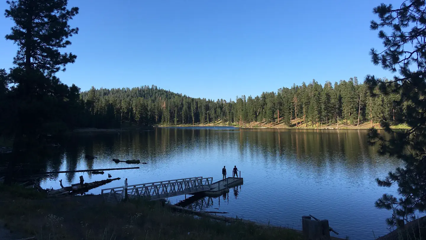
Magone Lake Campground is situated along its namesake lake. Visitors enjoy fishing, canoeing, swimming, mountain biking and hiking.
The campground is set in a forest of White Fir and Ponderosa Pine. Magone Lake covers about 50 acres and features both deep holes of up to 100 feet and shoals on the north side. Geologists believe Magone Lake was created by a landslide in the early 1800s.
Recreation
The Magone Lake area offers swimming, fishing, hiking and mountain biking opportunities. The lake contains eastern brook and rainbow trout. A boat ramp is available on-site. Visitors also enjoy viewing wildflowers and interesting geology throughout the region
Facilities
Day use swimming area with beach
Boat launch and dock
Fishing pier
Walking trail around the lake
Potable water during summer months
Mountain bike trails
Nearby Attractions
Middle Fork John Day River
Magone Bike Trail Network
Contact Info
For facility specific information, please call (541) 575-3000.The facts
- 21 bookable sites
- Up to 8 people per site
- Loops: Magone
Site types
- 18 Standard Nonelectric
- 3 Tent Only Nonelectric
Amenities
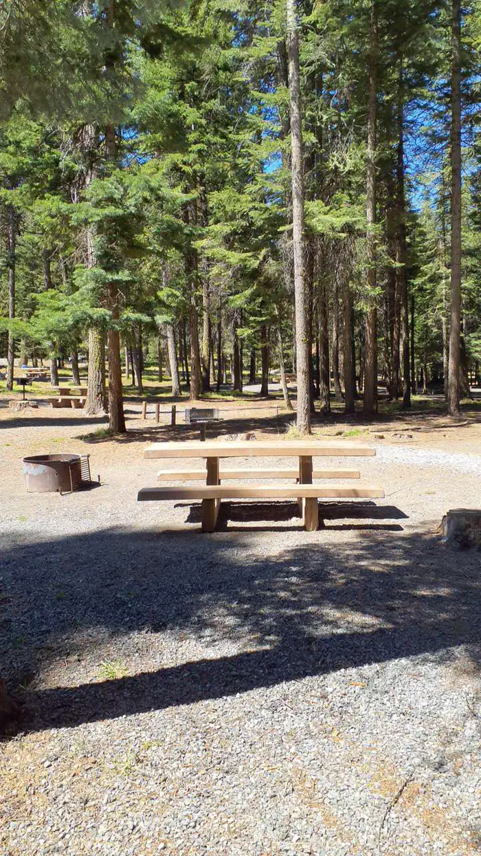
- Fire pits
- Picnic tables
- Shade
- Pets allowed
- Water hookups — not available
- Sewer hookups — not available
Not recorded upstream: electric hookups, campfires allowed, grills.
21 campsites at Magone Lake Campground
| Site | Loop | Type | Entry | Surface | Max rig | People | |
|---|---|---|---|---|---|---|---|
| 01 | Magone | Standard Nonelectric | Back In | Gravel | — | 8 | 🐾 |
| 02 | Magone | Standard Nonelectric | Back In | Gravel | — | 8 | 🐾 |
| 03 | Magone | Standard Nonelectric | Back In | Gravel | — | 8 | 🐾 |
| 04 | Magone | Standard Nonelectric | Back In | Gravel | — | 8 | 🐾 |
| 05 | Magone | Tent Only Nonelectric | Pull Through | Gravel | — | 8 | 🐾 |
| 06 | Magone | Tent Only Nonelectric | Pull Through | Gravel | — | 8 | 🐾 |
| 07 | Magone | Tent Only Nonelectric | Pull Through | Gravel | — | 8 | 🐾 |
| 08 | Magone | Standard Nonelectric | Back In | Gravel | — | 8 | 🐾 |
| 09 | Magone | Standard Nonelectric | Back In | Gravel | — | 8 | 🐾 |
| 10 | Magone | Standard Nonelectric | Back In | Gravel | — | 8 | 🐾 |
| 11 | Magone | Standard Nonelectric | Back In | Gravel | — | 8 | 🐾 |
| 12 | Magone | Standard Nonelectric | Back In | Gravel | — | 8 | 🐾 |
| 13 | Magone | Standard Nonelectric | Back In | Gravel | — | 8 | 🐾 |
| 14 | Magone | Standard Nonelectric | Back In | Gravel | — | 8 | 🐾 |
| 15 | Magone | Standard Nonelectric | Pull Through | Gravel | — | 8 | 🐾 |
| 16 | Magone | Standard Nonelectric | Back In | Gravel | — | 8 | 🐾 |
| 17 | Magone | Standard Nonelectric | Pull Through | Gravel | — | 8 | 🐾 |
| 18 | Magone | Standard Nonelectric | Pull Through | Gravel | — | 8 | 🐾 |
| 19 | Magone | Standard Nonelectric | Pull Through | Gravel | — | 8 | 🐾 |
| 20 | Magone | Standard Nonelectric | Back In | Gravel | — | 8 | 🐾 |
| 21 | Magone | Standard Nonelectric | Back In | Gravel | — | 8 | 🐾 |
Getting there
From John Day, Oregon, take U.S. Highway 26 east for approximately 9 miles. At the junction of County Road 18, travel north approximately 10 miles. At Forest Road 3620, turn west and drive approximately 1 mile to Forest Road 3618. The campground is about 1 mile from the turnoff. From Prairie City, Oregon, take U.S. Highway 26 approximately 3 miles west. At the junction of County Road 18, travel north approximately 10 miles. Turn west on Forest Road 3620 and travel approximately 1 mile to Forest Road 3618. The campground is about 1 mile from the turnoff.
More photos
Member photos
Common questions about Magone Lake Campground
- Can you reserve a site at Magone Lake Campground?
- Yes, Magone Lake Campground is reservable through Recreation.gov.
- How many campsites does Magone Lake Campground have?
- 21 sites.
- Are pets allowed at Magone Lake Campground?
- Yes, pets are allowed at Magone Lake Campground.
- Does Magone Lake Campground have hookups?
- No hookups are recorded here.
Contact
- Email SM.FS.malpubinfo@usda.gov
- Book Recreation.gov
Recreation.gov last updated this record on 2026-03-11.
Facility information and photographs from Recreation.gov (RIDB). SpotOpened is not affiliated with Recreation.gov or any federal agency.
Comments