Pink Beds Picnic Shelter
Campground · North Carolina · 1 bookable site ·
Managed by the USDA Forest Service
Pisgah National Forest (NF) · Open Access
- 1
- Bookable site
- up to 40
- People per site
- 3,265 ft
- Elevation
Overview
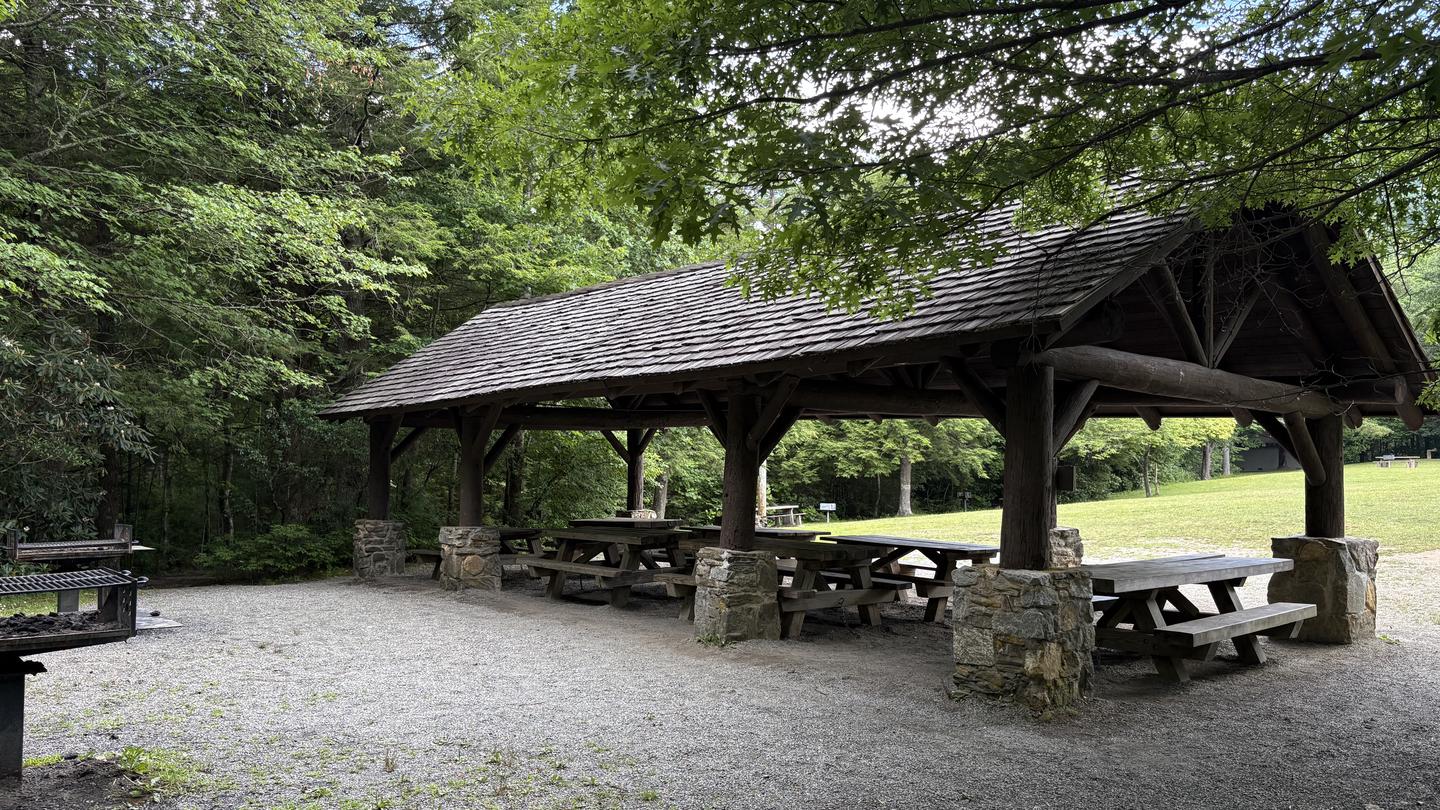
The Pink Beds Picnic Shelter is nestled within Pisgah National Forest along the scenic US 276 corridor. It sits adjacent to the historic Cradle of Forestry in America and is set within a lush woodland valley renowned for rhododendron, mountain laurel, azalea blooms, and rare high-altitude bogs—giving the area its iconic name.
Recreation
As part of the Pisgah National Forest, the Pink Beds area offers excellent opportunities. Visitors can pair a visit to the shelter with exploring the gentle, family-friendly Pink Beds Loop Trail—a scenic 5-mile hike through diverse habitats with boardwalks over boggy wetlands, creek crossings, and opportunities for wildlife viewing. The surrounding area is ideal for other types of recreation including fishing, horseback riding, and swimming. In addition, visitors are just steps away from the Cradle of Forestry in America, a historic site celebrating the birthplace of modern forest conservation. The Cradle of Forestry offers an indoor museum, paved hiking trails, outdoor exhibits, theater, cafe, and a gift shop.
Facilities
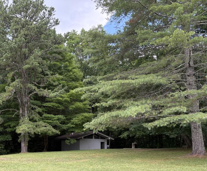
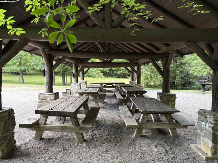
The area has a flush toilet restroom, 21 picnic tables, grills, an old Civilian Conservation Corps gazebo, and this large shelter. The parking area is a paved lot utilized for both Pink Beds Picnic Area and Pink Beds Loop Trailhead.
Natural Features
Named for the rhododendron, mountain laurel and azalea that bloom in spring and summer, the Pink Beds Picnic Shelter is renowned for its scenic forest setting and small stream nearby. At an elevation of 3,280 feet, it is appealing to visitors for its relatively flat valley which sustains some very large pine trees and rare mountain bogs.Contact Info
This location is unstaffed. To speak with our main office for general information, please call: (828) 866-3437.Nearby Attractions
The area is next door to the Cradle of Forestry in America Historic Site, and four miles from both the Blue Ridge Parkway and Sliding Rock Recreation Area.The facts
- 1 bookable site
- 1 site for day use only
- Up to 40 people per site
- Loops: PINK BEDS PICNIC SHELTER
Site types
- 1 Group Picnic Area
Amenities
- Shade
- Pets allowed
Not recorded upstream: electric hookups, water hookups, sewer hookups, campfires allowed, fire pits, picnic tables, grills.
1 campsite at Pink Beds Picnic Shelter
Check-in 7:00 AM · Check-out 9:00 PM
| Site | Loop | Type | Entry | Surface | Access | Max rig | People | |
|---|---|---|---|---|---|---|---|---|
| PINK BEDS PICNIC SHELTER | PINK BEDS PICNIC SHELTER | Group Picnic Area | — | — | Hike In | — | 40 | 🐾 |
Getting there
35.35361, -82.77778 · 35°21'13.0"N 82°46'40.0"W
Typical weather
| Jan | Feb | Mar | Apr | May | Jun | Jul | Aug | Sep | Oct | Nov | Dec | |
|---|---|---|---|---|---|---|---|---|---|---|---|---|
| High °F | — | — | — | — | — | — | — | — | — | — | — | — |
| Low °F | — | — | — | — | — | — | — | — | — | — | — | — |
| Precip in | 6.4 | 5.7 | 5.6 | 5.6 | 5.2 | 6.2 | 5.7 | 6.9 | 6.8 | 5.2 | 5.4 | 7.0 |
1991–2020 averages from the nearest NOAA station, 7.2 mi away — not measured at the facility itself, and elevation can make a real difference over that distance.
Map
More photos
Member photos
Common questions about Pink Beds Picnic Shelter
- Can you reserve a site at Pink Beds Picnic Shelter?
- Yes, Pink Beds Picnic Shelter is reservable through Recreation.gov.
- How many campsites does Pink Beds Picnic Shelter have?
- 1 site.
- Are pets allowed at Pink Beds Picnic Shelter?
- Yes, pets are allowed at Pink Beds Picnic Shelter.
Camping near Pink Beds Picnic Shelter
- Wolf Ford Horse Camp 2.8 mi · Campground · we watch it
- Mount Pisgah Campground 3.6 mi · Campground · we watch it
- Cove Creek Upper Group Camp 4.3 mi · Campground · we watch it
- Cove Creek Lower Group Camp 4.3 mi · Campground · we watch it
- White Pine South Group Camp 4.8 mi · Campground · we watch it
- Davidson River 5.9 mi · Campground · we watch it
- Sycamore Flats Picnic Shelter 6.6 mi · Campground · we watch it
- Wash Creek Horse Camp 8.1 mi · Campground · we watch it
- Cradle of Forestry In America Heritage Site 0.2 mi · Facility
- Wolf Ford Horse Camp 2.7 mi · Facility
- Cove Creek Group Campground 5 mi · Campground
- Black Mountain / South Toe River Area 5.8 mi · Facility
Contact
- Phone 828 877-3265
- Email SM.FS.pisgahrd@usda.gov
- Book Recreation.gov
Recreation.gov last updated this record on 2026-07-21.
Facility information and photographs from Recreation.gov (RIDB). SpotOpened is not affiliated with Recreation.gov or any federal agency.
Comments