Trapper Springs (MT)
Campground · Montana · 16 bookable sites ·
Managed by the Bureau of Land Management
Dillon Field Office (Bureau of Land Management MT) · Open Access
- 16
- Bookable sites
- 60 ft
- Max rig length
- up to 50
- People per site
- 4,484 ft
- Elevation
Overview
The Dillon Field Office is unable to make reservations for you. Please call Recreation.gov (877-444-6777) to book a reservation or book online.
Campsites are available for reservation for the Peak-Season times of May 1st through September 15th. All sites are first-come-first-serve from September 16th through April 30th.
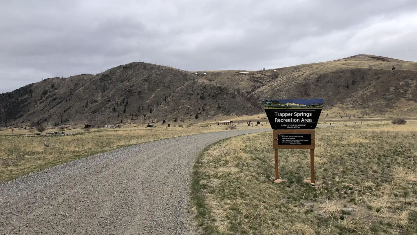
Trapper Springs Campground is adjacent to the lower Madison River and provides good access for camping, fishing and floating. The campground has 15 camp sites, 9 available for reservations. There is no boat launch available at this site, but there are several in the vicinity. The campground serves as a great central location to access the lower Madison River.
The day use area has a large pavilion with parking for 20 vehicles. The pavilion can be reserved for groups ($50/day). The campground has 15 camping sites with two accessible vault toilets. Organized Group permits are required for groups larger than 15 people.
Recreation
The Madison River is well known for its robust trout fishery. The lower Madison River is a very popular destination for non-angling floaters (tubers) during the warm summer months. Trapper Springs sits roughly half way between Warm Springs boat launch and Black's Ford Fishing Access Site.
Facilities
15 campsites, 3 accessible vault toilets, drinking water, group use pavilion, fire pits, and picnic tables. Firewood is available for purchase at Red Mountain Campground, when the volunteer campground host is present.
Natural Features
Madison River
Contact Info
This location is unstaffed. To speak with our main office for general information, please call: (406) 683-8000.Nearby Attractions
Lower Madison River, Bear Trap Canyon unit of the Lee Metcalf Wilderness Area, Norris Hot Springs, Ennis
Charges & Cancellations
Failing to arrive on the first night of your reservation will result in a forfeiture of your reservation and your site may be made available to someone else.
The facts
- 16 bookable sites
- 1 site for day use only
- Vehicles up to 60 ft
- Up to 50 people per site
- Loops: A, B
Site types
- 15 Standard Nonelectric
- 1 Group Shelter Nonelectric
Amenities
- Campfires allowed
- Fire pits
- Picnic tables
- Pets allowed
Not recorded upstream: electric hookups, water hookups, sewer hookups, grills, shade.
16 campsites at Trapper Springs (MT)
| Site | Loop | Type | Entry | Surface | Grade | Water | Max rig | People | |
|---|---|---|---|---|---|---|---|---|---|
| 1 | A | Standard Nonelectric | Back In | Gravel | Slight | Riverfront | 45 ft | 15 | 🐾 |
| 10 | A | Standard Nonelectric | Back In | Gravel | Slight | Riverfront | 55 ft | 15 | 🐾 |
| 11 | A | Standard Nonelectric | Back In | Gravel | Slight | Riverfront | 45 ft | 15 | 🐾 |
| 12 | A | Standard Nonelectric | Back In | Gravel | Slight | Riverfront | 40 ft | 15 | 🐾 |
| 13 | A | Standard Nonelectric | Back In | Gravel | Slight | Riverfront | 35 ft | 15 | 🐾 |
| 14 | A | Standard Nonelectric | Back In | Gravel | Slight | Riverfront | 45 ft | 15 | 🐾 |
| 15 | A | Standard Nonelectric | Back In | Gravel | Slight | Riverfront | 45 ft | 15 | 🐾 |
| 2 | A | Standard Nonelectric | Back In | Gravel | Slight | Riverfront | 50 ft | 15 | 🐾 |
| 3 | A | Standard Nonelectric | Back In | Gravel | Slight | Riverfront | 50 ft | 15 | 🐾 |
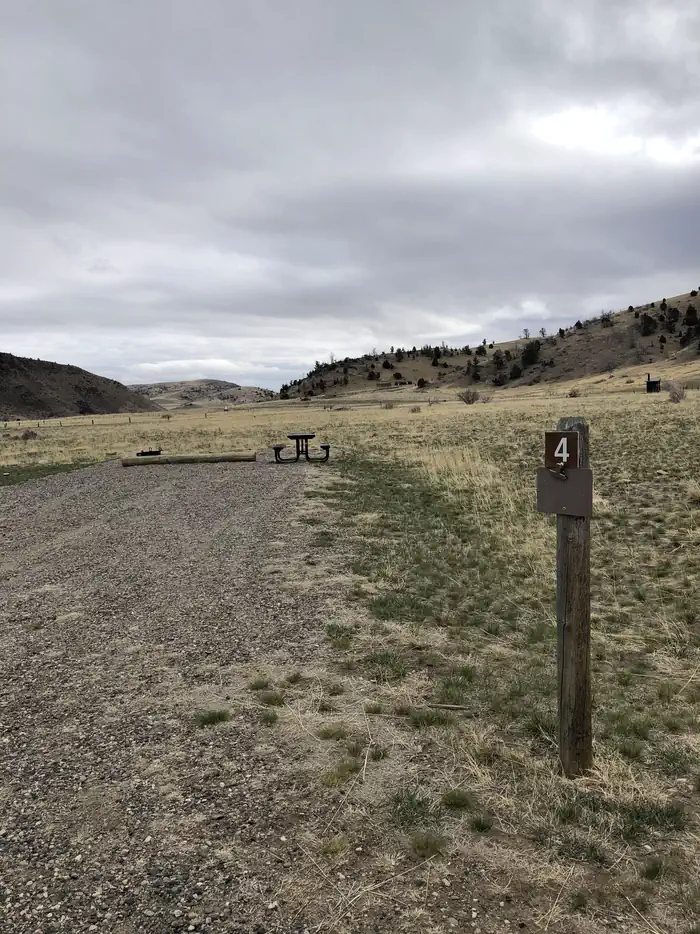
| 4 | A | Standard Nonelectric | Back In | Gravel | Slight | Riverfront | 60 ft | 15 | 🐾 |
| 5 | A | Standard Nonelectric | Back In | Gravel | Slight | Riverfront | 50 ft | 15 | 🐾 |
| 6 | A | Standard Nonelectric | Back In | Gravel | Slight | Riverfront | 60 ft | 15 | 🐾 |
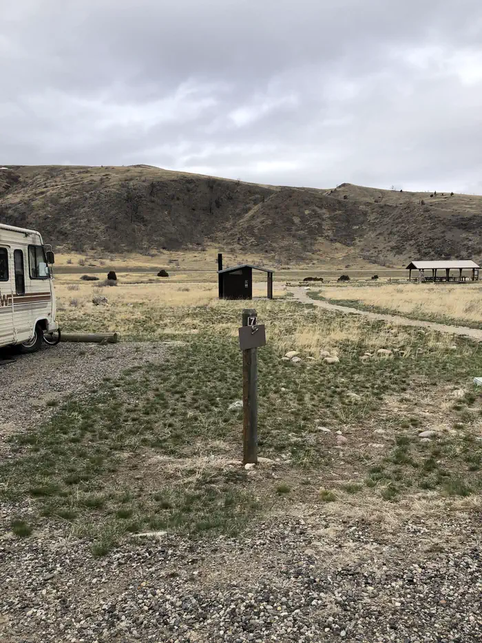
| 7 | A | Standard Nonelectric | Back In | Gravel | Slight | Riverfront | 45 ft | 15 | 🐾 |
| 8 | A | Standard Nonelectric | Back In | Gravel | Slight | Riverfront | 60 ft | 15 | 🐾 |
| 9 | A | Standard Nonelectric | Back In | Gravel | Slight | Riverfront | 50 ft | 15 | 🐾 |
| 1 | B | Group Shelter Nonelectric | — | Gravel | Slight | Riverfront | — | 50 | 🐾 |
Getting there
From Bozeman; Head west on MT Hwy 84 (Norris Road). Continue on MT Hwy 84 for 20.5 miles. Turn left (south) at South Bear Trap Canyon Road. If you cross the Madison River you have just passed the turn.
From Norris; Head East on MT Hwy 84 (Norris Road) travel for 8 miles and turn right (south) at South Bear Trap Canyon Road after you cross the Madison River.
45.60685, -111.56815 · 45°36'24.7"N 111°34'5.3"W
Typical weather
Typically 85°F in Jul, down to 38°F in Dec.
| Jan | Feb | Mar | Apr | May | Jun | Jul | Aug | Sep | Oct | Nov | Dec | |
|---|---|---|---|---|---|---|---|---|---|---|---|---|
| High °F | 39 | 42 | 50 | 57 | 66 | 75 | 85 | 85 | 75 | 60 | 47 | 38 |
| Low °F | 24 | 25 | 30 | 36 | 43 | 50 | 57 | 56 | 49 | 39 | 30 | 24 |
| Precip in | 0.5 | 0.7 | 1.2 | 2.3 | 3.0 | 3.2 | 1.3 | 1.4 | 1.4 | 1.7 | 0.8 | 0.8 |
1991–2020 averages from the nearest NOAA station, 8.8 mi away — not measured at the facility itself, and elevation can make a real difference over that distance.
Map
More photos
Member photos
Common questions about Trapper Springs (MT)
- Can you reserve a site at Trapper Springs (MT)?
- Yes, Trapper Springs (MT) is reservable through Recreation.gov.
- How many campsites does Trapper Springs (MT) have?
- 16 sites.
- What is the maximum RV length at Trapper Springs (MT)?
- 60 ft. That is the longest vehicle the sites here are recorded as taking; individual sites may be shorter.
- Are pets allowed at Trapper Springs (MT)?
- Yes, pets are allowed at Trapper Springs (MT).
- Are campfires allowed at Trapper Springs (MT)?
- Campfires are allowed at Trapper Springs (MT). Check for a current fire restriction before you go.
Camping near Trapper Springs (MT)
- Red Mountain (MT) 0.2 mi · Campground · we watch it
- Spanish Creek Cabin 14.3 mi · Campground · we watch it
- Spire Rock Campground 20.9 mi · Campground · we watch it
- Garnet Mountain Fire Lookout 21.5 mi · Campground · we watch it
- Canaday Boat Launch 0.4 mi · Facility
- Warm Spgs Day Use Area 1.9 mi · Facility
- Fall Creek Day Use Area 9.5 mi · Facility
- Revenue Flats 10.7 mi · Facility
- Trail Creek Picnic Area 11.3 mi · Facility
- Potosi Campground and Picnic Area 16.4 mi · Campground
- Branham Lakes Campground and Picnic Area 21.3 mi · Campground
- Spire Rock Campground 21.5 mi · Campground
Contact
- Phone 406-683-8000
- Book Recreation.gov
Recreation.gov last updated this record on 2026-02-25.
Facility information and photographs from Recreation.gov (RIDB). SpotOpened is not affiliated with Recreation.gov or any federal agency.
Comments