Sex Peak. Lookout Rental
Campground · Montana · 1 bookable site ·
Managed by the USDA Forest Service
Kaniksu National Forest (NF) · Open Access
- 1
- Bookable site
- up to 4
- People per site
- 5,800 ft
- Elevation
Overview
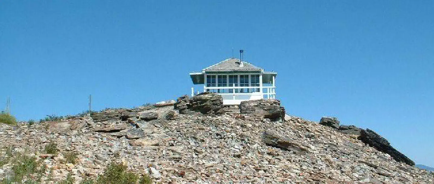
Sex Peak Lookout is situated in the Rocky Mountains at an elevation of 5,772 feet in the Kootenai National Forest. The original lookout was constructed in the early 1920s and replaced by the current lookout in 1948.The peak was named by I.V. Anderson, an early forester, and Harry Baker, supervisor of what was then Cabinet National Forest. It is rumored that they named the peak after their topic of conversation at the time.
The lookout is typically open from late June through mid-October and is accessible by car. This rustic retreat offers a few amenities, but guests should pack in most of their own supplies and gear.
Recreation
Old logging roads provide a way for hikers and mountain bikers to explore the area. Wild berries ripen in the area during the summer, inviting berry pickers.Facilities
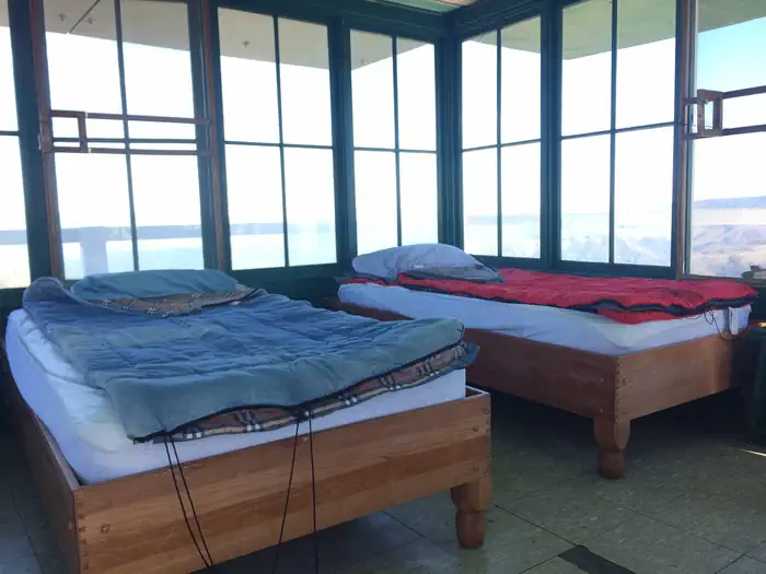
The 14x14-ft. lookout has windows on all sides and is encircled by a catwalk. The cabin sleeps 4 people and is equipped 2 twin size beds with mattresses. Other amenities include a table, chair, bench, a wood stove for heat, broom and dustpan.Firewood is provided. An outhouse with vault toilet and a campfire ring are located outside.
The lookout does not have electricity or water. Guests should being enough water for drinking, cooking and washing.
Items such as a cook stove, cooking gear, bedding, lanterns or flashlights, matches, extra toilet paper, first aid supplies, trash bags, dish soap, towels and an ice chest are not available. Guests are expected to pack out their trash and clean the cabin before leaving.
Natural Features
The lookout sits on a mound of rocks surrounded by evergreen forest. It offers panoramic views of Clarks Fork Valley, the Bitterroot Mountains to the west and the Cabinet Range to the east. This is an ideal vantage point to enjoy sunrises and sunsets and gaze out at starry skies on clear nights.Kootenai National Forest supports populations of deer, elk, moose, grizzly and black bears, wolves and mountain lions (bear safety). A variety of smaller mammals and birds can also be found.
The facts
- 1 bookable site
- Up to 4 people per site
- Loops: SEX PEAK. LOOKOUT RENTAL
Site types
- 1 Lookout
Amenities
- Campfires allowed
- Pets allowed
Not recorded upstream: electric hookups, water hookups, sewer hookups, fire pits, picnic tables, grills, shade.
1 campsite at Sex Peak. Lookout Rental
Check-in 2:00 PM · Check-out 11:00 AM
| Site | Loop | Type | Entry | Surface | Grade | Max rig | People | |
|---|---|---|---|---|---|---|---|---|
| 001 | SEX PEAK. LOOKOUT RENTAL | Lookout | Pull Through | Gravel | Moderate | — | 4 | 🐾 |
Getting there
From Cabinet Ranger Station, travel approximately 11 miles southeast on Highway 200 and turn right onto Big Beaver Creek Road 152 (Faro Lane). Drive south 2 miles and take a right at the "T" junction. Follow this road for approximately 9 miles, after passing the “Jackpine Flats” camping area the road spits. Stay right at split onto Road 2222 and follow this road approximately 8.5 miles to the lookout. Road 2222 is a loop road that intersects with Road #152 at two locations. The easterly portion of this road is subject to seasonal closures and may not be passable (first sign for Road 2222) . The advised route up to the lookout is via the right turn just past Jackpine Flats.
47.72304, -115.64442 · 47°43'22.9"N 115°38'39.9"W
Typical weather
| Jan | Feb | Mar | Apr | May | Jun | Jul | Aug | Sep | Oct | Nov | Dec | |
|---|---|---|---|---|---|---|---|---|---|---|---|---|
| High °F | — | — | — | — | — | — | — | — | — | — | — | — |
| Low °F | — | — | — | — | — | — | — | — | — | — | — | — |
| Precip in | 2.8 | 2.4 | 2.5 | 1.9 | 2.4 | 2.5 | 1.1 | 1.1 | 1.2 | 2.4 | 3.3 | 3.1 |
1991–2020 averages from the nearest NOAA station, 8.1 mi away — not measured at the facility itself, and elevation can make a real difference over that distance.
Map
More photos

Member photos
Common questions about Sex Peak. Lookout Rental
- Can you reserve a site at Sex Peak. Lookout Rental?
- Yes, Sex Peak. Lookout Rental is reservable through Recreation.gov.
- How many campsites does Sex Peak. Lookout Rental have?
- 1 site.
- Are pets allowed at Sex Peak. Lookout Rental?
- Yes, pets are allowed at Sex Peak. Lookout Rental.
- Are campfires allowed at Sex Peak. Lookout Rental?
- Campfires are allowed at Sex Peak. Lookout Rental. Check for a current fire restriction before you go.
Camping near Sex Peak. Lookout Rental
- Minton Peak Lookout 9.4 mi · Campground · we watch it
- Cougar Peak Lookout 12.2 mi · Campground · we watch it
- Avery Creek Cabin 13.3 mi · Campground · we watch it
- Kit Price 16.8 mi · Campground · we watch it
- Devils Elbow 17.6 mi · Campground · we watch it
- Berlin Flats 17.6 mi · Campground · we watch it
- Jackpine Flats Campground 2.6 mi · Campground
- North Shore Campground 9.5 mi · Campground
- #894 Roe Gulch 10.5 mi · Facility
- #892 West Fork Canyon Creek 11.4 mi · Facility
- Marten Creek Campground 12 mi · Campground
- Berlin Flats Group Campground 15.1 mi · Campground
Contact
- Phone 406-827-3533
- Book Recreation.gov
Recreation.gov last updated this record on 2026-02-25.
Facility information and photographs from Recreation.gov (RIDB). SpotOpened is not affiliated with Recreation.gov or any federal agency.
Comments