McGillivray Campground (MT)
Campground · Montana · 39 bookable sites ·
Managed by the USDA Forest Service
Kootenai National Forest (NF) · Open Access
- 39
- Bookable sites
- 40 ft
- Max rig length
- up to 200
- People per site
- 1
- Accessible site
- 2,493 ft
- Elevation
Overview
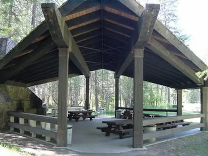
McGillivray Campground has 33 total campsites and provides reservation opportunities for two group sites within the campground loops and a large group shelter located within the facility . The two smaller group sites in the campground will accommodate up to 25 people each. The group shelter will accommodate up to 200 people making it great for reunions and receptions.
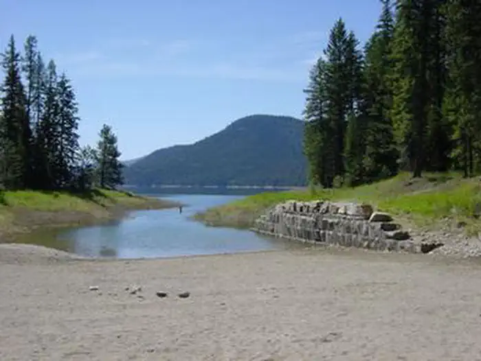
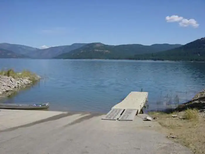
A high and low water boat ramp, swim beach and picnic area are also available at McGillivray Campground
Recreation
Fishing derbies are held multiple times each year and anglers can expect kokanee salmon, whitefish and a variety of trout.
Facilities
- The large group shelter (site 1) is equipped with a rock fireplace and multiple tables. Two Accessible vault toilets and drinking water are provided nearby. Two large cooking grills, horseshoe pits, path to beach area, fire ring and a 1-acre meadow adjoin the site.
A large paved parking lot is available for large parties. The site is gated for security of rental parties and it is recommended that the gate is swung closed. Electrical outlets are available within the shelter, however reservationists must provide their own generator. Firewood is provided for the shelter. - The two group sites (site 7 and site 23) within the campground provide parking for up to five RVs. Each site has three tent pads, three picnic tables, fire ring, and a large cooking grill are within the sites. All sites at this campground have no electricity and firewood is not provided.
Natural Features
The McGillivary is located on the western shore of Lake Koocanusa in northwest Montana, at an elevation of about 2,520 feet. It is nestled in a heavily forested area with dense vegetation on the forest floor. The adjacent 46,500-acre reservoir has over 127 miles of shoreline and is formed by the 422' tall Libby Dam on the Kootenai River, which stretches about 90 miles and into Canada. Osprey often fish around Libby Dam at sunset, making for enjoyable viewing opportunities. Bald eagles can be seen hunting kokanee in the river and lake during the fall. A variety of wildlife also makes its home in the area.Nearby Attractions
The Kootenai River, below Libby Dam, is a blue ribbon fishery. Guided tours of the dam and powerhouse are offered at the visitor center throughout the summer season.Visitors enjoy driving the 100-mile loop around the reservoir. Several trails, including some that lead to scenic waterfalls, are located along the route.
The facts
- Season: Memorial Day — USDA Forest Service, Aug 24, 2026
- 39 bookable sites
- 1 accessible site
- Vehicles up to 40 ft
- Up to 200 people per site
- Loops: Group Pavilion, Loop A, Loop B
Site types
- 31 Standard Nonelectric
- 5 Tent Only Nonelectric
- 2 Group Standard Nonelectric
- 1 Group Shelter Nonelectric
Amenities
- Campfires allowed
- Fire pits
- Picnic tables
- Grills
- Shade
- Pets allowed
Not recorded upstream: electric hookups, water hookups, sewer hookups.
39 campsites at McGillivray Campground (MT)
| Site | Loop | Type | Entry | Surface | Grade | Access | Max rig | People | |
|---|---|---|---|---|---|---|---|---|---|
| Group Site 1 | Group Pavilion | Group Shelter Nonelectric | Pull Through | Paved | Slight | Drive In | — | 200 | ♿ 🐾 |
| 17 | Loop A | Standard Nonelectric | Back In | Paved | Slight | Drive In | 40 ft | 8 | 🐾 |
| 18 | Loop A | Standard Nonelectric | Pull Through | Paved | Slight | Drive In | 40 ft | 8 | 🐾 |
| 19 | Loop A | Standard Nonelectric | Back In | Paved | Slight | Drive In | 40 ft | 8 | 🐾 |
| 20 | Loop A | Standard Nonelectric | Pull Through | Paved | Slight | Drive In | 40 ft | 8 | 🐾 |
| 21 | Loop A | Standard Nonelectric | Pull Through | Paved | Slight | Drive In | 40 ft | 8 | 🐾 |
| 22 | Loop A | Standard Nonelectric | Pull Through | Paved | Slight | Drive In | 40 ft | 8 | 🐾 |
| 23 - Group Site | Loop A | Group Standard Nonelectric | Pull Through | Paved | Slight | Drive In | 40 ft | 25 | 🐾 |
| 24 | Loop A | Standard Nonelectric | Pull Through | Paved | Slight | Drive In | 40 ft | 8 | 🐾 |
| 25 | Loop A | Standard Nonelectric | Pull Through | Paved | Slight | Drive In | 40 ft | 8 | 🐾 |
| 26 | Loop A | Standard Nonelectric | Back In | Paved | Slight | Drive In | 40 ft | 8 | 🐾 |
| 27 | Loop A | Standard Nonelectric | Pull Through | Paved | Slight | Drive In | 40 ft | 8 | 🐾 |
| 28 | Loop A | Standard Nonelectric | Pull Through | Paved | Slight | Drive In | 40 ft | 8 | 🐾 |
| 29 | Loop A | Standard Nonelectric | Back In | Paved | Slight | Drive In | 40 ft | 8 | 🐾 |
| 30 | Loop A | Standard Nonelectric | Back In | Paved | Slight | Drive In | 40 ft | 8 | 🐾 |
| 31 | Loop A | Standard Nonelectric | Back In | Paved | Slight | Drive In | 40 ft | 8 | 🐾 |
| 32 | Loop A | Standard Nonelectric | Back In | Paved | Slight | Drive In | 40 ft | 8 | 🐾 |
| 33 | Loop A | Standard Nonelectric | Pull Through | Paved | Slight | Drive In | 40 ft | 8 | 🐾 |
| Tent 1 | Loop A | Tent Only Nonelectric | — | Paved | Slight | Hike In | — | 4 | 🐾 |
| Tent 2 | Loop A | Tent Only Nonelectric | — | Paved | Slight | Hike In | — | 4 | 🐾 |
| Tent 3 | Loop A | Tent Only Nonelectric | — | Paved | Slight | Hike In | — | 4 | 🐾 |
| Tent 4 | Loop A | Tent Only Nonelectric | — | Paved | Slight | Hike In | — | 4 | 🐾 |
| Tent 5 | Loop A | Tent Only Nonelectric | — | Paved | Slight | Hike In | — | 4 | 🐾 |
| 1 | Loop B | Standard Nonelectric | Pull Through | Paved | Slight | Drive In | 40 ft | 8 | 🐾 |
| 10 | Loop B | Standard Nonelectric | Pull Through | Paved | Slight | Drive In | 40 ft | 8 | 🐾 |
| 11 | Loop B | Standard Nonelectric | Pull Through | Paved | Slight | Drive In | 40 ft | 8 | 🐾 |
| 12 | Loop B | Standard Nonelectric | Pull Through | Paved | Slight | Drive In | 40 ft | 8 | 🐾 |
| 13 | Loop B | Standard Nonelectric | Pull Through | Paved | Slight | Drive In | 40 ft | 8 | 🐾 |
| 14 | Loop B | Standard Nonelectric | Pull Through | Paved | Slight | Drive In | 40 ft | 8 | 🐾 |
| 15 | Loop B | Standard Nonelectric | Pull Through | Paved | Slight | Drive In | 40 ft | 8 | 🐾 |
| 16 (Camphost Site) | Loop B | Standard Nonelectric | Pull Through | Paved | Slight | Drive In | 40 ft | 8 | 🐾 |
| 2 | Loop B | Standard Nonelectric | Pull Through | Paved | Slight | Drive In | 40 ft | 8 | 🐾 |
| 3 | Loop B | Standard Nonelectric | Pull Through | Paved | Slight | Drive In | 40 ft | 8 | 🐾 |
| 4 | Loop B | Standard Nonelectric | Pull Through | Paved | Slight | Drive In | 40 ft | 8 | 🐾 |
| 5 | Loop B | Standard Nonelectric | Pull Through | Paved | Slight | Drive In | 40 ft | 8 | 🐾 |
| 6 | Loop B | Standard Nonelectric | Pull Through | Paved | Slight | Drive In | 40 ft | 8 | 🐾 |
| 7 - Group Site | Loop B | Group Standard Nonelectric | Pull Through | Paved | Slight | Drive In | 40 ft | 25 | 🐾 |
| 8 | Loop B | Standard Nonelectric | Pull Through | Paved | Slight | Drive In | 40 ft | 8 | 🐾 |
| 9 | Loop B | Standard Nonelectric | Pull Through | Paved | Slight | Drive In | 40 ft | 8 | 🐾 |
Getting there
48.48333, -115.30000 · 48°28'60.0"N 115°17'60.0"W
Typical weather
Typically 85°F in Aug, down to 34°F in Dec.
| Jan | Feb | Mar | Apr | May | Jun | Jul | Aug | Sep | Oct | Nov | Dec | |
|---|---|---|---|---|---|---|---|---|---|---|---|---|
| High °F | 35 | 40 | 49 | 58 | 68 | 75 | 85 | 85 | 74 | 57 | 42 | 34 |
| Low °F | 22 | 22 | 26 | 32 | 39 | 46 | 50 | 49 | 42 | 34 | 28 | 23 |
| Precip in | 1.5 | 1.1 | 1.1 | 1.2 | 1.8 | 2.4 | 0.8 | 0.7 | 1.1 | 1.7 | 1.8 | 1.7 |
1991–2020 averages from the nearest NOAA station, 5.1 mi away — not measured at the facility itself, and elevation can make a real difference over that distance.
Map
More photos
Member photos
Common questions about McGillivray Campground (MT)
- Can you reserve a site at McGillivray Campground (MT)?
- Yes, McGillivray Campground (MT) is reservable through Recreation.gov.
- How many campsites does McGillivray Campground (MT) have?
- 39 sites.
- What is the maximum RV length at McGillivray Campground (MT)?
- 40 ft. That is the longest vehicle the sites here are recorded as taking; individual sites may be shorter.
- Are pets allowed at McGillivray Campground (MT)?
- Yes, pets are allowed at McGillivray Campground (MT).
- Are campfires allowed at McGillivray Campground (MT)?
- Campfires are allowed at McGillivray Campground (MT). Check for a current fire restriction before you go.
Also listed by
McGillivray Campground (MT) also appears in other federal recreation data. Facts below are matched by name and location, not confirmed by McGillivray Campground (MT)'s operator.
USDA Forest Service — data as of Aug 24, 2026
- $16.00 daily fee per single site; 50% discount with US Golden Age/Access or Interagency Senior/Access Passes
- Group Camp sites (site 7/site 23): $50.00 daily fee per group camping site. Up to 25 people. Check-in/check-out 12:00 Noon
- Group Pavilion (site 01): 1-100 people $100.00 per night; 101- max people $200.00 per night. Check-in/check-out 12:00 Noon
Accessibility:
- Accessible picnic area, picnic shelters, sites and vault toilets
Camping near McGillivray Campground (MT)
- Timberlane Campground 10.3 mi · Campground · we watch it
- McGuire MTN. Lookout Rental 14.5 mi · Campground · we watch it
- Fairview Ranger Station 14.9 mi · Campground · we watch it
- Big Creek Baldy. Lookout Rental 15.4 mi · Campground · we watch it
- Barron Creek Boating Site 2.2 mi · Facility
- Rocky Gorge Campground 11.7 mi · Campground
- McGuire Mountain Lookout 14.3 mi · Campground
- Fisher River Area 14.9 mi · Facility
- Peck Gulch Campground 16.7 mi · Campground
- Libby Area 17.1 mi · Facility
- Loon Lake Campground 18.7 mi · Campground
- Stone Hill Climbing Area 21.2 mi · Facility
Contact
- Phone 406-293-7773
- Book Recreation.gov
Recreation.gov last updated this record on 2026-03-11.
Facility information and photographs from Recreation.gov (RIDB). SpotOpened is not affiliated with Recreation.gov or any federal agency.
Comments