Lupine Shelter
Campground · Montana · 1 bookable site ·
Managed by the USDA Forest Service
Beaverhead National Forest (NF) · Open Access
- 1
- Bookable site
- up to 74
- People per site
- 1
- Accessible site
- 7,631 ft
- Elevation
Overview
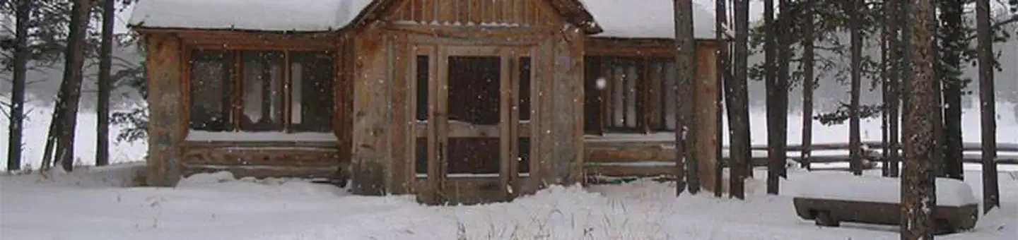
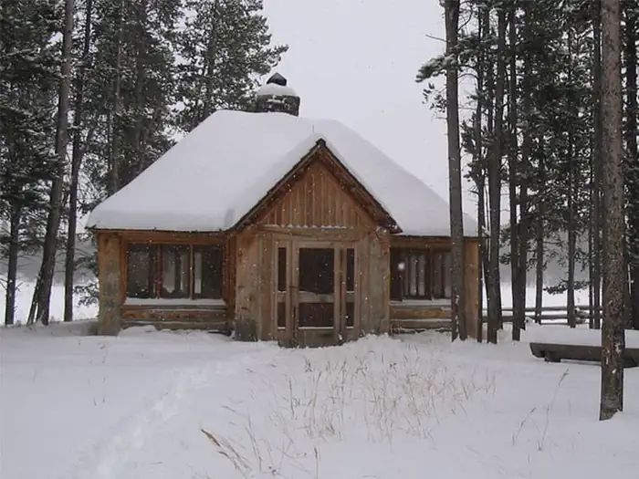
Lupine Shelter is a picnicking facility open year-round, however it is most heavily visited during the winter, when it is used by snowmobilers as a warming hut. It is an excellent location to have a picnic or a family gathering any time of year.Recreation
In winter, snowmobiling, cross country skiing and snowshoeing are popular activities in the snow-covered meadow surrounding the shelter.During the spring, summer and fall, a variety of hiking and mountain biking trails can be found in the area.
Facilities
The day-use shelter boasts a beautiful large rock fireplace, lots of window and two tables with chairs inside. Guests are encouraged to clean up after themselves with the provided broom and dust pan.Additional picnic tables are available outside the shelter. Accessible vault toilets are provided. No drinking water is available, nor is trash collection.
Natural Features
The shelter was built in the early 1990s, as a replica of a Civilian Conservation Corps-style building. It is situated in a grassy meadow surrounded by a forest of mature pine trees at an elevation of 7,600 feet.In spring and early summer, vivid wildflowers color the meadow. A variety of birds and wildlife make their home in the area.
Nearby Attractions
The closest town is Wise River, Montana, which is about 25 miles north of the picnic area.The facts
- 1 bookable site
- 1 site for day use only
- 1 accessible site
- Up to 74 people per site
- Loops: AREA LUPINE SHELTER
Site types
- 1 Group Shelter Nonelectric
1 campsite at Lupine Shelter
Check-in 8:00 AM · Check-out 10:00 PM
| Site | Loop | Type | Entry | Surface | Max rig | People | |
|---|---|---|---|---|---|---|---|
| 001 | AREA LUPINE SHELTER | Group Shelter Nonelectric | — | Gravel | — | 74 | ♿ |
Getting there
From Wise River, Montana, take the Pioneer Mountains Scenic Byway approximately 25 miles south.
45.50222, -113.10111 · 45°30'8.0"N 113°6'4.0"W
Typical weather
| Jan | Feb | Mar | Apr | May | Jun | Jul | Aug | Sep | Oct | Nov | Dec | |
|---|---|---|---|---|---|---|---|---|---|---|---|---|
| High °F | — | — | — | — | — | — | — | — | — | — | — | — |
| Low °F | — | — | — | — | — | — | — | — | — | — | — | — |
| Precip in | 2.8 | 2.6 | 2.8 | 3.4 | 3.4 | 3.3 | 1.4 | 1.3 | 1.7 | 2.4 | 2.8 | 3.0 |
1991–2020 averages from the nearest NOAA station, 9.3 mi away — not measured at the facility itself, and elevation can make a real difference over that distance.
Map
More photos
Member photos
Common questions about Lupine Shelter
- Can you reserve a site at Lupine Shelter?
- Yes, Lupine Shelter is reservable through Recreation.gov.
- How many campsites does Lupine Shelter have?
- 1 site.
Camping near Lupine Shelter
- Price Creek Campground (MT) 1.8 mi · Campground · we watch it
- Grasshopper Campground (MT) 3.7 mi · Campground · we watch it
- Mono Creek Campground 2.5 mi · Campground
- Grasshopper Campground and Picnic Area 3.7 mi · Campground
- Little Joe Campground 3.9 mi · Campground
- Willow Campground 9.2 mi · Campground
- Lodgepole Campground 9.8 mi · Campground
- Boulder Creek Campground 10.3 mi · Campground
- Dinner Station Campground and Picnic Area 10.8 mi · Campground
- Fourth of July Campground 11.2 mi · Campground
- Canyon Creek Campground 11.4 mi · Campground
- Pettengill Campground 12.7 mi · Campground
Contact
- Phone 406-832-3178
- Book Recreation.gov
Recreation.gov last updated this record on 2026-02-25.
Facility information and photographs from Recreation.gov (RIDB). SpotOpened is not affiliated with Recreation.gov or any federal agency.
Comments