Freedom Point Picnic Area
Campground · Montana · 1 bookable site ·
Managed by the USDA Forest Service
Deerlodge National Forest (NF) · Open Access
- 1
- Bookable site
- up to 100
- People per site
- 1
- Accessible site
- 6,358 ft
- Elevation

Overview
Freedom Point Pavilion is available for reservations for private gatherings from early June through Labor Day weekend. The pavilion will accommodate up to 50 people, but there are also several tables near the pavilion to accomodate groups larger than 75, with a group maximum of 100 people. It includes picnic tables, barbecue grills and water. There is no electricity to the pavilion, if electricity is needed please bring a generator.
Fees are based on group size:
$75 per day for groups 1-50
$125 per day for groups 51-100
With a 2+ day reservation, overnight use may be granted, but only with prior approval. For more information on fees or overnight use please call the Butte Ranger District at (406) 494-2147 during regular business hours or email Scott Forman: scott.forman@usda.gov.
Recreation
Recreational opportunities at Freedom Point include horseshoe pits, nature trails, volleyball courts, ball field and a paved walking trail. All pavilion picnic tables must be returned to their original location, if moved. All trash must be placed in a trash reciptical before vacanting the facility; no personal items can be left behind.
Facilities
Handicapped Accessible
Natural Features
Nearby Attractions
The facts
- 1 bookable site
- 1 site for day use only
- 1 accessible site
- Up to 100 people per site
- Loops: AREA FREEDOM POINT PICNIC AREA
Site types
- 1 Group Picnic Area
Amenities
- Shade
Not recorded upstream: electric hookups, water hookups, sewer hookups, campfires allowed, fire pits, picnic tables, grills, pets allowed.
1 campsite at Freedom Point Picnic Area
Check-in 8:00 AM · Check-out 10:00 PM
| Site | Loop | Type | Entry | Surface | Max rig | People | |
|---|---|---|---|---|---|---|---|
| 001 | AREA FREEDOM POINT PICNIC AREA | Group Picnic Area | — | Paved | — | 100 | ♿ |
Getting there
From Butte, take I-15/I-90 east for approximately 1 mile. Merge onto I-15 north and continue for approximately 12 miles. Take the Elk Park exit (no. 138) and drive west on Forest Service road #442 (Lowland Creek Road) for approximately 6 miles. Turn right onto Forest Service road #9485 and continue for approximately 2 miles. Turn right at the junction (Freedom Point) and drive approximately 1/8 mile. The road is a gravel road suitable for passenger vehicle access.
46.14833, -112.46667 · 46°8'54.0"N 112°28'0.0"W
Typical weather
Typically 81°F in Jul, down to 31°F in Dec.
| Jan | Feb | Mar | Apr | May | Jun | Jul | Aug | Sep | Oct | Nov | Dec | |
|---|---|---|---|---|---|---|---|---|---|---|---|---|
| High °F | 32 | 35 | 44 | 51 | 61 | 70 | 81 | 80 | 69 | 54 | 40 | 31 |
| Low °F | 8 | 10 | 19 | 26 | 34 | 41 | 46 | 44 | 37 | 27 | 16 | 7 |
| Precip in | 0.4 | 0.4 | 0.6 | 1.3 | 2.0 | 2.5 | 1.2 | 1.3 | 1.1 | 0.8 | 0.6 | 0.5 |
1991–2020 averages from the nearest NOAA station, 12.8 mi away — not measured at the facility itself, and elevation can make a real difference over that distance.
Map
Fees and stay limits
The fee is $50.00 per day for the first 50 people and $0.50 per person over the fifty. (Example: 65 people - $50 + 15x$0.50 ($7.50) = $57.50) For more information on fees please call the Butte Ranger District.
From Recreation.gov, which is not always current. The operator's own page is the authority on what you will be charged.
More photos
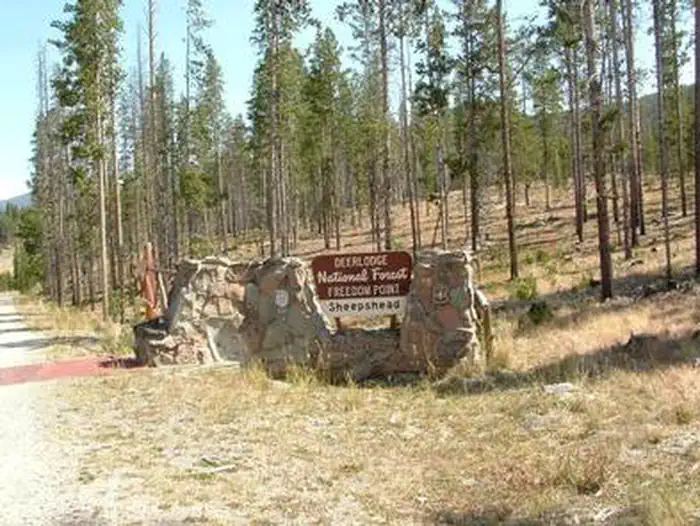

Member photos
Common questions about Freedom Point Picnic Area
- Can you reserve a site at Freedom Point Picnic Area?
- Yes, Freedom Point Picnic Area is reservable through Recreation.gov.
- How many campsites does Freedom Point Picnic Area have?
- 1 site.
Camping near Freedom Point Picnic Area
- Sheepshead Picnic Area 0.5 mi · Campground · we watch it
- Kading Cabin 19.5 mi · Campground · we watch it
- High Rye Cabin 20.1 mi · Campground · we watch it
- Lowland Campground and Picnic Area 2.1 mi · Campground
- Whitehouse Campground 7.7 mi · Campground
- Orofino Campground and Picnic Area 10.3 mi · Campground
- Jefferson Ranger District 12.3 mi · Facility
- Delmoe Lake Campground and Picnic Area 12.4 mi · Campground
- Butte-Jefferson Ranger Districts 14.9 mi · Facility
- Cromwell Dixon Campground 18.5 mi · Campground
- Pipestone Off-Highway Vehicle Area 19.6 mi · Facility
- Basin Canyon Campground and Picnic Area 20.6 mi · Campground
Contact
- Book Recreation.gov
Recreation.gov last updated this record on 2026-02-25.
Facility information and photographs from Recreation.gov (RIDB). SpotOpened is not affiliated with Recreation.gov or any federal agency.
Comments