Basin Montana Campground
Campground · Montana · 29 bookable sites ·
Managed by the USDA Forest Service
Custer National Forest (NF) · Open Access
- 29
- Bookable sites
- 45 ft
- Max rig length
- up to 8
- People per site
- 6
- Accessible sites
- 6,898 ft
- Elevation
Overview
Basin Campground is located 7 miles west of Red Lodge, Montana, along Forest Road 2071, which is paved all the way to the campground. The area is a popular location for hiking, backpacking and fishing.
Recreation
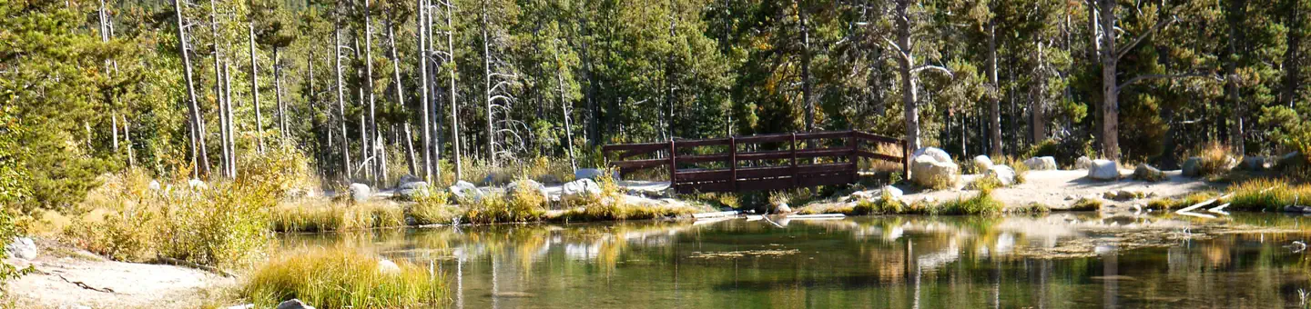
Fishing is a popular activity along the West Fork of Rock Creek and at nearby Wild Bill Lake. The small lake is open to kayaking and canoeing, and an accessible fishing dock is located on the shore.The Basin Lakes Trailhead is just across the road. Silver Run Plateau, West Fork and Timberline Lakes Trails offer access to the Absaroka-Beartooth Wilderness.
Mountain bikers enjoy the Ingles Creek Trail and a variety of loop trails at Silver Run. Biking is also allowed on the Basin Lakes Trail.
Facilities
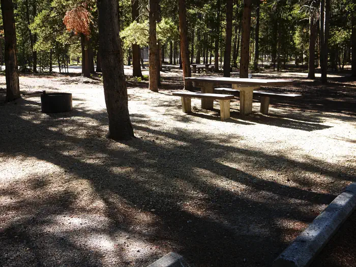
The campground offers several single-family sites, three of which are accessible. Each site is equipped with a picnic table and campfire ring with grill. Accessible vault toilets and drinking water are provided. Back-in spurs are medium length.Natural Features
The campground is situated on the banks of the West Fork of Rock Creek. The campground and the area surrounding the campground were burned by the Cascade Fire in 2008, leaving an open landscape abounding with wildflowers.Contact Info
For facility specific information, please call (928) 537-8888.Nearby Attractions
The charming town of Red Lodge, Montana offers a variety of dining and lodging options, galleries, shops and summer events. The Home of Champions Rodeo is held on Fourth of July weekend, Beartooth Bike Rally and Iron Horse Rodeo in mid-July, Mountain Man Rendezvous in late July and the Festival of Nations in early August.The Beartooth Highway was deemed "the most beautiful drive in America" by the late Charles Kuralt. It snakes across the rugged Beartooth Mountains from Red Lodge to Cooke City, Montana, and is the highest elevation highway in the Northern Rockies. Along the way, visitors are treated to sweeping views and plentiful outdoor recreation opportunities.
Charges & Cancellations
Refunds: Refund requests made through www.recreation.gov will be charged a $10 processing fee. This cancellation processing fee is retained by the reservation service contractor along with the non-refundable reservation fee. All requests for the return of the non-refundable reservation fee and the cancellation processing fee will be declined by the campground concessionaire as they did not receive these fees (these are the fees retained by the reservation contractor, a different entity).
The facts
- Season: 5/26 - 9/8 Weather Dependent — USDA Forest Service, Aug 24, 2026
- 29 bookable sites
- 30 sites in total, including non-bookable
- 6 accessible sites
- Vehicles up to 45 ft
- Up to 8 people per site
- Loops: AREA BASIN MONTANA CAMPGROUND
Site types
- 29 Standard Nonelectric
- 1 Management
Amenities
- Campfires allowed
- Fire pits
- Picnic tables
- Shade
- Pets allowed
Not recorded upstream: electric hookups, water hookups, sewer hookups, grills.
30 campsites at Basin Montana Campground
Check-in 2:00 PM · Check-out 1:00 PM
| Site | Loop | Type | Entry | Surface | Grade | Water | Max rig | People | |
|---|---|---|---|---|---|---|---|---|---|
| 01 Host | AREA BASIN MONTANA CAMPGROUND | Management | Back In | Paved | Slight | — | 30 ft | 8 | 🐾 |
| 02 | AREA BASIN MONTANA CAMPGROUND | Standard Nonelectric | Back In | Paved | Slight | — | 36 ft | 8 | ♿ 🐾 |
| 03 | AREA BASIN MONTANA CAMPGROUND | Standard Nonelectric | Back In | Paved | Slight | Riverfront | 36 ft | 8 | ♿ 🐾 |
| 04 | AREA BASIN MONTANA CAMPGROUND | Standard Nonelectric | Back In | Paved | — | — | 27 ft | 8 | ♿ 🐾 |
| 05 | AREA BASIN MONTANA CAMPGROUND | Standard Nonelectric | Back In | Paved | Slight | Riverfront | 27 ft | 8 | 🐾 |
| 06 | AREA BASIN MONTANA CAMPGROUND | Standard Nonelectric | Back In | Paved | Slight | — | 26 ft | 8 | 🐾 |
| 07 | AREA BASIN MONTANA CAMPGROUND | Standard Nonelectric | Back In | Paved | Slight | Riverfront | 24 ft | 8 | ♿ 🐾 |
| 08 | AREA BASIN MONTANA CAMPGROUND | Standard Nonelectric | Back In | Paved | Slight | — | 30 ft | 8 | 🐾 |
| 09 | AREA BASIN MONTANA CAMPGROUND | Standard Nonelectric | Back In | Paved | Slight | Riverfront | 30 ft | 8 | 🐾 |
| 10 | AREA BASIN MONTANA CAMPGROUND | Standard Nonelectric | Back In | Paved | Slight | Riverfront | 30 ft | 8 | 🐾 |
| 11 | AREA BASIN MONTANA CAMPGROUND | Standard Nonelectric | Back In | Paved | Slight | — | 28 ft | 8 | 🐾 |
| 12 | AREA BASIN MONTANA CAMPGROUND | Standard Nonelectric | Back In | Paved | Slight | — | 30 ft | 8 | 🐾 |
| 13 | AREA BASIN MONTANA CAMPGROUND | Standard Nonelectric | Back In | Paved | Slight | — | 26 ft | 8 | 🐾 |
| 14 | AREA BASIN MONTANA CAMPGROUND | Standard Nonelectric | Back In | Paved | Slight | — | 24 ft | 8 | 🐾 |
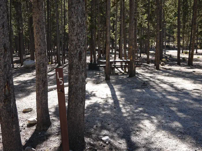
| 15 | AREA BASIN MONTANA CAMPGROUND | Standard Nonelectric | Back In | Paved | Slight | — | 27 ft | 8 | 🐾 |
| 16 | AREA BASIN MONTANA CAMPGROUND | Standard Nonelectric | Back In | Paved | Slight | — | 30 ft | 8 | ♿ 🐾 |
| 17 | AREA BASIN MONTANA CAMPGROUND | Standard Nonelectric | Back In | Paved | Slight | — | 35 ft | 8 | 🐾 |
| 18 | AREA BASIN MONTANA CAMPGROUND | Standard Nonelectric | Back In | Paved | Slight | — | 30 ft | 8 | 🐾 |
| 19 | AREA BASIN MONTANA CAMPGROUND | Standard Nonelectric | Back In | Paved | Slight | — | 32 ft | 8 | 🐾 |
| 20 | AREA BASIN MONTANA CAMPGROUND | Standard Nonelectric | Back In | Paved | Slight | — | 45 ft | 8 | 🐾 |
| 21 | AREA BASIN MONTANA CAMPGROUND | Standard Nonelectric | Back In | Paved | Slight | — | 32 ft | 8 | 🐾 |
| 22 | AREA BASIN MONTANA CAMPGROUND | Standard Nonelectric | Back In | Paved | Slight | — | 30 ft | 8 | 🐾 |
| 23 | AREA BASIN MONTANA CAMPGROUND | Standard Nonelectric | Back In | Paved | Slight | — | 27 ft | 8 | 🐾 |
| 24 | AREA BASIN MONTANA CAMPGROUND | Standard Nonelectric | Back In | Paved | Slight | — | 35 ft | 8 | 🐾 |
| 25 | AREA BASIN MONTANA CAMPGROUND | Standard Nonelectric | Back In | Paved | Slight | — | 35 ft | 8 | 🐾 |
| 26 | AREA BASIN MONTANA CAMPGROUND | Standard Nonelectric | Back In | Paved | Slight | — | 35 ft | 8 | 🐾 |
| 27 | AREA BASIN MONTANA CAMPGROUND | Standard Nonelectric | Back In | Paved | Slight | — | 32 ft | 8 | 🐾 |
| 28 | AREA BASIN MONTANA CAMPGROUND | Standard Nonelectric | Back In | Paved | Slight | — | 30 ft | 8 | ♿ 🐾 |
| 29 | AREA BASIN MONTANA CAMPGROUND | Standard Nonelectric | Back In | Paved | Slight | — | 40 ft | 8 | 🐾 |
| 30 | AREA BASIN MONTANA CAMPGROUND | Standard Nonelectric | Back In | Paved | Slight | — | 33 ft | 8 | 🐾 |
Getting there
45.16250, -109.39167 · 45°9'45.0"N 109°23'30.0"W
Typical weather
| Jan | Feb | Mar | Apr | May | Jun | Jul | Aug | Sep | Oct | Nov | Dec | |
|---|---|---|---|---|---|---|---|---|---|---|---|---|
| High °F | — | — | — | — | — | — | — | — | — | — | — | — |
| Low °F | — | — | — | — | — | — | — | — | — | — | — | — |
| Precip in | 1.2 | 1.6 | 2.5 | 4.3 | 5.0 | 3.2 | 1.8 | 1.6 | 2.2 | 3.0 | 1.8 | 1.4 |
1991–2020 averages from the nearest NOAA station, 2.8 mi away — not measured at the facility itself, and elevation can make a real difference over that distance.
Map
Fees and stay limits
The first vehicle is included in the basic fee; A second will be charged an extra $10 fee and collected at the campground, if your site will accomodate it. Firewood bundles can be purchased from the campground host.
From Recreation.gov, which is not always current. The operator's own page is the authority on what you will be charged.
More photos
Member photos
Common questions about Basin Montana Campground
- Can you reserve a site at Basin Montana Campground?
- Yes, Basin Montana Campground is reservable through Recreation.gov.
- How many campsites does Basin Montana Campground have?
- 30 sites in total, of which 29 can be booked.
- What is the maximum RV length at Basin Montana Campground?
- 45 ft. That is the longest vehicle the sites here are recorded as taking; individual sites may be shorter.
- Are pets allowed at Basin Montana Campground?
- Yes, pets are allowed at Basin Montana Campground.
- Are campfires allowed at Basin Montana Campground?
- Campfires are allowed at Basin Montana Campground. Check for a current fire restriction before you go.
Also listed by
Basin Montana Campground also appears in other federal recreation data. Facts below are matched by name and location, not confirmed by Basin Montana Campground's operator.
USDA Forest Service — data as of Aug 24, 2026
- $10 each additional vehicle
- $6 day use campground fee for over ½ hour
- 1/2 price fees for Interagency Senior and Access Pass holders
Accessibility:
- Handicap Accessible Facilities: Toilet and 3 campsites. Visit Recreation.gov for details.
Camping near Basin Montana Campground
- Cascade 3 mi · Campground · we watch it
- Sheridan 5.9 mi · Campground · we watch it
- Parkside 7 mi · Campground · we watch it
- Rattin Campground 7.1 mi · Campground · we watch it
- Limber Pine 7.3 mi · Campground · we watch it
- Greenough Lake 7.4 mi · Campground · we watch it
- Palisades Campground 4.1 mi · Campground
- Rattin Campground 6.1 mi · Campground
- Beartooth RD 7.6 mi · Facility
- Vista Point Observation Site 8.3 mi · Facility
- M-K Campground 8.8 mi · Campground
- M-K Campground 8.8 mi · Campground
Contact
- Phone 406-587-9054
- Email camping@rrmofa.com
- Book Recreation.gov
Recreation.gov last updated this record on 2026-03-11.
Facility information and photographs from Recreation.gov (RIDB). SpotOpened is not affiliated with Recreation.gov or any federal agency.
Comments