Pat's Bluff Day Use
Campground · Mississippi · 1 bookable site ·
Managed by the US Army Corps of Engineers
- 1
- Bookable site
- 1
- Accessible site
- 328 ft
- Elevation
Overview
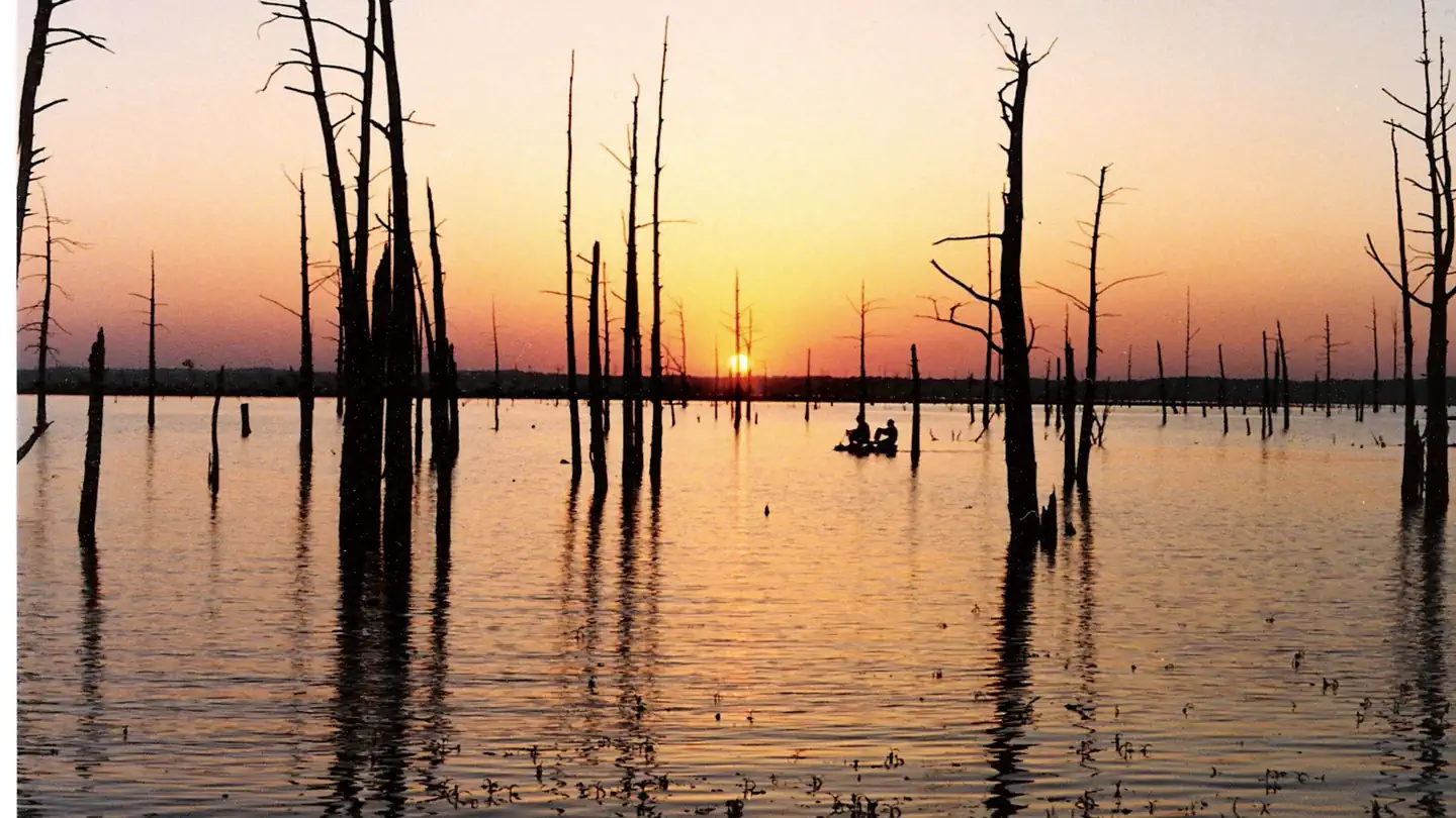
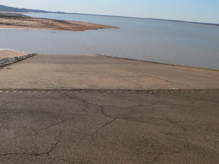
Pat’s Bluff is a recreation area with a pavilion, boat ramp and 15 site campground located on the southern shoreline of Sardis Lake. Conveniently located near I-55, Sardis Lake consistently ranks as one of the top crappie fishing location in the country. The 32,000 reservoir is also a great fishery for bass and catfish and offers many other outdoor activities as well.
Recreation
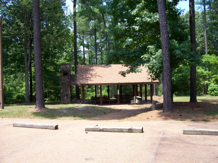
Pat's Bluff offers access to all the water activities Sardis Lake has to offer. Sardis Lake is known as one as the best crappie fishing lakes in the country. Sailing, skiing, kayaking, and fishing are all popular. Pat's Bluff also offers one group picnic shelter that can hold about 50 people.
Facilities
Pat’s Bluff has 15 campsites with water and electric hookups. Flush toilets, showers, and a dump station are available in the campground. The area also offers a group picnic shelter and a boat ramp.
Natural Features
Sardis Lake’s total area covers 98,000 acres in the rolling hills of North Mississippi. As part of Sardis Lake, Pat’s Bluff is appropriately named because of the sandstone bluff that prominent on the shoreline of Sardis Lake. The Pat’s Bluff Recreation Area is covered in a mixture of hardwood and pine forests that open up for great views of Sardis Lake.
Nearby Attractions
Pat’s Bluff campground is located off of MS Highway 278. It is a 20-minute drive to the university town of Oxford, MS (Home of Ole Miss) and a 10-minute drive to Batesville, MS. The towns of Sardis and Como are also nearby.
Contact Info
For facility specific information, please call (662) 563-4531.The facts
- 1 bookable site
- 1 site for day use only
- 1 accessible site
- Loops: Pats Bluff
Site types
- 1 Group Shelter Electric
1 campsite at Pat's Bluff Day Use
Check-in 08:00 AM · Check-out 10:00 PM
| Site | Loop | Type | Entry | Surface | Max rig | People | |
|---|---|---|---|---|---|---|---|
| Pats Bluff (136) | Pats Bluff | Group Shelter Electric | — | — | — | — | ♿ |
Getting there
From Interstate 55 take the Hwy. 278 east exit at Batesville, MS. Follow the road approximately 10 miles and take a left onto BlackJack Road. Follow Blackjack Road approximately 3/4 of a mile and turn right onto Sardis Lake Drive. Follow Sardis Lake Drive for approximately 6 miles and the road dead ends straight at Pat's Bluff Recreation Area. The road to the left leads to the picnic shelter and the boat ramp.
34.41811, -89.73405 · 34°25'5.2"N 89°44'2.6"W
Typical weather
Typically 92°F in Aug, down to 51°F in Jan.
| Jan | Feb | Mar | Apr | May | Jun | Jul | Aug | Sep | Oct | Nov | Dec | |
|---|---|---|---|---|---|---|---|---|---|---|---|---|
| High °F | 51 | 56 | 65 | 74 | 82 | 89 | 92 | 92 | 86 | 76 | 63 | 54 |
| Low °F | 33 | 37 | 44 | 52 | 62 | 70 | 74 | 72 | 66 | 54 | 43 | 36 |
| Precip in | 4.8 | 5.5 | 5.5 | 5.9 | 5.4 | 5.3 | 4.2 | 3.2 | 3.7 | 4.1 | 4.3 | 6.2 |
1991–2020 averages from the nearest NOAA station, 3.5 mi away — not measured at the facility itself, and elevation can make a real difference over that distance.
Map
Fees and stay limits
Pavilion Reservations are $100 per day
From Recreation.gov, which is not always current. The operator's own page is the authority on what you will be charged.
More photos
Member photos
Common questions about Pat's Bluff Day Use
- Can you reserve a site at Pat's Bluff Day Use?
- Yes, Pat's Bluff Day Use is reservable through Recreation.gov.
- How many campsites does Pat's Bluff Day Use have?
- 1 site.
Camping near Pat's Bluff Day Use
- Pat's Bluff 0.2 mi · Campground · we watch it
- Clear Creek (MS) 1.5 mi · Campground · we watch it
- Clear Creek Day Use Area (MS) 2.7 mi · Campground · we watch it
- Engineer Point 3.3 mi · Campground · we watch it
- Outlet Channel (Sardis) 3.4 mi · Campground · we watch it
- Big Acres 3.5 mi · Campground · we watch it
- Paradise Point 3.7 mi · Campground · we watch it
- Oak Grove (MS) 3.7 mi · Campground · we watch it
- Cypress Point 4.5 mi · Campground · we watch it
- Hurricane Landing 9.9 mi · Campground · we watch it
- Hurricane Landing Day Use 10.2 mi · Campground · we watch it
- Chickasaw Hill 18.3 mi · Campground · we watch it
Contact
- Phone 662-563-4531
- Email sardis.lake@usace.army.mil
- Book Recreation.gov
Recreation.gov last updated this record on 2026-02-25.
Facility information and photographs from Recreation.gov (RIDB). SpotOpened is not affiliated with Recreation.gov or any federal agency.
Comments