Clear Springs Recreation Area (MS)
Campground · Mississippi · 24 bookable sites ·
Managed by the USDA Forest Service
Homochitto National Forest (NF) · Open Access
- 24
- Bookable sites
- 99 ft
- Max rig length
- up to 100
- People per site
- 1
- Accessible site
- 346 ft
- Elevation
Overview
This location is available on a first-come, first-served basis only. Visitors are required to physically arrive at the campground to purchase and claim a site. Once on-site, you may be able to pay for your campsite(s) by scanning a QR code using the Recreation.gov mobile app, and the Scan and Pay feature. Only pay for a site that you have verified as vacant.
If this option is available, you will need to first download the free Recreation.gov mobile app https://www.recreation.gov/mobile-app prior to your arrival as some remote areas have limited or no cellular service.
This campground has 22 campsites and is generally open all year long. This location may be inaccessible at any time during the year due to weather and road conditions.
Recreation
Visitors will be able to bike, hike, canoe, fish, and view wildlife.
Facilities
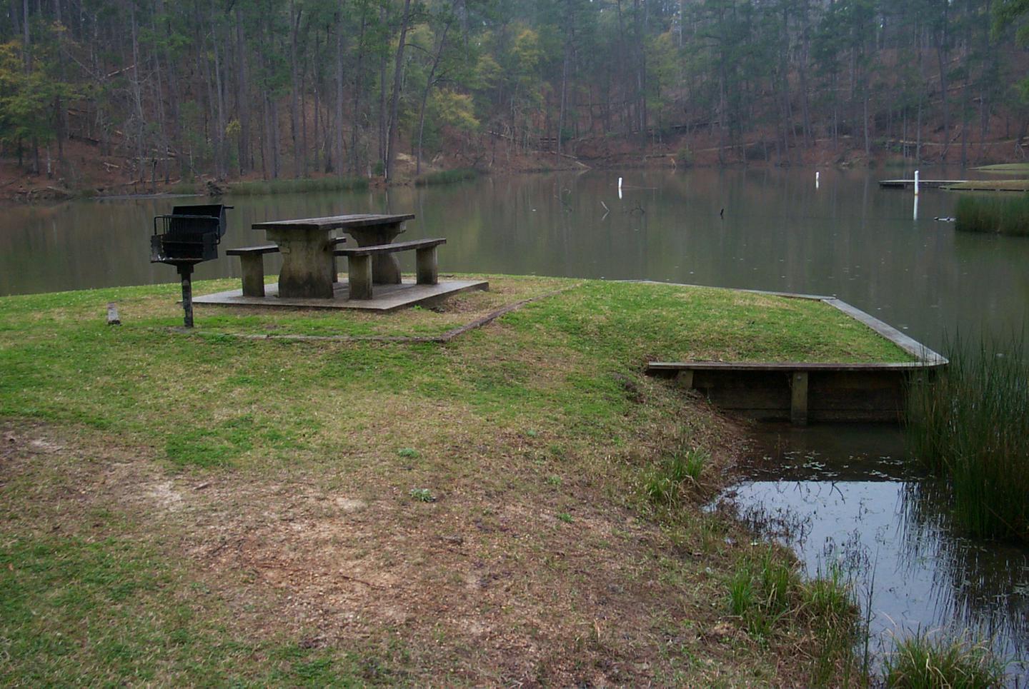
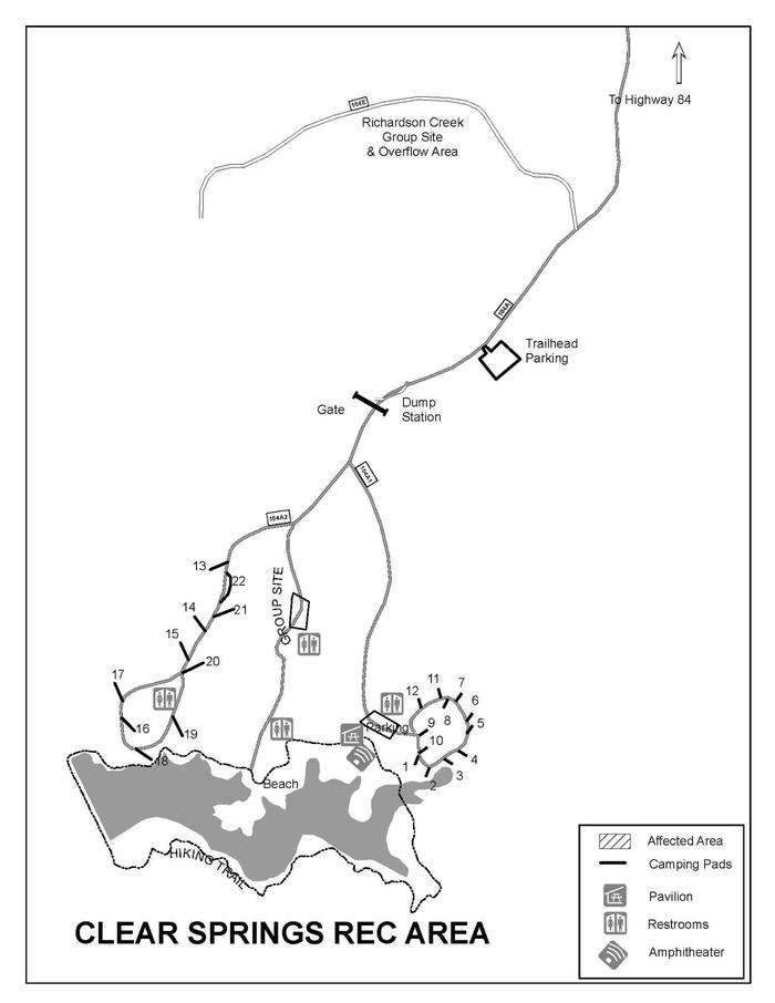
Facilities include camping, with 22 units with hookups for water and electricity. A group camp site(reservation required) 8 picnic tables within the day use area; A pavilion for 25-30 people(reservation required). Flush toilets and hot showers; A one mile hiking trail around the lake; An amphitheater. 10 miles hiking/mountain biking trail.
Natural Features
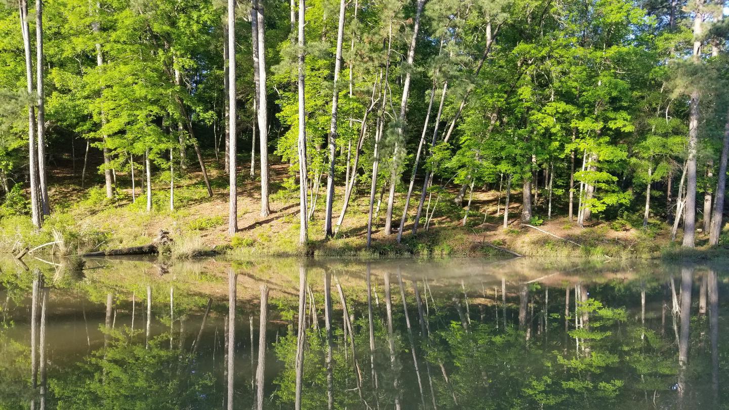
Clear Springs Recreation Areas is nestled in a secluded area of roling hills. The area, surrounded by tall stands of pine and mixed hardwood treees, provide visitors with a shady forest atmostpehere. A 10 acre lake connects both camping areas.
Contact Info
This location is unstaffed. To speak with our main office for general information, please call: (601) 384-5876.Nearby Attractions
- Okhissa lake is a 1,075 acre lake approximately 15 minutes away from the campground. It has a swim area, day use area, one boat launch. Fish that can be caught include catfish, largemouth bass, crappie, bluegill and other small panfish.
The facts
- 24 bookable sites
- 28 sites in total, including non-bookable
- 1 site for day use only
- 1 accessible site
- Vehicles up to 99 ft
- Up to 100 people per site
- Loops: Lower, Lower Loop, Scan and Pay, Upper, Upper Loop
Site types
- 22 RV Electric
- 4 Management
- 1 Group Shelter Electric
- 1 Shelter Electric
Amenities
- Electric hookups
- Water hookups
- Campfires allowed
- Shade
- Pets allowed
- Sewer hookups — not available
Not recorded upstream: fire pits, picnic tables, grills.
28 campsites at Clear Springs Recreation Area (MS)
| Site | Loop | Type | Entry | Surface | Grade | Access | Max rig | People | |
|---|---|---|---|---|---|---|---|---|---|
| 01 | Lower | Rv Electric | Back In | Paved | — | Drive In | 45 ft | 6 | 🐾 |
| 02 | Lower | Rv Electric | Back In | Paved | — | Drive In | 33 ft | 6 | 🐾 |
| 03 | Lower | Rv Electric | Back In | Paved | — | Drive In | 36 ft | 6 | 🐾 |
| 04 | Lower | Rv Electric | Back In | Paved | — | Drive In | 32 ft | 6 | 🐾 |
| 05 | Lower | Rv Electric | Back In | Paved | — | Drive In | 51 ft | 6 | 🐾 |
| 06 | Lower | Rv Electric | Back In | Paved | — | Drive In | 48 ft | 6 | 🐾 |
| 07 | Lower | Rv Electric | Back In | Paved | — | Drive In | 42 ft | 6 | 🐾 |
| 08 | Lower | Rv Electric | Back In | Paved | — | Drive In | 35 ft | 6 | 🐾 |
| 09 | Lower | Rv Electric | Back In | Paved | — | Drive In | 35 ft | 6 | 🐾 |
| 10 | Lower | Rv Electric | Back In | Paved | — | Drive In | 44 ft | 6 | 🐾 |
| 11 | Lower | Rv Electric | Back In | Paved | — | Drive In | 40 ft | 6 | 🐾 |
| 12 | Lower | Rv Electric | Back In | Paved | — | Drive In | 43 ft | 6 | 🐾 |
| Group Pavilion | Lower | Shelter Electric | — | — | — | Walk In | — | 100 | ♿ 🐾 |
| Sites 1-12 | Lower Loop | Management | — | — | — | — | — | 8 | 🐾 |
| ScanPay 4 | Scan and Pay | Management | — | — | — | — | — | — | |
| Standard | Scan and Pay | Management | — | — | — | — | — | — | |
| 13 | Upper | Rv Electric | Back In | Paved | — | Drive In | 23 ft | 6 | 🐾 |
| 14 | Upper | Rv Electric | Back In | Paved | — | Drive In | 59 ft | 6 | 🐾 |
| 15 | Upper | Rv Electric | Back In | Paved | — | Drive In | 61 ft | 6 | 🐾 |
| 16 | Upper | Rv Electric | Back In | Paved | — | Drive In | 30 ft | 6 | 🐾 |
| 17 | Upper | Rv Electric | Back In | Paved | — | Drive In | 44 ft | 6 | 🐾 |
| 18 | Upper | Rv Electric | Back In | Paved | — | Drive In | 39 ft | 6 | 🐾 |
| 19 | Upper | Rv Electric | Back In | Paved | — | Drive In | 47 ft | 6 | 🐾 |
| 20 | Upper | Rv Electric | Back In | Paved | — | Drive In | 33 ft | 6 | 🐾 |
| 21 | Upper | Rv Electric | Back In | Paved | — | Drive In | 57 ft | 6 | 🐾 |
| 22 | Upper | Rv Electric | Pull Through | Paved | — | Drive In | 99 ft | 6 | 🐾 |
| Group Campsite | Upper | Group Shelter Electric | Pull Through | Paved | Slight | — | 99 ft | 30 | 🐾 |
| Sites 13-22 | Upper Loop | Management | — | — | — | — | — | 8 |
Getting there
31.42917, -90.98333 · 31°25'45.0"N 90°58'60.0"W
Typical weather
Typically 92°F in Jul, down to 59°F in Jan.
| Jan | Feb | Mar | Apr | May | Jun | Jul | Aug | Sep | Oct | Nov | Dec | |
|---|---|---|---|---|---|---|---|---|---|---|---|---|
| High °F | 59 | 65 | 72 | 78 | 84 | 90 | 92 | 92 | 87 | 80 | 68 | 61 |
| Low °F | 36 | 39 | 46 | 52 | 61 | 69 | 71 | 70 | 65 | 54 | 44 | 39 |
| Precip in | 6.3 | 6.0 | 5.5 | 4.7 | 5.2 | 4.9 | 5.9 | 5.0 | 4.3 | 4.4 | 4.1 | 5.4 |
1991–2020 averages from the nearest NOAA station, 6.3 mi away — not measured at the facility itself, and elevation can make a real difference over that distance.
Map
More photos
Member photos
Common questions about Clear Springs Recreation Area (MS)
- Can you reserve a site at Clear Springs Recreation Area (MS)?
- Yes, Clear Springs Recreation Area (MS) is reservable through Recreation.gov.
- How many campsites does Clear Springs Recreation Area (MS) have?
- 28 sites in total, of which 24 can be booked.
- What is the maximum RV length at Clear Springs Recreation Area (MS)?
- 99 ft. That is the longest vehicle the sites here are recorded as taking; individual sites may be shorter.
- Are pets allowed at Clear Springs Recreation Area (MS)?
- Yes, pets are allowed at Clear Springs Recreation Area (MS).
- Does Clear Springs Recreation Area (MS) have hookups?
- Electric, Water.
- Are campfires allowed at Clear Springs Recreation Area (MS)?
- Campfires are allowed at Clear Springs Recreation Area (MS). Check for a current fire restriction before you go.
Also listed by
Clear Springs Recreation Area (MS) also appears in other federal recreation data. Facts below are matched by name and location, not confirmed by Clear Springs Recreation Area (MS)'s operator.
USDA Forest Service — data as of Aug 24, 2026
- Day Use Fees: Cars and trucks: $5 per vehicle Senior and Access Pass: $2.50 per vehicle Commercial vehicles, walk-ins and bicycles: $1 per person Senior and Access Pass: $.50 per person MS Adventure Pass: free Annual Pass: free Camping Fees: Campsite with hookups: $20 per night Senior and Access Pas
Restrictions:
- Boat trailers are prohibited.
Camping near Clear Springs Recreation Area (MS)
- Mount Locust Information Center Milepost 15.5 21.5 mi · Facility
- Melrose Visitor Center 24.8 mi · Visitor Center
- William Johnson House Visitor Center 26.5 mi · Visitor Center
- Natchez Visitor Center 26.7 mi · Facility
- Rocky Springs Campground, Milepost 54.8 46.8 mi · Campground
Contact
- Phone N/A
- Book Recreation.gov
Recreation.gov last updated this record on 2026-02-25.
Facility information and photographs from Recreation.gov (RIDB). SpotOpened is not affiliated with Recreation.gov or any federal agency.
Comments