Watercress
Campground · Missouri · 19 bookable sites ·
Managed by the USDA Forest Service
Mark Twain National Forest (NF) · Open Access
- 19
- Bookable sites
- 40 ft
- Max rig length
- up to 75
- People per site
- 465 ft
- Elevation
Overview
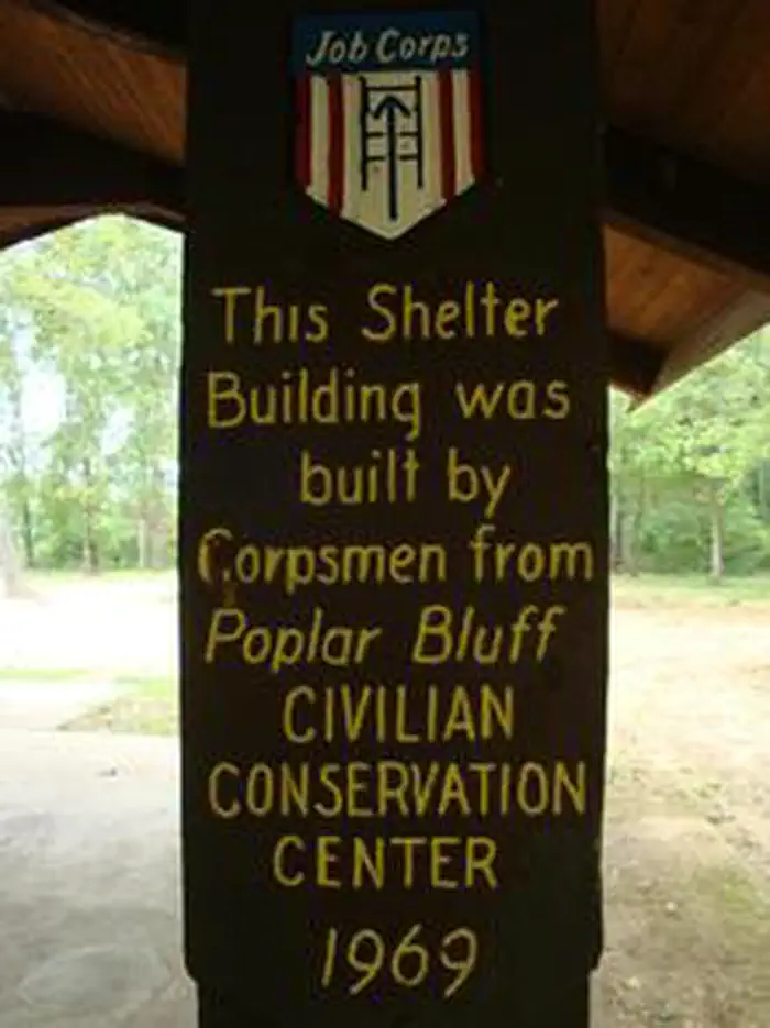
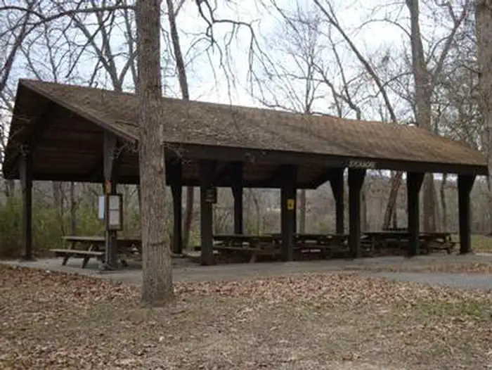
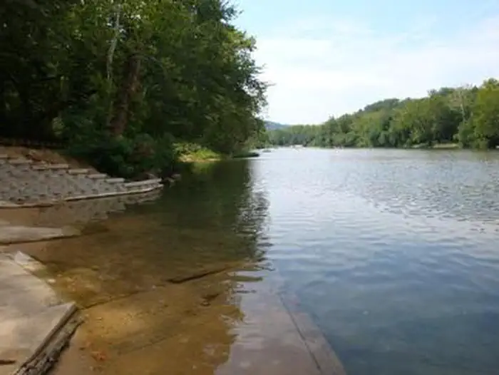
***Watercress sustained substantial damage to the pavilions during the 2017 flood, they are not reservable at this time, however the boat ramp is still open for public use.*** Watercress Campground lies on the banks one of the forest’s greatest treasures; the Current River. Floats on the river provide views of southeastern Missouri that otherwise can't be seen. The area is home to a variety of birds and wildlife and recreation opportunities are plentiful in the surrounding area.Recreation
Boating and canoeing on the Current River, as well as on other nearby rivers, are popular activities. A boat ramp for both motorized and non-motorized boats is available on the east bank of the Current River. Anglers enjoy fishing for bass, walleye, sunfish and the occasional catfish.Big Spring, Missouri's largest spring, is just five miles from the campground. Hikers at Watercress area enjoy the Songbird Trail, a 1.2-mile loop that leads to Watercress Spring, passing remnants of Civil War-era earthwork that overlook the Current River.
Facilities
The campground offers 17 campsites for tent or RV camping and the sites are available on a first-come, first-served basis. Each site is equipped with a table and campfire ring. Vault toilets and drinking water are provided.Two group picnic shelters which can accommodate up to 75 people each are located alongside the river. Each is equipped with tables and grills. A seasonal trash collection dumpster is also available between April 1 and October 1 at the campground entrance.
Natural Features
Located within the town of Van Buren, the campground and day use area are adjacent to the Current River, which flows past scenic bluffs, springs, caves as it meanders through the Mark Twain National Forest toward Doniphan, MO.Nearby Attractions
The campground is adjacent to the Ozark National Scenic Riverways, which is a series of protected rivers in the area managed by the National Park Service. More information about the National Park Service sites can be found here.The facts
- Season: May 1 – October 1 — USDA Forest Service, Aug 24, 2026
- 19 bookable sites
- 2 sites for day use only
- Vehicles up to 40 ft
- Up to 75 people per site
- Loops: WATERCRESS
Site types
- 17 Standard Nonelectric
- 2 Group Picnic Area
Amenities
- Electric hookups
- Campfires allowed
- Shade
- Pets allowed
- Water hookups — not available
- Sewer hookups — not available
Not recorded upstream: fire pits, picnic tables, grills.
19 campsites at Watercress
| Site | Loop | Type | Entry | Surface | Water | Max rig | People | |
|---|---|---|---|---|---|---|---|---|
| 01 | WATERCRESS | Standard Nonelectric | Back In | Gravel | Riverfront | 40 ft | 8 | 🐾 |
| 02 | WATERCRESS | Standard Nonelectric | Back In | Gravel | Riverfront | 40 ft | 8 | 🐾 |
| 03 | WATERCRESS | Standard Nonelectric | Back In | Gravel | Riverfront | 40 ft | 8 | 🐾 |
| 04 | WATERCRESS | Standard Nonelectric | Back In | Gravel | Riverfront | 40 ft | 8 | 🐾 |
| 05 | WATERCRESS | Standard Nonelectric | Back In | Gravel | Riverfront | 40 ft | 8 | 🐾 |
| 06 | WATERCRESS | Standard Nonelectric | Back In | Gravel | Riverfront | 40 ft | 8 | 🐾 |
| 07 | WATERCRESS | Standard Nonelectric | Back In | Gravel | Riverfront | 40 ft | 16 | 🐾 |
| 08 | WATERCRESS | Standard Nonelectric | Back In | Gravel | Riverfront | 40 ft | 8 | 🐾 |
| 09 | WATERCRESS | Standard Nonelectric | Back In | Gravel | Riverfront | 40 ft | 8 | 🐾 |
| 10 | WATERCRESS | Standard Nonelectric | Back In | Gravel | Riverfront | 40 ft | 8 | 🐾 |
| 11 | WATERCRESS | Standard Nonelectric | Back In | Gravel | Riverfront | 40 ft | 16 | 🐾 |
| 12 | WATERCRESS | Standard Nonelectric | Back In | Gravel | Riverfront | 40 ft | 8 | 🐾 |
| 13 | WATERCRESS | Standard Nonelectric | Back In | Gravel | Riverfront | 40 ft | 8 | 🐾 |
| 14 | WATERCRESS | Standard Nonelectric | Back In | Gravel | Riverfront | 40 ft | 8 | 🐾 |
| 15 | WATERCRESS | Standard Nonelectric | Back In | Gravel | Riverfront | 40 ft | 8 | 🐾 |
| 16 | WATERCRESS | Standard Nonelectric | Back In | Gravel | Riverfront | 40 ft | 8 | 🐾 |
| 17 | WATERCRESS | Standard Nonelectric | Back In | Gravel | Riverfront | 40 ft | 16 | 🐾 |
| Old Hickory Pavilion | WATERCRESS | Group Picnic Area | — | Paved | Riverfront | 36 ft | 75 | 🐾 |
| Sycamore Pavilion | WATERCRESS | Group Picnic Area | — | Paved | Riverfront | 36 ft | 75 | 🐾 |
Getting there
From Highway 60, drive north on Main Street to the National Park Service sign on Watercress Road. Turn north and drive just past the Park Service building complex, then make a left to Watercress Recreation Area. The picnic shelters are on the left toward the north end of the day use area.
37.00194, -91.01861 · 37°0'7.0"N 91°1'7.0"W
Typical weather
| Jan | Feb | Mar | Apr | May | Jun | Jul | Aug | Sep | Oct | Nov | Dec | |
|---|---|---|---|---|---|---|---|---|---|---|---|---|
| High °F | — | — | — | — | — | — | — | — | — | — | — | — |
| Low °F | — | — | — | — | — | — | — | — | — | — | — | — |
| Precip in | 3.1 | 2.8 | 4.6 | 5.4 | 5.7 | 4.3 | 3.3 | 3.5 | 4.0 | 3.7 | 4.7 | 3.6 |
1991–2020 averages from the nearest NOAA station, 6.7 mi away — not measured at the facility itself, and elevation can make a real difference over that distance.
Map
More photos
Member photos
Common questions about Watercress
- Can you reserve a site at Watercress?
- Yes, Watercress is reservable through Recreation.gov.
- How many campsites does Watercress have?
- 19 sites.
- What is the maximum RV length at Watercress?
- 40 ft. That is the longest vehicle the sites here are recorded as taking; individual sites may be shorter.
- Are pets allowed at Watercress?
- Yes, pets are allowed at Watercress.
- Does Watercress have hookups?
- Electric.
- Are campfires allowed at Watercress?
- Campfires are allowed at Watercress. Check for a current fire restriction before you go.
Also listed by
Watercress also appears in other federal recreation data. Facts below are matched by name and location, not confirmed by Watercress's operator.
USDA Forest Service — data as of Aug 24, 2026
- Single Sites: $10/night
- Double Sites: $20/night
Restrictions:
- No OHVs/ATVs/UTVs allowed to operate at this recreation area.
- No more than 8 people are permitted at any one site (16 for double sites).
- When fishing at Watercress Recreation Area, all limits apply and necessary permits are required.
- Maximum Stay Permitted (days): 14.
- No fireworks
Accessibility:
- The tables, grills and fire rings are accessible.
Camping near Watercress
- Big Spring 3.4 mi · Campground · we watch it
- Pinewoods Lake Rec Area 14.2 mi · Campground · we watch it
- Webb Creek Park 15.4 mi · Campground · we watch it
- River Road Park 16.6 mi · Campground · we watch it
- Piedmont Park 16.8 mi · Campground · we watch it
- Bluff View(clearwater Lake) 17.7 mi · Campground · we watch it
- Two Rivers 19.7 mi · Campground · we watch it
- Big Spring Entrance Station 3.9 mi · Visitor Center
- Pinewoods Lake Recreation Area 14.6 mi · Campground
- Stinking Pond Float Camp 21.2 mi · Campground
- Horseshoe Bend Float Camp 21.3 mi · Campground
- Barn Hollow Float Camp 21.5 mi · Campground
Contact
- Book Recreation.gov
Recreation.gov last updated this record on 2026-05-22.
Facility information and photographs from Recreation.gov (RIDB). SpotOpened is not affiliated with Recreation.gov or any federal agency.
Comments