Jacks Fork / Middle Current Backcountry Campsites
Campground · Missouri · 52 bookable sites ·
Managed by the National Park Service
- 52
- Bookable sites
- 50 ft
- Max rig length
- up to 6
- People per site
Overview
Jacks Fork / Middle Current Backcountry Campsites will be reservable in advance beginning October 1st, 2025. If calling the Recreation.gov Call Center to make your reservation, please state the campsite you are wanting to reserve is in the “Jacks Fork/Middle Current District” of Ozark National Scenic Riverways and then state the campground and site number. Please download the Recreation.gov app before starting your journey to the backcountry sites, as cell service can be limited or simply non existent in these remote areas of the park.
Within Ozark National Scenic Riverways, a "backcountry campground" refers to campgrounds with some basic amenities, but not as many as developed campgrounds. All backcountry sites have picnic tables, fire rings, lantern posts, and vault toilets.
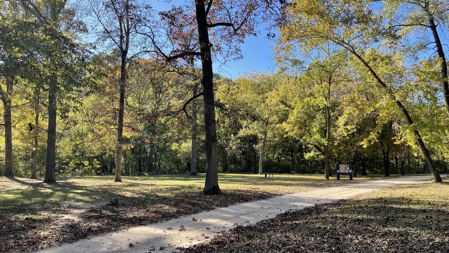
These campgrounds may have fewer amenities, but they are some of the most beautiful locations in the park. Certain sites are located right on the river's edge, allowing quick water access. Some sites are far away from other campers, giving you a chance to enjoy natural peace and quiet. If you crave a camping experience that is off the beaten path, these are the sites for you!
Keep in mind that these campgrounds are often harder to reach due to their location. Most backcountry sites require driving down gravel roads. Some roads are unsuitable for vehicles with low clearance.
Horse camping is not allowed within ONSR. Trail riders who desire to camp should contact local campgrounds with stables. Day trail riders can park horse trailers during daylight hours at Shawnee Staging Area and Broadfoot Staging Area.
Recreation
The river flows past the campground, offering excellent canoeing, tubing, swimming and fishing. Over 130 miles (209 km) of waterways exist within the park. Canoe and kayak rentals and outfitters can be found nearby.
Several miles of hiking and horseback riding trails crisscross the region, include the Alley Overlook Trail, Chubb Hollow Trail, Ozark Trail, Cave Spring Trail and Big Springs Trail.
Facilities
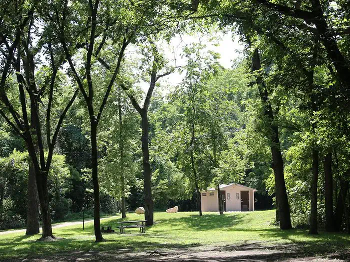
This campground has vault toilets available. Picnic tables, fire rings, and lantern posts are provided.
Natural Features
The Ozark National Scenic Riverways is known for its caves, springs, sinkholes and losing streams, and features over 300 identified caves within its boundaries. The caves range in size from a rock overhang to almost seven miles of identified passages. Eight caves, including an open sinkhole, have been designated as outstanding natural features.
The Ozark forest is mostly White oak and Shortleaf pine, Missouri's only native pine species. Along the rivers, Sycamore, Cottonwood, River birch and maples are common.
Redbud and dogwoods are also abundant, putting on a spectacular show during most spring months.
Nearby Attractions
Round Spring Cave is nearby, with ranger-guided tours offered daily during summer months. Historic and picturesque Alley Mill and Alley Spring are also nearby. The mill is open daily in the summer and ranger-guided tours are available upon request.
Scenic Big Spring is the largest freshwater spring in North America and produces an outflow of 280 million gallons a day.
Charges & Cancellations
With the backcountry sites now utilizing the Recreation.gov Scan and Pay system, there will not be any capability for changes and refunds. If you are unsure of your plans, please pay one night at a time.
The facts
- 52 bookable sites
- Vehicles up to 50 ft
- Up to 6 people per site
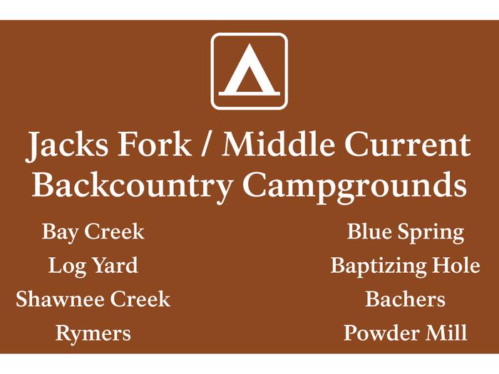
- Loops: Bachers Campground, Baptizing Hole Campground, Bay Creek Campground, Blue Spring Campground, Log Yard Campground, Powder Mill Campground, Rymers Campground, Shawnee Creek Campground
Site types
- 46 Standard Nonelectric
- 6 Tent Only Nonelectric
Amenities
- Campfires allowed
- Fire pits
- Picnic tables
- Shade
- Pets allowed
- Water hookups — not available
- Sewer hookups — not available
Not recorded upstream: electric hookups, grills.
52 campsites at Jacks Fork / Middle Current Backcountry Campsites
Check-in 1:00 PM · Check-out 12:00 PM
| Site | Loop | Type | Entry | Surface | Grade | Access | Water | Max rig | People | |
|---|---|---|---|---|---|---|---|---|---|---|
| Bachers Campground - Site 10 | Bachers Campground | Standard Nonelectric | — | — | — | Drive In | Riverfront | 18 ft | 6 | 🐾 |
| Baptizing Hole Campground - Site 8 | Baptizing Hole Campground | Standard Nonelectric | — | — | — | Drive In | Riverfront | 18 ft | 6 | 🐾 |
| Baptizing Hole Campground - Site 9 | Baptizing Hole Campground | Standard Nonelectric | — | — | — | Drive In | Riverfront | 18 ft | 6 | 🐾 |
| Bay Creek Campground - Site 1 | Bay Creek Campground | Standard Nonelectric | Parallel | — | Slight | Drive In | Riverfront | 25 ft | 6 | 🐾 |
| Bay Creek Campground - Site 10 | Bay Creek Campground | Standard Nonelectric | Back In | Gravel | Slight | Drive In | Riverfront | 18 ft | 6 | 🐾 |
| Bay Creek Campground - Site 11 | Bay Creek Campground | Standard Nonelectric | Pull Through | — | Slight | Drive In | Riverfront | 25 ft | 6 | 🐾 |
| Bay Creek Campground - Site 2 | Bay Creek Campground | Standard Nonelectric | Parallel | — | Slight | Drive In | Riverfront | 25 ft | 6 | 🐾 |
| Bay Creek Campground - Site 3 | Bay Creek Campground | Standard Nonelectric | Parallel | — | Slight | Drive In | Riverfront | 25 ft | 6 | 🐾 |
| Bay Creek Campground - Site 4 | Bay Creek Campground | Standard Nonelectric | Parallel | — | Slight | Drive In | Riverfront | 25 ft | 6 | 🐾 |
| Bay Creek Campground - Site 5 | Bay Creek Campground | Standard Nonelectric | Parallel | — | Slight | Drive In | Riverfront | 25 ft | 6 | 🐾 |
| Bay Creek Campground - Site 6 | Bay Creek Campground | Standard Nonelectric | Parallel | — | Slight | Drive In | Riverfront | 25 ft | 6 | 🐾 |
| Bay Creek Campground - Site 7 | Bay Creek Campground | Standard Nonelectric | Back In | Gravel | Slight | Drive In | Riverfront | 18 ft | 6 | 🐾 |
| Bay Creek Campground - Site 8 | Bay Creek Campground | Standard Nonelectric | Back In | Gravel | Slight | Drive In | Riverfront | 18 ft | 6 | 🐾 |
| Bay Creek Campground - Site 9 | Bay Creek Campground | Standard Nonelectric | Back In | Gravel | Slight | Drive In | Riverfront | 18 ft | 6 | 🐾 |
| Blue Spring Campground - Site 1 | Blue Spring Campground | Standard Nonelectric | Back In | Paved | Slight | Drive In | Riverfront | 22 ft | 6 | 🐾 |
| Blue Spring Campground - Site 2 | Blue Spring Campground | Standard Nonelectric | — | — | — | Drive In | Riverfront | 14 ft | 6 | 🐾 |
| Blue Spring Campground - Site 3 | Blue Spring Campground | Tent Only Nonelectric | — | — | — | Walk In | Riverfront | — | 6 | 🐾 |
| Blue Spring Campground - Site 4 | Blue Spring Campground | Tent Only Nonelectric | — | — | — | Walk In | Riverfront | — | 6 | 🐾 |
| Blue Spring Campground - Site 5 | Blue Spring Campground | Tent Only Nonelectric | — | — | — | Walk In | Riverfront | — | 6 | 🐾 |
| Blue Spring Campground - Site 6 | Blue Spring Campground | Standard Nonelectric | Back In | Gravel | Moderate | Drive In | Riverfront | 18 ft | 6 | 🐾 |
| Blue Spring Campground - Site 7 | Blue Spring Campground | Standard Nonelectric | Back In | Gravel | Moderate | Drive In | Riverfront | 18 ft | 6 | 🐾 |
| Log Yard Campground - Site 1 | Log Yard Campground | Standard Nonelectric | — | — | Slight | Drive In | Riverfront | 25 ft | 6 | 🐾 |
| Log Yard Campground - Site 10 | Log Yard Campground | Standard Nonelectric | Pull Through | Gravel | Moderate | Drive In | Riverfront | 35 ft | 6 | 🐾 |
| Log Yard Campground - Site 11 | Log Yard Campground | Standard Nonelectric | Pull Through | Gravel | Moderate | Drive In | Riverfront | 35 ft | 6 | 🐾 |
| Log Yard Campground - Site 12 | Log Yard Campground | Standard Nonelectric | Pull Through | Gravel | Moderate | Drive In | Riverfront | 35 ft | 6 | 🐾 |
| Log Yard Campground - Site 13 | Log Yard Campground | Standard Nonelectric | Pull Through | Gravel | Moderate | Drive In | Riverfront | 35 ft | 6 | 🐾 |
| Log Yard Campground - Site 14 | Log Yard Campground | Standard Nonelectric | Pull Through | Gravel | Moderate | Drive In | Riverfront | 35 ft | 6 | 🐾 |
| Log Yard Campground - Site 2 | Log Yard Campground | Standard Nonelectric | — | — | Slight | Drive In | Riverfront | 25 ft | 6 | 🐾 |
| Log Yard Campground - Site 3 | Log Yard Campground | Standard Nonelectric | — | — | Slight | Drive In | Riverfront | 25 ft | 6 | 🐾 |
| Log Yard Campground - Site 4 | Log Yard Campground | Standard Nonelectric | — | — | Slight | Drive In | Riverfront | 25 ft | 6 | 🐾 |
| Log Yard Campground - Site 5 | Log Yard Campground | Standard Nonelectric | — | — | Slight | Drive In | Riverfront | 25 ft | 6 | 🐾 |
| Log Yard Campground - Site 6 | Log Yard Campground | Standard Nonelectric | — | — | Slight | Drive In | Riverfront | 25 ft | 6 | 🐾 |
| Log Yard Campground - Site 7 | Log Yard Campground | Standard Nonelectric | — | — | Slight | Drive In | Riverfront | 20 ft | 6 | 🐾 |
| Log Yard Campground - Site 8 | Log Yard Campground | Standard Nonelectric | Pull Through | Gravel | Moderate | Drive In | Riverfront | 35 ft | 6 | 🐾 |
| Log Yard Campground - Site 9 | Log Yard Campground | Standard Nonelectric | Pull Through | Gravel | Moderate | Drive In | Riverfront | 35 ft | 6 | 🐾 |
| Powder Mill Campground - Site 1 | Powder Mill Campground | Standard Nonelectric | Back In | — | — | Drive In | Riverfront | 50 ft | 6 | 🐾 |
| Powder Mill Campground - Site 2 | Powder Mill Campground | Standard Nonelectric | Back In | Gravel | Slight | Drive In | Riverfront | 50 ft | 6 | 🐾 |
| Powder Mill Campground - Site 3 | Powder Mill Campground | Standard Nonelectric | Back In | Gravel | Slight | Drive In | Riverfront | 50 ft | 6 | 🐾 |
| Powder Mill Campground - Site 4 | Powder Mill Campground | Standard Nonelectric | Back In | Gravel | Slight | Drive In | Riverfront | 50 ft | 6 | 🐾 |
| Powder Mill Campground - Site 5 | Powder Mill Campground | Standard Nonelectric | Back In | Gravel | Slight | Drive In | Riverfront | 50 ft | 6 | 🐾 |
| Powder Mill Campground - Site 6 | Powder Mill Campground | Standard Nonelectric | Back In | Gravel | Slight | Drive In | Riverfront | 50 ft | 6 | 🐾 |
| Powder Mill Campground - Site 7 | Powder Mill Campground | Standard Nonelectric | Back In | Gravel | Slight | Drive In | Riverfront | 50 ft | 6 | 🐾 |
| Powder Mill Campground - Site 8 | Powder Mill Campground | Standard Nonelectric | Back In | Gravel | Slight | Drive In | Riverfront | 50 ft | 6 | 🐾 |
| Rymers Campground - Site 1 | Rymers Campground | Standard Nonelectric | Back In | — | Slight | Drive In | Riverfront | 20 ft | 6 | 🐾 |
| Rymers Campground - Site 2 | Rymers Campground | Standard Nonelectric | Back In | — | Slight | Drive In | Riverfront | 20 ft | 6 | 🐾 |
| Rymers Campground - Site 3 | Rymers Campground | Standard Nonelectric | Back In | — | Slight | Drive In | Riverfront | 20 ft | 6 | 🐾 |
| Shawnee Creek Campground - Site 1 | Shawnee Creek Campground | Standard Nonelectric | Back In | Gravel | Slight | Drive In | Riverfront | 30 ft | 6 | 🐾 |
| Shawnee Creek Campground - Site 2 | Shawnee Creek Campground | Standard Nonelectric | Back In | Gravel | Slight | Drive In | Riverfront | 30 ft | 6 | 🐾 |
| Shawnee Creek Campground - Site 3 | Shawnee Creek Campground | Standard Nonelectric | Back In | Gravel | Slight | Drive In | Riverfront | 30 ft | 6 | 🐾 |
| Shawnee Creek Campground - Site 4 | Shawnee Creek Campground | Tent Only Nonelectric | — | Gravel | Slight | Drive In | Riverfront | — | 6 | 🐾 |
| Shawnee Creek Campground - Site 5 | Shawnee Creek Campground | Tent Only Nonelectric | — | Gravel | Slight | Drive In | Riverfront | — | 6 | 🐾 |
| Shawnee Creek Campground - Site 6 | Shawnee Creek Campground | Tent Only Nonelectric | — | Gravel | Slight | Drive In | Riverfront | — | 6 | 🐾 |
Getting there
POWDER MILL:
Physical Address
NPS Road 509 Eminence Township, MO 63638
Directions
Powder Mill can be found 13.5 miles east of Eminence, MO. From Eminence, drive east on Highway 106. After roughly 13 miles, you will cross a bridge over the Current River. After the bridge, take the first right towards the Powder Mill Campground. Drive down the side road until you find a large grass field; this field is the campground.
LOG YARD:
Physical Address
County Road 555 Winona Township, MO 63638
Directions
Log Yard is located about 30 minutes from Eminence, MO. Starting in Eminence, head east on State Highway 106. After 16.25 miles, turn south onto Highway HH. Stay on HH for about 6 miles, until it dead-ends into County Road 555. Turn west and follow the gravel road until you reach the campground (less than a mile). This route requires driving on gravel roads for less than one mile.
BAY CREEK:
Physical Address
County Road 106-425 Summersville, MO 65571
Directions
Starting in Eminence, drive west on Highway 106. After about 9.7 miles, turn left onto County Road 106-425. Stay straight on the main path as it heads into the woods. Follow the gravel road for just over 2 miles, until it runs into Bay Creek. This route requires driving on gravel roads for about 2 miles.
BLUE SPRING and BAPTIZING HOLE (JACKS FORK):
Physical Address
County Road OO-493 Mountain View, MO 65548
Directions
Blue Spring Campground is located about 15 minutes from Mountain View, MO. Starting in Mountain View, drive east on Highway 60. After 3 miles, turn left onto Highway OO. Drive north on Highway OO for about 2.5 miles. After a large bend in the road, it will intersect with County Road OO-493. Take the left turn onto OO-493. Follow the main path for about 2 miles, after which it will dead-end into Blue Spring Campground. This route requires driving on gravel roads for about 2 miles. (Baptizing Hole is located on a spur of OO-493 on the right, just before you drop down into Blue Spring campground).
BACHERS:
Physical Address
County Road 493B Mountain View, MO 65548
Directions
Bachers Campground is located about 20 minutes from Mountain View, MO. This route follows gravel roads for 3 miles. High clearance is recommended. Starting in Mountain View, drive east on Highway 60. After 3 miles, turn left onto Highway OO. Drive north on Highway OO for about 2.5 miles. After a large bend in the road, it will intersect with County Road OO-493. Take the left turn onto OO-493. Follow the main path for about 1.4 miles, then turn right onto 493B. Follow this road for 1.6 miles to Bachers. Please note that there is only 1 campsite located at Bachers.
RYMERS:
Physical Address
County Road M-471 Birch Tree, MO 65438
Directions
Rymers Campground is roughly 20 minutes from Birch Tree, Missouri. This route requires driving on rough, narrow gravel roads for about 2.5 miles. High clearance is recommended. Starting in Birch Tree, head west on Highway 60. After 4 miles, turn north onto State Highway M. Stay on this road for 1.5 miles, then take the right turn to stay on M. After another 2 miles, the road will turn to gravel - this is County Road M-471. Stay on the main path until you reach Rymers Campground, about 2.5 miles away.
SHAWNEE:
Physical Address
County Road 106-211 Eminence, MO 65466
Directions
Shawnee Creek Campground is located roughly 12 minutes from Eminence, MO. Starting in Eminence, head east on Highway 106. After 3 miles, you will cross a bridge over Shawnee Creek. Take the next left onto County Road 106-211. Follow this road for about 2 miles, at which point it will dead-end into Shawnee Creek Campground. This route requires driving on gravel roads for about 2 miles. The horse staging area is near the intersection just before the campground.
Fees and stay limits
Backcountry campgrounds are available on a first-come, first-served basis. Campers simply select their site, set up their tent/RV, then proceed to the bulletin board for payment. Upper Current District Backcountry Campsites will be reservable in advance beginning October 1st, 2025. Until then, all backcountry sites are payable upon arrival using Scan & Pay on your mobile device until September 30th, 2025. Please download the Recreation.gov app before starting your journey to the backcountry sites, as cell service can be limited or simply non existent in these remote areas of the park. Beginning April 15, 2025, backcountry sites will require a fee year-round. Payment is only accepted through Scan & Pay, via the Recreation.gov app until October 1st, 2025 at which time all backcountry sites will be reservable on Recreation.gov website, app or by calling 1-877-444-6777.
From Recreation.gov, which is not always current. The operator's own page is the authority on what you will be charged.
More photos
Member photos
Common questions about Jacks Fork / Middle Current Backcountry Campsites
- Can you reserve a site at Jacks Fork / Middle Current Backcountry Campsites?
- Yes, Jacks Fork / Middle Current Backcountry Campsites is reservable through Recreation.gov.
- How many campsites does Jacks Fork / Middle Current Backcountry Campsites have?
- 52 sites.
- What is the maximum RV length at Jacks Fork / Middle Current Backcountry Campsites?
- 50 ft. That is the longest vehicle the sites here are recorded as taking; individual sites may be shorter.
- Are pets allowed at Jacks Fork / Middle Current Backcountry Campsites?
- Yes, pets are allowed at Jacks Fork / Middle Current Backcountry Campsites.
- Does Jacks Fork / Middle Current Backcountry Campsites have hookups?
- No hookups are recorded here.
- Are campfires allowed at Jacks Fork / Middle Current Backcountry Campsites?
- Campfires are allowed at Jacks Fork / Middle Current Backcountry Campsites. Check for a current fire restriction before you go.
Contact
- Phone 573-323-4236
- Book Recreation.gov
Recreation.gov last updated this record on 2026-06-13.
Facility information and photographs from Recreation.gov (RIDB). SpotOpened is not affiliated with Recreation.gov or any federal agency.
Comments