Jeanette Lake
Campground · Minnesota · 12 bookable sites ·
Managed by the USDA Forest Service
Boundary Waters Canoe Area Mining Protection Area Mineral Reserve Area (Mineral Reserve Area) · Open Access
- 12
- Bookable sites
- 35 ft
- Max rig length
- up to 9
- People per site
- 1,357 ft
- Elevation
Overview
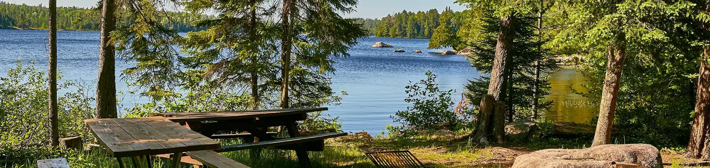
Jeanette Lake Campground is a small, single-loop campground on a peninsula reaching out onto the glacier-carved Lake Jeanette in Superior National Forest. Originally built by the Civilian Conservation Corps in the 1930s, this sweet, picturesque campground is well worth the drive.The facility provides sites that are usually accessible to RVs and tent trailers along with tent-only and hike-in sites.
Superior National Forest, located in northeastern Minnesota's arrowhead region, is comprised of three million acres. The forest spans 150 miles along the United States-Canada border. Visitors can find recreation opportunities year-round, including travel in the famous Boundary Waters Canoe Area Wilderness.
Recreation
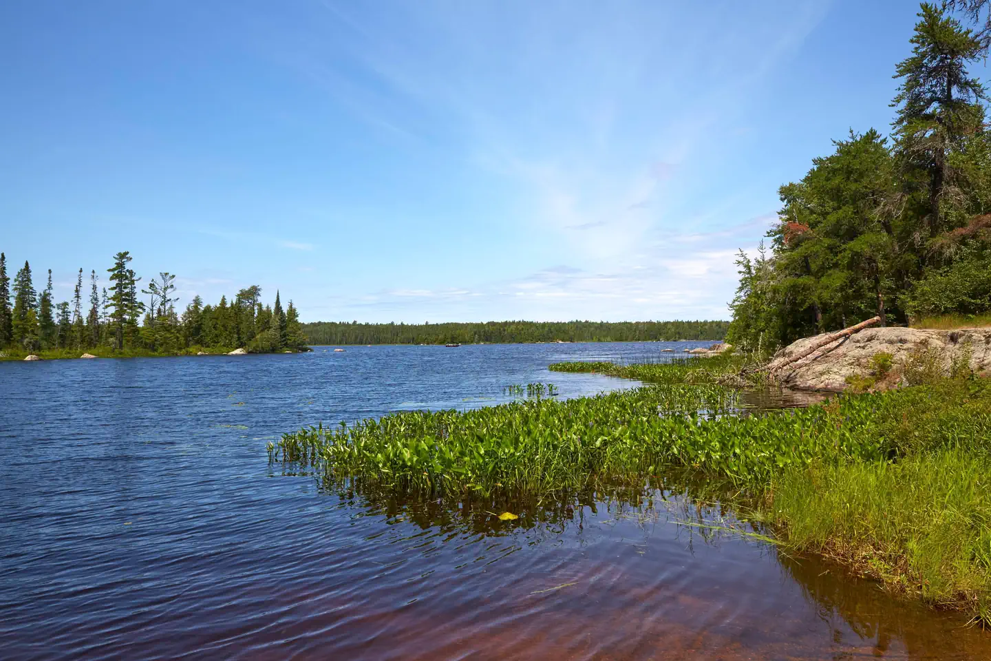
The winding shoreline and islands make the 638-acre Lake Jeanette a great place to explore in a canoe or kayak. Fishing opportunities include walleye, northern pike and perch. The campground provides access to the Astrid Lake Hiking Trail for those who want to stretch their legs.The surrounding national forest offers a wide variety of recreational opportunities, including hiking in secluded woodlands and canoeing in pristine lakes and rivers.
View recreation guides and maps of hiking trails and canoe routes in the national forest.
Facilities
There are 12 sites total with six reservable standard sites, 4 First Come First Serve standard sites, and two First Come First Serve tent-only sites.
Most sites have a view of the lake and some are located on the lakeshore. The campsites are close together providing fair privacy, except for walk-in sites which enjoy excellent privacy.
The walk-in tent sites have an additional backcountry latrine nearby (campers may want to bring toilet paper).
Lake Jeanette also has six dispersed backcountry sites that are first-come, first-served and accessible only by boat.
Natural Features
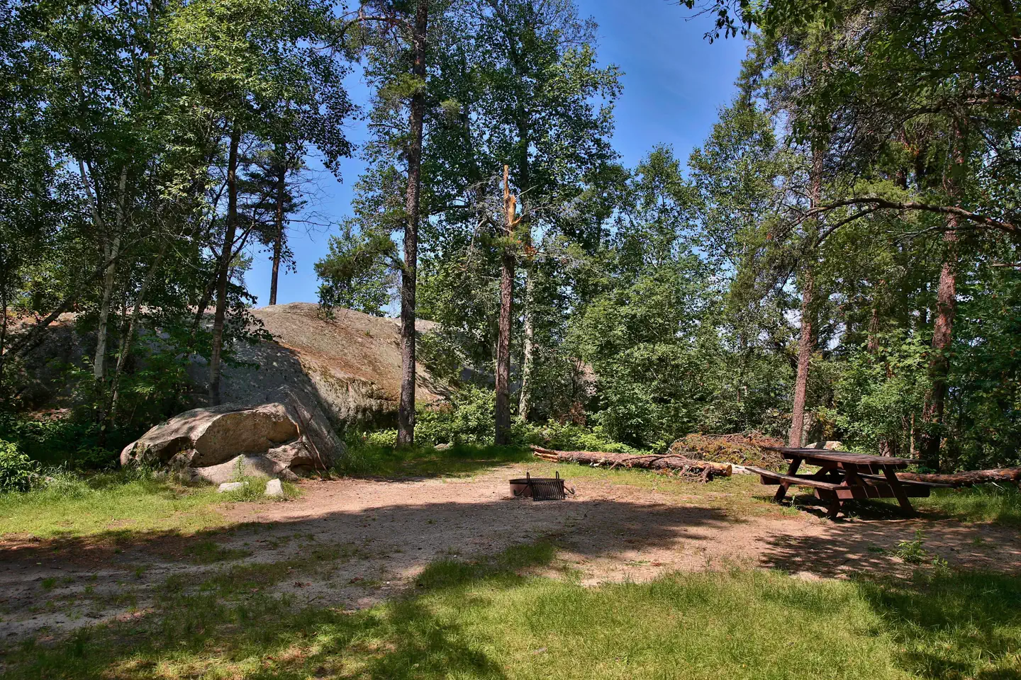
Lake Jeanette is not the largest or most isolated lake in the national forest, but it feels like it is both. Created long ago by a massive glacier, this lake is considered by many to be a special location.The campground is wooded with a pleasant mix of hardwoods, pine and spruce providing shade for most sites. The understory of fern, wildflowers and grass is kept under control by mowing, giving the campground a manicured appearance.
Glacial "erratics" (massive boulders) left behind by the receding glacier give the campground character and a place for moss to grow.
Nearby Attractions
Possible day trips from the campground include Voyageurs National Park, Crane Lake and Vermillion Falls.Numerous outdoor recreation opportunities lie within Superior National Forest's 77 lake accesses, 13 fishing piers, 10 swimming beaches and 22 picnic areas. The forest is also home to three scenic byways and the Boundary Waters Canoe Area Wilderness.
Additional sites of interest
The facts
- Season: May 9 – September 2 — USDA Forest Service, Aug 24, 2026
- 12 bookable sites
- 14 sites in total, including non-bookable
- Vehicles up to 35 ft
- Up to 9 people per site
- Loops: JEAN, Jean
Site types
- 9 Standard Nonelectric
- 3 Tent Only Nonelectric
- 2 Management
Amenities
- Campfires allowed
- Shade
- Pets allowed
- Water hookups — not available
Not recorded upstream: electric hookups, sewer hookups, fire pits, picnic tables, grills.
14 campsites at Jeanette Lake
Check-in 2:00 PM · Check-out 1:00 PM
| Site | Loop | Type | Entry | Surface | Access | Max rig | People | |
|---|---|---|---|---|---|---|---|---|
| 01 | JEAN | Standard Nonelectric | Back In | Gravel | Drive In | 35 ft | 9 | 🐾 |
| 02 | JEAN | Standard Nonelectric | Back In | Gravel | Drive In | 35 ft | 9 | 🐾 |
| 03 | JEAN | Standard Nonelectric | Back In | Gravel | Drive In | 35 ft | 9 | 🐾 |
| 04 | JEAN | Tent Only Nonelectric | Parallel | Gravel | Drive In | 20 ft | 9 | 🐾 |
| 05 | JEAN | Standard Nonelectric | Back In | Gravel | Drive In | 35 ft | 9 | 🐾 |
| 06 | JEAN | Standard Nonelectric | Back In | Gravel | Drive In | 35 ft | 9 | 🐾 |
| 07 | JEAN | Standard Nonelectric | Back In | Gravel | Drive In | 35 ft | 9 | 🐾 |
| 08 | JEAN | Standard Nonelectric | Parallel | Gravel | — | 35 ft | 9 | 🐾 |
| 09 | JEAN | Standard Nonelectric | Back In | Gravel | Drive In | 35 ft | 9 | 🐾 |
| 10 | JEAN | Standard Nonelectric | Back In | Gravel | Drive In | 35 ft | 9 | 🐾 |
| 11 | JEAN | Tent Only Nonelectric | — | Gravel | Hike In | — | 9 | 🐾 |
| 12 | JEAN | Tent Only Nonelectric | — | — | Hike In | — | 9 | 🐾 |
| Standard S&P | Jean | Management | Back In | Gravel | Drive In | — | 9 | 🐾 |
| Tent S&P | Jean | Management | — | Gravel | Hike In | — | 9 | 🐾 |
Getting there
48.13222, -92.29583 · 48°7'56.0"N 92°17'45.0"W
Typical weather
Typically 77°F in Jul, down to 15°F in Jan.
| Jan | Feb | Mar | Apr | May | Jun | Jul | Aug | Sep | Oct | Nov | Dec | |
|---|---|---|---|---|---|---|---|---|---|---|---|---|
| High °F | 15 | 21 | 35 | 48 | 63 | 72 | 77 | 75 | 65 | 50 | 34 | 21 |
| Low °F | -5 | -2 | 11 | 26 | 40 | 51 | 56 | 54 | 46 | 34 | 20 | 5 |
| Precip in | 1.1 | 0.7 | 1.1 | 1.8 | 2.7 | 4.0 | 4.5 | 3.5 | 3.3 | 2.5 | 1.6 | 1.0 |
1991–2020 averages from the nearest NOAA station, 19.8 mi away — not measured at the facility itself, and elevation can make a real difference over that distance.
Map
More photos
Member photos
Common questions about Jeanette Lake
- Can you reserve a site at Jeanette Lake?
- Yes, Jeanette Lake is reservable through Recreation.gov.
- How many campsites does Jeanette Lake have?
- 14 sites in total, of which 12 can be booked.
- What is the maximum RV length at Jeanette Lake?
- 35 ft. That is the longest vehicle the sites here are recorded as taking; individual sites may be shorter.
- Are pets allowed at Jeanette Lake?
- Yes, pets are allowed at Jeanette Lake.
- Does Jeanette Lake have hookups?
- No hookups are recorded here.
- Are campfires allowed at Jeanette Lake?
- Campfires are allowed at Jeanette Lake. Check for a current fire restriction before you go.
Also listed by
Jeanette Lake also appears in other federal recreation data. Facts below are matched by name and location, not confirmed by Jeanette Lake's operator.
USDA Forest Service — data as of Aug 24, 2026
- Single Site: $18/night
Restrictions:
- Maximum of 9 people per site. There is space for 2 vehicles (a towed camper counts as 1 vehicle). Additional vehicles on the site require additional half fee and must park on the spur. No vehicles may park on the grass or where they impede traffic. ATVs not allowed.
Camping near Jeanette Lake
- Echo Lake (Minn) 9.4 mi · Campground · we watch it
- Astrid Lake Area 2.5 mi · Facility
- Picket Lake 4.4 mi · Campground
- Crane Lake 12.4 mi · Campground
- Crane Lake Visitor Center 12.7 mi · Visitor Center
- Big Lake 14.3 mi · Campground
- Myrtle Lake 16.9 mi · Campground
- Agassa Lake 17 mi · Campground
- Lake Vermilion 17.1 mi · Facility
- Franklin Lake 17.6 mi · Campground
- Johnson Lake 18.1 mi · Campground
- Nels Lake 19.6 mi · Facility
Contact
- Phone (218) 666-0020
- Book Recreation.gov
Recreation.gov last updated this record on 2026-05-02.
Facility information and photographs from Recreation.gov (RIDB). SpotOpened is not affiliated with Recreation.gov or any federal agency.
Comments