Katahdin Woods & Waters National Monument Camping
Campground · Maine · 25 bookable sites ·
Managed by the National Park Service
Katahdin Woods and Waters National Monument (National Monument) · Open Access
- 25
- Bookable sites
- up to 20
- People per site
- 1
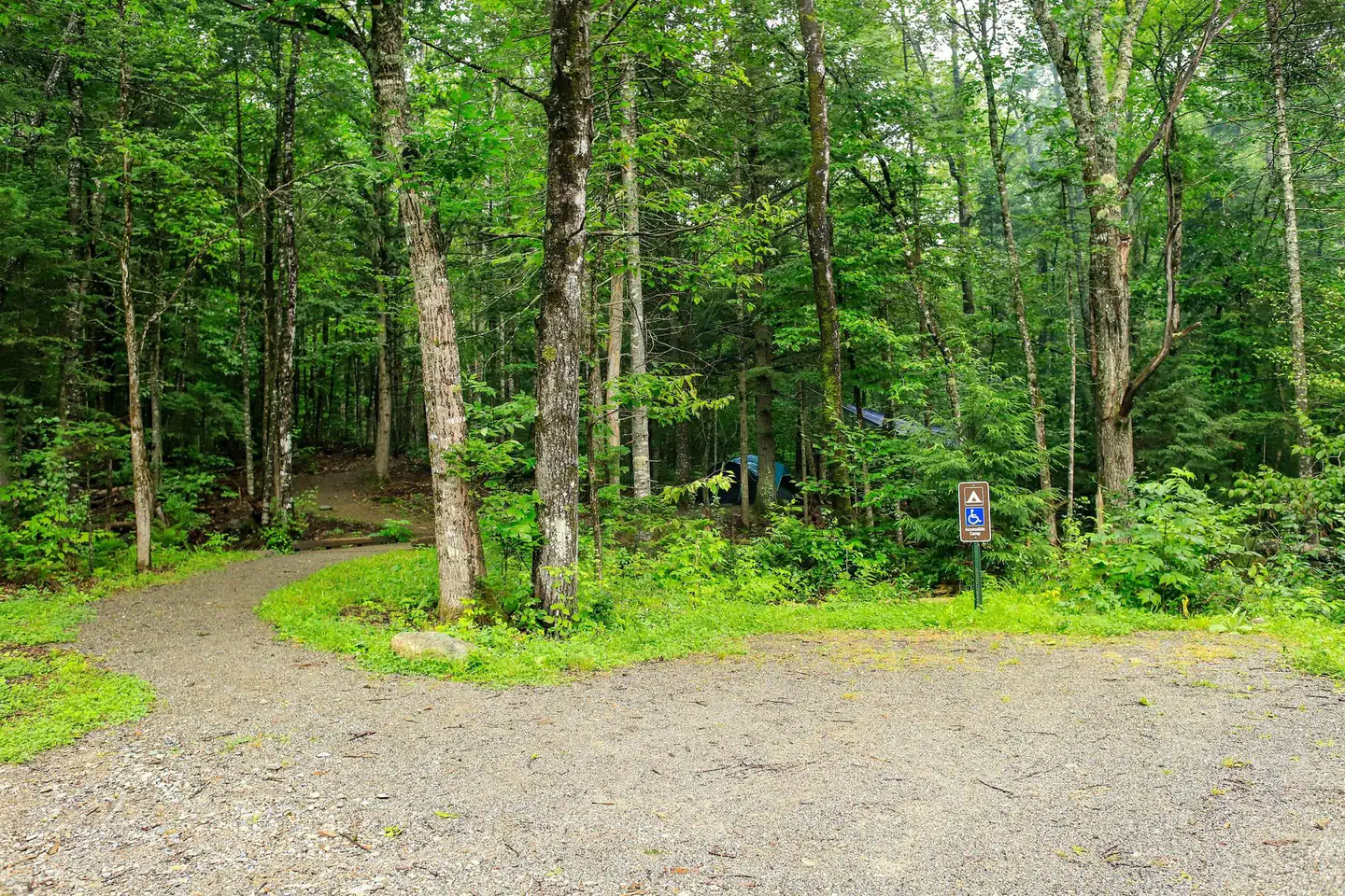
- Accessible site
- 648 ft
- Elevation
Overview
Katahdin Woods and Waters National Monument is located in Maine’s north woods. Katahdin Woods and Waters protects part of an extraordinary natural and cultural landscape: the mountains, woods, and waters where the East Branch of the Penobscot River and its tributaries, including the Wassataquoik Stream and the Seboeis River, run freely. Campsites, lean-tos and huts located throughout the monument provide opportunities to stay overnight while hiking, biking, paddling and enjoying other recreational activities.
Recreation
There are many ways visitors can experience Katahdin Woods and Waters National Monument. Below are a few recommended activities:
- Hiking: Choose a hike that meets your abilities to observe the biodiversity of the monument.
- Biking: Bike on historic logging roads (current and former) within the monument that display signs of logging activity that dates back as early as the 1800s.
- Camping: Sleep under the stars. Katahdin Woods and Waters is an International Dark Sky Sanctuary, the first to be certified in the state of Maine and in New England.
- Paddling: Paddlers can experience the scenic hydraulic features that are ecologically and culturally significant within the monument. The streams and rivers within the monument provide important habitat for spawning and rearing federally endangered Atlantic salmon.
- Wildlife watching and birding: The monument provides a landscape for a wide variety of wildlife. Birds can be seen and heard year-round. Pollinators, reptiles, and amphibians are most active during the spring and summer months. However, large mammals like moose, black bear, and Canada lynx are often what visitors have their cameras ready for.
- Fishing: Anglers enjoy catching brook trout, rainbow trout, brown trout, as well as smallmouth and largemouth bass at the monument.
- Sight seeing: Visitors often enjoy the views of Katahdin (located in Baxter State Park ) and the scenic waterways at the monument.
- Snowmobiling and hunting in designated areas: Snowmobiling and hunting are only allowed in specifically designated areas of the monument.
- Cross-country skiing and snowshoeing in the winter: The monument provides a limited area of groomed cross-country trails at the North Gate for visitors to use.
Facilities
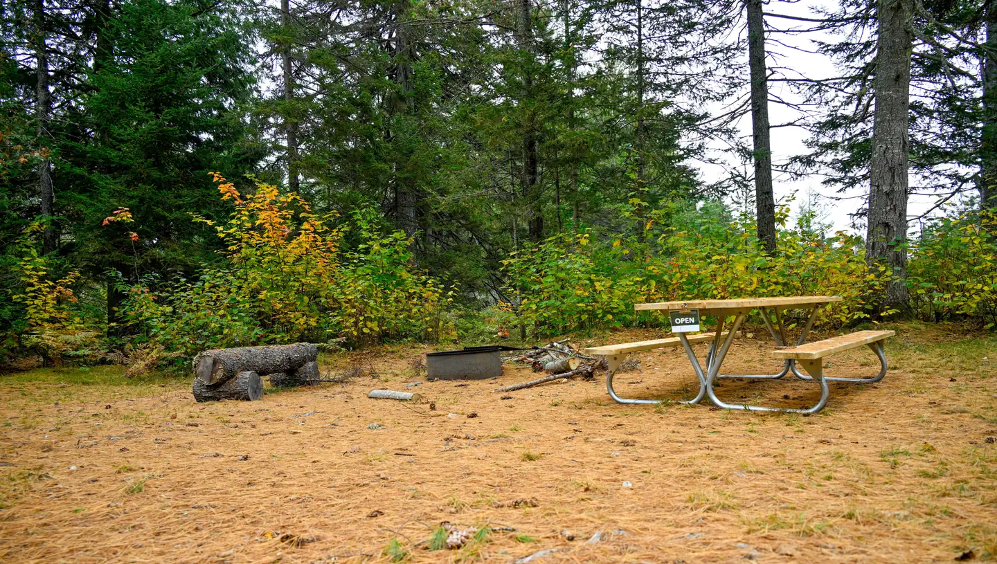
Campsites, lean-tos and huts are dispersed throughout Katahdin Woods and Waters National Monument. Huts are only open for reservation and stay during the winter season. All roads within the monument are unpaved. Some sites can only be reached by hiking, biking, paddling, skiing or snowshoeing. There are no flush toilets within the monument boundaries. Campsites may have vault or pit toilets; other sites require following Leave No Trace practices for human waste. Most campsites have picnic tables and a stone or metal fire ring. Brown metal food storage lockers , also known as bear boxes, are available in some campsites. All odorous items must be stored in a bear-resistant canister or in a contained vehicle if there is no food locker available. Campfires may require a permit from the Maine Forest Service.
Natural Features
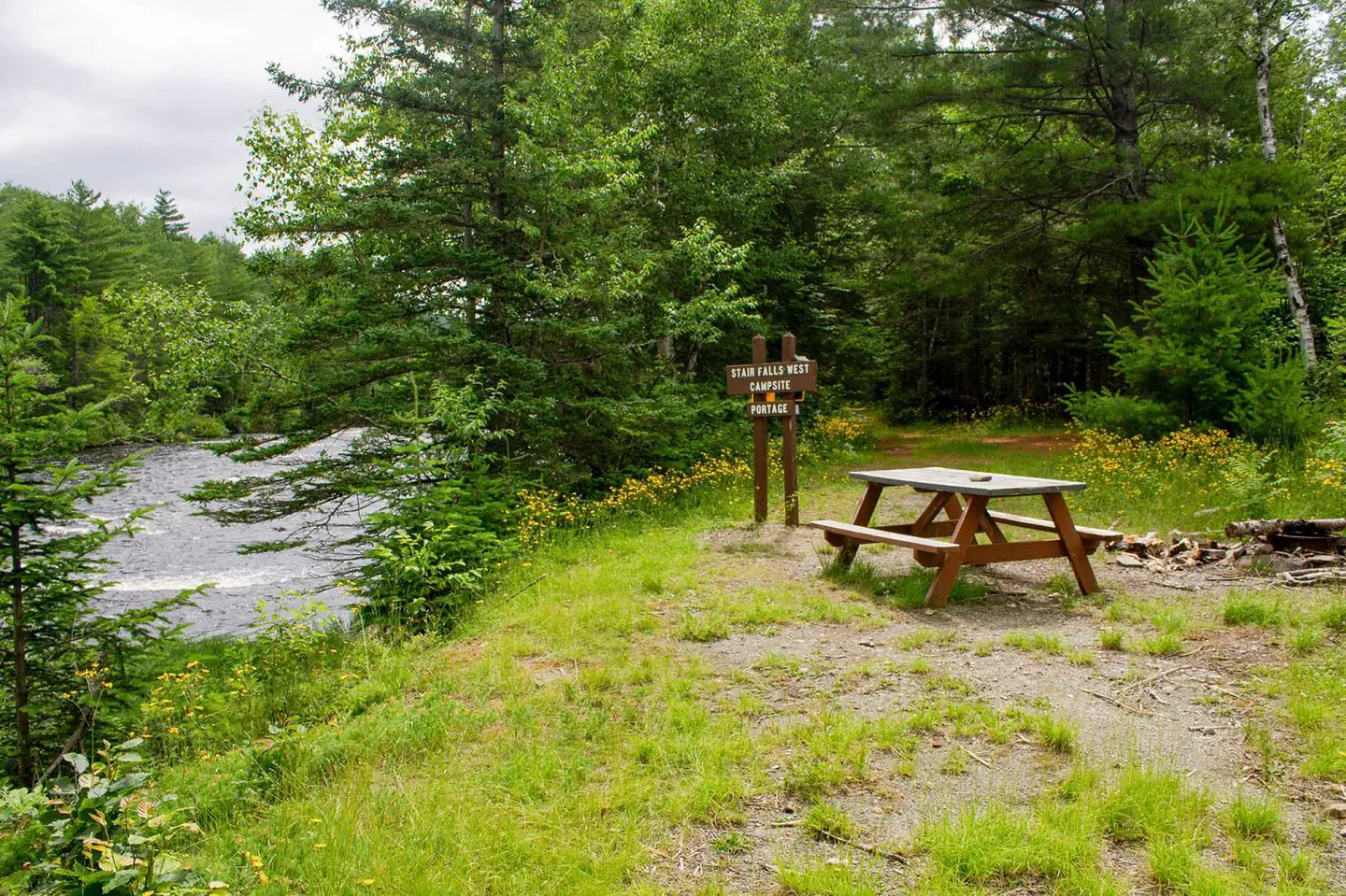
The East Branch of the Penobscot River flows all the way through the monument, about 25 miles from north to south. The first 10 miles drops over 200ft, creating a series of waterfalls and rapids (Stair Falls, Haskell Rock Pitch, Pond Pitch, Grand Pitch, the Hulling Machine, and Bowlin Falls).
The Seboeis River and Wassataquoik Stream also create scenic viewpoints in the monument, such as Orin Falls.
Katahdin Woods and Waters is known for its dark sky. In 2020 it was certified as an International Dark Sky Sanctuary.
Forest, waterways, and wetlands provide critical habitat and corridors for plants and wildlife, including threatened species such as Atlantic salmon, Canada lynx, and rare mussels and butterflies.
Geological formations are throughout the monument. Haskell Rock is a 20 ft tall conglomerate bedrock pillar in the East Branch. Popular hikes include trails on Barnard, Deasey, and Lunksoos Mountains.
Contact Info
This location is unstaffed. To speak with our main office for general information, please call: (207) 456-6001.Nearby Attractions
Baxter State Park (where Katahdin and the Appalachian Trail's northern terminusare located) is adjacent to the western boundary of Katahdin Woods and Waters National Monument.
Charges & Cancellations
The reservation fee is non-refundable. Please cancel your reservation if you do not plan to use it. You may cancel or modify your reservation online up to one day prior to your reservation start date.
The facts
- 25 bookable sites
- 27 sites in total, including non-bookable
- 1 accessible site
- Up to 20 people per site
- Loops: Katahdin Woods and Waters, Sandbank Stream
Site types
- 9 Hike To
- 6 Standard Nonelectric
- 6 Walk To
- 2 Boat In
- 2 Group Walk To
- 2 Management
Amenities
- Campfires allowed
- Fire pits
- Picnic tables
- Shade
- Pets allowed
- Water hookups — not available
- Sewer hookups — not available
Not recorded upstream: electric hookups, grills.
27 campsites at Katahdin Woods & Waters National Monument Camping
| Site | Loop | Type | Entry | Surface | Grade | Access | Water | Max rig | People | |
|---|---|---|---|---|---|---|---|---|---|---|
| Big Seboeis | Katahdin Woods and Waters | Boat In | — | — | — | Boat In | Riverfront | — | 6 | 🐾 |
| Big Spring Brook | Katahdin Woods and Waters | Boat In | — | — | — | Boat In | Riverfront | — | 5 | 🐾 |
| Big Spring Brook Hut | Katahdin Woods and Waters | Management | — | — | — | Hike In | Riverfront | — | 6 | |
| Esker | Katahdin Woods and Waters | Hike To | — | — | — | Hike In | Riverfront | — | 5 | 🐾 |
| Grand Pitch Lean-to | Katahdin Woods and Waters | Hike To | — | — | — | Hike In | — | — | 6 | |
| Haskell Deadwater | Katahdin Woods and Waters | Hike To | — | — | — | Hike In | Riverfront | — | 10 | 🐾 |
| Haskell Hut | Katahdin Woods and Waters | Management | — | — | — | Hike In | Riverfront | — | 8 | |
| Katahdin Brook Lean-to | Katahdin Woods and Waters | Hike To | — | — | — | Hike In | — | — | 6 | |
| Lunksoos 1 | Katahdin Woods and Waters | Walk To | — | — | — | — | — | — | 5 | ♿ 🐾 |
| Lunksoos 2 | Katahdin Woods and Waters | Walk To | — | — | — | Hike In | — | — | 5 | 🐾 |
| Lunksoos 3 | Katahdin Woods and Waters | Walk To | — | — | — | Hike In | — | — | 5 | 🐾 |
| Lunksoos 4 | Katahdin Woods and Waters | Walk To | — | — | — | Hike In | — | — | 5 | 🐾 |
| Lunksoos 5 | Katahdin Woods and Waters | Walk To | — | — | — | Hike In | — | — | 5 | 🐾 |
| Lunksoos 6 | Katahdin Woods and Waters | Group Walk To | — | — | — | Hike In | — | — | 20 | 🐾 |
| Lunksoos 7 | Katahdin Woods and Waters | Group Walk To | — | — | — | Hike In | — | — | 20 | 🐾 |
| Lunksoos Lean-to | Katahdin Woods and Waters | Hike To | — | — | — | Hike In | — | — | 6 | |
| Pond Pitch | Katahdin Woods and Waters | Hike To | — | — | — | Hike In | Riverfront | — | 5 | 🐾 |
| Sandbank Stream 1 | Katahdin Woods and Waters | Standard Nonelectric | — | — | — | — | — | — | — | |
| Sandbank Stream 2 | Katahdin Woods and Waters | Standard Nonelectric | — | — | — | — | — | — | — | |
| Sandbank Stream 3 | Katahdin Woods and Waters | Standard Nonelectric | — | — | — | — | — | — | — | |
| Stair Falls | Katahdin Woods and Waters | Hike To | — | — | — | Hike In | Riverfront | — | 5 | 🐾 |
| Upper East Branch | Katahdin Woods and Waters | Walk To | — | — | — | — | Riverfront | — | 10 | 🐾 |
| Wassataquoik | Katahdin Woods and Waters | Hike To | — | — | — | Hike In | — | — | 5 | 🐾 |
| Wassataquoik Lean-to | Katahdin Woods and Waters | Hike To | — | — | — | Hike In | — | — | 6 | |
| Sandbank Stream Site 1 | Sandbank Stream | Standard Nonelectric | Back In | Gravel | Slight | Drive In | — | — | 5 | 🐾 |
| Sandbank Stream Site 2 | Sandbank Stream | Standard Nonelectric | — | Gravel | Slight | Drive In | — | — | 5 | 🐾 |
| Sandbank Stream Site 3 | Sandbank Stream | Standard Nonelectric | Back In | Gravel | Slight | Drive In | — | — | 5 | 🐾 |
Getting there
Katahdin Woods and Waters National Monument is located in north central Maine, approximately a 2-hour drive northwest of Acadia National Park in Bar Harbor and 1.5-hour drive north of Bangor, Maine. Both areas are served by regional airports.
You can access all parts of the monument from I-95. Take exit 244 (Medway) or exit 264 (Sherman) to access Maine Route 11. Once you exit I-95, you will travel on Maine Route 11 to access the monument. If you are southbound on I-95, you can also access the monument from exit 276 (Island Falls). Maine Route 11 is the main access route to the monument. It is also known as the Katahdin Woods and Waters National Scenic Byway.
North Entrance
From Exit 244 (Medway), head west for approximately 0.8 miles towards Medway and turn right onto Route 11 (also called Grindstone Road). If you cross the East Branch of the Penobscot River, you have missed the turn for Route 11 north. Continue north on Maine Route 11 to Patten. Turn left onto Maine Route 159 (also called Shin Pond Road). Maine Route 159 continues for approximately 11.6 miles and then becomes Grand Lake Road. Continue on Grand Lake Road for another approximately 12.7 miles, then turn left onto New River Road (also known as Messer Pond Road) to access the North Entrance.
From Exit 264 (Sherman), follow signs for Maine Route 11 north towards Patten. In approximately 10 miles, turn left onto Maine Route 159 (also called Shin Pond Road). Maine Route 159 continues for approximately 11.6 miles and then becomes Grand Lake Road. Continue on Grand Lake Road for another approximately 12.7 miles, then turn left onto New River Road (also known as Messer Pond Road) to access the North Entrance.
From Exit 276 (Island Falls), proceed west to Patten on Route 159 for approximately 8 miles. At the junction of Maine Route 159 & Maine Route 11, follow the above directions to access the North Entrance by Maine Route 159 and Grand Lake Road.
From the intersection of Maine Route 11 & Maine Route 159 in Patten, it is approximately 25 miles (approximately 40 minutes driving time) to the North Entrance. To access the monument, take the second left turn onto New River Road after you cross the East Branch of the Penobscot River near Grand Lake Matagamon. New River Road dead-ends at a parking area near Haskell Gate in approximately 4 miles. After October, vehicle traffic ends at North Gate parking area.
South Entrance and Katahdin Loop Road
From Exit 244 (Medway), head west for approximately 0.8 miles towards Medway and turn right onto Maine Route 11 (also called Grindstone Road). If you cross the East Branch of the Penobscot River, you have missed the turn for Maine Route 11. Follow Maine Route 11 for approximately 20 miles and then turn left onto Swift Brook Road (it is a gravel road). Use caution with this turn as sight distance is limited. The Swift Brook Road will lead you to the Katahdin Loop Road in approximately 10 miles.
From Exit 264 (Sherman), follow signs for Maine Route 11. To reach the south entrance and the Katahdin Loop Road, turn left at the next intersection (onto Grindstone Road) to stay on Maine Route 11. In approximately 5 miles continue straight onto the gravel road when the paved road curves left. This gravel road will lead you to the Swift Brook Road and to the Katahdin Loop Road.
From Exit 276 (Island Falls), proceed west to Patten on Maine Route 159 for approximately 8 miles. At the junction of Maine Route 159 & Maine Route 11, follow the above directions for access to either the Swift Brook Road or the Katahdin Loop Road.
From the intersection of Maine Route 11 & Swift Brook Road in Stacyville, it is approximately 12 miles to the Katahdin Loop Road. Plan your trip by viewing a map of the local area and follow signs within the monument proper.
Traveling on Swift Brook Road
Use caution when traveling on the Swift Brook Road, which is a gravel road. All gravel roads in the area are shared with logging and equipment trucks. Logging trucks always have the right of way. It is important to drive slowly, keep to the right side of the road, and yield to oncoming trucks. If you are traveling north on Maine Route 11, use caution when making the left turn onto Swift Brook Road as there is limited sight distance.
Please be considerate of your speed as you pass the residential area near the intersection. There is no public transportation to the monument. Mobile phone and GPS coverage is spotty and unreliable. There is no public transportation to the monument.
46.12520, -68.80140 · 46°7'30.7"N 68°48'5.0"W
Typical weather
Typically 76°F in Jul, down to 22°F in Jan.
| Jan | Feb | Mar | Apr | May | Jun | Jul | Aug | Sep | Oct | Nov | Dec | |
|---|---|---|---|---|---|---|---|---|---|---|---|---|
| High °F | 22 | 25 | 35 | 48 | 62 | 72 | 76 | 75 | 67 | 54 | 41 | 29 |
| Low °F | 3 | 6 | 16 | 29 | 40 | 49 | 55 | 54 | 45 | 35 | 25 | 13 |
| Precip in | — | — | — | — | — | — | — | — | — | — | — | — |
1991–2020 averages from the nearest NOAA station, 16.1 mi away — not measured at the facility itself, and elevation can make a real difference over that distance.
Map
Fees and stay limits
Recreation Fee: $0. Campsites and huts are free. Huts are only available during the winter season. Reservation Fee: $8 when booked online or $9 through the contact center at (877) 444-6777 (toll free) or (606) 515-6777 (international), open 10:00 a.m. to 12:00 midnight (Eastern Time Zone). The reservation fee covers the cost of reservation services through Recreation.gov. Entrance Fee: Katahdin Woods and Waters National Monument does not charge an entrance fee.
From Recreation.gov, which is not always current. The operator's own page is the authority on what you will be charged.
More photos
Member photos
Common questions about Katahdin Woods & Waters National Monument Camping
- Can you reserve a site at Katahdin Woods & Waters National Monument Camping?
- Yes, Katahdin Woods & Waters National Monument Camping is reservable through Recreation.gov.
- How many campsites does Katahdin Woods & Waters National Monument Camping have?
- 27 sites in total, of which 25 can be booked.
- Are pets allowed at Katahdin Woods & Waters National Monument Camping?
- Yes, pets are allowed at Katahdin Woods & Waters National Monument Camping.
- Does Katahdin Woods & Waters National Monument Camping have hookups?
- No hookups are recorded here.
- Are campfires allowed at Katahdin Woods & Waters National Monument Camping?
- Campfires are allowed at Katahdin Woods & Waters National Monument Camping. Check for a current fire restriction before you go.
Camping near Katahdin Woods & Waters National Monument Camping
- Tekakapimək Contact Station 17.3 mi · Visitor Center
Contact
- Phone 207-456-6001
- Email kaww_info@nps.gov
- Book Recreation.gov
Recreation.gov last updated this record on 2026-05-20.
Facility information and photographs from Recreation.gov (RIDB). SpotOpened is not affiliated with Recreation.gov or any federal agency.
Comments