Pax River Hog Point Campgrounds
Campground · Maryland · 4 bookable sites ·
Managed by the Commander, Navy Installation Command (CNIC)
Naval Air Station Patuxent River · Closed to Public Access
- 4
- Bookable sites
- up to 4
- People per site
- 19 ft
- Elevation
Overview
Visitors eligible for reservations at this location are limited to Active Duty, Reservists, Retired Military, Unremarried Widow, Veterans and Department of Defense employees. Learn more about eligible visitors and access to this military base recreation site.
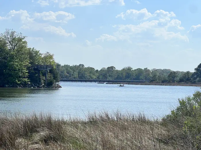
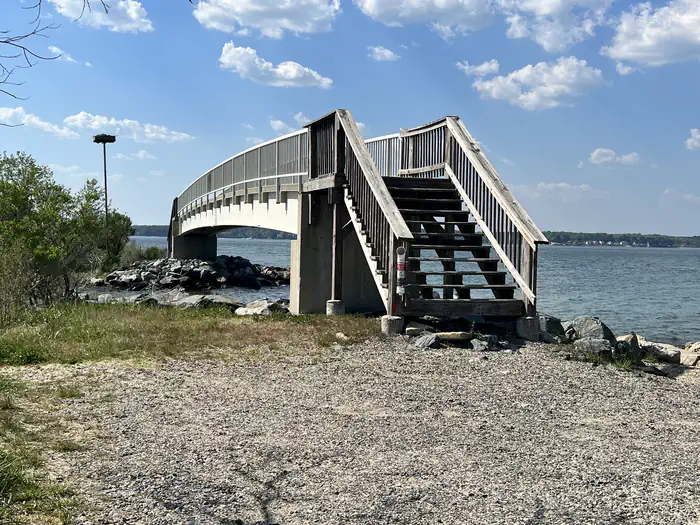
A variety of recreational programs and facilities await you and your family at Naval Air Station Patuxent River, located just 55 miles south of Washington D.C. Situated at the confluence of the Patuxent River and Chesapeake Bay, this is an area rich in both American and Navy history and natural beauty. Part of the legacy of Southern Maryland may be found in the spacious, natural campsite areas aboard the installation. Hogs Point Campsites are nestled in the woods between the Chesapeake Bay and Patuxent River and are just a few walking steps for fishing and crabbing.
Recreation
Water lovers will find that NAS Patuxent River strectches across approximately 12 miles of shoreline offering locations to launch kayaks, stand up paddle boards, motor and sail boats, places for fishing and crabbing as well as areas for the beach lovers.
Bicyclists will find a 10 mile paved loop within the installation as well as designated bike trails.
MWR also has a Golf Course, Outdoor Pool, Marina, Theater, Community Recreation Office, Auto Hobby Shop and Fitness Center.
Facilities
- Tent Only Nonelectric
- Overnight
Natural Features
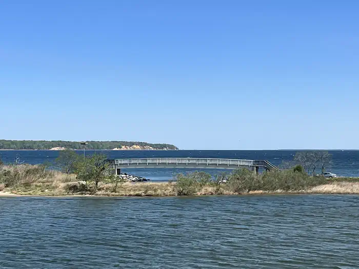
NAS Patuxent River Hogs Point Campground is located where the Chesapeake Bay meets the Patuxent River, offering the best views for sunrises.
Nearby Attractions
- Historic St. Mary's City
- Patuxent River Air Museum
- Historic Sotterly
- St. Clement's Island
- Point Lookout State Park
- Solomon's Island
- Navy Recreation Center Solomons
Contact Info
This location is staffed. Please call (301) 342-3573 to speak with local staff.The facts
- 4 bookable sites
- Up to 4 people per site
- Loops: Hog Point
Site types
- 4 Tent Only Nonelectric
Amenities
- Campfires allowed
- Fire pits
- Picnic tables
- Shade
- Pets allowed
- Water hookups — not available
Not recorded upstream: electric hookups, sewer hookups, grills.
4 campsites at Pax River Hog Point Campgrounds
Check-in 1:00 PM · Check-out 12:00 PM
| Site | Loop | Type | Entry | Surface | Water | Max rig | People | |
|---|---|---|---|---|---|---|---|---|
| H1 | Hog Point | Tent Only Nonelectric | — | Gravel | Riverfront | — | 4 | 🐾 |
| H2 | Hog Point | Tent Only Nonelectric | — | Gravel | Riverfront | — | 4 | 🐾 |
| H3 | Hog Point | Tent Only Nonelectric | — | Gravel | Riverfront | — | 4 | 🐾 |
| H4 | Hog Point | Tent Only Nonelectric | — | Gravel | Riverfront | — | 4 | 🐾 |
Getting there
From Washington D.C:
Take 295 S towards I-95/495, merge onto I-495 S, take exit 7A toward MD 5 S/ Branch Ave, turn left on to Mattawoman Beantown Road, turn left onto MD 5 S/Leonardtown Road, continue on MD 235 to NAS Patuxent River Gate 1, cedar point road
38.30700, -76.39486 · 38°18'25.2"N 76°23'41.5"W
Typical weather
Typically 87°F in Jul, down to 45°F in Jan.
| Jan | Feb | Mar | Apr | May | Jun | Jul | Aug | Sep | Oct | Nov | Dec | |
|---|---|---|---|---|---|---|---|---|---|---|---|---|
| High °F | 45 | 48 | 55 | 66 | 75 | 83 | 87 | 85 | 79 | 69 | 58 | 50 |
| Low °F | 30 | 31 | 37 | 47 | 57 | 66 | 71 | 69 | 63 | 52 | 41 | 34 |
| Precip in | 2.9 | 2.8 | 4.0 | 3.7 | 3.7 | 4.3 | 4.5 | 4.7 | 4.2 | 4.0 | 3.1 | 3.5 |
1991–2020 averages from the nearest NOAA station, 1.3 mi away — not measured at the facility itself, and elevation can make a real difference over that distance.
Map
More photos
Member photos
Common questions about Pax River Hog Point Campgrounds
- Can you reserve a site at Pax River Hog Point Campgrounds?
- Yes, Pax River Hog Point Campgrounds is reservable through Recreation.gov.
- How many campsites does Pax River Hog Point Campgrounds have?
- 4 sites.
- Are pets allowed at Pax River Hog Point Campgrounds?
- Yes, pets are allowed at Pax River Hog Point Campgrounds.
- Does Pax River Hog Point Campgrounds have hookups?
- No hookups are recorded here.
- Are campfires allowed at Pax River Hog Point Campgrounds?
- Campfires are allowed at Pax River Hog Point Campgrounds. Check for a current fire restriction before you go.
Camping near Pax River Hog Point Campgrounds
- Pax River Paradise Grove Campgrounds 0.1 mi · Campground · we watch it
- Blackwater National Wildlife Refuge Turkey Hunt Lottery and Permits 17.7 mi · Permit · we watch it
- Blackwater National Wildlife Refuge Deer Hunt Permits 18.4 mi · Permit · we watch it
- George Washington Birthplace National Monument Picnic Pavilion 29.3 mi · Campground · we watch it
- Fort Washington Park Day Use Facilities 44.2 mi · Campground · we watch it
- Fort Hunt Picnic Areas 45.4 mi · Campground · we watch it
- Harriet Tubman Underground Railroad Visitor Center 17 mi · Facility
- Thomas Stone Visitor Center 38 mi · Facility
- Fort Washington Park Visitor Center 44.5 mi · Facility
- Potomac Heritage National Scenic Trail 47.5 mi · Facility
- Oxon Hill Farm Visitor Center 47.6 mi · Facility
- Star-Spangled Banner National Historic Trail 48 mi · Facility
Contact
- Phone 301.342.3573
- Email mwrpaxrivercamping@us.navy.mil
- Book Recreation.gov
Recreation.gov last updated this record on 2026-02-25.
Facility information and photographs from Recreation.gov (RIDB). SpotOpened is not affiliated with Recreation.gov or any federal agency.
Comments