Fifteen Mile Creek Campsite
Campground · Maryland · 10 bookable sites ·
Managed by the National Park Service
Chesapeake and Ohio Canal National Historical Park (National Historical Park) · Restricted Access
- 10
- Bookable sites
- up to 30
- People per site
- 434 ft
- Elevation
Overview
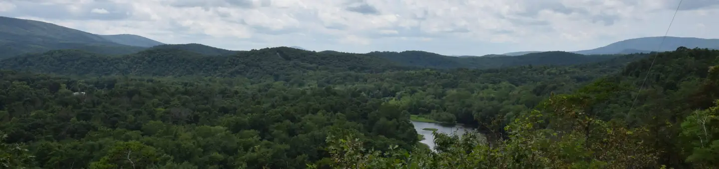
The Fifteen Mile Creek Campground is located at Mile 140 on the C&O Canal Towpath, in the town of Little Orleans upstream of Hancock and downstream of Paw Paw, WV, on the Maryland side of the of the Potomac River. The campsites are drive-in, large enough to park a small fifth wheel/travel trailer/RV/pop-out with a 20' ft. maximum. Alcoholic beverages are prohibited.
Recreation
The most popular activity for Fifteen Mile Creek campers is boating and fishing. The campground has a boat ramp for easy access to the Potomac River for kayakers and fisherman alike. Be sure to acquire a Maryland Fishing License for those age 16 or older.Facilities
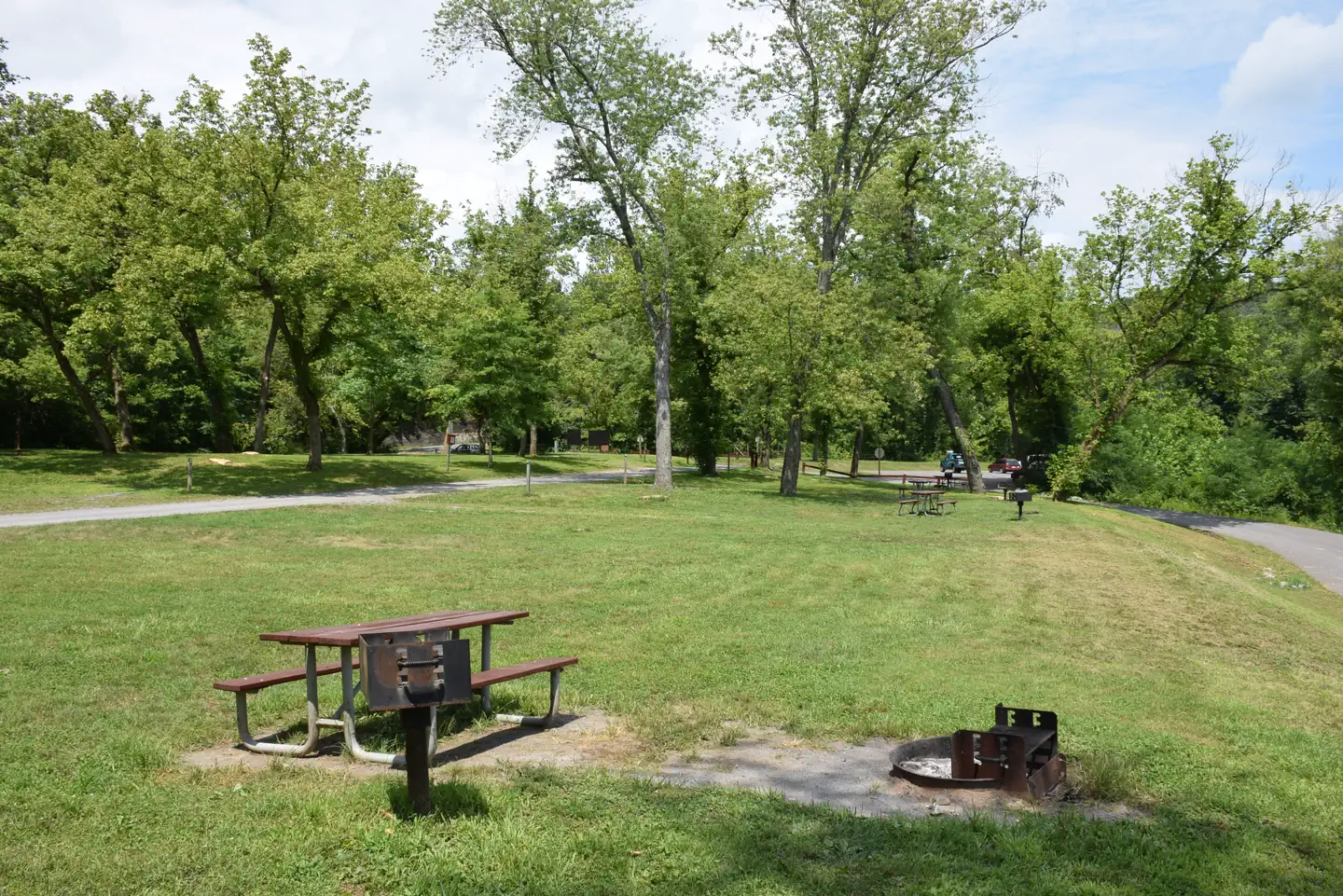
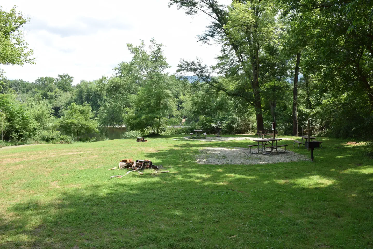
The campground has nine single drive-in campsites. There is one group site available that does not have direct vehicle access. The group site can accommodate 30 people. Each single will accommodate up to eight people. Single campsites have a picnic table, fire ring and grill. Protected pit toilets are located between campsite #3 and campsite #4 along the dead end circle. Potable hand pump water is available from April 15 - October 31. No motor vehicle traffic is allowed on the towpath. Parking is allowed in the drive-in campsites and the adjacent parking lot for vehicles with trailers and support vehicles for the group site.Natural Features
Fifteen Mile Creek Campground is adjacent to the confluence of Fifteen Mile Creek and the Potomac River on the Maryland side. Tucked in the mountains of Western Maryland and adjacent to Green Ridge State Forest, natural beauty is plentiful all times of the year, but especially during autumn.Contact Info
This location is unstaffed. To speak with our main office for general information, please call: (301) 739-4200.Nearby Attractions
Greenridge State Forest and Billmeyer Wildlife Management Area are state managed areas available for additional activities. This area is remote.
The facts
- 10 bookable sites
- Up to 30 people per site
- Loops: Fifteen Mile Creek Campsite
Site types
- 9 Standard Nonelectric
- 1 Group Tent Only Area Nonelectric
Amenities
- Campfires allowed
- Fire pits
- Picnic tables
- Grills
- Shade
- Pets allowed
Not recorded upstream: electric hookups, water hookups, sewer hookups.
10 campsites at Fifteen Mile Creek Campsite
Check-in 1:00 PM · Check-out 12:00 PM
| Site | Loop | Type | Entry | Surface | Access | Water | Max rig | People | |
|---|---|---|---|---|---|---|---|---|---|
| 01 | Fifteen Mile Creek Campsite | Standard Nonelectric | — | — | Hike In | Riverfront | — | 8 | 🐾 |
| 02 | Fifteen Mile Creek Campsite | Standard Nonelectric | — | — | Hike In | Riverfront | — | 8 | 🐾 |
| 03 | Fifteen Mile Creek Campsite | Standard Nonelectric | — | — | Hike In | Riverfront | — | 8 | 🐾 |
| 04 | Fifteen Mile Creek Campsite | Standard Nonelectric | — | — | Hike In | Riverfront | — | 8 | 🐾 |
| 05 | Fifteen Mile Creek Campsite | Standard Nonelectric | — | — | Hike In | Riverfront | — | 8 | 🐾 |
| 06 | Fifteen Mile Creek Campsite | Standard Nonelectric | — | — | Hike In | Riverfront | — | 8 | 🐾 |
| 07 | Fifteen Mile Creek Campsite | Standard Nonelectric | — | — | Hike In | Riverfront | — | 8 | 🐾 |
| 08 | Fifteen Mile Creek Campsite | Standard Nonelectric | — | — | Hike In | Riverfront | — | 8 | 🐾 |
| 09 | Fifteen Mile Creek Campsite | Standard Nonelectric | — | — | Hike In | Riverfront | — | 8 | 🐾 |
| 10 | Fifteen Mile Creek Campsite | Group Tent Only Area Nonelectric | — | — | Hike In | Riverfront | — | 30 | 🐾 |
Getting there
From Hagerstown: Take I-70 W to I-68 W. Take Exit 68 towards Little Orleans. Follow Orleans Rd for 4 miles. Make a left on High Germany Rd. and it will dead end at the campground.
From Cumberland: Take I-68 east for 25 miles to exit 68 and then follow Orleans Road for 4 miles. Make a left on High Germany Rd and it will dead end in the park.
RV and Oversized Vehicle Warning: Do not use GPS as it will try to take you through a low clearance tunnel. After taking Exit 68, stay on Orleans Rd for 3 miles then turn left onto High Germany Rd. at the intersection of Mountain Rd, High Germany Rd, and Orleans Rd. Stay on High Germany Rd for 3 miles. Campsite will be on the left.
39.62473, -78.38484 · 39°37'29.0"N 78°23'5.4"W
Typical weather
Typically 85°F in Jul, down to 40°F in Jan.
| Jan | Feb | Mar | Apr | May | Jun | Jul | Aug | Sep | Oct | Nov | Dec | |
|---|---|---|---|---|---|---|---|---|---|---|---|---|
| High °F | 40 | 43 | 52 | 64 | 73 | 81 | 85 | 83 | 77 | 66 | 54 | 44 |
| Low °F | 21 | 23 | 30 | 40 | 49 | 58 | 62 | 60 | 53 | 42 | 32 | 25 |
| Precip in | 3.6 | 2.2 | 3.0 | 3.5 | 4.4 | 4.9 | 4.3 | 3.1 | 4.4 | 3.4 | 2.6 | 3.3 |
1991–2020 averages from the nearest NOAA station, 9.2 mi away — not measured at the facility itself, and elevation can make a real difference over that distance.
Map
More photos
Member photos
Common questions about Fifteen Mile Creek Campsite
- Can you reserve a site at Fifteen Mile Creek Campsite?
- Yes, Fifteen Mile Creek Campsite is reservable through Recreation.gov.
- How many campsites does Fifteen Mile Creek Campsite have?
- 10 sites.
- Are pets allowed at Fifteen Mile Creek Campsite?
- Yes, pets are allowed at Fifteen Mile Creek Campsite.
- Are campfires allowed at Fifteen Mile Creek Campsite?
- Campfires are allowed at Fifteen Mile Creek Campsite. Check for a current fire restriction before you go.
Camping near Fifteen Mile Creek Campsite
- Paw Paw Tunnel Campsite 7 mi · Campground · we watch it
- Indigo Neck Hiker Biker Overnight (HBO) Campsite 1.4 mi · Campground
- Devils Alley Hiker-Biker Campsite 1.4 mi · Campground
- Stickpile Hill Hiker-Biker Overnight (HBO) Campsite 2.9 mi · Campground
- Sorrel Ridge Hiker-Biker Overnight (HBO) Campsite 5.2 mi · Campground
- Cacapon Junction Hiker-Biker Overnight (HBO) Campsite 5.6 mi · Campground
- Purslane Run Hiker-Biker Overnight (HBO) Campsite 7.5 mi · Campground
- Leopards Mill Hiker-Biker Overnight (HBO) Campsite 7.9 mi · Campground
- White Rock Hiker-Biker Campsite 10 mi · Campground
- Town Creek Hiker-Biker Overnight (HBO) Campsite 10.7 mi · Campground
- Potomac Forks Hiker-Biker Campsite 12.7 mi · Campground
- Little Pool Hiker-Biker Campsite 15 mi · Campground
Contact
- Email choh_information@nps.gov
- Book Recreation.gov
Recreation.gov last updated this record on 2026-06-11.
Facility information and photographs from Recreation.gov (RIDB). SpotOpened is not affiliated with Recreation.gov or any federal agency.
Comments