Monomoy Wilderness
Facility · Massachusetts ·
Managed by the Fish and Wildlife Service
Monomoy National Wildlife Refuge (National Wildlife Refuge) · Open Access
- 47 ft
- Elevation
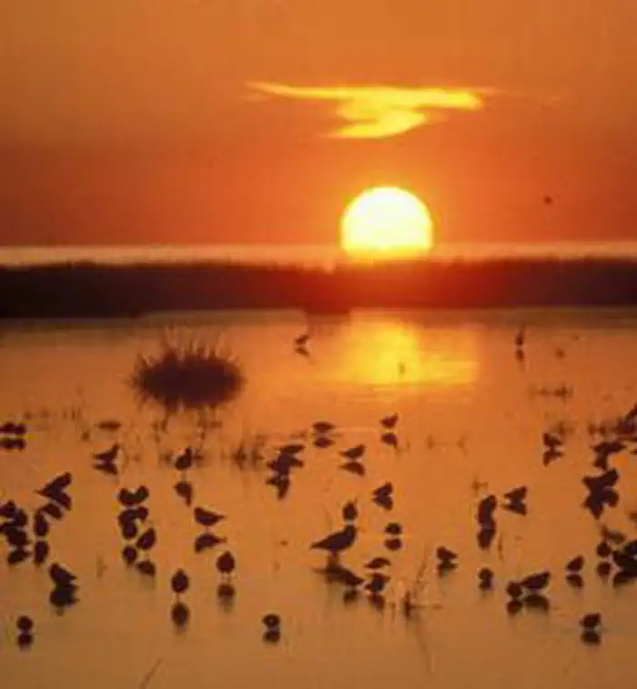
The Monomoy Wilderness now contains a total of 3,244 acres and is managed by the Fish & Wildlife Service. All of the Wilderness is in the state of Massachusetts. In 1970 the Monomoy Wilderness became part of the now over 110 million acre National Wilderness Preservation System.
As recently as 1958, this area was an extension of the mainland, the eroding shoreline at the elbow of Cape Cod. Severe winter storms isolated Monomoy Point from the mainland and, 20 years later, separated North Monomoy Island from South Monomoy Island. Ten miles of surf-beaten dunes on the eastern shore of the islands, still-shifting sands that sometimes reach 100 feet in height, give way to salt marsh and then to mudflats on the western shore. The ecosystem is a perfect habitat for migratory birds.
Dubbed a sanctuary for wildlife in 1944, most of 7,604-acre Monomoy National Wildlife Refuge has been designated Wilderness: all of the north island and all but two tracts on the south island. The mainland portion of the refuge remains non-Wilderness. People are known to have lived here from 1711 on, and a lighthouse complex on the south island attests to their presence. Among the migratory birds you may see are grebes, shearwaters, petrels, gannets, bitterns, egrets, herons, swans, geese, ducks, and the endangered piping plover and roseate tern. Hundreds of gray and harbor seals winter along the coastline. Boaters swarm the shores in summer. Camping, fires, and pets are not permitted.
Getting there
41.65787, -69.95915 · 41°39'28.3"N 69°57'32.9"W
Typical weather
Typically 76°F in Jul, down to 39°F in Jan.
| Jan | Feb | Mar | Apr | May | Jun | Jul | Aug | Sep | Oct | Nov | Dec | |
|---|---|---|---|---|---|---|---|---|---|---|---|---|
| High °F | 39 | 39 | 43 | 51 | 60 | 69 | 76 | 76 | 70 | 61 | 52 | 44 |
| Low °F | 25 | 25 | 31 | 40 | 48 | 57 | 63 | 63 | 58 | 49 | 40 | 31 |
| Precip in | 4.0 | 3.8 | 4.7 | 4.0 | 3.3 | 3.2 | 2.8 | 3.2 | 3.8 | 4.3 | 4.1 | 4.7 |
1991–2020 averages from the nearest NOAA station, 0.1 mi away — not measured at the facility itself, and elevation can make a real difference over that distance.
Map
Member photos
Common questions about Monomoy Wilderness
- Can you reserve a site at Monomoy Wilderness?
- No. Monomoy Wilderness is not reservable through Recreation.gov, so sites are first-come, first-served or booked elsewhere.
Camping near Monomoy Wilderness
- Le Count Beach House 18.3 mi · Campground · we watch it
- Sunrise House 18.5 mi · Campground · we watch it
- Ocean View House 18.6 mi · Campground · we watch it
- Cape Cod National Seashore Ranger-Guided Programs 19.2 mi · Tickets · we watch it
- Bay View House 21.6 mi · Campground · we watch it
- Highland Beach Suites, unit 3 27.4 mi · Campground · we watch it
- Highland Beach Suites, Unit 2 27.4 mi · Campground · we watch it
- Highland Beach Suites, Unit 1 27.4 mi · Campground · we watch it
- Salt Pond Visitor Center 12.4 mi · Facility
- Province Lands Visitor Center 31.4 mi · Facility
- Visitor Center & Park Garden Hours 49.8 mi · Facility
Contact
- Phone (508)945-0594
- Email r5rw_mnwr@fws.gov
- Info Recreation.gov
Recreation.gov last updated this record on 2026-02-25.
Facility information and photographs from Recreation.gov (RIDB). SpotOpened is not affiliated with Recreation.gov or any federal agency.
Comments