Cherry Glen Picnic
Campground · Iowa · 6 bookable sites ·
Managed by the US Army Corps of Engineers
National Guard Camp Dodge Johnston Training Site · Closed to Public Access
- 6
- Bookable sites
- up to 200
- People per site
- 6
- Accessible sites
- 934 ft
- Elevation
Overview
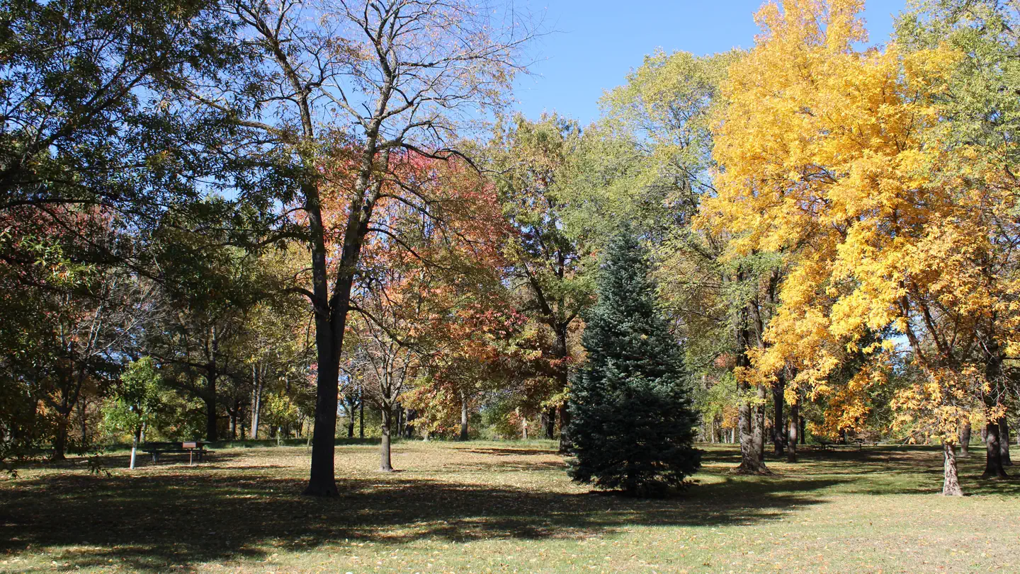
Cherry Glen Picnic Area is a day-use facility located on the 26,000-acre Saylorville Lake Project, which stretches over 50 miles up the Des Moines River Valley. The lake provides a wide variety of recreational activities, including boating, swimming, fishing, hiking and hunting.Recreation
Visitors come to Saylorville Lake for its great boating, sailing, water skiing, windsurfing and swimming opportunities. Anglers fish for walleye, wiper, largemouth bass, catfish, crappie and northern pike.The paved Neal Smith Trail winds 24 miles from Des Moines to Big Creek State Park and connects the campgrounds on the east side of the lake. It is designated as a National Recreation Trail and is used for biking, hiking, jogging, walking and in-line skating.
Facilities
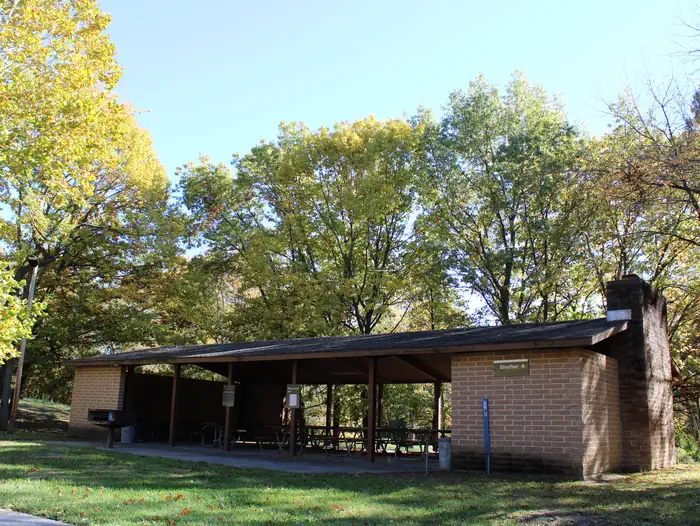
This day-use area offers six group picnic shelters, all with electric hookups. Amenities include flush toilets, a playground and hiking trails. Cherry Glen Campground is adjacent as well as Cherry Glen Boat Ramp.Natural Features
Cherry Glen is nestled on a compact 13-acre wooded ridge. Visiting with family and friends while relaxing in the shade of one of the area's many trees is a popular pastime.Wildlife is abundant throughout the project. White-tailed deer, turkeys, pheasants, waterfowl, and other small game animals roam the lands around the lake.
Nearby Attractions
Cherry Glen Campground and Cherry Glen Boat Ramp.The facts
- 6 bookable sites
- 6 sites for day use only
- 6 accessible sites
- Up to 200 people per site
- Loops: CHERRY GLEN PICNIC
Site types
- 6 Group Shelter Electric
Amenities
- Electric hookups
- Water hookups
- Picnic tables
- Grills
- Shade
- Pets allowed
Not recorded upstream: sewer hookups, campfires allowed, fire pits.
6 campsites at Cherry Glen Picnic
| Site | Loop | Type | Entry | Surface | Max rig | People | |
|---|---|---|---|---|---|---|---|
| 1 | CHERRY GLEN PICNIC | Group Shelter Electric | — | Paved | — | 100 | ♿ 🐾 |
| 2 | CHERRY GLEN PICNIC | Group Shelter Electric | — | Paved | — | 75 | ♿ 🐾 |
| 3 | CHERRY GLEN PICNIC | Group Shelter Electric | — | Paved | — | 50 | ♿ 🐾 |
| 4 | CHERRY GLEN PICNIC | Group Shelter Electric | — | Paved | — | 100 | ♿ 🐾 |
| 5 | CHERRY GLEN PICNIC | Group Shelter Electric | — | Paved | — | 125 | ♿ 🐾 |
| 6 | CHERRY GLEN PICNIC | Group Shelter Electric | — | Paved | — | 200 | ♿ 🐾 |
Getting there
Utilize address 4586 NW 94th Avenue Polk City IA 50223 (Not a valid mailing address).
From I-35, take Exit 92 in Ankeny and turn right on East 1st Street. Travel approximately 5 miles west to NW 94th Ave. Continue across HWY 415 approximately .5 miles to Cherry Glen Picnic Area on your right.
41.73194, -93.68028 · 41°43'55.0"N 93°40'49.0"W
Typical weather
Typically 86°F in Jul, down to 30°F in Jan.
| Jan | Feb | Mar | Apr | May | Jun | Jul | Aug | Sep | Oct | Nov | Dec | |
|---|---|---|---|---|---|---|---|---|---|---|---|---|
| High °F | 30 | 34 | 47 | 61 | 72 | 82 | 86 | 84 | 77 | 64 | 48 | 35 |
| Low °F | 12 | 16 | 27 | 38 | 50 | 61 | 65 | 62 | 53 | 41 | 29 | 18 |
| Precip in | 1.0 | 1.0 | 2.0 | 4.0 | 5.3 | 5.4 | 4.2 | 4.7 | 3.6 | 2.7 | 1.9 | 1.4 |
1991–2020 averages from the nearest NOAA station, 1.6 mi away — not measured at the facility itself, and elevation can make a real difference over that distance.
Map
More photos
Member photos
Common questions about Cherry Glen Picnic
- Can you reserve a site at Cherry Glen Picnic?
- Yes, Cherry Glen Picnic is reservable through Recreation.gov.
- How many campsites does Cherry Glen Picnic have?
- 6 sites.
- Are pets allowed at Cherry Glen Picnic?
- Yes, pets are allowed at Cherry Glen Picnic.
- Does Cherry Glen Picnic have hookups?
- Electric, Water.
Camping near Cherry Glen Picnic
- Cherry Glen Campground less than 0.1 mi · Campground · we watch it
- Oak Grove Picnic Area 0.5 mi · Campground · we watch it
- Prairie Flower Recreation Area 1.2 mi · Campground · we watch it
- Lake View Recreation Area (Saylorville) 2 mi · Campground · we watch it
- Bob Shetler Recreation Area 2.1 mi · Campground · we watch it
- Walnut Ridge Recreation Area 2.1 mi · Campground · we watch it
- Sandpiper Recreation Area 2.1 mi · Campground · we watch it
- Acorn Valley 2.3 mi · Campground · we watch it
- Bob Shetler Picnic Area 2.5 mi · Campground · we watch it
- Cottonwood Recreation Area 2.9 mi · Campground · we watch it
- Fifield (Ia) 40.1 mi · Campground · we watch it
- Whitebreast Point Shelter (Ia) 40.6 mi · Campground · we watch it
Contact
- Phone 515-276-4656
- Book Recreation.gov
Recreation.gov last updated this record on 2026-02-25.
Facility information and photographs from Recreation.gov (RIDB). SpotOpened is not affiliated with Recreation.gov or any federal agency.
Comments