Whitetail Ridge
Campground · Georgia · 58 bookable sites ·
Managed by the US Army Corps of Engineers
- 58
- Bookable sites
- 75 ft
- Max rig length
- up to 16
- People per site
- 663 ft
- Elevation
Overview
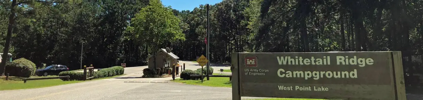
Whitetail Ridge Campground is a waterfront facility on the western shore of West Point Lake, which spans parts of Alabama and Georgia.This man-made lake has 525 miles of shoreline that provide excellent opportunities for fishing, camping, boating and other recreational activities.
Recreation
Whether sailing or power boating, West Point Lake is a boater's paradise. There are boat ramps in 34 public recreation areas around the lake, including Amity, as well as two privately owned full-service marinas. Fishing is one of the most popular activities on the lake. A dozen creeks and more than 40 square miles of lake provide plenty of good fishing spots for the thousands of anglers who fish here regularly. The lake abounds with bass, catfish, crappie and bream. Bank fishing is excellent at many locations, including public fishing piers at Hardley Creek, Rocky Point and McGee Bridge parks. Several trails wind along the lake and through the landscape, including the Lakeside Trail, which is perfect for mountain biking. A wildlife management area of nearly 10,000 acres, located at the upper end of the lake, provides habitat for many types of wildlife. This area offers excellent hunting opportunities.Facilities
The Whitetail Ridge Campground offers 58 sites with electric and water hookups. Additional amenities include a dump station, laundry facilities and hot showers.Natural Features
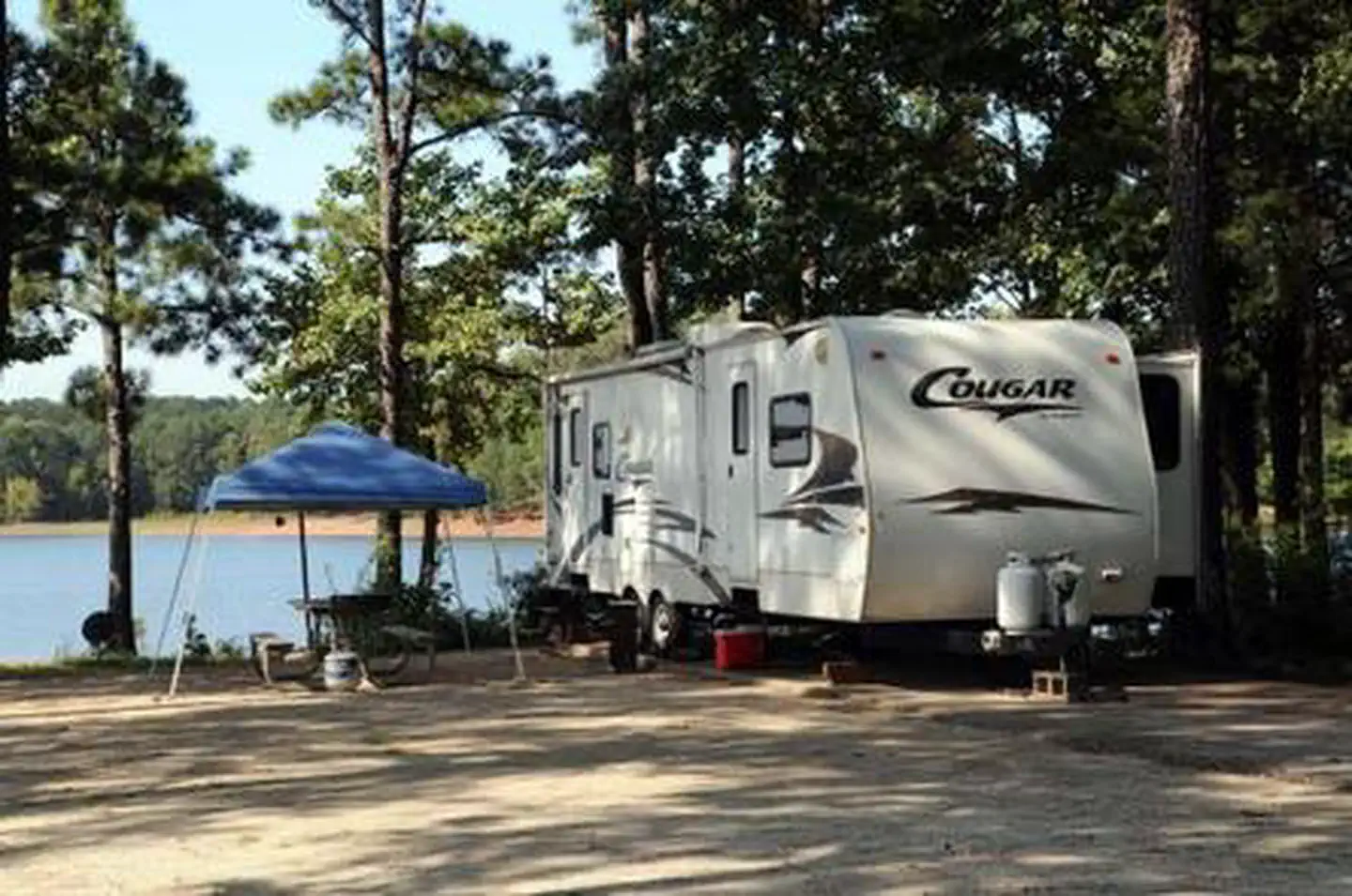
Surrounded by rolling fields and deep forests that display outstanding fall foliage, West Point Lake extends 35 miles along the Chattahoochee River on the Alabama-Georgia state line. The campground is forested and sits on the shore overlooking the 25,900-acre lake.Nearby Attractions
The lake offers 21 day-use parks. While many people visit the lake to boat and camp, the parks offer a variety of other recreation facilities including tennis courts, ball fields, basketball courts, fishing piers with fish attractors, hiking trails and picnic shelters for individuals or large groups.Charges & Cancellations
Changes and Cancellations: A $10.00 service fee will apply if you change or cancel your reservation. Late cancellations are subject to additional fees. For full details see R1S Reservation PolicyThe facts
- 58 bookable sites
- Vehicles up to 75 ft
- Up to 16 people per site
- Loops: LOOA, LOOB, LOOC, LOOD, LOOE, LOOF, LOOG
Site types
- 58 Standard Electric
Amenities
- Electric hookups
- Water hookups
- Campfires allowed
- Picnic tables
- Shade
- Pets allowed
Not recorded upstream: sewer hookups, fire pits, grills.
58 campsites at Whitetail Ridge
Check-in 4:00 PM · Check-out 3:00 PM
| Site | Loop | Type | Entry | Surface | Water | Max rig | People | |
|---|---|---|---|---|---|---|---|---|
| 01 | LOOA | Standard Electric | Back In | Paved | Lakefront | 63 ft | 8 | 🐾 |
| 02 | LOOA | Standard Electric | Back In | Paved | Lakefront | 33 ft | 8 | 🐾 |
| 03 | LOOA | Standard Electric | Back In | Paved | Lakefront | 40 ft | 16 | 🐾 |
| 04 | LOOA | Standard Electric | Back In | Paved | Lakefront | 40 ft | 8 | 🐾 |
| 05 | LOOA | Standard Electric | Back In | Paved | Lakefront | 33 ft | 8 | 🐾 |
| 06 | LOOA | Standard Electric | Back In | Paved | Lakefront | 30 ft | 8 | 🐾 |
| 07 | LOOA | Standard Electric | Back In | Paved | Lakefront | 30 ft | 8 | 🐾 |
| 08 | LOOA | Standard Electric | Back In | Paved | Lakefront | 30 ft | 8 | 🐾 |
| 09 | LOOA | Standard Electric | Back In | Paved | Lakefront | 30 ft | 8 | 🐾 |
| 10 | LOOA | Standard Electric | Back In | Paved | Lakefront | 33 ft | 8 | 🐾 |
| 11 | LOOB | Standard Electric | Pull Through | Paved | Lakefront | 35 ft | 8 | 🐾 |
| 12 | LOOB | Standard Electric | Back In | Paved | Lakefront | 60 ft | 8 | 🐾 |
| 13 | LOOB | Standard Electric | Back In | Paved | Lakefront | 45 ft | 8 | 🐾 |
| 14 | LOOB | Standard Electric | Back In | Paved | Lakefront | 35 ft | 8 | 🐾 |
| 15 | LOOB | Standard Electric | Back In | Paved | Lakefront | 35 ft | 8 | 🐾 |
| 16 | LOOB | Standard Electric | Back In | Paved | Lakefront | 60 ft | 8 | 🐾 |
| 17 | LOOB | Standard Electric | Pull Through | Paved | Lakefront | 40 ft | 8 | 🐾 |
| 18 | LOOB | Standard Electric | Back In | Paved | Lakefront | 60 ft | 8 | 🐾 |
| 19 | LOOB | Standard Electric | Back In | Paved | Lakefront | 50 ft | 8 | 🐾 |
| 20 | LOOB | Standard Electric | Back In | Paved | Lakefront | 40 ft | 8 | 🐾 |
| 21 | LOOB | Standard Electric | Back In | Paved | Lakefront | 40 ft | 8 | 🐾 |
| 22 | LOOB | Standard Electric | Back In | Paved | — | 50 ft | 8 | 🐾 |
| 23 | LOOB | Standard Electric | Back In | Paved | — | 50 ft | 8 | 🐾 |
| 24 | LOOB | Standard Electric | Back In | Paved | — | 45 ft | 8 | 🐾 |
| 25 | LOOB | Standard Electric | Back In | Paved | — | 40 ft | 8 | 🐾 |
| 26 | LOOC | Standard Electric | Back In | Paved | — | 40 ft | 8 | 🐾 |
| 27 | LOOC | Standard Electric | Pull Through | Paved | — | 40 ft | 8 | 🐾 |
| 28 | LOOC | Standard Electric | Pull Through | Paved | — | 40 ft | 8 | 🐾 |
| 29 | LOOC | Standard Electric | Pull Through | Paved | — | 40 ft | 8 | 🐾 |
| 30 | LOOC | Standard Electric | Back In | Paved | — | 60 ft | 8 | 🐾 |
| 31 | LOOC | Standard Electric | Back In | Paved | — | 40 ft | 8 | 🐾 |
| 32 | LOOD | Standard Electric | Back In | Paved | Lakefront | 40 ft | 16 | 🐾 |
| 33 | LOOD | Standard Electric | Back In | Paved | Lakefront | 50 ft | 8 | 🐾 |
| 34 | LOOD | Standard Electric | Back In | Paved | Lakefront | 40 ft | 8 | 🐾 |
| 35 | LOOD | Standard Electric | Back In | Paved | Lakefront | 30 ft | 8 | 🐾 |
| 36 | LOOD | Standard Electric | Back In | Paved | Lakefront | 45 ft | 8 | 🐾 |
| 37 | LOOE | Standard Electric | Pull Through | Paved | Lakefront | 40 ft | 8 | 🐾 |
| 38 | LOOE | Standard Electric | Back In | Paved | Lakefront | 40 ft | 8 | 🐾 |
| 39 | LOOE | Standard Electric | Back In | Paved | Lakefront | 53 ft | 8 | 🐾 |
| 40 | LOOE | Standard Electric | Back In | Paved | Lakefront | 40 ft | 8 | 🐾 |
| 41 | LOOE | Standard Electric | Back In | Paved | Lakefront | 75 ft | 8 | 🐾 |
| 42 | LOOE | Standard Electric | Back In | Paved | Lakefront | 50 ft | 8 | 🐾 |
| 43 | LOOE | Standard Electric | Back In | Paved | Lakefront | 33 ft | 8 | 🐾 |
| 44 | LOOE | Standard Electric | Pull Through | Paved | Lakefront | 45 ft | 8 | 🐾 |
| 45 | LOOE | Standard Electric | Back In | Paved | Lakefront | 33 ft | 8 | 🐾 |
| 46 | LOOE | Standard Electric | Pull Through | Paved | Lakefront | 48 ft | 8 | 🐾 |
| 47 | LOOF | Standard Electric | Back In | Paved | Lakefront | 70 ft | 8 | 🐾 |
| 48 | LOOF | Standard Electric | Back In | Paved | Lakefront | 45 ft | 8 | 🐾 |
| 49 | LOOF | Standard Electric | Back In | Paved | — | 50 ft | 8 | 🐾 |
| 50 | LOOF | Standard Electric | Back In | Paved | — | 40 ft | 8 | 🐾 |
| 51 | LOOF | Standard Electric | Back In | Paved | Lakefront | 50 ft | 8 | 🐾 |
| 52 | LOOF | Standard Electric | Back In | Paved | — | 50 ft | 8 | 🐾 |
| 53 | LOOG | Standard Electric | Back In | Paved | — | 65 ft | 8 | 🐾 |
| 54 | LOOG | Standard Electric | Back In | Paved | — | 50 ft | 8 | 🐾 |
| 55 | LOOG | Standard Electric | Back In | Paved | Lakefront | 60 ft | 8 | 🐾 |
| 56 | LOOG | Standard Electric | Back In | Paved | Lakefront | 60 ft | 16 | 🐾 |
| 57 | LOOG | Standard Electric | Back In | Paved | Lakefront | 45 ft | 8 | 🐾 |
| 58 | LOOG | Standard Electric | Back In | Paved | Lakefront | 40 ft | 8 | 🐾 |
Getting there
33.02222, -85.19167 · 33°1'20.0"N 85°11'30.0"W
Typical weather
Typically 90°F in Jul, down to 56°F in Jan.
| Jan | Feb | Mar | Apr | May | Jun | Jul | Aug | Sep | Oct | Nov | Dec | |
|---|---|---|---|---|---|---|---|---|---|---|---|---|
| High °F | 56 | 60 | 67 | 75 | 82 | 88 | 90 | 89 | 84 | 75 | 66 | 58 |
| Low °F | 32 | 35 | 41 | 48 | 57 | 65 | 69 | 68 | 63 | 50 | 40 | 35 |
| Precip in | 4.9 | 4.7 | 5.3 | 4.6 | 3.9 | 3.9 | 4.7 | 4.0 | 3.7 | 3.1 | 4.4 | 5.4 |
1991–2020 averages from the nearest NOAA station, 9.4 mi away — not measured at the facility itself, and elevation can make a real difference over that distance.
Map
Fees and stay limits
West Point Lake campgrounds will accept payment by credit card, debit card or prepaid credit card only. No other form of payment will be accepted. This practice streamlines financial transactions, provides quicker processing of refunds and enhances gatehouse operations.
From Recreation.gov, which is not always current. The operator's own page is the authority on what you will be charged.
More photos
Member photos
Common questions about Whitetail Ridge
- Can you reserve a site at Whitetail Ridge?
- Yes, Whitetail Ridge is reservable through Recreation.gov.
- How many campsites does Whitetail Ridge have?
- 58 sites.
- What is the maximum RV length at Whitetail Ridge?
- 75 ft. That is the longest vehicle the sites here are recorded as taking; individual sites may be shorter.
- Are pets allowed at Whitetail Ridge?
- Yes, pets are allowed at Whitetail Ridge.
- Does Whitetail Ridge have hookups?
- Electric, Water.
- Are campfires allowed at Whitetail Ridge?
- Campfires are allowed at Whitetail Ridge. Check for a current fire restriction before you go.
Camping near Whitetail Ridge
- Holiday (Georgia) 0.8 mi · Campground · we watch it
- Horace King Park 1.3 mi · Campground · we watch it
- Glass Bridge Park 1.9 mi · Campground · we watch it
- Long Cane Recreation Area 2.2 mi · Campground · we watch it
- Rocky Point Recreation Area 2.3 mi · Campground · we watch it
- Earl Cook Recreation Area 2.7 mi · Campground · we watch it
- Veasey Creek Park 3.2 mi · Campground · we watch it
- Amity 4 mi · Campground · we watch it
- McGee Bridge Park 4.6 mi · Campground · we watch it
- Anderson Park 6 mi · Campground · we watch it
- Yellowjacket Creek Recreation Area 6.3 mi · Campground · we watch it
- R Shaefer Heard 6.8 mi · Campground · we watch it
Contact
- Phone 706-884-8972
- Book Recreation.gov
Recreation.gov last updated this record on 2026-02-25.
Facility information and photographs from Recreation.gov (RIDB). SpotOpened is not affiliated with Recreation.gov or any federal agency.
Comments